Good afternoon, everybody. It’s a gorgeous early fall day in the Commonwealth as lower humidity levels continue to press in from the north. This air will help take our overnight lows into the 40s for some. The main weather story continues to be Hurricane Sally down in the Gulf of Mexico. This is heading toward the central Gulf Coast nd may throw some offshoot moisture our way ahead of another late week fall cold front.
As mentioned, lows tonight drop into the upper 40s to low 50s for many…
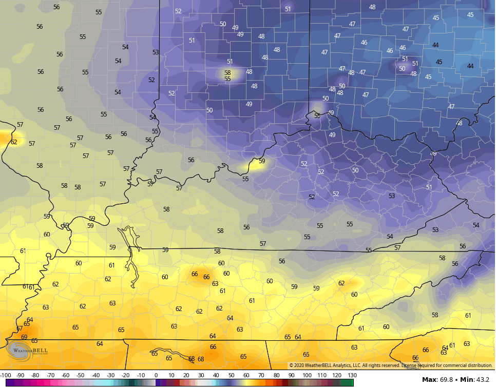
Some of the traditional cool spots may drop into the middle 40s. The rest of Tuesday looks awesome with temps generally in the 70s with a mix of sun and clouds.
Sally continues to strengthen as it heads toward a Tuesday landfall…

Here is the latest from the National Hurricane Center…

![[Key Messages]](https://www.nhc.noaa.gov/storm_graphics/AT19/refresh/AL192020_key_messages+png/215807_key_messages_sm.png)
Use our exclusive interactive radar to go up close and personal with Sally. This will include any live storm chase streams in the path of the storm…
The center of this stays well to our south, but it’s likely to throw some offshoot tropical moisture our way by later Wednesday and Thursday. That’s when it should interact with a strong fall cold front dropping in from the northwest…
GFS

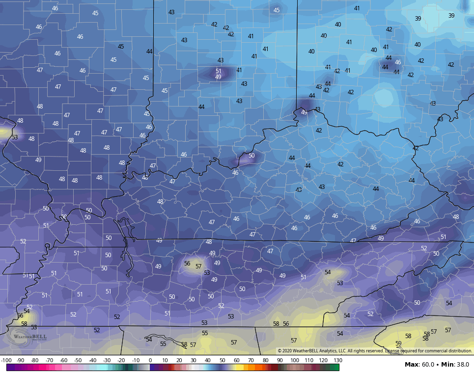
Temps behind this may not get out of the 60s for highs and lows drop deep into the 40s…
The overall tropics are as active as you will ever find in the Atlantic basin. We currently have 5 named storms. FIVE…

Enjoy the rest of the day and take care.
