Good afternoon, everybody. It’s another gorgeous day in the bluegrass state with pleasant temps and a mostly sunny sky. You may be seeing a few clouds well out ahead of what’s left of Beta down along the Gulf Coast. Those clouds will stream our way into the next few days, bringing the potential for some rain by Thursday and Friday. How much rain remains to be seen, but a few models are showing a bigger impact.
Beta is now inland near the Texas coast. This system will lift to the northeast and interact with an upper level low. How much rain can this bring to Kentucky? That remains to be seen, but several models are increasing our odds.
The NAM fam is showing a big rain hit with this system. Here’s the future radar from the Hi Res NAM into Thursday…

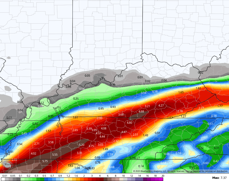
That’s putting down a lot of rain across the south and southeast. The NAM takes us through Friday and is showing some big time rain numbers…
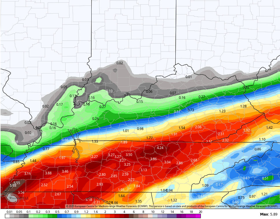
The EURO has lower totals, but has similar placement…
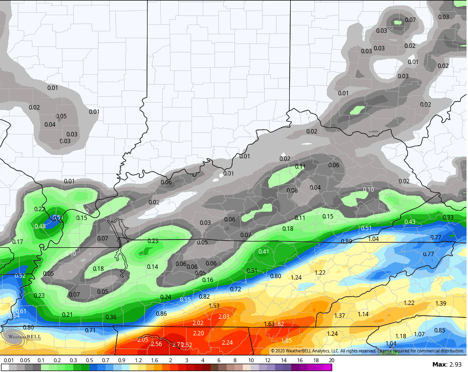
The GFS is much more disjointed with the rainfall and has substantially lower amounts…
Let’s give this a few more runs to see how things shake out.
The pattern after this continues to throw a cold front at us on Sunday with scattered storms. A much bigger system then works in here early next week with a blast of cold air behind it…
EURO

GFS

Additional systems should dive in behind this through early October. The 7 day average (September 29-October 6) temperature anomaly from the GFS Ensembles shows this…
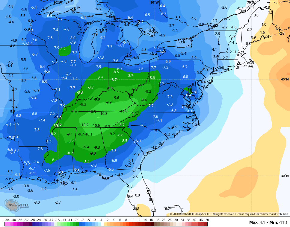
Again, that’s a 7 day average from the average of 21 members.
Enjoy the rest of the day and take care.
