Good Wednesday, everyone. We have a super windy day across the region as southwest winds crank ahead of another cold front dropping in from the northwest. This front will bring even colder air in here by the end of the week with another system set to drop in here by Sunday and Monday. This continues a pretty active pattern that’s also skewed much colder than normal.
Today is a a nice and very windy day. We could see gusts approach 40mph at times through the evening…
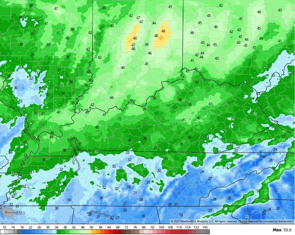
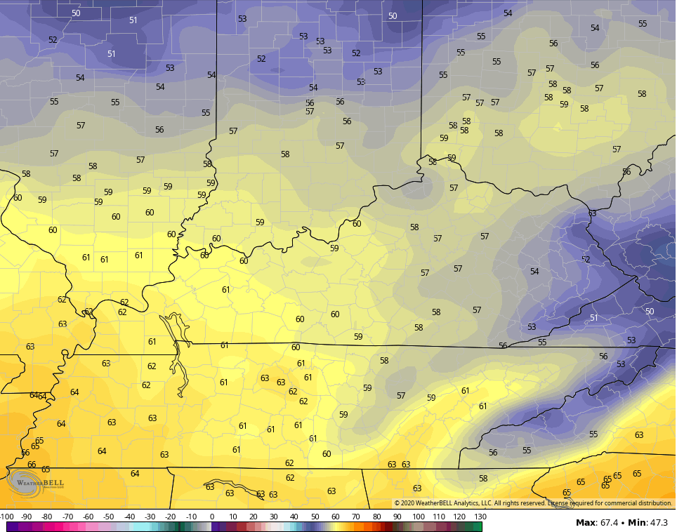
Temps start the day in the low 40s in many areas and we could see some pockets of mid and upper 30s show up. That would, once again, go below what the models suggest. Highs this afternoon range from the upper 60s east to 70-75 west.
Some late day clouds increase from the northwest with the potential for a broken line of showers dropping in here from the northwest…

October starts on a nice note for Thursday with highs in the low and mid 60s with a mix of sun and clouds. Another band of showers may move in by evening as even colder air presses in here…

This sets the stage for Friday to start in the 30s for many areas. Can we get some frost? That depends on winds and cloud cover, but some patchy frost is possible, at least. Highs on Friday will likely stay in the 50s…
Saturday starts in the 30s and ends with upper 50s to low 60s. Clouds will increase a bit, but this looks like a really, really nice weather day.
The next system then rolls in here later Sunday into Monday, but we do have some timing and strength differences. The Canadian and EURO Models are slower and stronger with this system…
CANADIAN

EURO

The GFS is likely playing right into it’s bias of being too flat and too progressive with this system…

Regardless, temps under this system may not get much above 50 degrees for highs. Winds would be rather gusty and this will make for a raw couple of days.
Temps look to rebound to normal by the middle of next week and that should make for some great fall days. Another trough may try to dig in later next week, but what happens in the tropics may play a big role in the overall pattern. This system continues to be monitored in the Caribbean…

I will see you with another update later today. Have a good one and take care.
