Good afternoon, folks. Hurricane Delta continues to grow into a monster storm as it churns toward the Gulf of Mexico. This system is going to be a major hit across the central Gulf Coast and is then likely to have a big impact on us this weekend.
Before we get to Delta, let’s talk about another frosty morning without a frost advisory…
It was another frosty morning for much of the region with temps in the low and middle 30s. Here are the top 10 coldest numbers from the Kentucky Mesonet. #kywx pic.twitter.com/U34zznZwsC
— Chris Bailey (@Kentuckyweather) October 6, 2020
The numbers for Lexington have been historic…
How unusual is this early season cold snap? Lexington has hit the 30s on 4 of the first 6 days to start October. This is only the third time in recorded history that’s happened. 1935 and 1974 are the other two years. #kywx
— Chris Bailey (@Kentuckyweather) October 6, 2020
All of this and not a single Frost Advisory from our friends who work for the taxpayers.
Ok, let’s get to the star of the weather show and that’s Hurricane Delta. This storm will slam ashore in Louisiana later this week and, what’s left of it, should move our way for the coming weekend. I have made only minor changes to my earlier line of thinking…
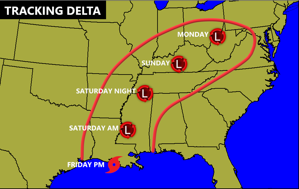
This would bring heavy rain, gusty winds and the potential for a few strong storms into Kentucky starting Friday night and going through Sunday. Obviously, the exact timing and track is still not set in stone and I’ll be providing updates as needed.
The latest from the National Hurricane Center shows just how powerful this storm is…

They are just a little slower with this storm than before and that’s certainly a possibility, but there’s likely to be a plume of tropical moisture well ahead of the center of circulation.
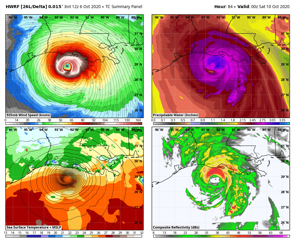
We are now getting to within the range of the high powered hurricane models…
HWRF
HMON
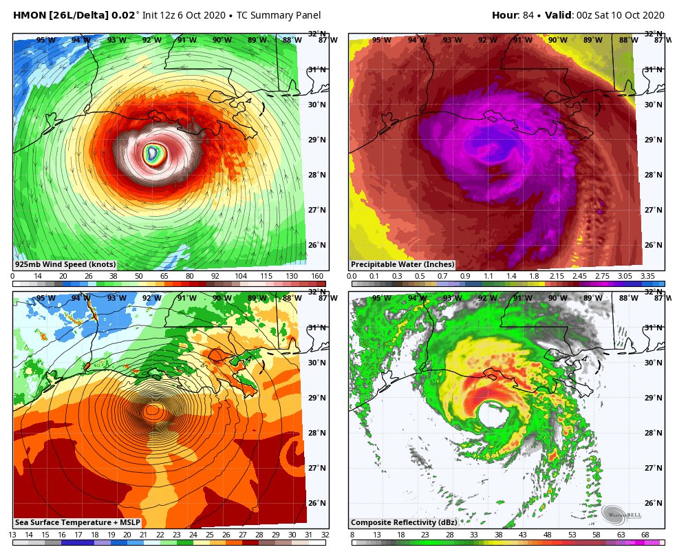
Notice both of those are slower with the storm and likely the reason the NHC has slowed this down a bit.
As far as the operational models are concerned, we find the EURO doing what it did with Sally and Laura and is forecasting the farthest west landfall…

You will notice just how painfully slow it is after landfall, too. That allows for it to merge with a deep trough moving in here early next week. This time, the EURO does have a dancing partner in the Canadian…
 It’s not as slow as the EURO but has the farther west track just ahead of the trough coming in behind it.
The GFS has done a better job of handling tropical systems this season and is farther east and faster…

The GFS Ensembles spaghetti plot is also a bit west…

The Hurricane Model spaghetti plot has been slowly inching back to the northwest, with the majority into Kentucky…

This will be interesting to see how the track plays out and that’s what will keep me busy this week. I may even drop by for a rare third update this evening.
Make it a good one and take care.

Hope some of rain get to me here NW Pennsylvania were running a deficit here of 6 inches rain for the year.
Thanks, CB! Nashville dropped to the mid-40s the last two nights, although Clarksville TN sank to 37 this morning. Some in our neighborhood have closed their pools for the season, but several others are still trying to hang on to summer.
While I had hoped the remnants of Hurricane Delta would not arrive in our area until before or after the weekend, thoughts and prayers need to go out to those in the path of the Cat 4 storm. Also, good there are signs the Jetstream will finally dip across the west to perhaps provide some moisture for the bad fire issues there.