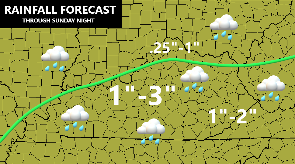
Good afternoon, folks. Hurricane Delta is coming ashore in Louisiana and will throw rain into our region this weekend. Some of this rain will be heavy at times, leading to a local high water threat for some. Once through the weekend, the pattern features several cold fronts dropping in here and those threaten to get our cold season started early.
Here’s the latest sat shot of Delta…

Here’s all the current information on the storm from the National Hurricane Center…

Take our exclusive interactive radar into the path of Delta. Once there, you can click on live streams from storm chasers as this powerful hurricane comes ashore…
A few showers will show up in southern Kentucky this evening and that will overspread the state later tonight…

I have no changes to the rainfall forecast that’s already out…
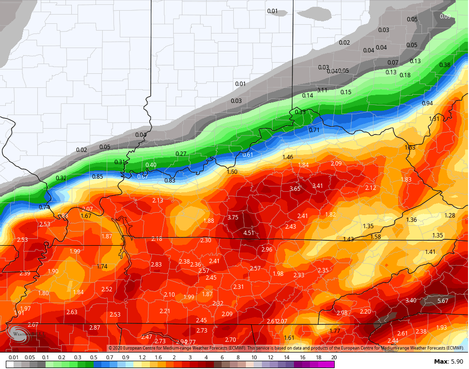
Will it be perfect? No, but it’s a good rough estimate. The new run of the EURO seems to lineup pretty well with it…
A strong cold front moves in here Monday evening and should bring a line of showers and storms with it. Seasonally chilly air comes in behind this for Tuesday and Wednesday. A stronger push of cold air dives in by the end of the week into next weekend. Frost and freeze conditions are likely behind this and we will see additional shots of cold diving in here for the rest of the month and into early November. Can some early season flake action show up? The pattern doesn’t say “no chance”! 🙂
Enjoy the rest of your day and take care.
