Good Tuesday, everyone. It’s a REALLY nice fall weather day across the state and this looks to hang tough for the next few days. By the end of the week, a powerhouse of a cold front sweeps across the state and brings the coldest air of the young fall season. This sets up a much colder than normal pattern through next week and, perhaps, a little longer.
Let’s kick this off with today’s weather. It’s awesome. 🙂
Wednesday will be another nice one as highs return to the low and middle 70s as winds become a little gusty. Those gusty winds are ahead of our Thursday cold front that barrels across the state with the cold air following…

Temps behind this drop like a proverbial rock and stay in the low and middle 50s for Friday. Lows by Saturday morning can drop toward freezing or a touch below.
As this cold shot moves our later in the weekend, the next blast is loading up to dive in here by early next week. Odds favor this being accompanied by an early season winter looking storm from the Rockies and plains to start. From there, this may stretch toward the Great Lakes and Ohio Valley. To what extent remains to be seen, but all models agree with this scenario, with their typical timing and placement disagreements.

Again, how that plays out is still to be determined and it will take a bit because of how anomalous this pattern is for mid-October. One thing is for sure, that’s some very cold air coming behind this system.
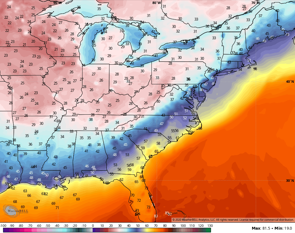
Here’s the coldest morning from the GFS…
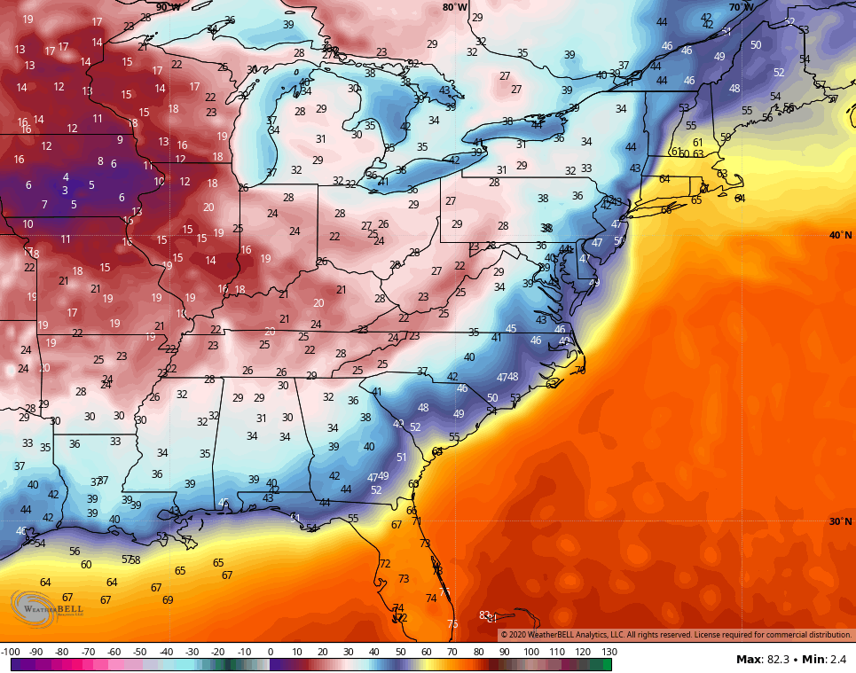
The Canadian continues to go to the extreme…
I will have another update later today, so check back. Until then, have a good one and take care.
