Good Wednesday everyone. Winds are about to crank as we get a powerhouse of a cold front to sweep across the state over the next few days. This will usher in the coldest air of the season and likely bring widespread frost and a light freeze to the region to start the weekend. Beyond that, another strong push of cold air sweeps in here early next week, but timing questions remain.
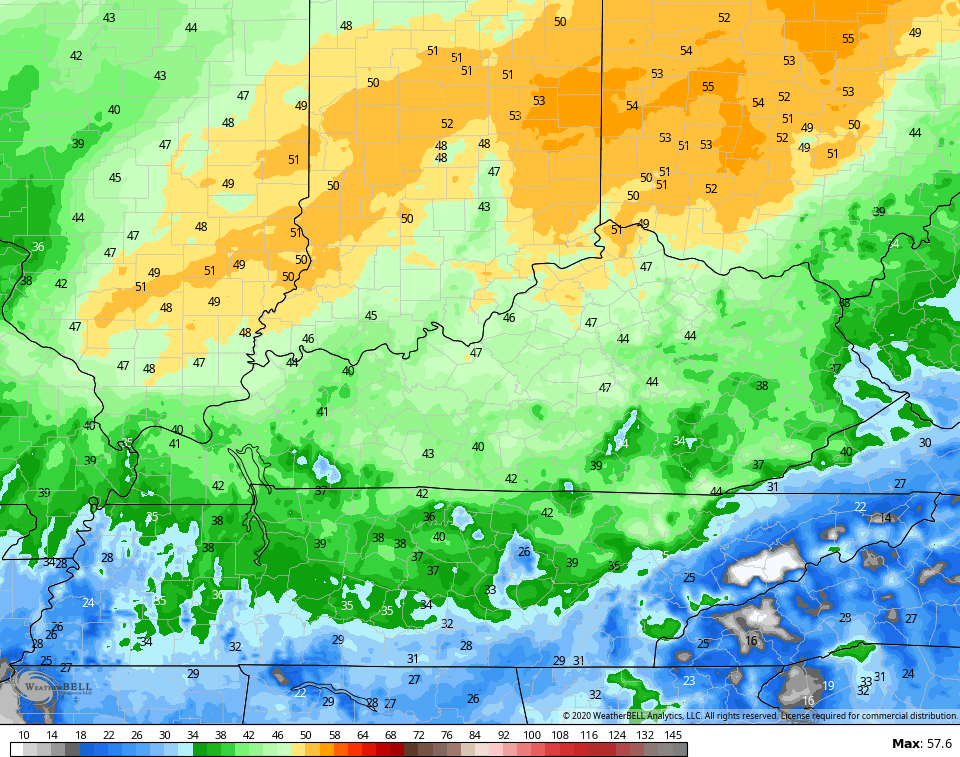
Today is a really nice weather day across the region with highs in the 70s with a mix of sun and clouds. Winds will slowly increase today then will REALLY pick up tonight and early Thursday. This strong southwesterly wind may bring gusts of 40mph or higher…
Man, that’s some serious gusts in the north and we will need to watch this.
The front doesn’t arrive in here until late in the day on Thursday and brings some showers into the region. This may hang tough in the east into early Friday…

Highs on Friday are mainly in the 50s, but areas of the east may not get out of the 40s if clouds don’t clear. Brr!
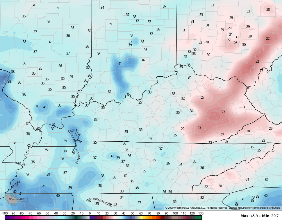
Speaking of Brr, the numbers may drop well below freezing in many areas by Saturday morning…
The setup after this continues to be absolutely all over the place from run to run and model to model. It appears one of the reasons is what to do with a system in the central Atlantic. Some models develop it, while others really don’t do much with it. If it develops, it helps slow the overall pattern behind it in North America. I need to look into that a little closer today.
The GFS is actually decently consistent with the system it’s bringing into the Ohio Valley early next week…

While possible, I think that’s too fast and too flat with that system. What may wind up happening is we see this system much deeper and slower in moving our way. That could easily allow for another temp spike ahead of our storm system and subsequent temp crash by the middle of next week. I’m wondering if that storm can have severe weather in front of it and snow behind it as it rolls into the plains and east?
If you’ve been following along, I’ve used the term “first time since 2012” quite a bit in referencing the below normal temps of September and into early October. 2012 was the last time we were below normal for both September and October. The end of that October featured Hurricane/Superstorm Sandy going up the eastern seaboard into the New York City area. That merged with a winter trough and produced snows all the way back into eastern Kentucky.
Recent model runs have been hinting at a tropical system developing and potentially threatening the eastern seaboard next weekend or so. While this is still well out there in la la land for the models, one of the recent runs of the GFS did this…

Virtual weather is fun to look at, but we have to remember it’s just that… Virtual, for now.
I will have another update later today. Until then, make it a good one and take care.

I remember super storm Sandy pounding the mountain areas of West Virginia with an early heavy snowstorm.
A virtual Nor’Easter lol.
Beautiful Fall weather. Enjoy it while we have it.
Say goodbye to the breathtaking fall leafs.
Nothing last 4 ever.
Very windy here in the Chicago area again today, as a Wind Advisory is in effect for all of Northern IL this afternoon, with gusts expected to be in the 45-50 MPH range from the SW. Yesterday we had wind gusts over 40 MPH.
Also, a Red Flag Warning is in effect for the South and SW suburbs this afternoon due to the extremely dry conditions along with the strong winds.
This will likely be our last day in the 70s until next Spring, with the below normal temperatures on the way.