Good Thursday, folks. It’s another very warm September-like day across the bluegrass state, but a strong cold front wipes that out when it arrives late Friday and early Saturday. Rain and a major temperature drop will be noted with this system. The pattern behind this will feature very active conditions next week as another big temp fight breaks out, with the cold finally winning the battle.
We know today is awesome so let’s skip ahead to our Friday front. Winds will be rather gusty as the front works through here with an increasing band of showers and storms. The prime time for this comes during the afternoon and evening from west to east, with lingering showers into Saturday…

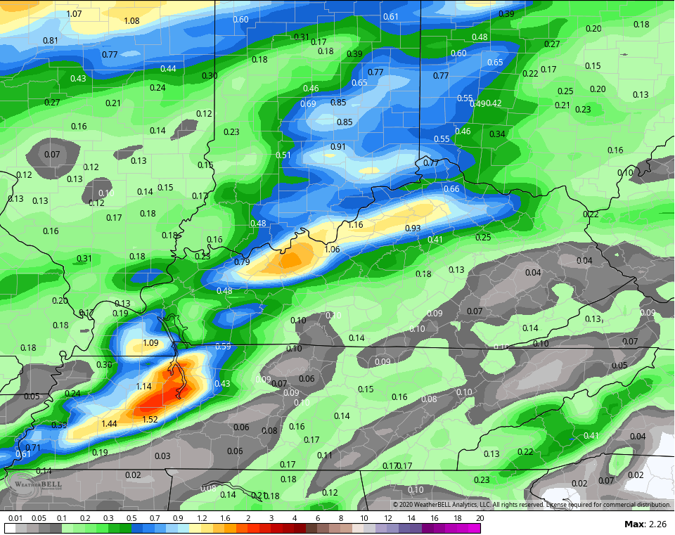
The NAM is spitting out some decent totals with this across areas of central and northern Kentucky…
The temp drop behind this front looks to colder and colder as we get closer. We go from highs hitting the 70s on Friday to temps struggling to get out of the 40s on Saturday. The NAM keeps much of the region in the 40s…

If clouds hang tough, we may very well not get to 50. If the skies break, we hit the 50s. Still, that’s a very chilly day no matter how you slice it.
It’s interesting to note how much colder this is looking than just a few days ago and that’s something we’ve seen a lot of on the models this fall. Keep that in mind when looking too far down the road. Yes, we are warm right now, but the overall trend of the year has been for colder than what the models suggest.
I’ve been talking about how the tropics would clog up the pattern across the country and this Water Vapor view of Hurricane Epsilon says it all…

WOW! That thing is massive and now you can see firsthand what we’ve been yapping about for the past week or so.
In addition to Epsilon, we have another system in the Caribbean to watch in the coming days…

All of that continues to complicate the evolution of extreme cold coming into the United States and how it impacts our region. It continues to look like a good old fashioned fight breaks out right on top of us with several waves of low pressure bringing the potential for quite a bit of rain…

Slow your roll, tropics! 🙂
I will have another update late today, so check back. Have a good one and take care.

That water vapor view is amazing! Wow!!