Good evening, everyone. We have another mild day out there as we wait on our Friday cold front to slam through the state. This front will bring showers and thunderstorms ahead and much colder air behind it. As a matter of fact, temps may be 25 degrees or so colder on Saturday than at the same time Friday. This kicks off a very active period for the final week of October.
Before we get to all that. there’s a tiny shot for a shower going up this afternoon, especially in central and northern Kentucky…

Winds will gust up ahead of the front tonight and Friday. Scattered showers and thunderstorms develop Friday afternoon and evening with a line of showers and storms along the front racing eastward.
Some of the late day Friday storms could even be strong or locally severe. The Storm Prediction Center has added much of central and western Kentucky into the low-end risk for severe weather…

Lingering showers will likely accompany low clouds on Saturday.
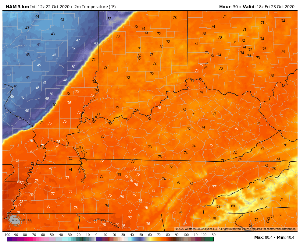
The temp drop will be the big story. Look at the dramatic day to day difference on the NAM…
Temps for Sunday will likely be all over the place with 50s north and near 70 in the south and southeast. Temps spike briefly on Monday, but come right back down as our next front moves in and stalls on top of the region. This will lead to repeat rain and some thunderstorm action into next week, but the models continue to differ on exactly how to handle it all…

Again, how all this works out is largely dependent on the how the tropics behave through the next week or so.
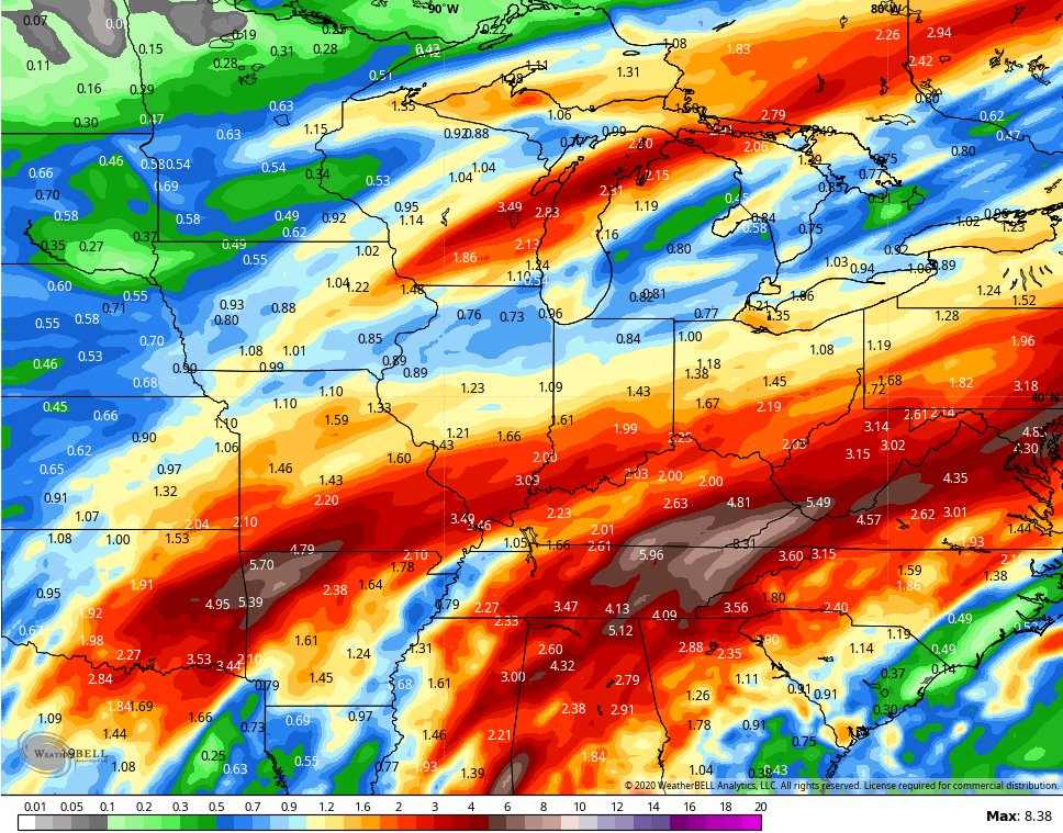
The potential for quite a bit of rain is there over the next week or so as the models continue to show several inches of rain…
We need the tropics to calm down and let the cold air win the battle or we could be in for some issues during this time. UGH.
Enjoy the rest of your day and take care.

Temps have soared into the 70s here in the Chicago Metro Area this afternoon, as it’s 76 degrees in the SW suburbs at the NWS forecast office in Romeoville. The dew point is also way up at 68.
Lots of rain on the way here after midnight and into Friday morning, this after we had waves of showers and thunderstorms cross Northern IL Wednesday night into Thursday morning.