Good afternoon, everybody. A powerhouse of a cold front is sweeping into the state and bringing the potential for strong and locally severe storms. This front is also going to do a number on the temps as readings crash from a September feel to November level readings on Saturday. This is kicking off a super-active pattern that will bring a lot of rain and very chilly air in here for the final week of October.
Let’s kick things off with what’s happening out there today. We continue to watch scattered showers and storms blowing up ahead of our potent cold front. As the front moves in, a line of showers and storms will be noted and some strong storms will show up. There’s even a low-end risk for severe weather from the Storm Prediction Center…

Damaging wind is the main player with these storms. A few of the storms can also put down some hit and run torrential rains, with pockets of 1″ possible. Your tracking tools come up in a few.
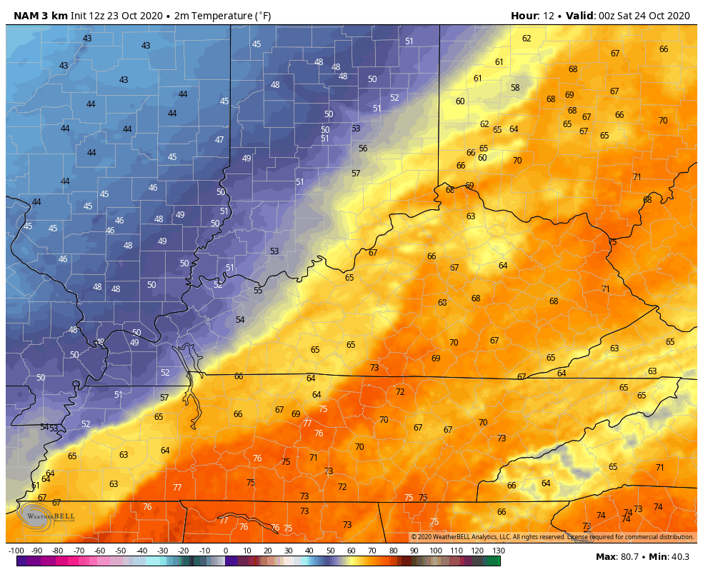
As expected, temps are deep into the 70s today, but the temp drop is going to be dramatic as the front slides through. The weekend continues to look colder and colder as we get closer and that now includes Sunday. The models keep most of the state in the upper 40s and low 50s for Saturday afternoon, and are trending colder for Sunday. Sunday temps may reach the 60s in the far south and southeast, with the rest of the state in the 50s, with even upper 40s north. Watch all this on the Hi Res NAM…
Unlike recent years, this is a year the colder air is actually winning the battle verses what the models think will happen. We are seeing that playing out in a major way this weekend and now we are seeing that trend for the upcoming week.
The numbers should bounce up on Monday, but come right back down starting Tuesday and then go well below normal for the rest of the week/month. Waves of rain will be noted Monday and Tuesday before a break by Wednesday. A bigger storm system then moves in by the end of the week and that one is trying to tap even colder air to our northwest…
GFS

Notice all that early week winter weather just to our west and northwest? Notice how close that second system is to some flakes around here? Interesting.
Another trough drops in here Halloween weekend…

Once again, much of what happens depends on how the tropics play out. Hurricane Epsilon is finally getting out of the picture in the Atlantic…

Now we have to watch for something going up in the Caribbean…

Some of the models do try to bring moisture from that system and combine it with the late week storm system working in here. One of those models is the European Model, but that’s one of the last models I trust with any system coming out of the southwestern part of the country in this type of pattern. Still, here it is…

We shall see how all that works out, but the potential for a lot of rain is very much likely next week.
Here are your storm tracking tools for the rest of the day…

Current watches

Possible Watch Areas

Have a great rest of the day and take care.

Chris, maybe this will be another winter like those 2 back to back winters we had 2013/14/15?