Good afternoon, everybody. It’s another chilly day for much of the region and this is a trend taking us into the start of the new week. It’s a week that will be dominated by two systems rolling our way. One is coming from the southwestern part of the country and the other is Zeta out of the Gulf of Mexico. Those two will combine forces to impact our weather by the second half of the week.
Let’s begin with today and roll forward. Temps are doing what we’ve talked about and coming in much chillier than the models through. Upper 40s to middle 50s show up for many, except the south and southeast. That’s where temps are spiking into the 60s.
A shower or two will fire back up as we roll through the evening…

The NAM is absolutely smoking the other models with temps. Models like the EURO are garbage with temps to begin with, but the GFS is now running too warm. The NAM keeps today’s temp gradient going through Monday and Tuesday…

Beware your app and walking app temp forecasts in the coming days. 😉
Gusty showers will also be noted from time to time over the next few days. We may see the western part of the state seeing some heavier amounts compared to everybody else.
Tropical Storm Zeta is forecast to become a hurricane as it heads into the Gulf of Mexico, taking a very familiar track this season…

Notice how Kentucky is in the track cone once again. Did you know Kentucky has been in the tropical track cone more this season than Florida? Check out this map from @splillo on Twitter…
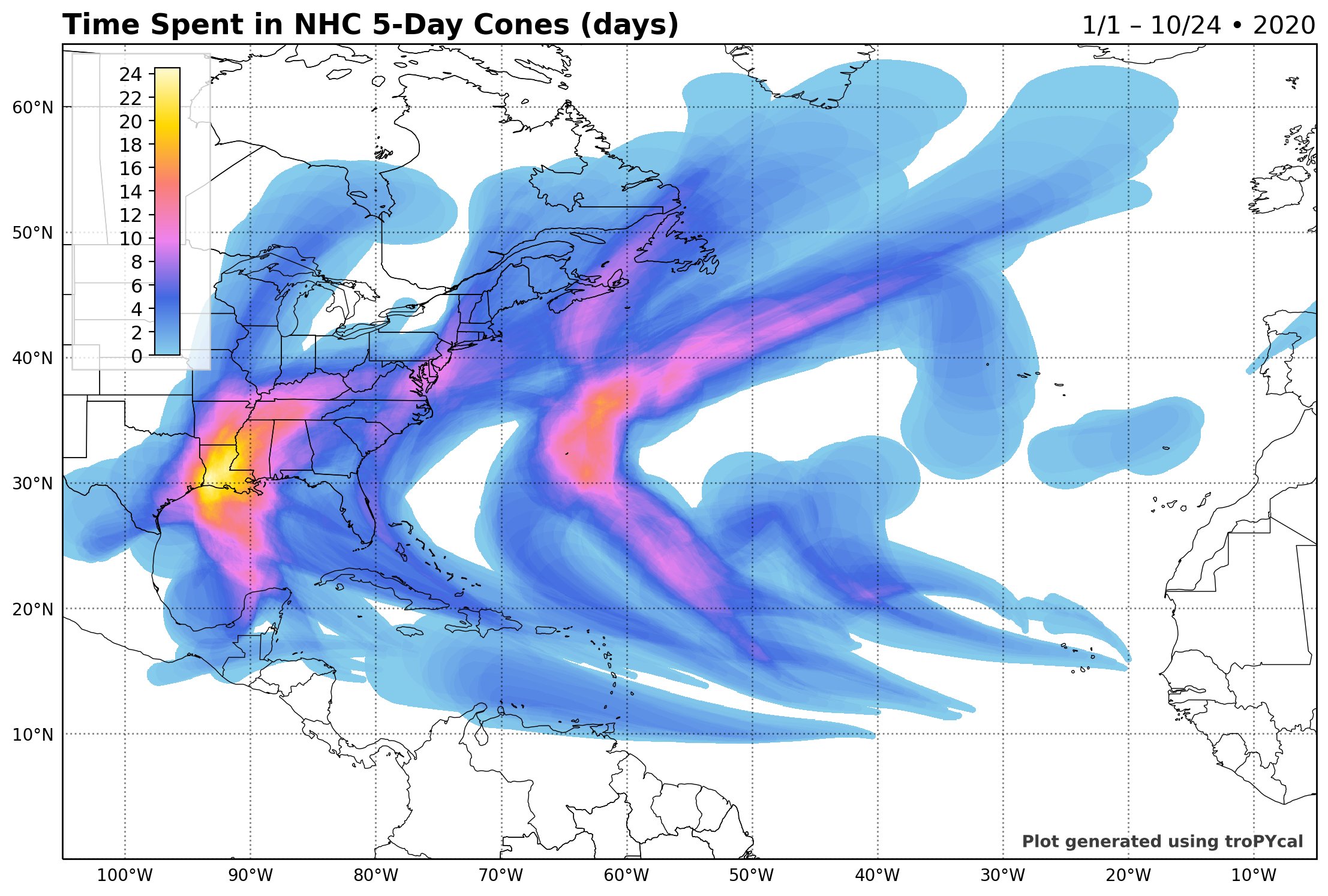
We are adding to that right now. Can we garner anything from this? My only take is we have had an exceptionally stable pattern this fall and that looks like it continues.
The remnants from ZETA are likely to impact our weather by late Wednesday and Thursday. To what extent remains to be seen and will depend on the exact track of the center of circulation and how much of it gets pulled into the storm coming from the southwest. The models have the same general concept, but still vary from run to run…
GFS

CANADIAN

EURO

Here’s the wind gust map from the EURO…

It will be interesting to see how all this plays out in the coming week, but quite a bit of rain and wind may impact the state later in the week.
BTW, I don’t think the tropics are finished, yet. Watch for another storm or two during the first half of November.
Enjoy the rest of the day and take care.
