Good Friday, everyone. It’s a very chilly day across the state as we get ready to close out the month of October. This chill will turn downright cold as November blows into town on Sunday. That’s when a blast of frigid air engulfs much of the eastern half of the country.
Let’s kick things off with today’s weather. Low clouds are likely to linger across central and eastern Kentucky for much of the day. A few rays of sunshine will try to show up for some, so keep those fingers crossed. On the flip side, a few light showers may still show up early on. Here are your friendly radars to follow along…

Temps today likely stay in the 40s for the eastern half of the state, but could briefly hit the low 50s IF you get enough sun. Farther west, highs in the 50-55 degree range will be noted.
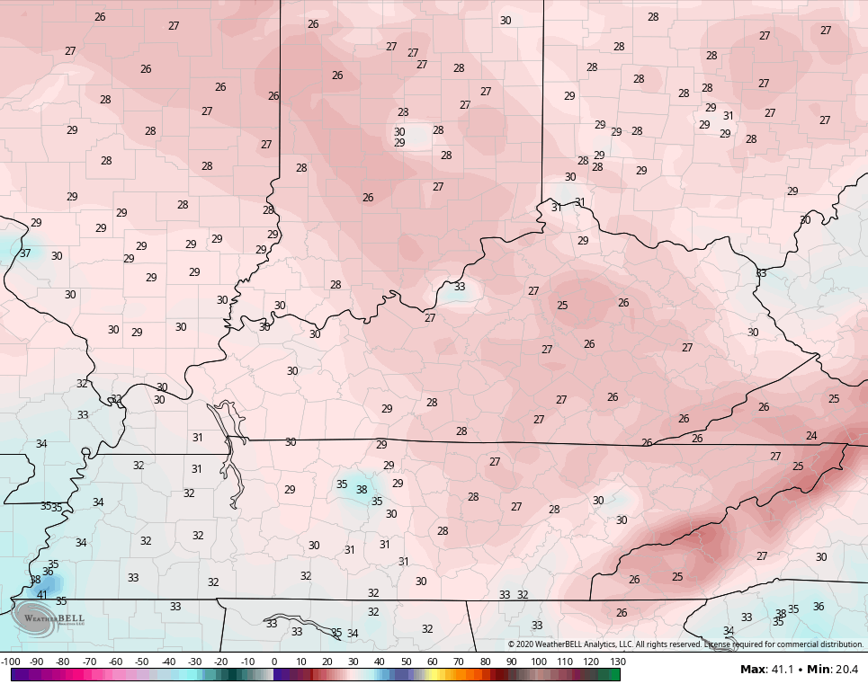
Frosty cold numbers will show up tonight and Halloween Morning. That’s when temps hit the low 30s for many, with pockets of upper 20s likely saying hello. The rest of the day continues to look great with some afternoon clouds around and highs in the 55-60 degree range for most of the area. Trick-Or-Treat temps will drop into the 40s for the end of the limited candy rounds.
Our Sunday front sweeps in here very quickly, bringing gusty winds and the chance for a stray shower ahead of it. Early day temps in the 50s will crash through the 40s from northwest to southeast during the afternoon. As that cold air blows in, some snows are likely to fly into parts of Ohio and West Virginia. Accumulating snows will even show up in the WV mountains. Can a flake graze the far east? There’s still an outside chance…
CANADIAN

GFS

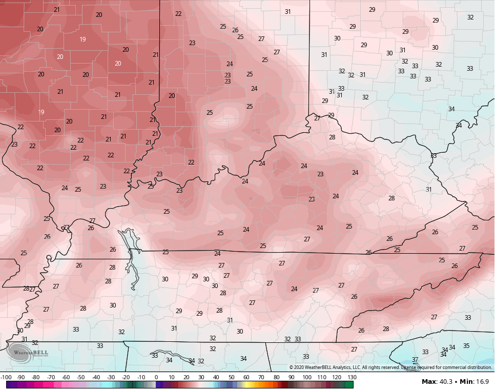
Temps then tank by Monday morning and are deep into the middle 20s with some low 20s showing up in the coldest valleys. Record lows are in the low 20s during this time. The models forecasts are growing colder…
CANADIAN
GFS
NAM

Gusty winds will give us a wind chill that dips into the high teens to start Monday…

Election Day looks awesome with 20s to start and 50s during the afternoon. This kicks off a gorgeous stretch of early November weather that likely takes us through next weekend. Beyond that, I do think cold air dives back into the west and plains and charges eastward early the following week.
Meanwhile, the tropics will still try to have another say in the overall pattern…

The 2020 tropical season is the Michael Myers of tropical seasons… It just won’t die.
I will have another update later today, so check back. Have a great Friday and take care.

A hard freeze will welcome November along with Sunshine.
Autumn foliage is past peak. The gloomy weather prevented seeing the bright colors of Autumn. Maybe next year ?
Everyone don’t get too cold waiting for the “Great Pumpkin.”
Past peak here in the SE part of KY as well, and the wind took most of the foliage yesterday. My planned drive to take photos didn’t come to fruition c/o the rain and overcast.
I could forgive that if w could have a few flakes flying around, though. 🙂 Fingers crossed.