Good afternoon, everyone. It’s a cold late October day across the bluegrass state as clouds SLOWLY begin to clear out. This sets the stage for a cold night that leads into a very nice Halloween and wrap to the month of October. Once into Sunday, a big time push of cold air crashes in here to kick off November.
We’ve already had numerous morning’s with frost so far this month and a few mornings below freezing. I see Frost Advisories are out and the only explanation I can see for having one at this point is you’re trying to make up for the ones you missed earlier this month.
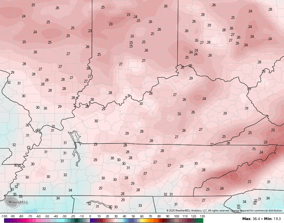
Upper 20s and low 30s show up to begin Halloween and then top out in the 55-60 degree range. Some clouds increase during the afternoon and evening, but it’s a nice day overall.
As the front slams in here on Sunday, winds are going to crank and we are likely to see a few showers along and ahead of it. The Canadian model continues to indicate a flow behind that front that can bring flakes into the north and east…

The EURO is close…

I’ve highlighted this “outside chance” for flakes for almost a week now, so it will be interesting to see just how close those get or if the flakes can make it into the state.
Regardless, the blast of cold for Monday is December-like. Lows hit the low and middle 20s for many…
Near record lows are possible if skies are clear. Wind chill temps briefly drop into the upper teens to start the day. Highs on Monday are generally 40-45, but the gusty winds make it feel a bit colder.
I have no changes to the rest of the forecast as things look pretty darn nice for the rest of next week into the following weekend. Winter talk comes your way with my weekend posts, so spread the word. 🙂
Enjoy the rest of your day and take care.

A few clouds with a full Moon will only make it more “spooky” for Halloween night.
Looking forward to the Winter discussion Chris.
I just want a lot more sunshine in my candy bag.