Good afternoon, folks. As we roll through a gorgeous Halloween, I wanted to drop by for a quick update on the cold blast ahead of us. This rolls into town Sunday and takes our temps deep into the 20s. Can it also bring a flake to the east? Meh, we shall see.
You know the specifics of the forecast, so I’m not going to recap all that. Our front slams in with a few showers ahead of it and a mainly dry sky behind it. Still, a quick hitting northwest wind has an outside shot to spit out a flake or two in the eastern part of the state. The future radar from the Hi-Res NAM continues to show this small chance…

Temps crash from northwest to southeast behind the front and wind up into the middle 20s for many by Monday morning…
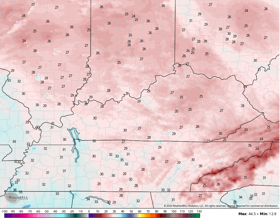
Pockets of low 20s may show up. Record lows are in the low 20s for Monday.
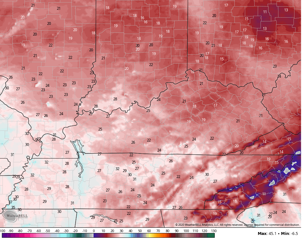
Winds will make it feel a little colder. Check out the Monday morning wind chill…
Highs Monday are low and middle 40s with plenty of sun. We are back below freezing to kick off our Election Day as temps hit the 50s during the afternoon. This kicks off a dry and milder pattern for the rest of the week through next weekend. Make plans to do something outdoors… NOW! 🙂
Eta is in the making down in the Caribbean…

This system is a slow-mover, but should eventually turn north. Could we have another hurricane hit on the US from this? The chance is there and the GFS is consistently showing this…

The Canadian doesn’t go out as far as the GFS, but it has a similar idea…

The EURO has a similar look, but somehow shows two different tropical systems…

As this is happening, the pattern is primed for another big surge of cold and winter working into the eastern half of the country.
Enjoy the rest of the day.
