Good afternoon, folks. This is a blowout post, so buckle up! Winds are cranking as we usher in the coldest air of the season to kick off the month of November. This is surging in behind a powerful cold front that has limited moisture with it. Once into the middle of the week, the weather looks absolutely perfect for early November for several days. Beyond that, things get very active with another tropics verses winter battle taking shape. Speaking of winter, we have a little bit of talk about that, too.
Winds are crazy gusty today with some spots clocking those gusts around 45mph. Goodbye, leaves!
I mentioned today’s front has limited moisture, but the radars will pick up on any isolated shower across the region. Later on, they will also pick up on some flakes flying not too far away…

Overnight lows will dive deep into the 20s and may challenge a few records. The record for Lexington is 22 from 1954 and the Canadian suggests we can get there…
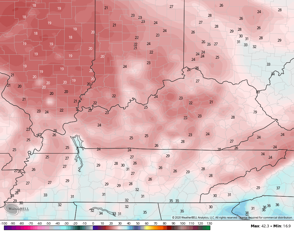
Other models like the NAM say we can get within a few degrees of the record…
Wind chills will be into the mid and upper teens at times to begin the day. It’s a day featuring temps in the low and middle 40s for highs with mostly sunny skies.
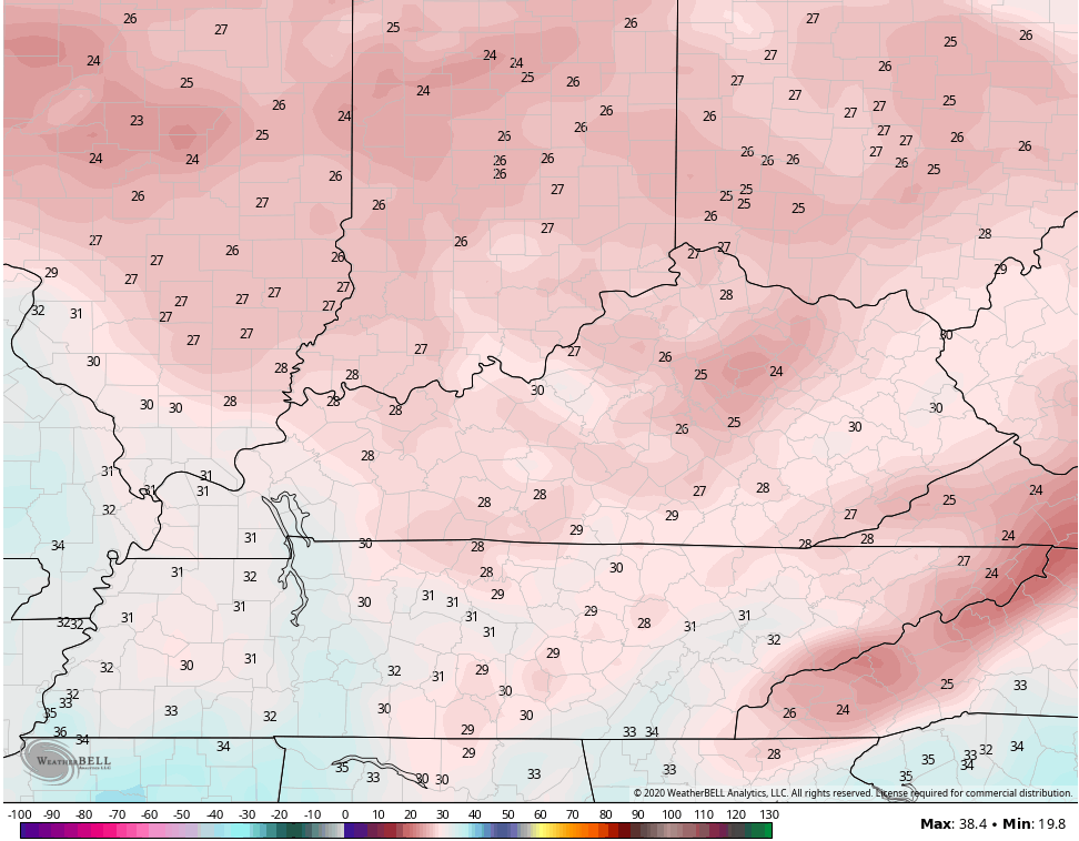
Election Day continues to look really good with upper 20s to start and 50s in the afternoon. This kicks off a pattern of AWESOME weather around here for the rest of the week into next weekend. Dry skies and pleasant temps in the 60s will be common. A few 70 degree high temps will also show up by the weekend. 70s in November are actually quite common, but I find it interesting that the past two November’s didn’t get to 70 in Lexington and the ensuing winters were mild with not much snow. I’ll get to more winter talk in a bit.
The pattern by the following week is likely to go back toward an extreme look with winter weather engulfing the west and plains and trying to roll back into the east. At the same time, we may have a tropical system lurking around Florida.
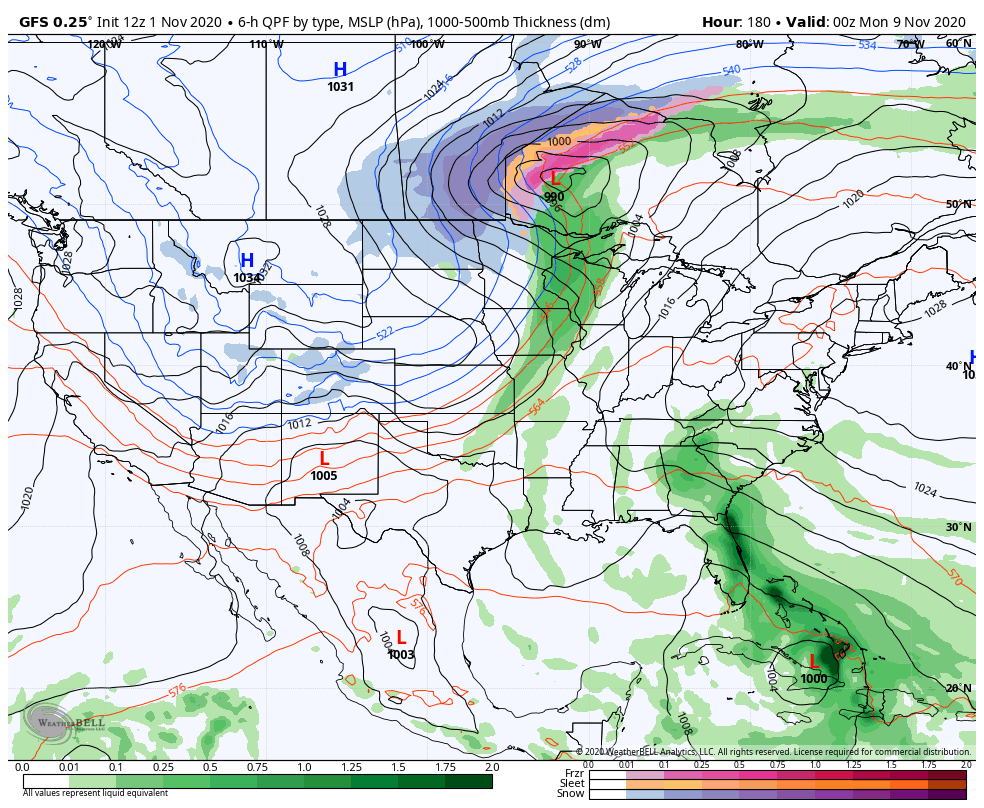
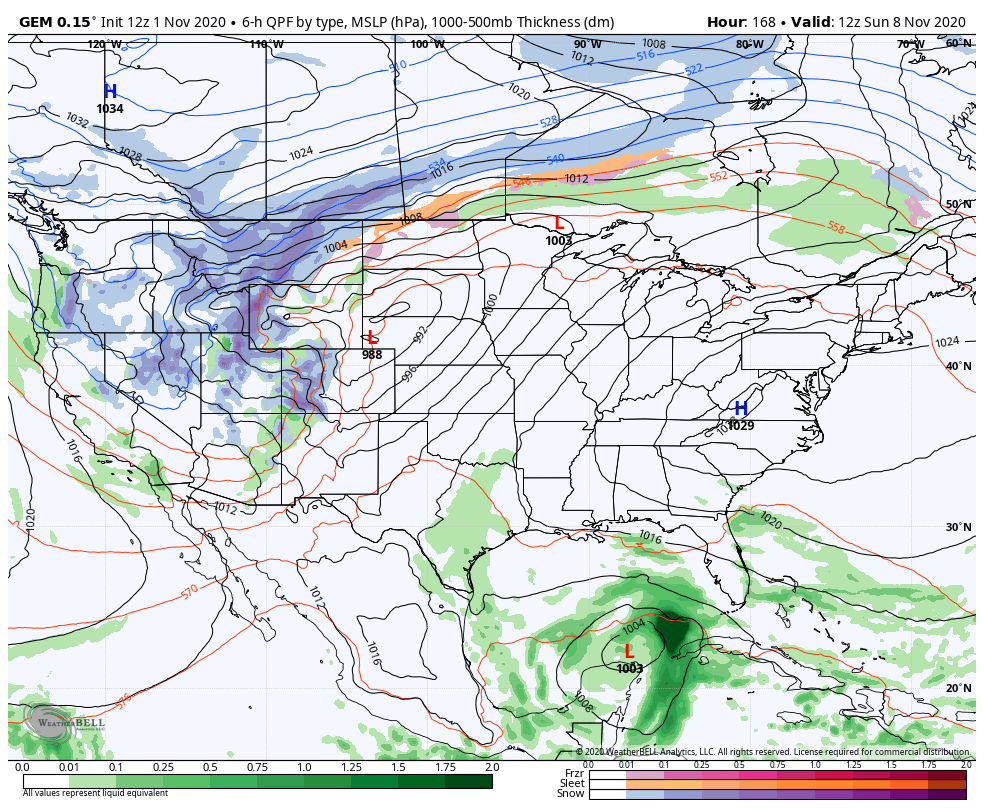
The models will exhibit wild swings with details, but they are consistent in showing a similar fight to what we just saw…
GFS
CANADIAN
EURO
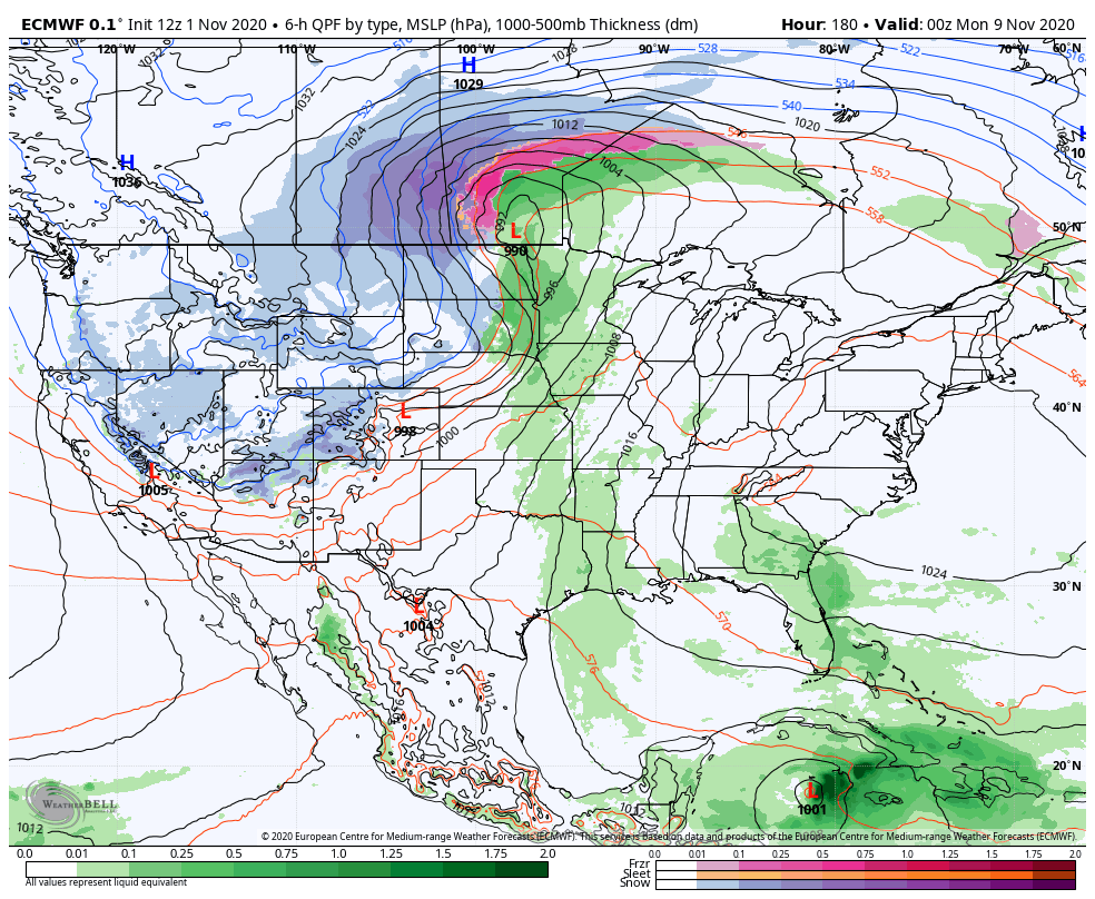
You can clearly see how each model handles it all differently, but have an overall similar look with the trough coming east and a tropical system somewhere in the Caribbean/Gulf region.
Now that November has kicked off the cold weather season that runs through March, I thought it would be a good time to take a look at the state of the Pacific Ocean. This is one of the biggest drivers of the weather across the country and water temp profiles can make a big difference in what kind of winter we have.
Here’s a look at the ocean temp anomalies across the globe…
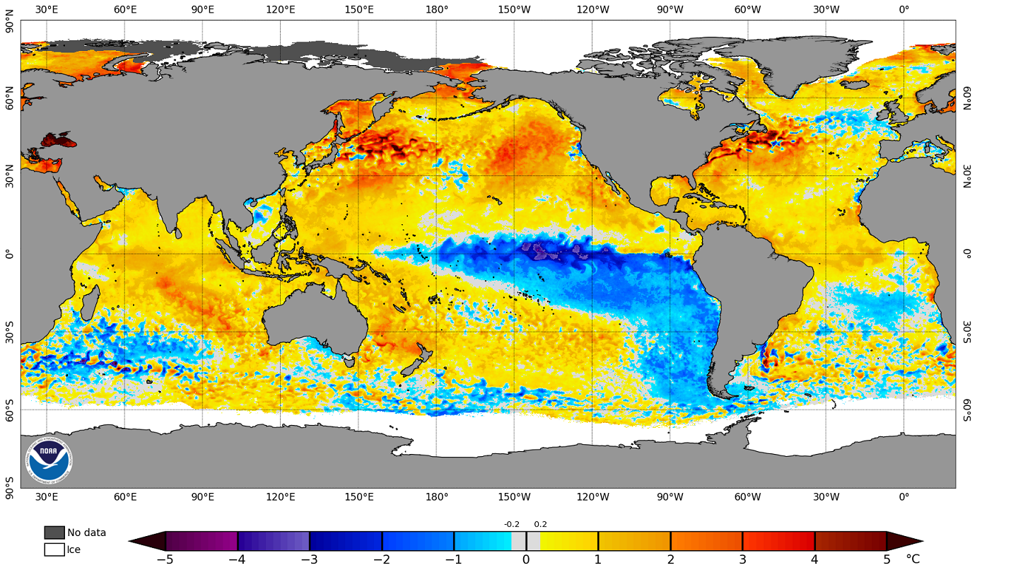
First off, you will notice how much of the globe has water temps that are above normal. This has certainly been the trend of the past decade and this is making seasonal forecasting much more challenging because we really don’t have anything to compare it with.
If we purely focus on the Pacific Ocean, you notice the big blob of warm water off the west coast into the Gulf of Alaska and the increasing La Nina in the equatorial waters…
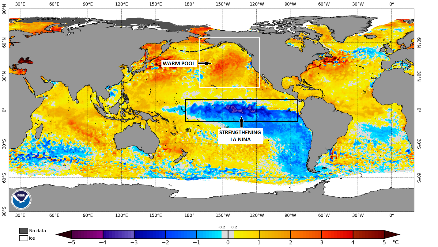
The location of that warm pool is the friend of anyone wanting a cold and snowy winter around here. Last year, it was there, but faded and pushed farther west, crushing our winter dreams. By this same point last year, it was already beginning to do just that. That’s not the case with this year… At least not now.
The La Nina continues to flex some muscle and should become moderate or even strong. The current coldest anomalies are showing up in a region known as 3.4. To see such a warm pool over top of such a strong La Nina isn’t very typical, so this will also lead to a limited number of true analogs from the Pacific.
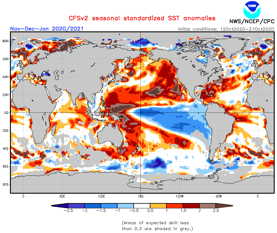
So do both of these signals hold up through the winter? Here’s the new November-January forecast from the CFS V2…
Here’s the average for December-February…
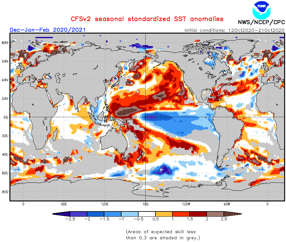
The warm pool off the west coast and into the Gulf of Alaska holds tight as the La Nina becomes more west based in time.
Now, I have to digest all this and figure out where I think it means for our winter ahead. I should have the winter forecast out here in a few weeks, as usual. Some of my working analogs for the winter ahead are:
- 2017/18
- 2010/11
- 2000/01
- 1995/96
- 1984/85
- 1983/84
- 1978/79
- 1970/71
- 1966/67
- 1964/65
- 1962/63
And NO, those are not solely based on how the Pacific Ocean looks.
How’s that for a Sunday afternoon update? 🙂
Enjoy the rest of your day and take care.

Now THAT’S what I call an update!! Regarding those analog years, several were associated with memorable winters, so fingers crossed.
Thanks Chris, I’m late in reading the above post, but I find it very interesting. I hope we have a variety of Winter weather to make it more eventful for discussion.
The years 1964-65 brought snow early and late.
The years 1962-63 was a frigid Winter with some good snowstorms.
The years 1966-67 was mild without any Winter weather.
All of the above weather occurred in south central Indiana.