Good afternoon, folks. It’s a cold early November day after an absolutely frigid start across the entire region. As we roll through the rest of the week, we get in on some fantastic early November weather with milder temps and plenty of sunshine. Beyond that, things look to turn super-active once again.
Let’s review just how cold it was this morning…
It was absolutely frigid this morning. Check out the top 10 coldest low temps from the Kentucky Mesonet. #kywx pic.twitter.com/x2AbCRglhj
— Chris Bailey (@Kentuckyweather) November 2, 2020
This morning's low of 24 in Lexington is the coldest this early in the season since the same day in 2002. We also hit 24 degrees this morning 18 years ago. #kywx
— Chris Bailey (@Kentuckyweather) November 2, 2020
Folks, this has been a fall featuring some stout cold shots, the likes we haven’t seen around here in many years. This has been a totally different pattern from the past several years.
Temps for our Election Day will start in the upper 20s and end in the 50s under mostly sunny skies. Daily highs hit the 60s from Wednesday through Friday and may spike to 70 over the coming weekend. Again, this is the polar opposite of the past few Novembers when we didn’t hit 70.
Hurricane ETA is heading toward Central America as a rare Cat 4 November hurricane…

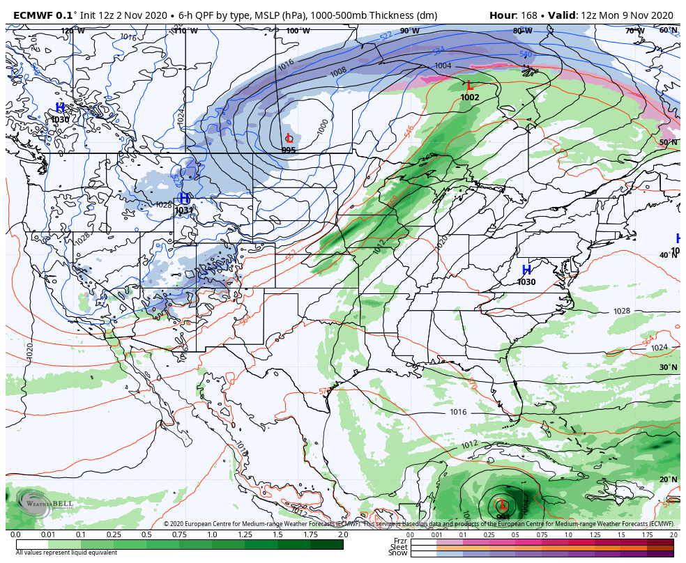
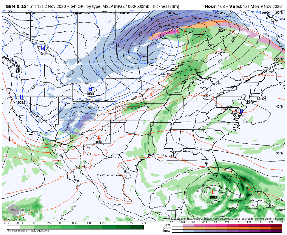
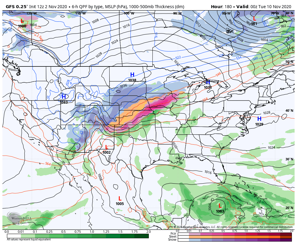
Notice how slow that system moves once it gets inland, but the forecast drifts it to the north by the end of the week. From there, we are likely to see this system drifting northward toward Florida or the Gulf of Mexico. As this happens, another big blast of winter weather invades the central and wester parts of the country.
These two extremes mean some wild model swings will continue as they figure out how to handle it all.
EURO
CANADIAN
GFS
Enjoy the rest of the day and take care.
