Good evening, folks. It’s another record warm day across parts of the region as this crazy warm setup rolls on for another 24 hours or so. By the time we get in late Tuesday and Wednesday, a strong cold front sweeps through here with gusty showers and storms. This will also bring seasonal temps behind it as we watch a bigger system lurking for the weekend.
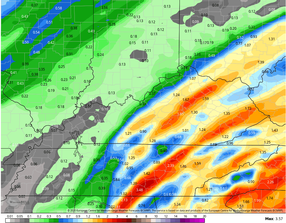
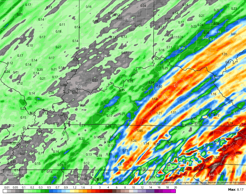
Let’s start this out by focusing on the showers and storms moving in Tuesday through Wednesday. The greatest threat for heavy rain continues to be across central and eastern Kentucky where some 1″-2″ rains may show up…
EURO
Hi Res NAM
Winds will be very gusty during this time as seasonal temps come in behind the front for the rest of the week.
Much of what happens from here may depend on Tropical Storm ETA. Let’s check in on Eta down in the eastern Gulf of Mexico…

This storm has really been struggling, more than I thought, so far today. Here’s the latest from the National Hurricane Center…

There is growing evidence this will drift much farther west and could even impact… Louisiana. Shocked? Didn’t think so. Some of the latest Hurricane Models are showing this…

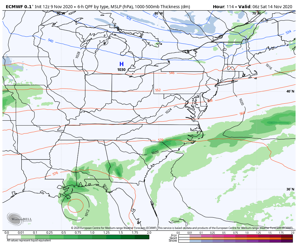
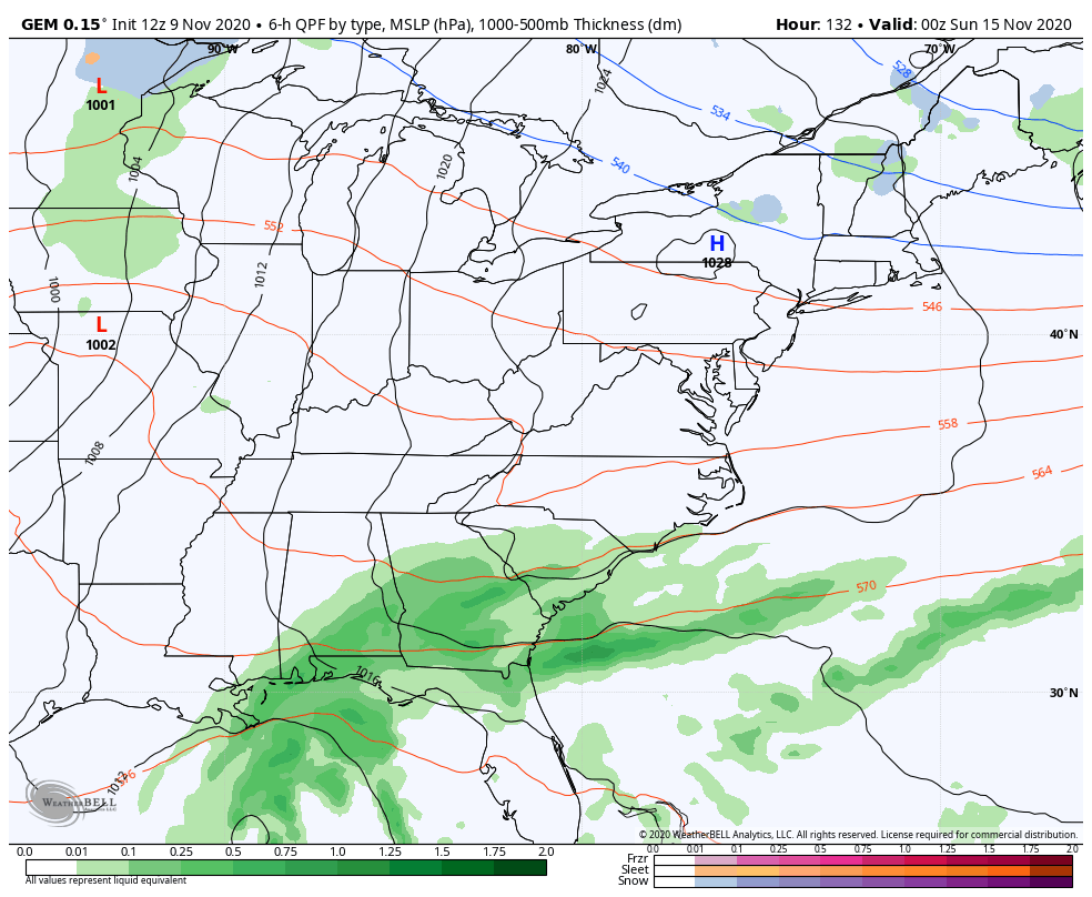
That would give our weekend storm system a much better chance to entrain some tropical moisture as it works through our part of the world and this is now showing up on the models…
EURO
CANADIAN
This could be a potent storm system that has much colder air surging in behind it.
We certainly have a lot to track in the coming days and that’s what we will be doing. Enjoy the rest of your day and take care.

The high temperature of 76 degrees Tuesday afternoon at Chicago’s O’Hare Airport set another record high, breaking the old record for the date of 74 degrees set in 1999.
The SPC has placed much of Illinois, including the Chicago Metro Area, in the marginal risk for severe weather Tuesday afternoon and early evening, with damaging wind gusts from thunderstorms the main threat later in the afternoon. Even before the storms arrive, winds are predicted to gust as high as 50 MPH.
My bad, I’m one day ahead of myself… The 76 degrees was on Monday afternoon. Tomorrow afternoon could break another high temp for the date before the cold front moves through.