Good Tuesday, everyone. It’s a very busy weather day taking shape as a strong cold front works in from the west. This front brings gusty winds, showers and storms and a big time temp drop to the bluegrass state. After this clears the region later Tuesday, our focus then turns to a bigger storm system showing up this weekend.
Here’s a rundown of how things play out with the front moving in:
- Temps spike back into the 70s and may, once again, set a few record highs.
- Scattered showers and thunderstorms will quickly develop this afternoon/evening as a plume of moisture works from south to north.
- The actual front arrives tonight with a line of showers and storms that looks to slow down and increase as it moves into central and eastern Kentucky.
- This keeps rain going through Wednesday across the east. Local 1″-2″ amounts may show up in the central and east.
- The temp map will look awesome as we see a pronounced drop behind the front moving through. Highs for Wednesday are in the 50s for the most part.
Here are your radars to follow the rain and storms…

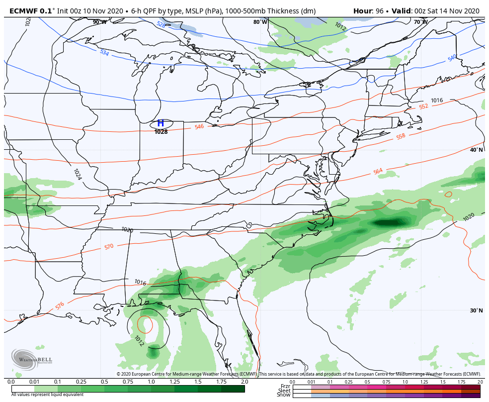
Seasonal temps continue through the rest of the week, but another quick spike is likely just ahead of our big weekend storm system. This comes at us from the southwest and may be able to entrain tropical moisture from ETA.
ETA is still flailing around in the eastern Gulf of Mexico…

The National Hurricane Center’s forecast for ETA continues to go farther west…

As our storm system develops in the southern plains, it will try to pick up some moisture from ETA. That could enhance the rain potential as our storm system rolls through with cold air coming behind it. Remember when I said to watch for the trough coming in behind it to grow stronger on the models? Well, that’s what they’re now showing.
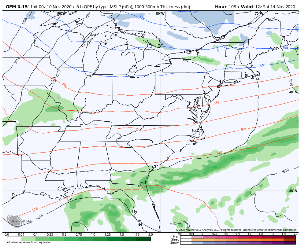
Here’s the EURO…
CANADIAN
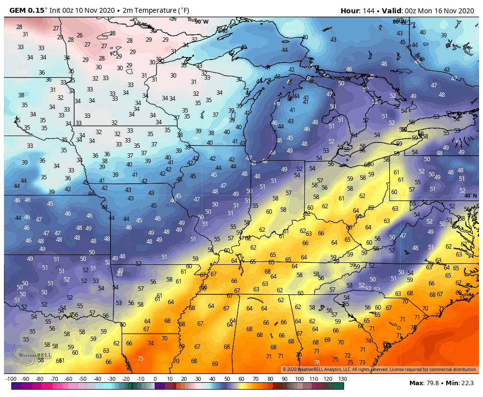
Temps
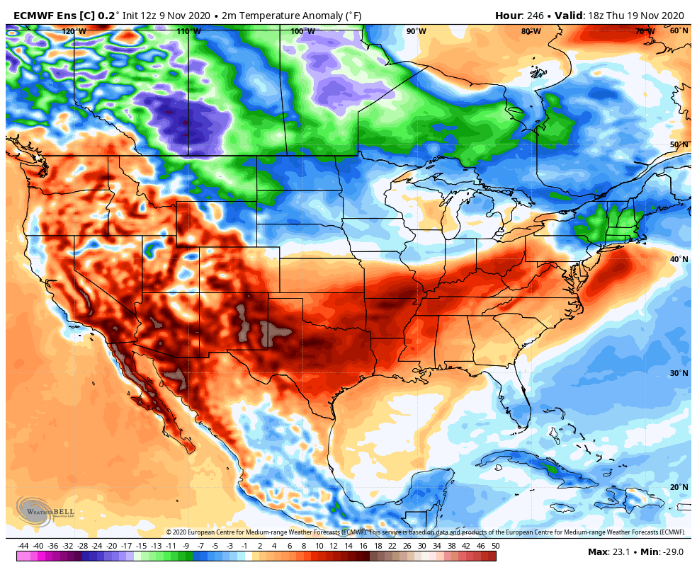
If we can get the tropics to finally give up ( Theta is well out in the Atlantic and I’m not convinced we don’t get another storm), we may finally see the colder air pressing back into the eastern part of the country in greater fashion. This is something the latest control run of the EURO Ensembles are seeing once past the mid-month mark…
I will have another update later today. Have a terrific Tuesday and take care.

Yesterday, it was 80 degrees for an afternoon high in my backyard. It is very nice weather, but when the air conditioner comes on the 9th of November I start to wonder about where our climate is going.
I checked out the tropics yesterday and ETA may become a very interesting storm to follow as the tract is changing. The longer ETA is over very warm Gulf waters it could become a major hurricane. Hopefully this won’t happen. The tropics are now the most active ever recorded in modern history.
Will we have Winter weather later or will it be an extreme change from the nice weather we are experiencing now to frigid Arctic weather at the end this month.
I would commend any climatologist who predicts the coming Winter accurately.
Much of Northern and Western Illinois has been upgraded to a slight risk of severe weather by the SPC for today and this evening. There’s already a Severe Thunderstorm Watch in effect for much of Western IL until 6 PM local time.
In addition, a Wind Advisory is in effect for much of IL except for the southern part for non-thunderstorm wind gusts exceeding 50 MPH. Yeah, it’s really windy!
All this is ongoing amidst another record-breaking warm day here with temps approaching 75 degrees.
There’s just enough shear available for a 5% chance of a isolated tornado or two from about Milwaukee and Chicago to Missouri. November is considered to be a secondary tornado season; of course the spring months are prime time for severe weather.
Meanwhile, there is cold and snow for areas just to the west including Nebraska. Little wonder that the clash of seasons is fueling possible severe weather.
Nashville has received a few sprinkles this morning, but looks like Tennessee and Kentucky will be limited to sub-severe thunderstorms.