Good Thursday, everyone. It’s feeling like November as a seasonal brand of chill is back in the bluegrass state. This is ahead of a bigger push of cold air diving into our region by late this weekend and early next week. It’s a blast that will be introduced by some big time winds and numerous showers.
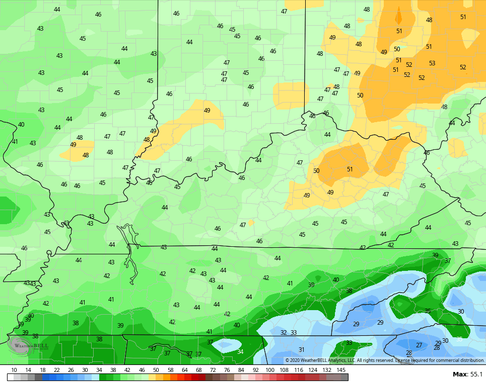
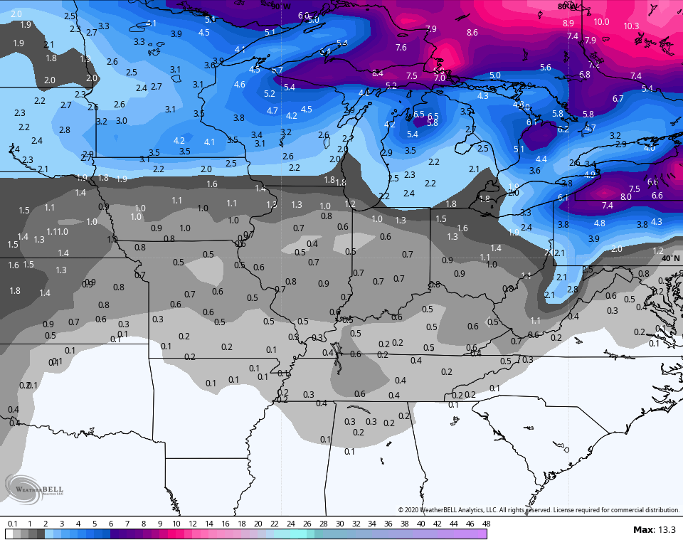
Before we look ahead, let’s look back at the heavy rain maker from Tuesday night and Wednesday. Here are the totals from the Kentucky Mesonet…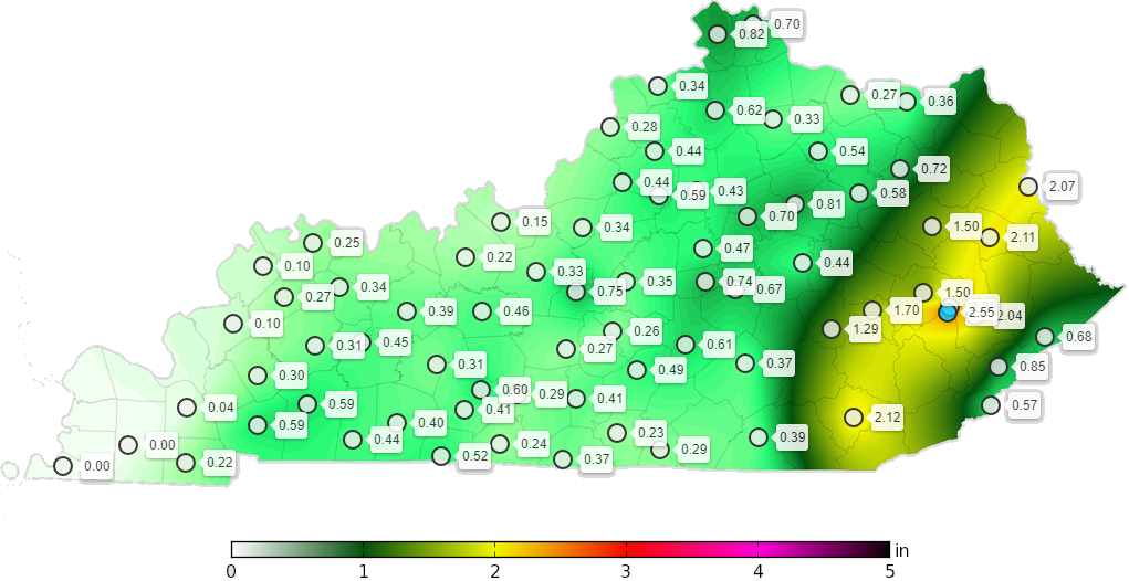
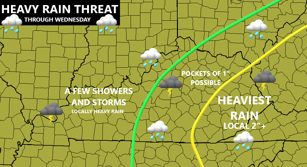
That matches up well with the forecast map…
Chef’s kiss goes here. 🙂
Temps out there today start in the 30s for many and end up with temps a little below normal for highs. Upper 40s and low 50s will be noted in the north with mid and upper 50s in the south.
The numbers look to remain normal or even a touch below into the start of the weekend. Here’s the NAM temperature forecast from Friday morning through 7pm Saturday…
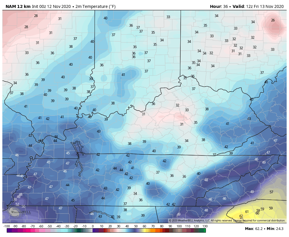
It’s interesting to note how the models are trending colder with this setup than what they’ve been suggesting for the past several days. This isn’t the first time I’ve said that in the past several months and seems to be a definite trend to keep in mind going forward.
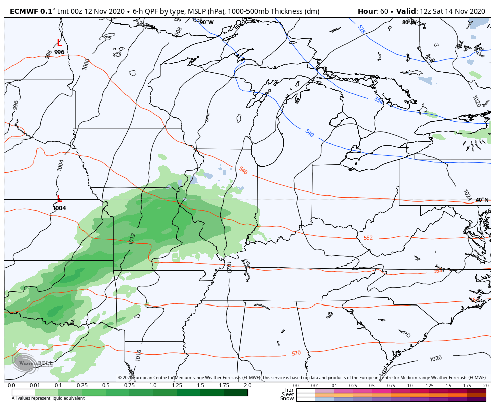
I have already talked about how we would see the models trending colder with the setup for early next week and we’ve already been seeing that. We have another strong cold front ready to blast in here on Sunday, unleashing a round of frigid temps. This is going to become a big time wind maker across the entire region. Gusts of 40mph+ will be possible from Saturday night through Sunday afternoon…
EURO
GFS
That could get a little crazy and it’s something for us to keep a close eye on.
This blast of wind will be accompanied by widespread showers and a rumble of thunder as this potent system sweeps through here…
The models have been going back and forth on bringing a clipper looking feature coming in behind this later Tuesday and Wednesday. The Canadian has been most consistent in showing this…
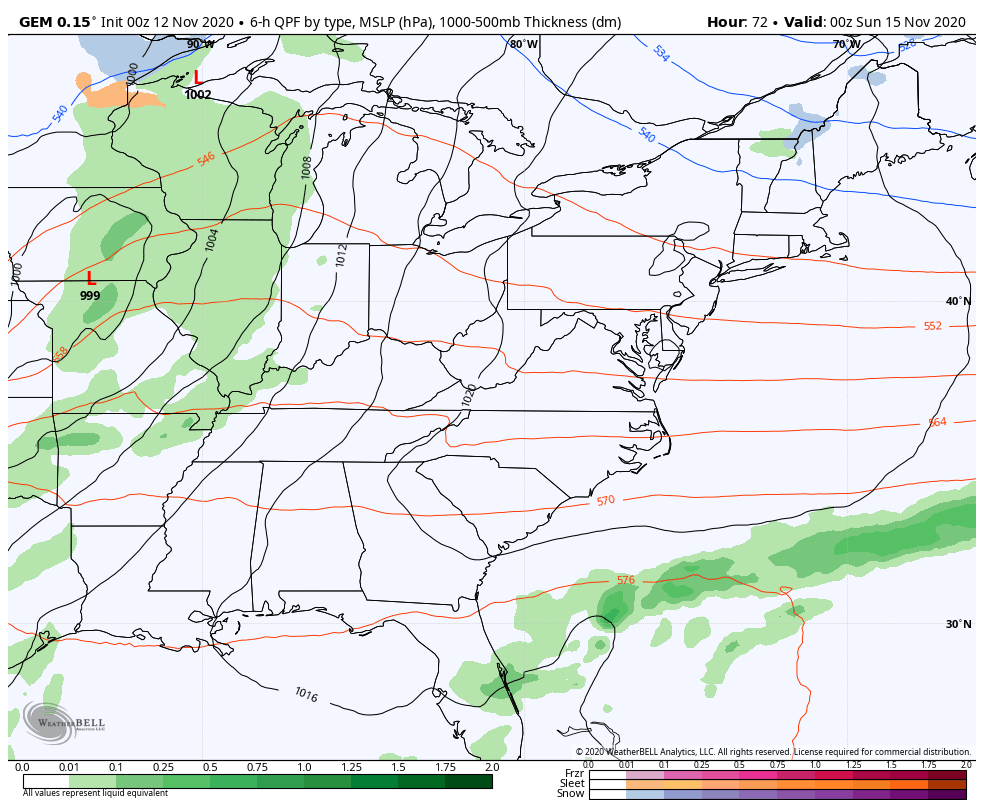
If the Canadian is analyzing this feature properly (that’s a big if), it shows absolutely frigid temps…
I’m not normally one to use the Canadian for much in the medium range, especially for temps, but this model has done well in this range with the cold shots of the past few months.
I still think the pattern snaps back to normal or a little above later in the week before another cold shot or two takes aim at us next weekend into Thanksgiving Week. That’s when we have a chance for a taste of winter weather at some point. The GFS Ensembles now match the EURO Ensembles in giving us an opportunity for some flake action…
I will have another update later today. Until then, have a good one and take care.

Here is the final Public Information Statement from the NWS Chicago regarding the historic warm stretch from November 4th – 10th, and details the numerous records that were broken. http://weather.gov/lot/2020NovemberWarmth
Among them:
-This is the first time ever that Chicago has seen seven consecutive days of 70+ degree weather during the month of November, breaking the previous record of five consecutive days set back in 1953.
-The seven 70+ degree days sets the record for the most 70-degree days for any November in Chicago, breaking the previous record of six days set in 1953 and 1975.
Also, here is the link for the complete summary of the severe thunderstorms and strong winds that hit Northern IL and the Chicago area during the late afternoon and early evening of November 10th, including photos of some of the damage. http://weather.gov/lot/10Nov2020
Interesting Mike and thanks for sharing. Until the tropics “give up” we are going to continue to be under the influence of the “southeast ridge.”
A new tropical storm is likely to form in the Caribbean today or tomorrow.
In contrast, the Arctic is very frigid and one of these days the Polar Low will weaken and the AO will become negative and all that Arctic air will plunge southward.
If we had an active subtropical jet stream (which we don’t due to La Nina) we would have a chance for a major snowstorm here in Kentucky.
I think we will see some “clipper systems” move through sometime this winter, but the snow would be north of where I live. Northern to southeastern Kentucky would see the most snow along with Lake Michigan’s influence.
Good work Chris on your accuracy !
I had 0.25 inches of rain as the cold front went through early yesterday.