Good afternoon, folks. Seasonally chilly temps are back in the bluegrass state as we watch another cold front crashing in for your weekend. This will bring a big blast of wind with it before very cold air surges in for much of next week.
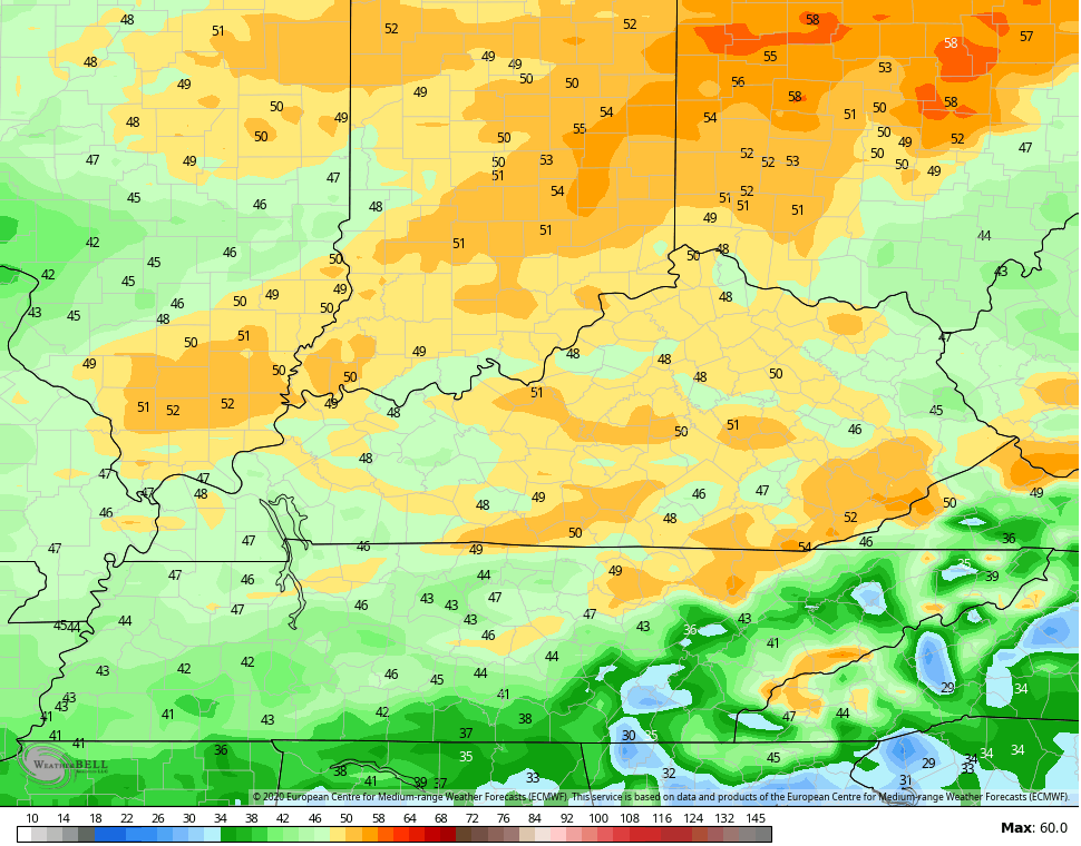
The forecast through Saturday hasn’t changed on my end as temps actually run a little colder than normal during this time.
Winds will begin to gust on Saturday as our cold front approaches from the west. Those winds will absolutely crank Saturday night and Sunday as the front slams in here. Gusts may top 50mph at times. There’s some nice agreement among the models…
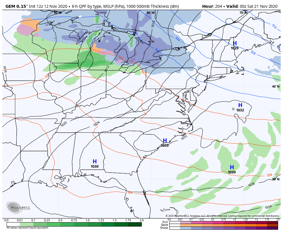
EURO
NAM
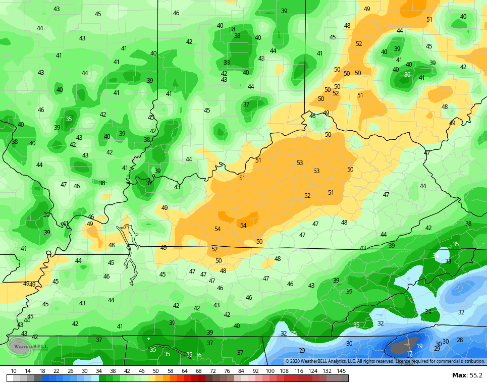
GFS
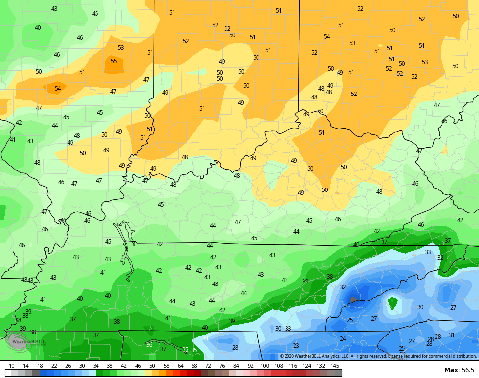
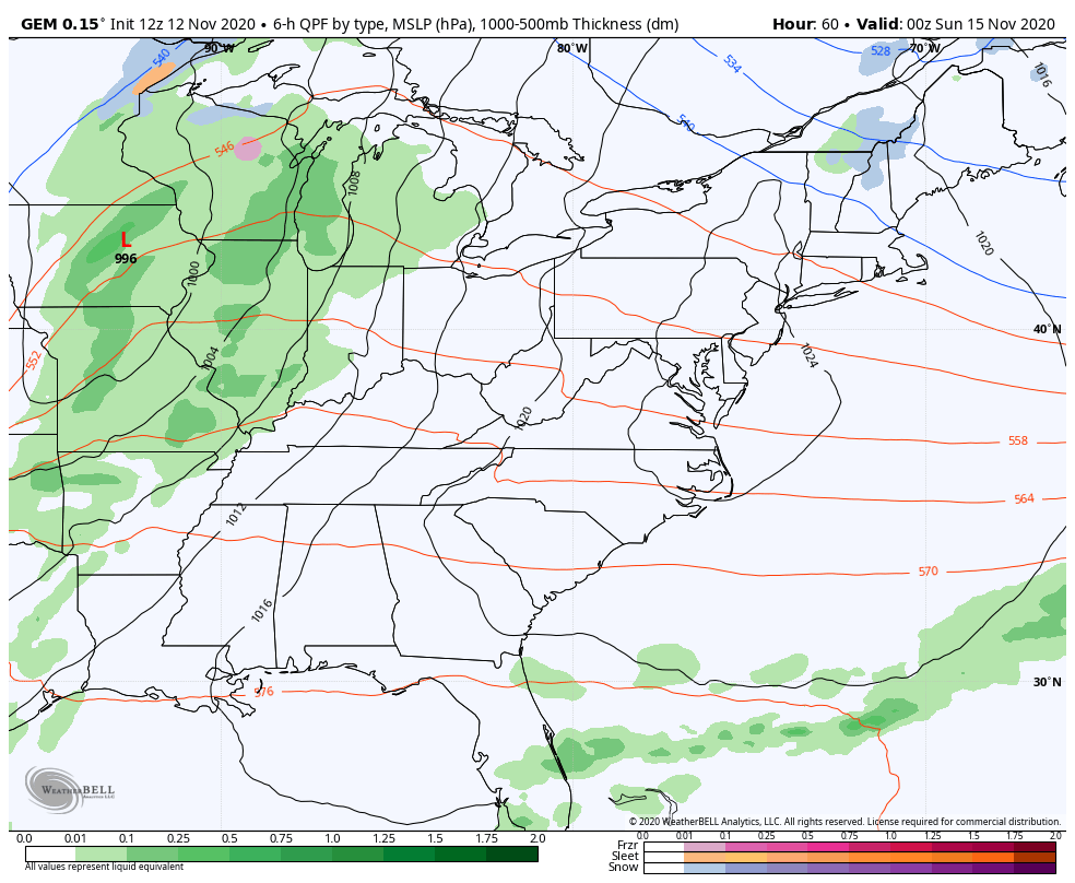
A few showers show up ahead of the front later Saturday, but this action becomes widespread as we go into Saturday night and early Sunday. From there, colder air moves in with another front pushing in behind this one…
I continue to think temps moderate quickly by the end of next week into the start of the weekend. But, the trend continues to be for another push of cold air to dive in here from the northwest to kick off Thanksgiving week. Can this setup have a storm system with it?
The Canadian says yes…
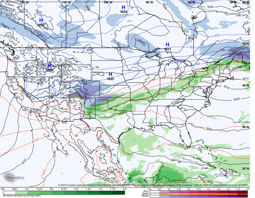
The EURO is slower but you can see low pressure coming out of the southwest on the final day of the model run…
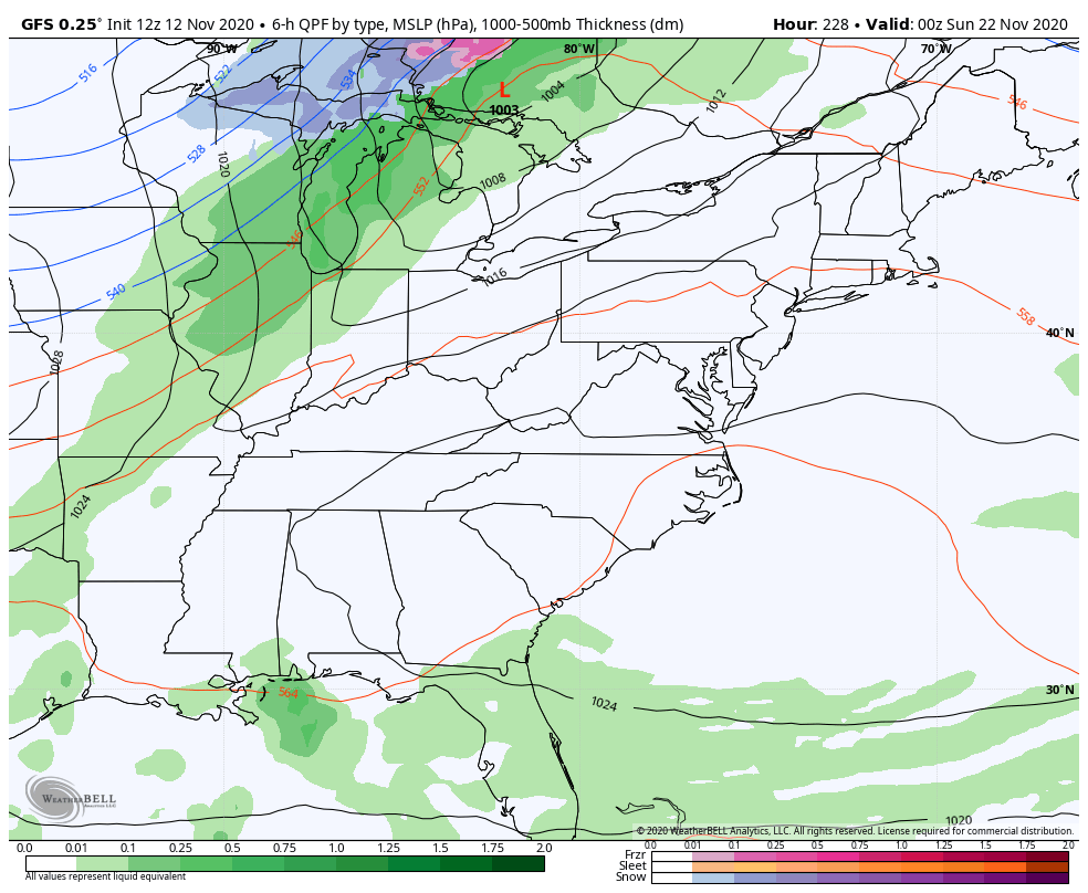
The GFS sees the cold shot coming, but is always showing a progressive look…
So, my idea of Thanksgiving week giving us something to watch out for seems to have some merit. At least it does for now. 🙂
Enjoy the rest of your day and take care.

Last year, Chicago’s O’Hare Airport had received a total of 8 inches of snow from late October through November 11th (and around 5 inches here in the SW suburbs), compared to just a trace so far this season. And on November 12th last year, the low was 7 degrees, the coldest temperature Chicago has ever recorded for so early in the season.
But then the snow suddenly turned off, with O’Hare only receiving 2 more inches the rest of November through December, along with temps warming into the 60s on Christmas Week.
We’ll see what the rest of this year brings.