Good Friday, folks. We have a very fine weather day taking shape to kickoff the weekend, but gusty winds will soon take center stage. This occurs as a strong cold front drops in here from the northwest early Sunday and some of those winds may cause issues. That front also ushers in a blast of colder air for early next week. I’ll take a look at that and focus on the Turkey week outlook and beyond.
The weekend front will throw clouds at us as early as Saturday and a few showers also show up. The best chance for Saturday rain is across the west and north, but this looks fairly scattered at the moment. There’s also likely to be a big temp spread from north to south.
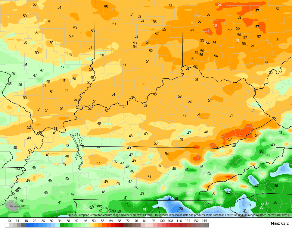
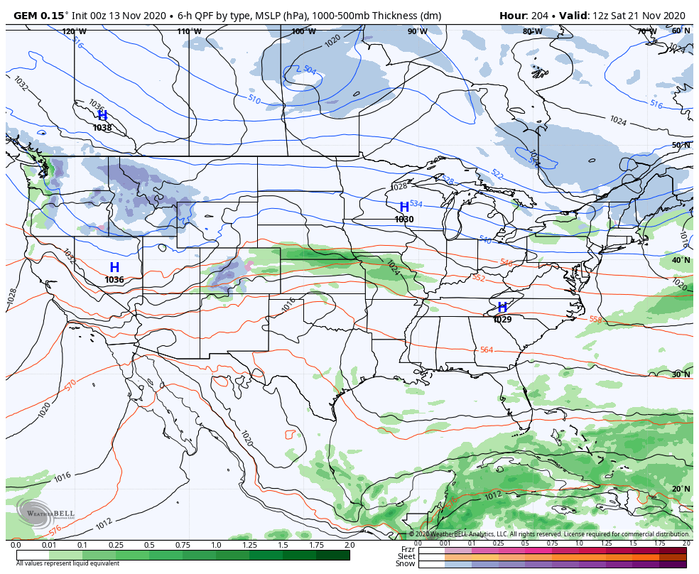
Low pressure develops in the Mississippi Valley and heads into the Great Lakes early Sunday, dragging a cold front across the state. Winds will absolutely crank in this setup and a few gusts may reach 40mph-50mph at times. Look at some of the gusts the models are spitting out.
EURO
GFS

NAM
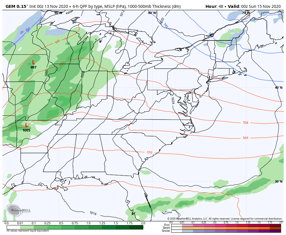
A band of quick-hitting showers will be along and ahead of the front, but this should clear out for some sunshine by Sunday afternoon. Another front then drops in behind this with a seasonal brand of cold air into the middle of next week. The Canadian Model still likes that sneaky little clipper looking system behind it…
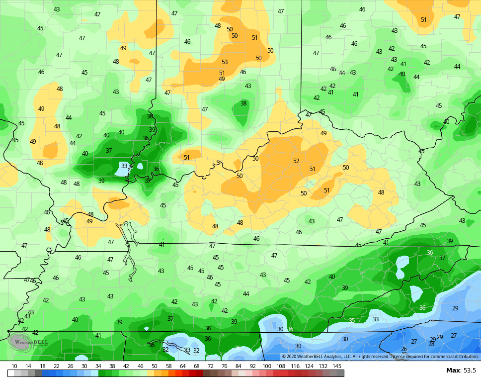
Temps will rebound slowly behind that by the end of the week.
So, I have the winter forecast all finished up and it will be released on WKYT next Thursday. Upon completion, I usually take a look around to see what other folks have come up with. I always wait until I’m done so nothing skews my independent judgement. Once I started looking, it confirmed just how much the weather community has become an echo chamber. Just about every seasonal outlook I’ve stumbled across (pro and amateur) seem to use the exact same couple of analog years to come to the exact same conclusion. Folks, as someone who has had some seasonal success and seasonal fails, I can flat out tell you it ain’t as easy as finding a year or two and saying this year will be exactly like that. As a matter of fact, it never ever happens.
I was also seeing recent forecasts for a blazing warm Thanksgiving week. These were put out at the same time I’ve been talking about signals showing up that can lead to colder weather and some winter stuff in the eastern half of the country.
Those signals are starting to show up a little better in some of the computer model guidance.
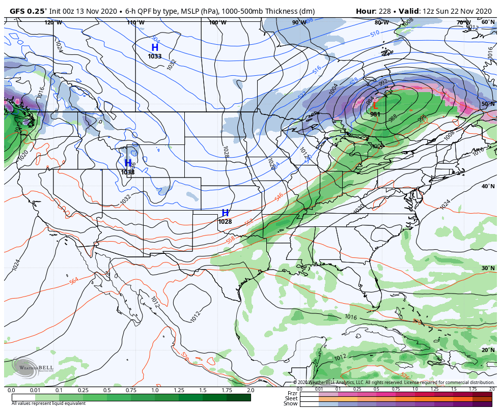
The GFS for Thanksgiving week has a busy look to it…
The Canadian Model only goes out to next Sunday, but you can see the cold front pressing in with a storm system developing near Texas ready to ride northeastward…
Notice how the average of the 51 member EURO Ensembles is showing a trough developing on top of us Thanksgiving week…
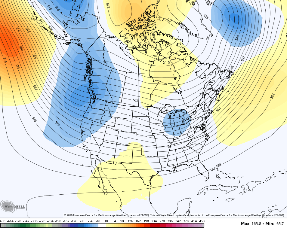
The EURO Control is much more pronounced…

If we look a little deeper down the road courtesy of the new GFS extended, we find some festive flake chances through the first few weeks of December…
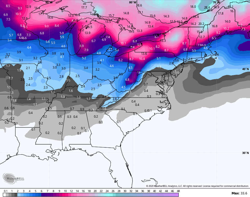
GFS Extended Control
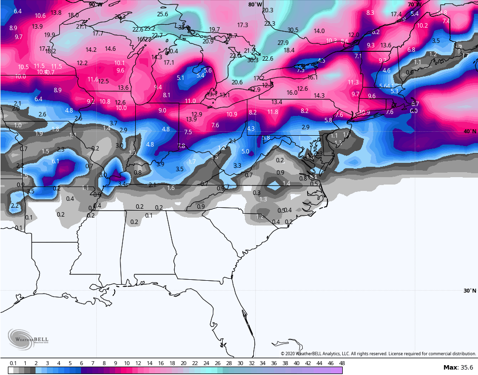
Again, those aren’t meant to be taken literally, folks. I just use them as an illustration on how models are seeing the opportunity for some snows. 🙂
I will throw you another update later today. Have a fantastic Friday and take care.

Thanks Chris, We have had a very quiet Autumn and I must say it has been most pleasant and I hope it doesn’t change too abruptly.
If anyone out there has been reading my post I have been dropping hints as I think how our Winter will turn out. Chris, my analog years are 1966-67 and 1989-90. The year 1966-67 was one of the mildest Winters in my lifetime and the year 1989-90 featured the coldest December on record without snow and a mild second half.
Looking forward to Chris’s Winter outlook and if correct I will commend him and if not I will thank him for all his hard work.
On a personal note, I turned 69 years old today and I thank the good Lord for giving me these many years with all the health problems I have had here lately.
Happy Birthday! And I am sure you have many more years left in you.
Happy birthday Schroeder!
Thanks Dottie ! and God Bless you and your Family.
It may have been warm where you lived during the winter of 1966-67, but Chicago received its largest snowfall ever on January 26-27, 1967, with an amazing 23 inches of snow! This came two days after a record-breaking 65-degree high temperature. I don’t have any memories of this as I was just a baby.
Here’s the wikipedia link that goes into detail about that incredible blizzard that shut down the Chicago Metro Area for days: en.wikipedia.org/wiki/1967_Chicago_blizzard
Enjoy your Birthday! As long as you’re able to walk and go outside to appreciate everything wonderful that nature has to offer, you’re very blessed!
THANK YOU and I hope to have many years to enjoy.
God Bless you and your Family.
Thanks Mike, I remember that big snowstorm in Chicago well from the news/weather out of Terre Haute, Indiana. That whole Winter was mild 1966-67 in south central Indiana.
For Everyone the following:
On October 25th this year I had to go to the ER (U of L Hospital) in Louisville, Kentucky to have an MRI on my lower spine. The diagnosis came back as a Herniated disk in the Lumbar area. My right leg and foot had “shock pains” and this continues now going on two months, but seems to be getting better slowly. Hopefully, I will get back to my normal walking and enjoying the outdoors again.
Getting back to the weather another tropical storm has formed in the Caribbean. Unbelievable year for the tropics.
Have a good evening All !