Good Saturday, everyone. A potent cold front is racing into the region and bringing the potential for high winds to much of the region from this evening into early Sunday. This front will also bring some showers our way as colder air settles in for early in the new week. I’m also continuing to watch Thanksgiving week for the potential for early season fun and games.
Let’s start this out with a breakdown of the weekend:
- Winds are the main player. Gusts of 40-50mph will be possible as our front moves in. Locally higher gusts will be possible.
- This may cause some wind damage, so keep that in mind.
- Clouds will stream in today ahead of our front and some showers will show up in the west. A few of those may sneak into central Kentucky this evening.
- A line of showers and some thunderstorms show up along the front overnight and Sunday morning. A few strong storms are possible.
- By Sunday afternoon, that line is well to our east with sunny skies taking over as winds start to come down.
- Temps will be in the 55-60 degree range Sunday morning then drop into the upper 40s and low 50s by late afternoon.
Here are your radars to track the showers increasing from the west…

Another front blows in with no moisture late Monday and early Tuesday. Temps behind this will be fairly cold with readings in the 40s for highs and 20s for lows.
Temps moderate by the end of the week into the weekend, but I’m still looking toward late weekend and into Thanksgiving week for the potential of winter weather in our part of the world. The models continue to see more and more of the potential I’ve been talking about for many days now.
The GFS brings a cold front in here on Sunday with low pressure developing along it. Now, this is just a snapshot of a current model run that will change, but the current GFS shows the winter potential to kick off turkey week…
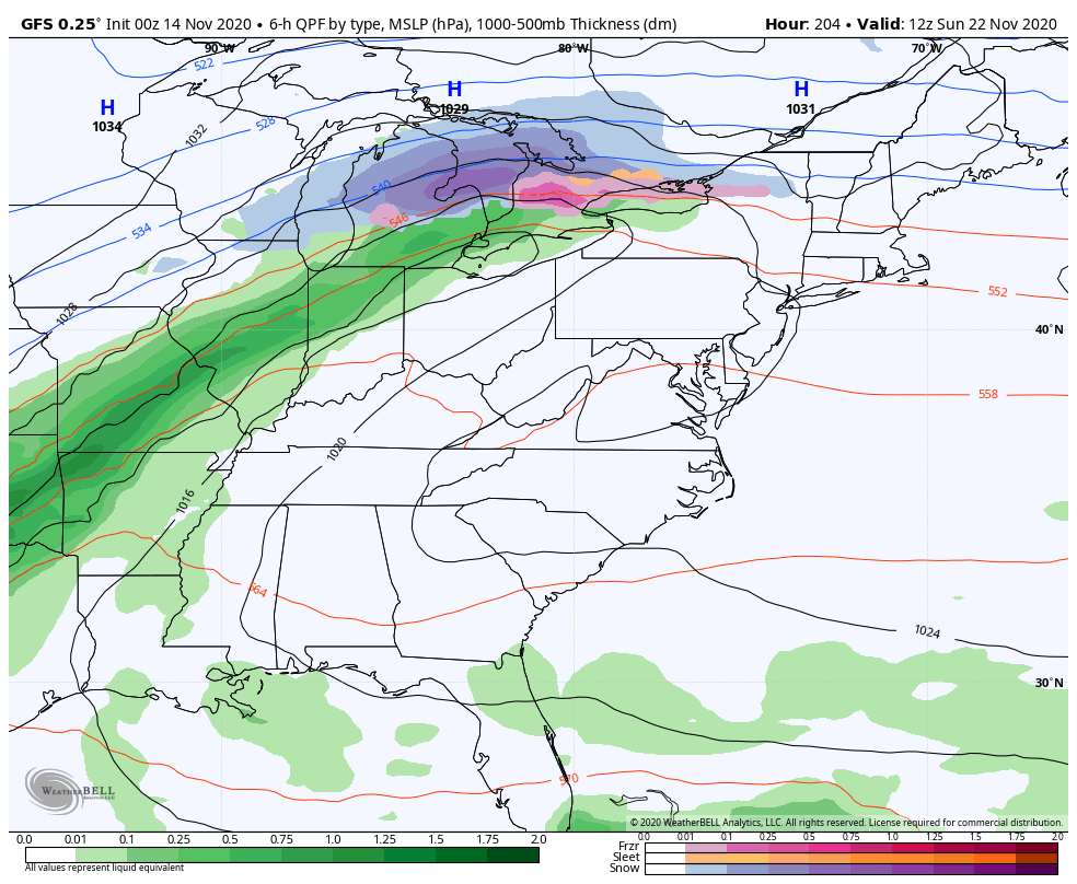
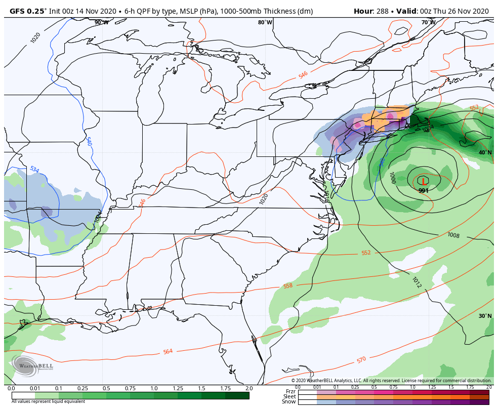
It goes on to follow that up with additional winter chances for Thanksgiving Weekend…
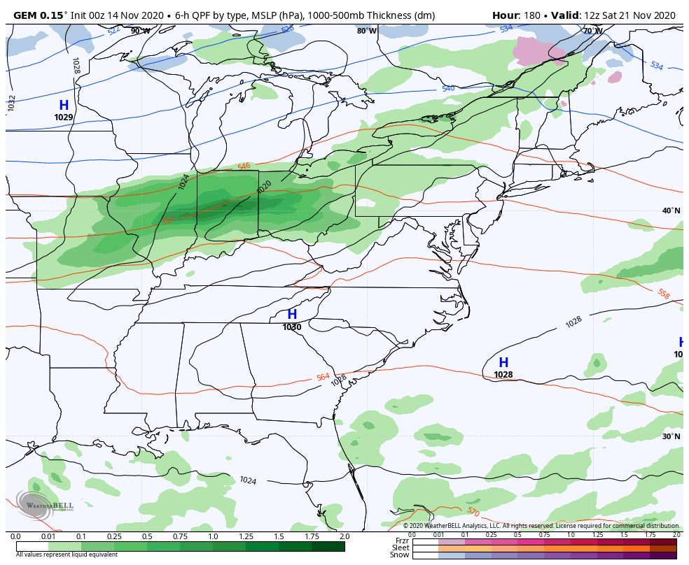
The Canadian doesn’t go out as far as the GFS, but it does show the first system to start the holiday week…
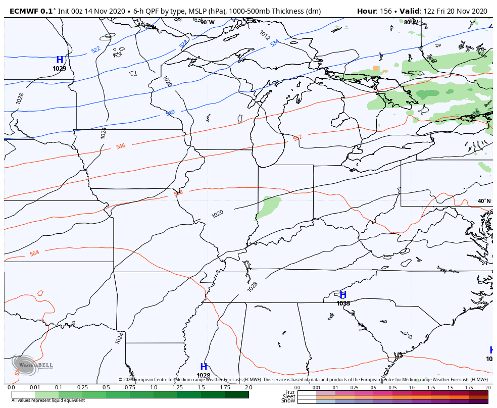
The new EURO takes on a big time winter look, but it’s doing so in different fashion. It presses colder air in here much quicker with rain returning as early as Friday. From there, cold overwhelms the pattern to start Thanksgiving week…
Why is the model overwhelming the pattern with cold? Because it’s developing one massive block over the Arctic and essentially sends the Polar Vortex toward the United States…
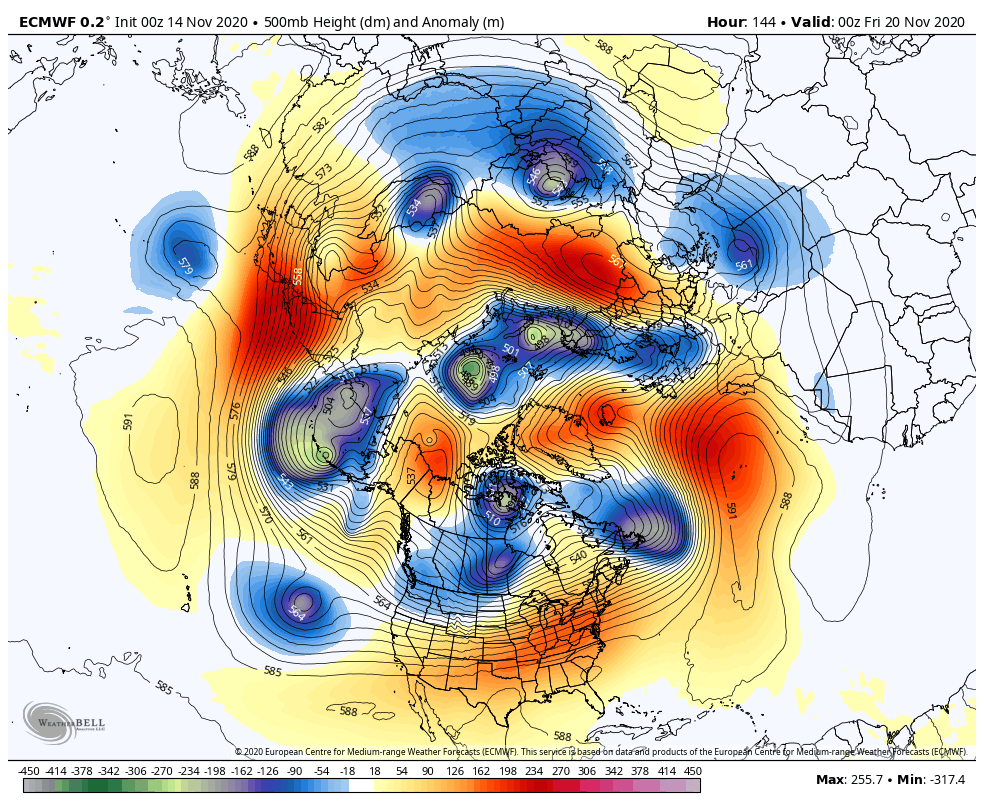
Now, this is a big change from prior runs of the model, but it’s probably going to get a lot of attention today. If that kind of block materializes over the Arctic(-AO) to go along with the blocking showing up over Greenland (-NAO)… Look out below!
Again, we are looking at trends and nothing overly specific, but it’s good to see model support for my ideas. 🙂
I will throw you another update later today, so check back. Have a good one and take care.

I would be happy if this was the first and last time to hear ‘polar vortex’.
The wind out there this weekend is going to make deer hunting interesting. I’m sad that I’m not able to be hunting myself this time, but I’m also glad that I won’t be in that deer stand when that wind starts rocking and rolling!
Instead, I’ll be at home watching the CATS bring one home for Coach Schlarman. GO BIG BLUE!
Dottie, I quit hunting and fishing years ago, but my brother still hunts and this year he harvested a nice 8 point buck in the early season. Hope you will be back hunting soon. You can’t give up something you love to do.
I do not care for the term “Arctic Vortex” either actually it’s called the “Polar Low.”
Correction: Not Arctic Vortex but Polar Vortex.
Sounds like a “wild ride” Chris. Forecasters in my area are predicting sustained winds of 35 mph with gust to 50 mph for tonight into part of Sunday. We could loose our power with limbs coming down over power lines.
Teleconnections are difficult to forecast long term, is what I’ve been learning. I do know that the NAO in a strong negative phase along with a strong negative AO along with a strong negative EPA and lastly a strong positive PNA would bring Winter weather to the eastern part of the country.
The Arctic is freezing over with almost total snow cover over the entire region and at the same time the tropics remain strong and active. Something is going to have to give. It will be interesting to see what happens over the Winter.
The “fly in the ointment” is the notorious “Southeast Ridge” which has been stealing Winter weather from our area over the last several years. Looks like we would be long overdue for a weak El Nino which would give us an active subtropical jet stream and better chances for snowstorms in the Ohio Valley. A climate scenario which is difficult to determine.
I’ve been watching videos of blizzards and huge snowstorms and had to ask myself this question “Why would I want this type of weather?” It would be dangerous to have this type of weather where I live with no one around to help if I needed it.
If we just had about 2 inches of snow on Christmas Day and mild, dry weather till Spring that would be fine with me.
I’ve really changed as I age. I’m no longer a snow lover because I’ve seen enough of it.