Good evening, gang. Winds are starting to crank across the west as we get ready for the big blast of it coming tonight into Sunday. Much of the region is under a Wind Advisory as a cold front slams in here late tonight, bringing those high winds and the potential for a few strong storms. Beyond all this, much colder air moves in early next week as we start to eye bigger changes for Thanksgiving week.
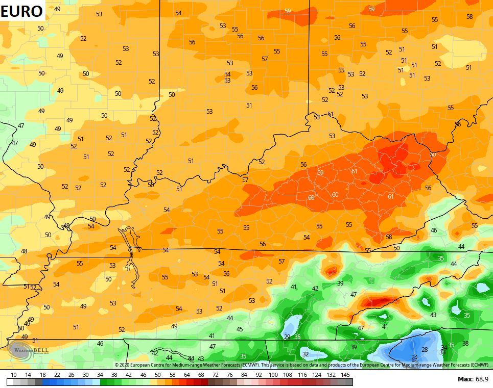
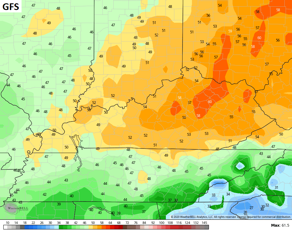
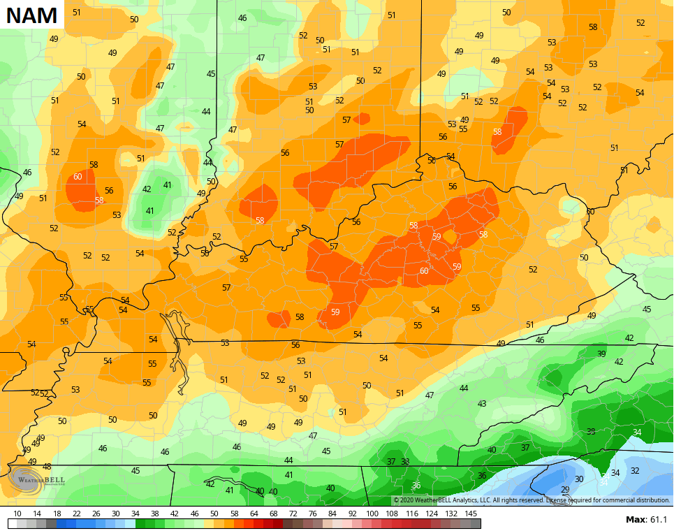
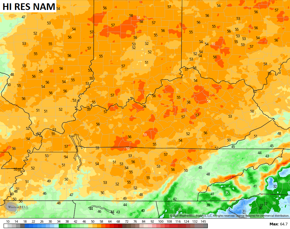
There’s nothing more I can say about the winds coming that I haven’t already said. This has been on our radar all week long and it looks like gusts tonight may top 50mph or higher in some spots. Here’s a rundown of the latest computer model forecasts for those gusts…
The line of showers and storms enters western Kentucky this evening then races eastward overnight and early Sunday morning. There’s the chance for a few warnings with this line all the way into central Kentucky, but the Storm Prediction Center only has far western Kentucky in the low-end risk for severe storms…

Here are your radars to follow along…

The sun returns quickly on Sunday as early morning temps around 60 drop to near 50 in the afternoon. Winds will continue to crank, but will be down compared to the early morning blast. Another cold front slides in here late Monday, bringing colder air through the middle of next week. Highs in the 40s and lows in the 20s will be noted for a few days.
I continue to watch the setup for next weekend into Thanksgiving week. Things look active as colder air presses back into the country. This could set the stage for winter weather across the eastern half of the country.
As I’ve said, don’t key on any model run because they will change from run to run. Just focus on the overall trend of action and cold trying to hook up.
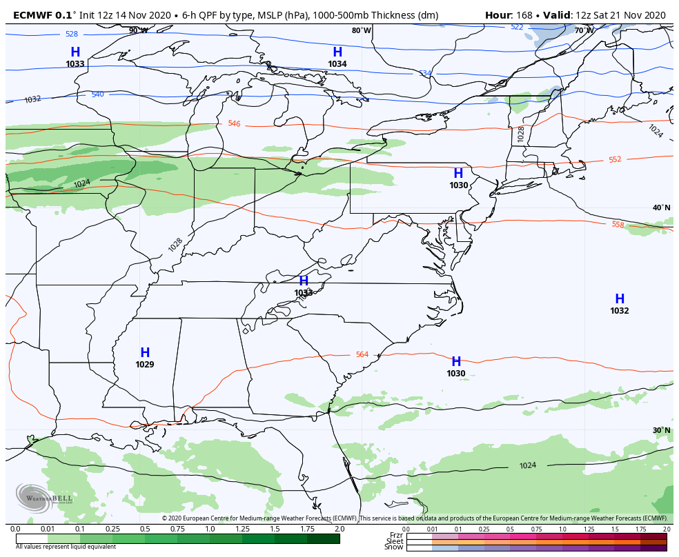
Here’s the latest EURO into the start of Thanksgiving week…
The Canadian for the same time…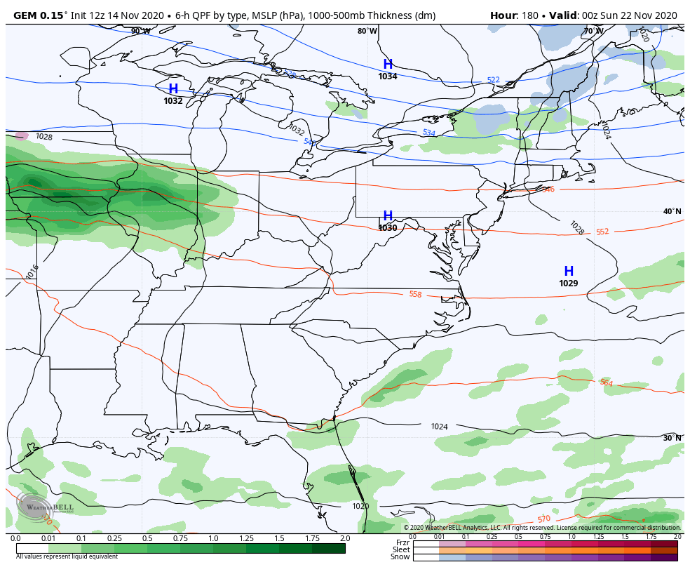
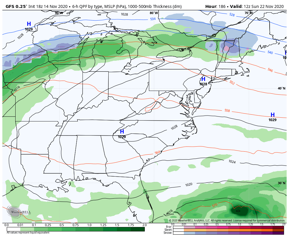
The GFS goes out deeper than those two models and shows cutoff low city through the entire week…
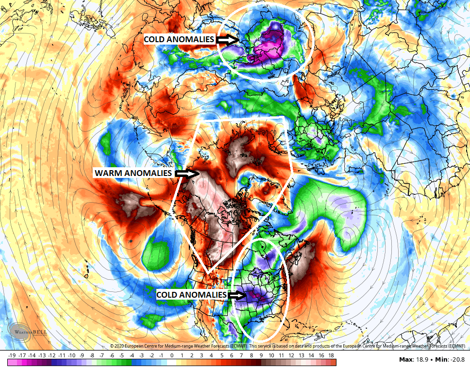
Again, it’s fun to watch and see how this whole thing evolves, but it’s giving us a lot to track. I continue to watch how the EURO is evolving over the North Pole and the potential for warming there. Notice how the day 10 EURO continues to show the warmest anomalies up there and across Canada. Notice how that sends the coldest anomalies on either side of the planet…
I’m more interested in this for the potential implications in December. Some heavy hitter December’s are showing up in my analog package, which I’ve shared with you guys in the past. You will just have to dig around to find them because I can’t even remember which posts are which. 🙂
Enjoy the rest of the evening and take care.
