Good Monday, everyone. We have another cold front dropping into the region tonight and this will bring one more blast of wind as colder air filters in for the next few days. This cold air won’t have a long shelf life as things turn pretty darn nice by the end of the week into the start of the weekend. Thanksgiving week continues to look busy with a few storm systems rolling our way and I’m still watching to see if we can sneak out some winter weather with one of those.
Temps out there today range from the upper 40s and low 50s north and east to the middle and upper 50s in the west. As the next front moves in, it doesn’t have any moisture with it, but it may still spit out some gusty winds. There’s a shot at 40mph gusts for some across central and eastern Kentucky. Here’s the Hi Res NAM…
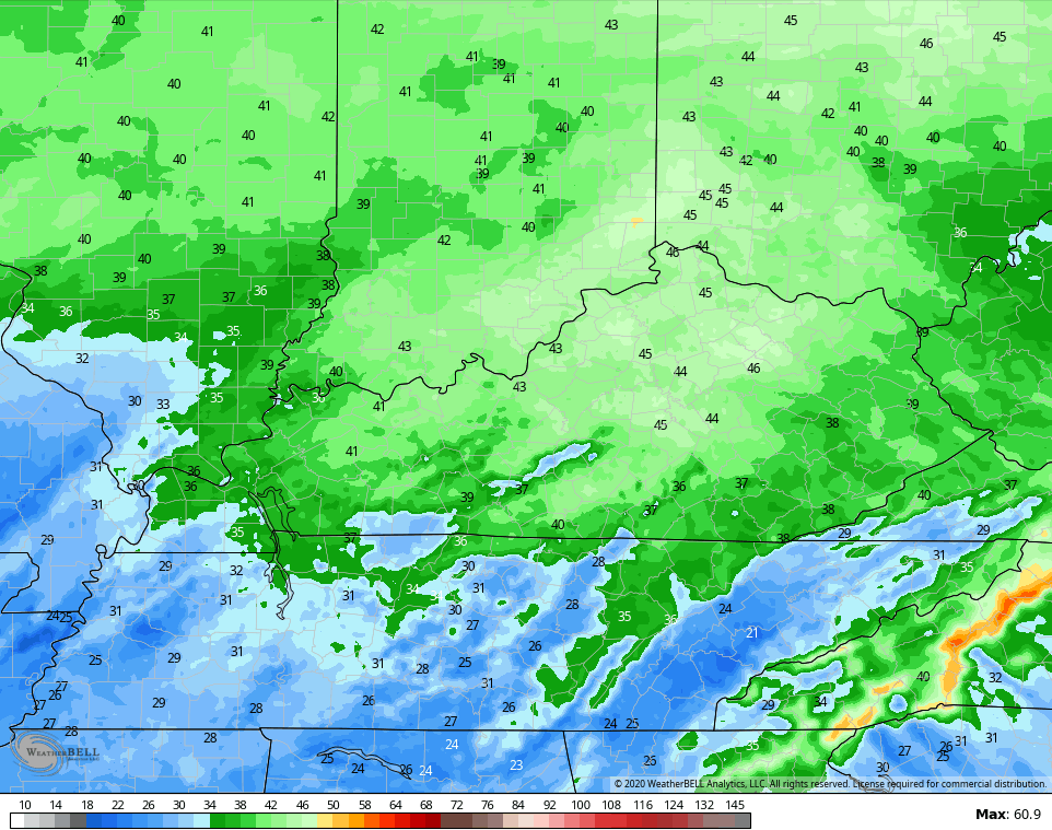
Highs behind this for Tuesday look to stay in the 40s for many…
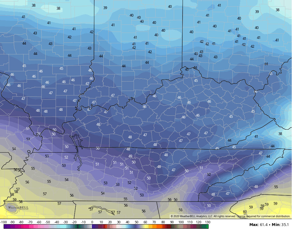
Wind chills will make it feel like the 30s for most of the day. There’s still an outside chance for a snow flurry to show up across the east on a strong northwest wind flow.
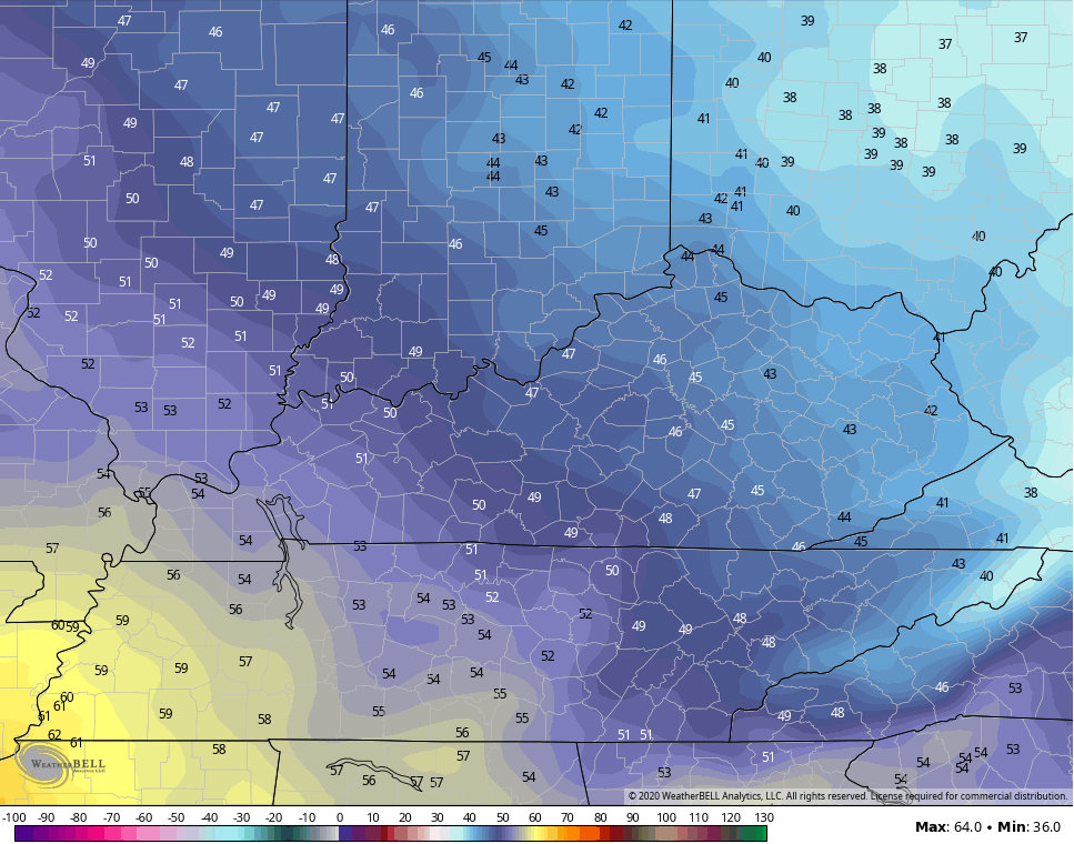
Wednesday’s temps look similar, but you can already see the recovery underway in the west…
Highs in the 60s look good for the end of the week into the weekend as we hang on to dry skies.
Before we get into Thanksgiving week, let’s talk about another historic hurricane. Iota is a beast as it heads toward Central America…

This looks to be a major hurricane when it makes landfall…

This is the first time in recorded history for November to produce 2 major hurricanes in the Atlantic Basin. Just… Wow!
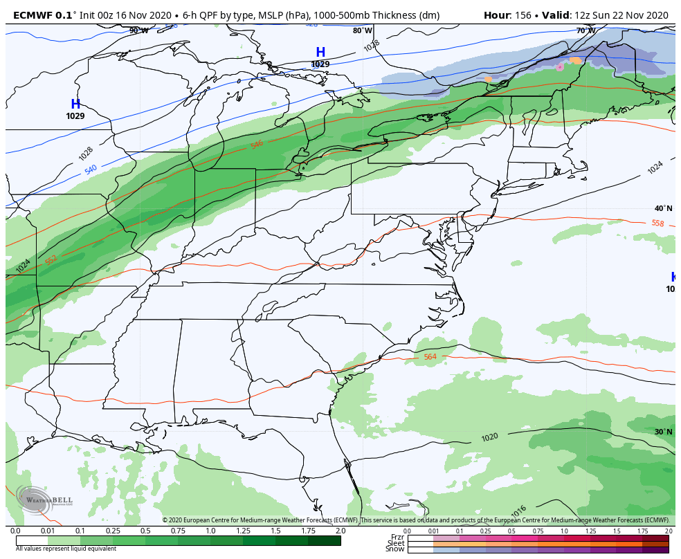
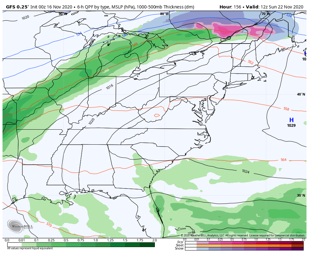
Back here in our part of the world, it’s all eyes on Thanksgiving week and what’s likely to be a very active storm setup. It’s one that should throw, at least, a few systems our way. The question is… Can we get some winter weather out of the setup? The short answer is… Yes, but it’s far from a certainty.
The EURO continues to be much colder with the first system from Sunday into Monday and has some backlash flakes around here. It also brings a weaker system in here with some rain and snow getting close to western Kentucky before diminishing Wednesday…
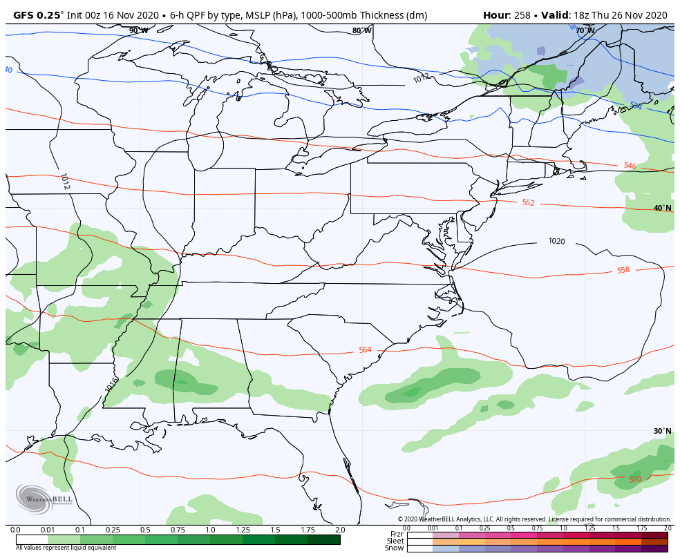
The GFS brings this out in two different systems and doesn’t see as much cold behind it…
After a Thanksgiving Day break, it sees a third system for Black Friday…
The Canadian has a similar take, but is colder than the GFS…
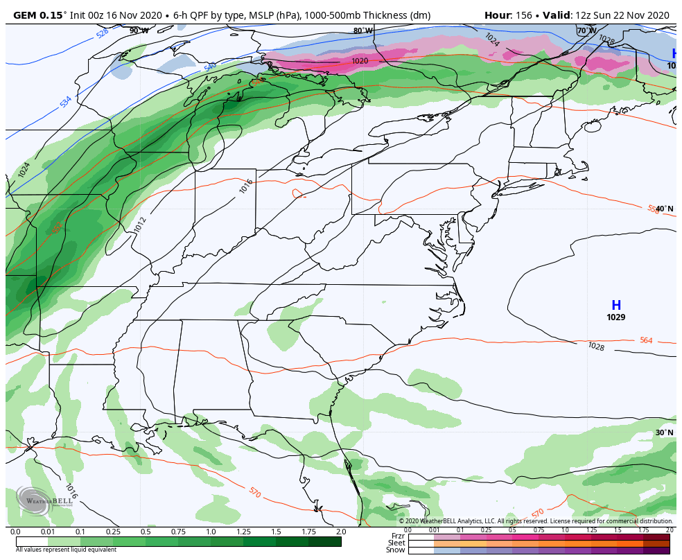
It’s certainly an interesting setup for the big holiday week ahead and one that will be fun to track in the coming days.
I’ll throw you guys another update later today. Have a good one and take care.

This is the time of year when I usually start to sample an assortment of Winter forecasts, during the run-up to Chris’s Winter forecast, which is due to hit on Thursday. For a Winter lover like me, the mood seems to be very pessimistic, with many forecasts predicting “Above Normal” to “Much Above Normal” temps for our region. In most cases, the culprit is their call for a moderate to strong La Niǹa during the period, plus a strong polar vortex , which means that the PV stays parked over the pole, keeping the really frigid air bottled up. What they’re not mentioning is the continuing above normal sea surface temperatures off the Gulf of Alaska, which helps direct polar air into the region.
I have a feeling that Chris’s forecast will be a good deal more optimistic, at least I’m hoping that is the case!
Here’s the link to a Public Information Statement from the Chicago NWS regarding the strong winds on Sunday across the Chicago area. Most places saw non-thunderstorm wind gusts over 50 MPH, with the highest wind gust reported at 69 MPH near Midway Airport. O’Hare Airport had a wind gust of 53 MPH. http://weather.gov/lot/2020Nov15
Chicago is known as the Windy City, and that’s really proving true this Autumn. Since October 12th, 20 of the 35 days have seen wind gusts over 30 MPH at O’Hare Airport, and it looks like some more windy days are ahead this week.
Here in NW PENNSYLVANIA this November is going to go down as one of top 5 warmest November in recorded history we started November off with 9 consecutive days with 70 degrees or plus temps including to days with over 80 degrees. I’ve lived here for 13 yrs and not once did the temperature break 70 once here in November and to have 9 consecutive days is amazing.
Yeah, That is unusual as that area of Pennsylvania use to be know as the “Ice box region of the nation.”
Maybe the lake effect snows will start in December if the action in the tropics subsides ?
If you want Winter weather it’s in Canada.
Check out the Ventusky weather site.
Here in central Kentucky the wind gust to 50 mph yesterday afternoon under mostly sunny skies. No reports of power outages in the area, which is unusual with the high winds.
Only 0.25 inches of rain recorded.
The week ahead looks nice and dry with seasonal temperatures as weak Pacific fronts move through with the northwest flow dominating.
I’ve been checking some of the national forecasts for the upcoming Winter of 2020-2021, and what I found doesn’t bode well for Winter weather lovers like myself. For the December through February timeframe, most long range outlooks are predicting “Above Normal” or “Much Above Normal” temperatures during the period. The primary factor driving this outlook is a forecasted Moderate to Strong La Niǹa. An additional factor is the likelihood of a Strong Polar Vortex, which would tend to keep the coldest air bottled up in the far northern regions. However, these forecasts make no mention of sea surface temperatures, especially the above normal temperatures in the northeast quadrant of the Pacific off the coast of Alaska. This anomaly has a direct impact on our weather, affecting the polar jet stream’s orientation by creating a ridge over Alaska, and a corresponding trough in the center of our country.
Forecast accuracy has suffered over the past few years, especially in regards to long range and seasonal outlooks. This may be due to their algorithm’s inability to handle the impact of temperature extremes, which have been introduced into our atmosphere as a result of Climate Change/Global Warming. been
Chris, unlike many forecasters, has consistently taken these factors into consideration, which is one of the reasons why his forecast accuracy is much above that of other forecasters. His Winter forecast for Kentucky is due on Thursday, and I’m looking forward to it, snow shovel in hand!
Great post and I agree 100%
Yea,upper level’s not looking good atm.Know it’s almost winter but looking on down the road believe severe weather will be what’s talked about in January and beyond.