Good afternoon, everyone. As milder southwest winds blow today, the overall setup continues to skew colder and colder as we head into the weekend. That’s because the changes we’ve been pointing to and showing up quicker and quicker. This means the weekend forecast isn’t looking as nice as just a day or so ago and this ugly weather kicks off a super busy Thanksgiving week pattern.
Reminder: The winter forecast is tonight at 6pm on WKYT. We will also go more in depth on this during the 7pm news on the CW Lexington.
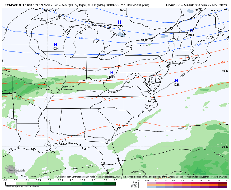
A front is likely to drop in from the northwest on Friday and it looks to make it into Kentucky before slowing down. This will bring an increase in clouds and scattered showers and also brings colder air in.
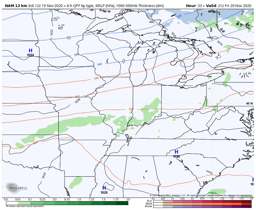
This same front then sees low pressure develop along it and lift across the Ohio Valley, bringing widespread showers on Sunday with snow possible just to our north. The NAM was the first to see this and now the other models are going that direction. Here’s the NAM from Friday afternoon through 7pm Sunday…
Check out the chillier look to the temps now during the same time period…

I mentioned how the other models were going in this direction and that includes the GFS. You can also see how the model follows that up with a bowling ball storm system late Tuesday into Wednesday…
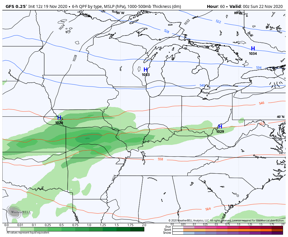 The GFS is also starting to better see the possible winter weather maker coming just after Thanksgiving…

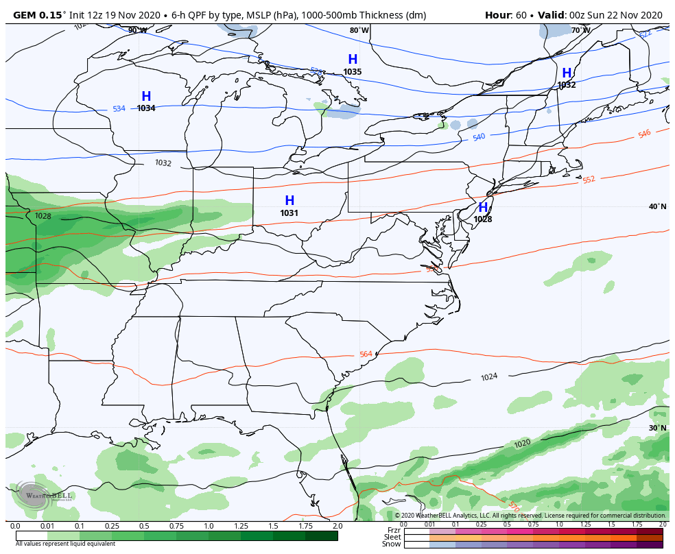
The Canadian is similar with all three systems…
The Euro has a good handle on the first two systems…
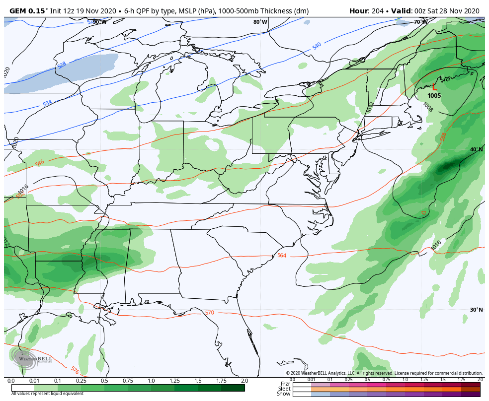
The model’s bias of holding energy back in the southwest is taking it out of the equation for the post-Thanksgiving potential. This likely sets up a deepening trough across the eastern half of the country to start out December.
Enjoy the rest of your day and take care.

Another Wind Advisory is out for the Chicago Metro Area for SW winds gusting between 40-45 MPH this afternoon, expiring at sunset. The very windy Autumn here continues, also the warm November, with temps around 65 degrees.
If the computer models are correct, the Chicago Metro Area could get its first measurable snow of the season next week. I’m not quite buying into that yet with this month having been so mild, but it’ll be interesting to follow in coming days.
I am hoping for a good soaking rain over the weekend to get us out of the ‘ red fag warning.’
Then I am hoping for our first flakes of snow for the snow lovers.