Good Friday, folks. We have a cold front working into the region from the northwest and this will slow down right on top of us into the weekend. That means quite the temp gradient will be setting up as showers get ready to increase. The outlook for Thanksgiving week remains a very active one with the potential of a winter looking system Thanksgiving weekend.
Before we get into all that, here’s a look at my winter forecast from last night on WKYT…
In case you missed it…https://t.co/BVAl4Hy8bk
— Chris Bailey (@Kentuckyweather) November 20, 2020
That forecast and 50 cents will get you a cheap cup of coffee. 🙂
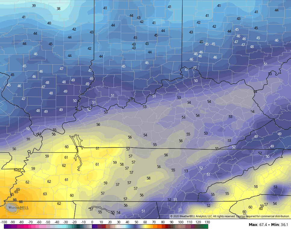
Clouds are increasing out there today with the greatest concentration across the north and west. This will impact our temps with 50s in the north and 60s for the south and southeast. Those clouds may also start to spit out a few showers by evening across the north.
Here are your radars for later today…

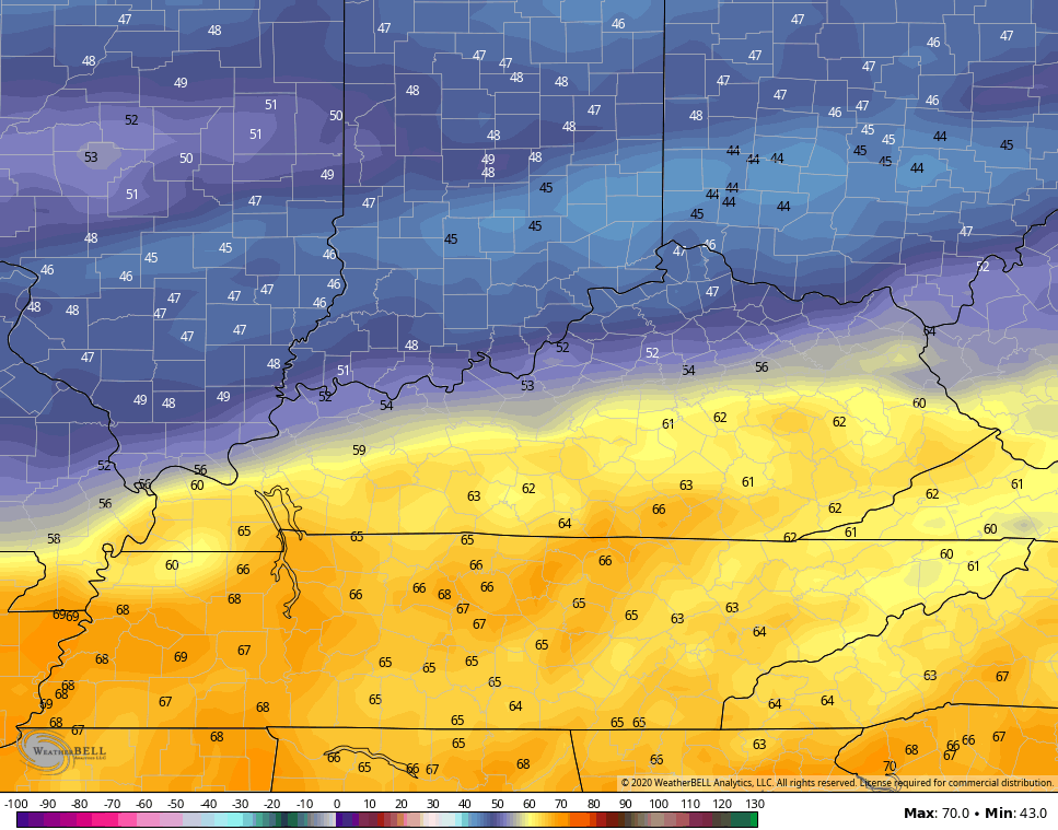
The threat for showers will increase on Saturday as the front sags a little farther south. This will also set up a more pronounced temp gradient from north to south…
NAM
GFS
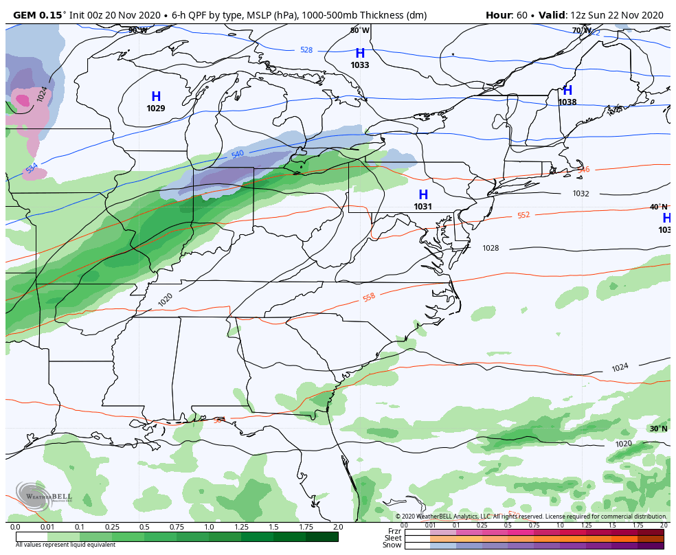
Low pressure develops along the front and rides through here on Sunday and Sunday night. This brings gusty showers from west to east and also drops our temps. Here’s how the NAM sees that system…
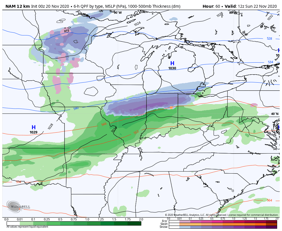
Sunday temps start in the 50s and drop into the 40s behind the front. That sets the stage for a mostly dry Monday with temps around freezing to start and mainly in the 40s for highs.
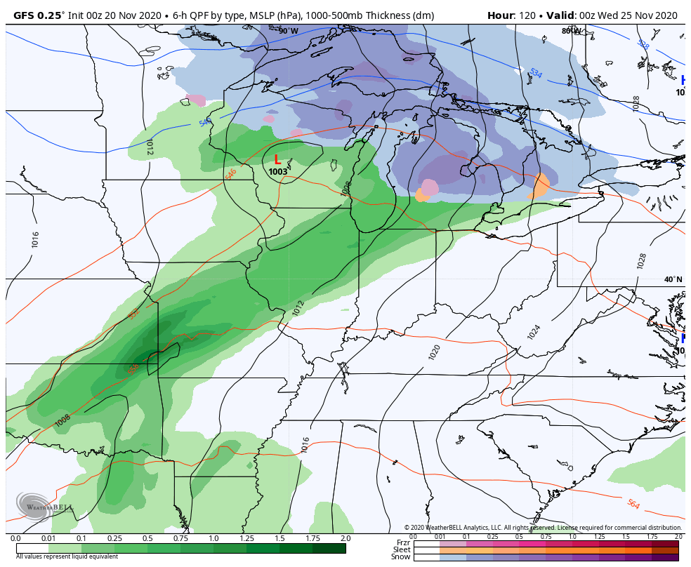
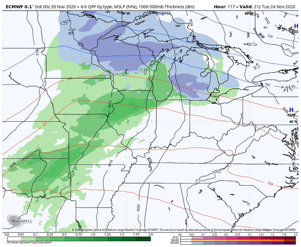
Those temps do spike again on Tuesday as we get ready for the next system to roll in from the west. This looks much stronger and slower and brings gusty winds and heavy rain for the busy travel day on Wednesday. Leftover showers and colder winds look to hang tough into Thanksgiving Day…
GFS
The Canadian Model is colder with the first system and even spits out a flake in the southeast Monday morning. It’s also weaker with the second system…
The EURO is the slowest and strongest of the bunch with our second system…
In terms of the post-Thanksgiving storm system, the GFS totally lost it on the last run, but it’s still there on the Canadian and Euro…
CANADIAN
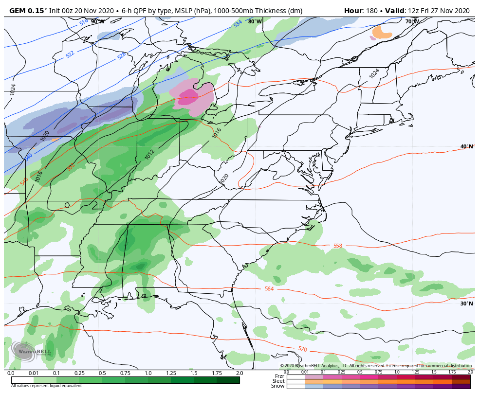
EURO

As we look into early December, you’re now seeing the GFS Ensembles showing much more of a trough developing across our region. Notice how we see a trough digging into the Aleutian Islands with a ridge going up along the west coast…
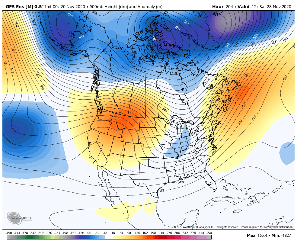
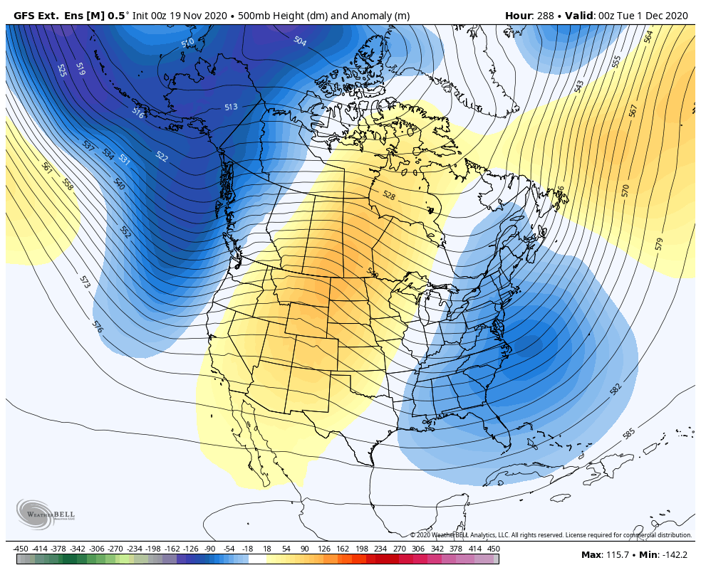
That’s also showing up on the GFS Ensembles Extended run through the week before Christmas. Notice how the lower heights are showing up across the US while heights increase across Canada…
I’ve seen much worse December patterns in recent years.
Another update rolls your way later today, so roll on back here. Have a great Friday and take care.

I’m not buying into anything that the Canadian is showing for next week, as it has a major snowstorm hitting the Chicago area late Tuesday into Wednesday, with more snow for next Friday. The GFS and Euro don’t show any snow for Chicago at all next week.
Thanks Chris, I didn’t miss your Winter forecast as I was able to connect live on my computer. Actually I watch the entire news cast and I must say all of you at WKYT do an excellent job at broadcasting information we all need to know.
Guess that should pop a +PNA early December..Canada still looks warm though.Got to have cold air source.
Your right about the Pacific North America Oscillation would have to go positive, but the Arctic Oscillation currently is strong and allowing frigid air to build and snow cover to increase over the entire Arctic region.
The air m*a*s*ses this Autumn are coming from the northeastern Pacific which are cool and not cold. The lower temperatures at night are due to radiational cooling.
Here is the current temperatures across the Arctic region: https://www.ventusky.com/?p=67;-128;1&l=temperature-2m
Correction: Here are not here is.