Good Tuesday, everyone. We have a big storm system ready to rumble through here before Thanksgiving and this may cause some big travel issues. Behind that will come another system that may take aim at us this weekend and early next week. Depending on the track, this one may bring our first blast of winter weather. I’ll take a look at all this and we will go deeper into December in what is one of the longest blog posts in KWC history. Buckle up, kiddos!
Today features a mix of sun and clouds with temps hitting the 50s for most areas. A mix of sun and clouds will be noted, but we stay dry.
Farther west, our storm system is coming together with showers and thunderstorms. A few strong to severe storms are possible west of the Mississippi this afternoon and a few of those may sneak into far western Kentucky later this evening or into the wee hours of Wednesday.
The Storm Prediction Center has a low-end risk this evening in the far west…

You can watch for this stuff to develop to our west or track rain and snow just to our north on our radars…

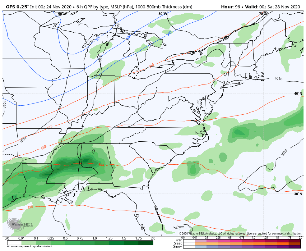
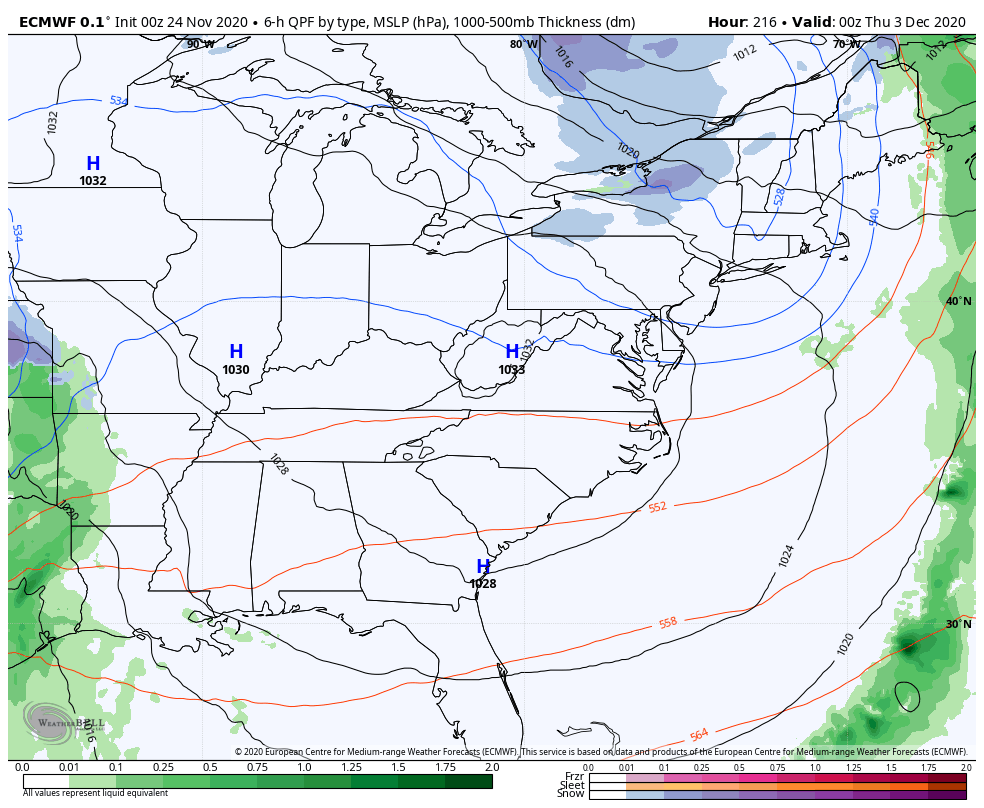
This strong low pressure then works into the region Wednesday into Wednesday night. Gusty winds of 40mph or higher, heavy rain and the potential for thunderstorms will all show up. Here’s the future radar from the Hi Res NAM…
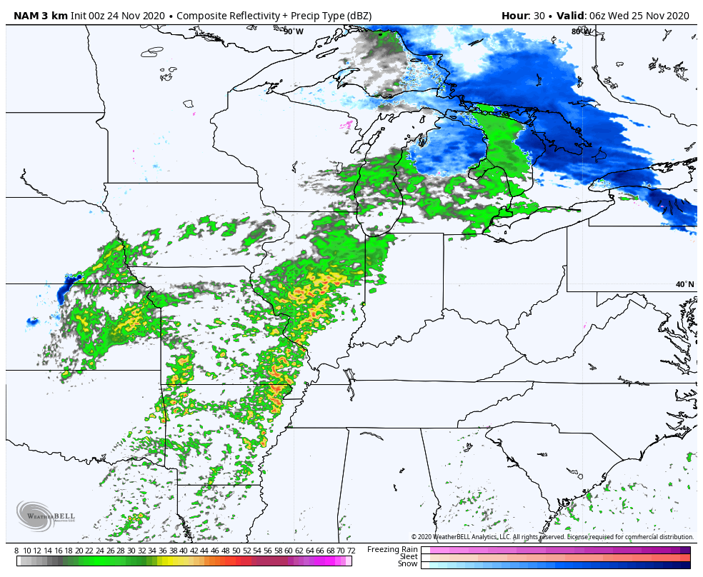
The same model run is showing those stout wind gusts…
The Hi Res NAM and the NAM both have similar gusts and both did very well with the last big wind maker.
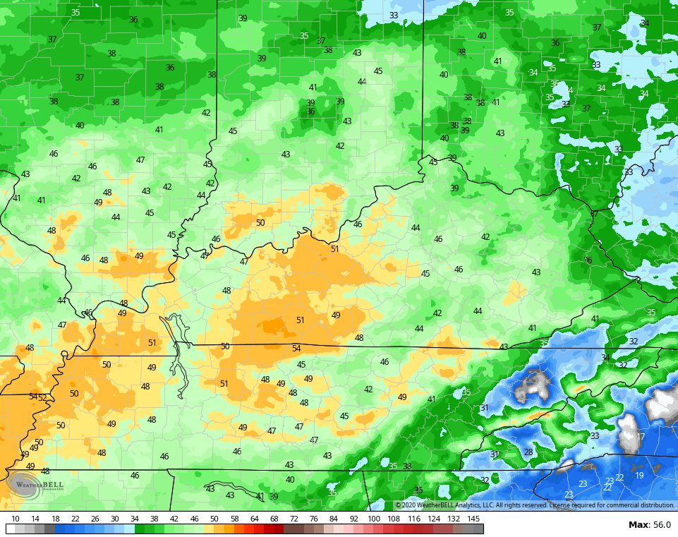
Some of the storms may even be strong or locally severe. The Storm Prediction Center has areas of central and western Kentucky in the low-end risk for severe storms…

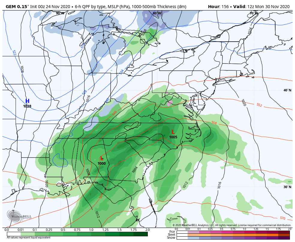
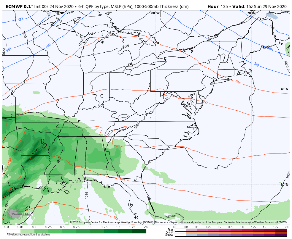
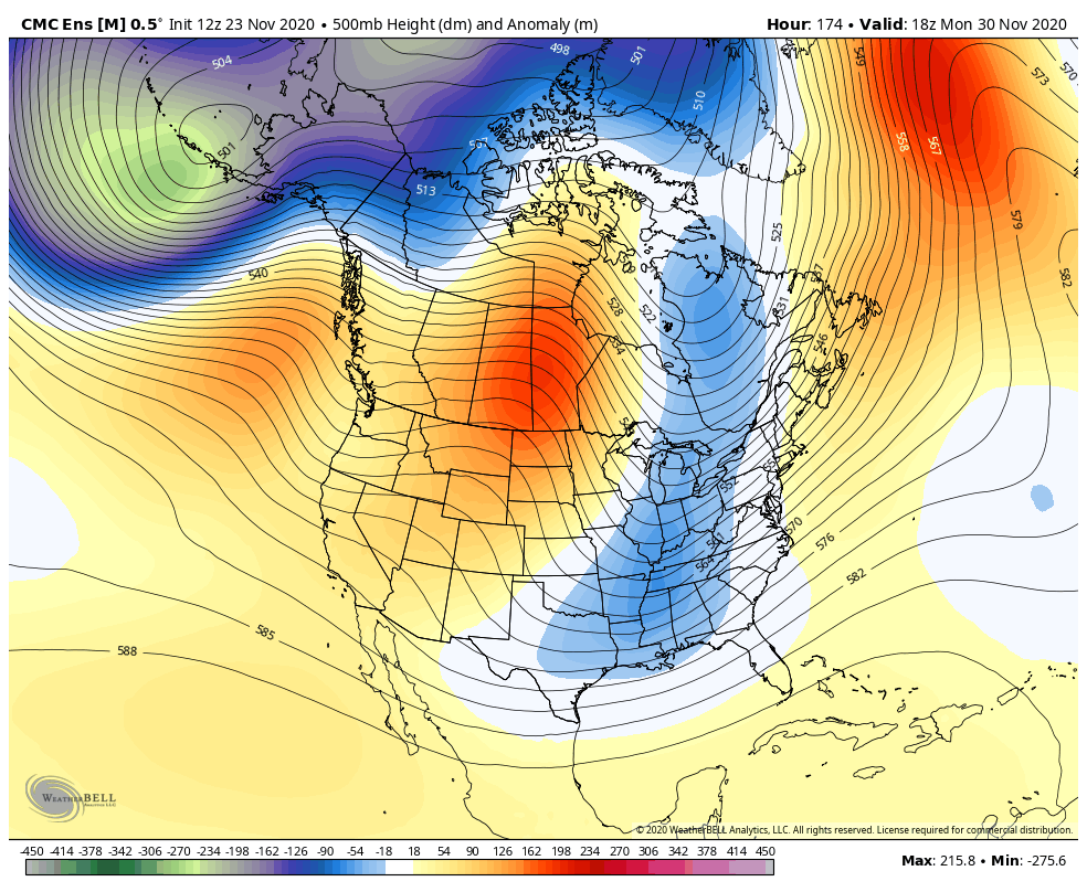
Now we turn our attention to the late weekend/early next week system that continues to look very interesting. The models will continue to go back and forth a bit, but the overnight trend was for them to go straight to a big rain to snow system around here.
The Canadian is leading the charge with a powerful storm…
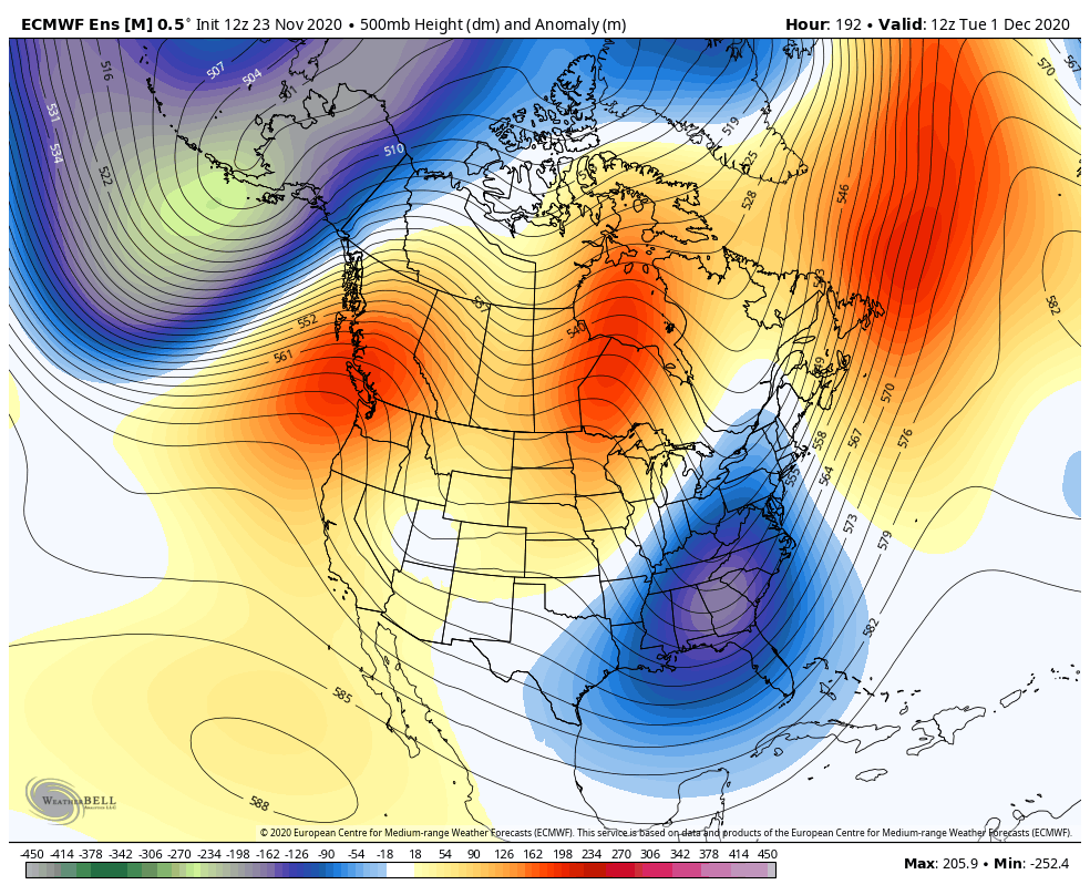
The EURO is back…
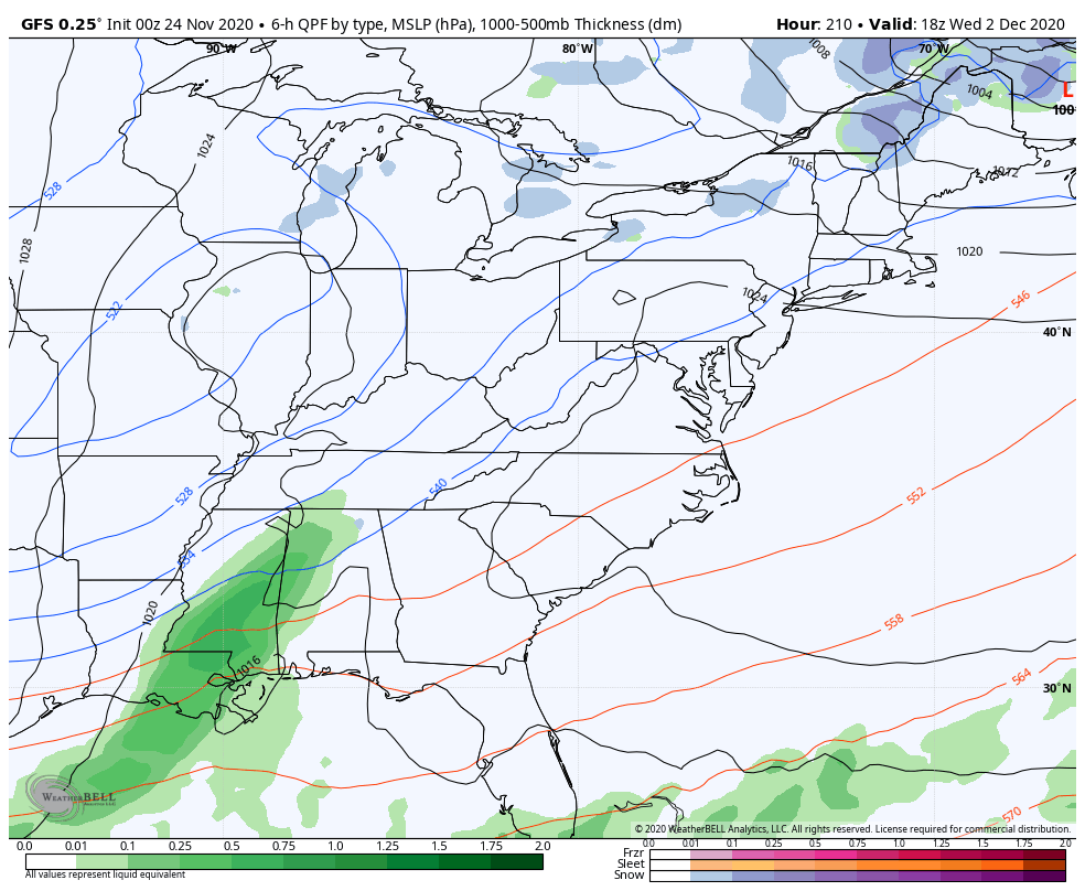
The GFS is doing what I said it would do and slowly trend slower and farther west…
It’s finally picking up on the cold shot, too. Check out the wind chills…
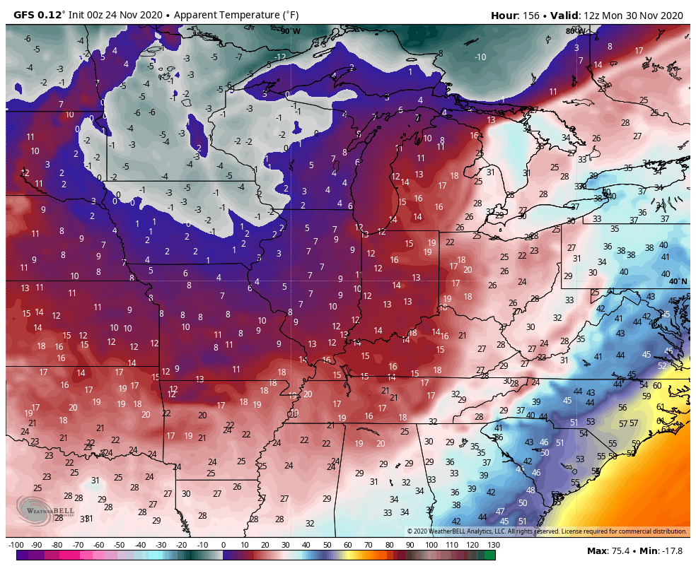
That’s some cold wind, folks!
The GFS was the first to suggest another storm to follow that up in the middle of next week…
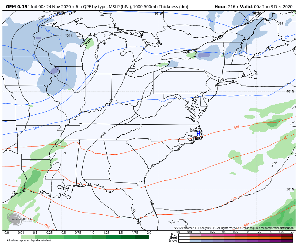
It’s getting some friends, now. The Canadian and EURO models don’t go out as far, but show the beginning of this system…
CANADIAN
The EURO is a bit slower and west, but that’s a bias of the model at this range…
As you can see, there’s a real chance for winter to start out on a good note. As always, let’s wait and see how things unfold, but the pattern is there!
Regular readers know I’ve been looking into a much different December pattern than what we’ve seen for the past several years. All my analogs suggested this and the various forecast models are showing this pattern developing nicely. A developing trough in the Aleutian Islands, a ridge up the west coast and even a bit of blocking over Canada/Greenland all lead to a trough in the eastern and southeastern US.
I’ve shared some of these with you guys in recent weeks and I’ll keep sharing until they decide my thoughts aren’t valid. 😉
Here are the Canadian Ensembles into the first 9 days of December…
The EURO Ensembles through December 8th…
Last week, I went on a diatribe against the EURO Weeklies and how they have been pretty bad this year. They’ve rarely seen any kind of trough or cold air anywhere across the country and folks should go back and look at the track record before taking them verbatim right now. Well, the model must have heard me and decided it can indeed spot a trough. It keeps the above trough going into the second half of December…
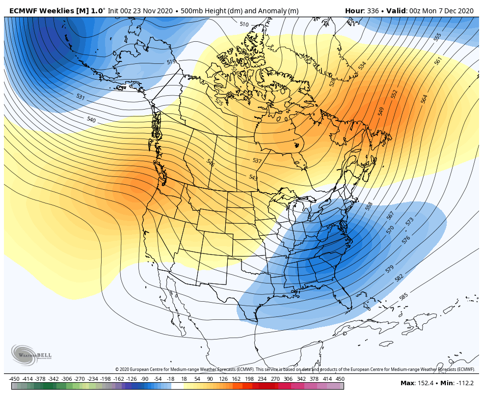
Again, this is a much different pattern than what we’ve seen the past several years as we move into December. This makes sense because every month of late has been the total opposite of the past few years as well.
I mean, this has to mean something good for winter lovers… Right? 🥶❄️☃️
Are you guys stoked that tonight is the annual ✈️🚆 🚗 post???!!!! Thought so!
I’ll have another update before then, so check back. Make it a great day and take care.

E. Ky. looks to be in the best position for snow at the moment.
The first Winter Weather Advisories of the season are out for portions of the Chicago area this morning (for reduced visibilities where snow is falling), specifically the W and NW suburbs, where a slushy inch or two of snow could accumulate, mainly on gra*s*s*y areas. That will change to all rain late this morning as temps rise into the 40s. Any snow that does accumulate won’t last long at all., as temps are currently a few degrees above freezing. O’Hare Airport is forecast to receive about an inch of snow, while in the SW suburbs at the NWS office in Romeoville near where I live, only a few tenths of an inch are forecast.
After the rain ends later on Wednesday, it looks to be quiet for several days here. The main action will be well south of us towards Kentucky, as the above forecast models from CB indicate. Hope you guys can get some snow out of that!
blog about to get busy…
Looks interesting. Hope to see a lot of hte regulars back in hte comment section. It’s always fun to see what they have to say.
Thanks Chris, and great blog this morning very interesting.
I just hope the severe weather stays away for everyone’s sake.
Snow lovers are getting excited over the agreements in the various models.
For me I’m hoping for just plain rain and back to mild and Sunny weather.
2020 has been nothing but consistent when it comes to being a year for the history books, so let’s hope this winter’s snow makes it into them as well! 🙂
This is music to my ears. I’m hopeful everything pans out and goes our way.