Good afternoon, everyone. It’s a calm day across the bluegrass state, but big changes are coming tonight and Wednesday. This is when a major storm system moves into the region and brings heavy rain, gusty winds and thunderstorms our way. From there, the focus is on a potential Thanksgiving Weekend system that can bring more of the same and a bit of winter weather.
While we are dry through the rest of the daytime hours, showers and thunderstorms will push into western Kentucky this evening. The Storm Prediction Center continues to watch this area for the low-end threat for a few strong to severe storms…

Take the interactive radar on a little trip to the west so you can watch the rain and storm action come together…

That area pushes east into much of western and central Kentucky on Wednesday. The SPC has a low-end risk for severe storms across much of the state…

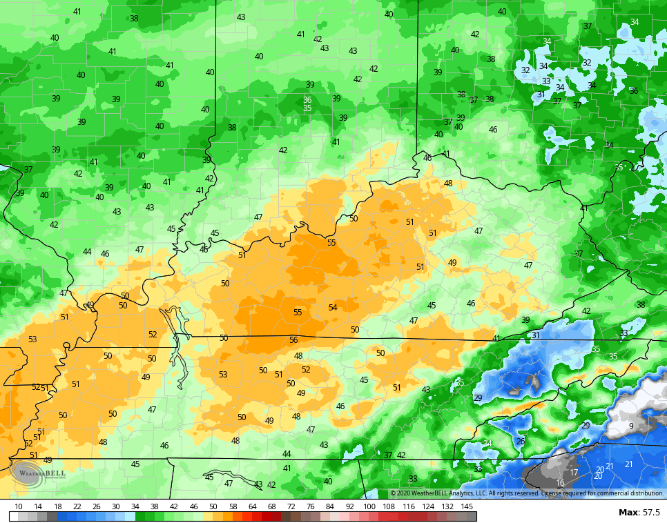
Regardless of the severe threat, heavy rain and high winds will be a major player tomorrow. Wind gusts of 50mph are possible in many areas. The Hi Res NAM continues to show this very well…
Leftover clouds and a stray shower will be noted on Thanksgiving. Another weak system may throw more clouds and a shower or two at us Friday into Saturday, setting the stage for a much bigger system coming in behind this. This may be a potent winter storm for parts of the eastern half of the country. Can Kentucky get in on, at least, some of this action? Yep.
The GFS is doing what we told you it would do and trend farther west and stronger with our storm. It now brings rain to snow across central and eastern Kentucky on Monday and Tuesday…
The cold air and wind coming in behind this is impressive. This run of the GFS takes wind chill numbers to near zero…
The Canadian is similar, but stronger than the GFS…
The EURO is, as one expects from the model, farthest west with our storm…
The trend is the ONLY thing to watch for from this point. We are looking to see that a storm will indeed be there and this appears to be the case. Now we have to figure out the exact intensity and track. Regardless, the chance for us seeing, at least, the first snowflakes of the season is high. The odds of us getting the first snowfall of the season are increasing as we get closer.
There will be another system coming in behind this for the second half of next week and it’s one that can also produce winter weather. The EURO…
I will have the latest on WKYT through the evening and may even drop by for another update if needed.
Have a good one and take care.

It is going to be a fun few days
hello gang! Been a while since I’ve commented ! Always look forward to the Planes Trains and automobiles edition of KWC coming up! And definitely looking forward to the SNOW CHANCES! it’s been a boring few winters in my neck of the woods ..