Good Thursday and Happy Thanksgiving. Here’s hoping this holiday finds each of you safe, healthy and happy. It’s a rather dreary Thanksgiving Day for a lot of the region as low clouds are being a bit stubborn. This IS what you all came here to talk about, right? No? Maybe it’s about the potential for a significant winter weather event from Sunday night through Tuesday? Thought so. 😉
We will begin with our Thanksgiving and then roll forward. As I mentioned, clouds are hanging tough out there today with temps ranging from the upper 40s to middle 50s, depending on where you live. There’s also a small risk for some drizzle or a very light shower. Most of that will be too light to show up on regional radar, but what the heck…

A weak front drops in here late Friday and early Saturday. That brings a few more clouds to the region, but moisture is limited. Temps spike into the 50s Friday then fall down a bit on Saturday with a mix of sun and clouds.
That brings us to our potential winter storm system developing late Sunday and carrying into early next week. We are one day closer to this event, so our confidence is increasing on a major storm system coming together. How much of an impact this has on our weather remains to be seen, but odds are in our favor of picking up on, not only the first flakes of the season, but the first accumulating snows of the season.
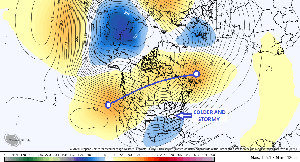
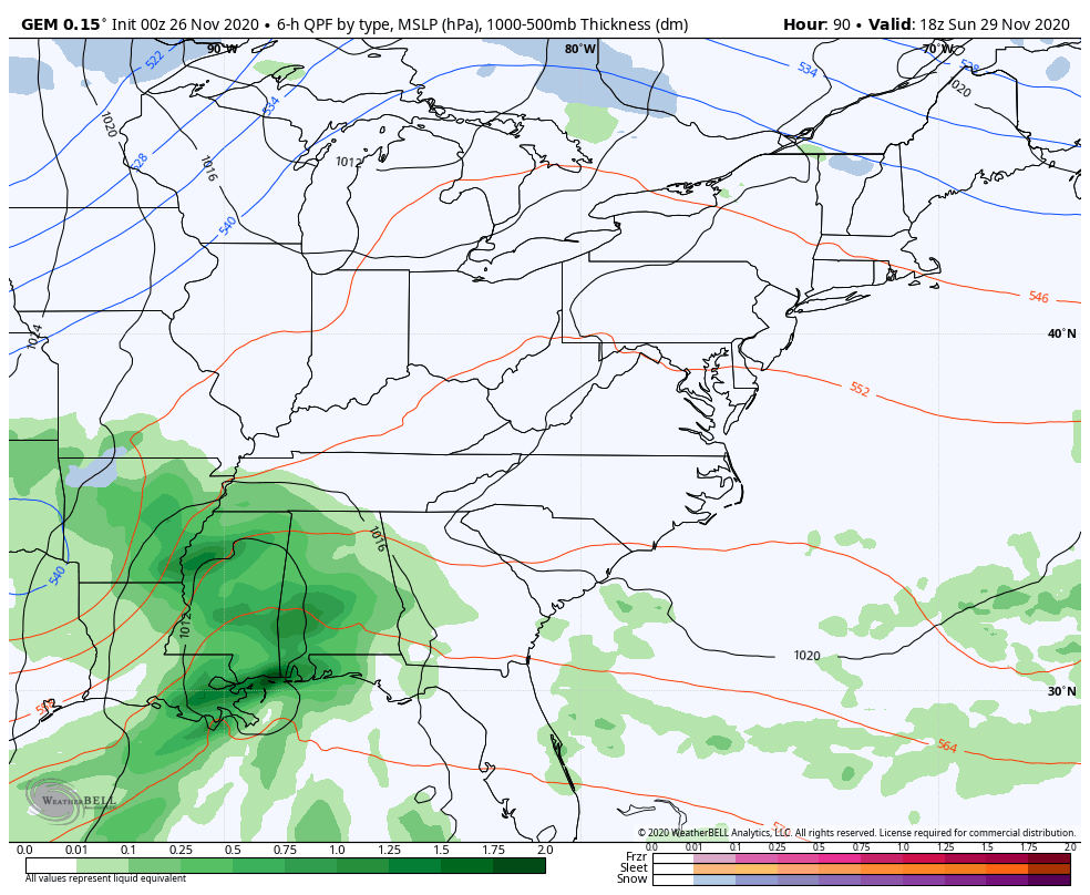
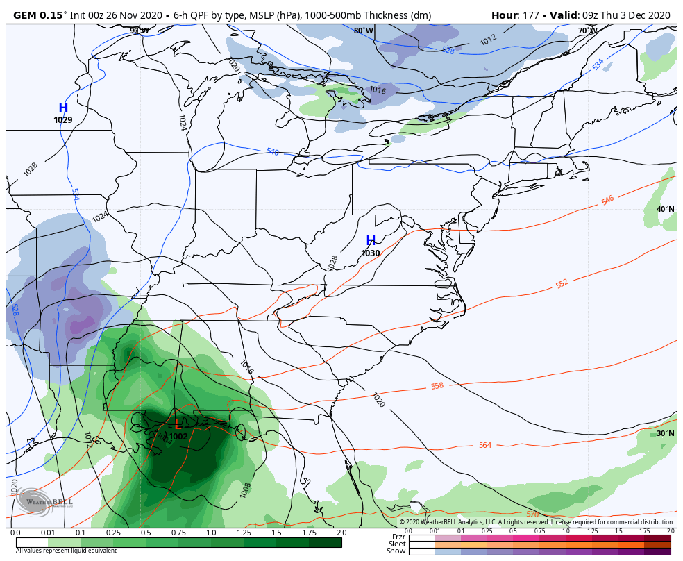
This looks like a fully phased storm as energy dives in from the north and merges with energy coming from the southwest. This then will form a massive upper level low and strong surface low. Just look at the upper levels putting in a textbook performance…
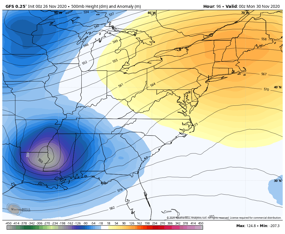
This happens as massive blocking takes shape across Canada and essentially keeps that upper level system trapped underneath. About a week ago, I posted a map showing just this type of a pattern building for the start of December…
That signal has been there for a while now and we now have to see if it can really pay off with some honest to goodness winter weather around here from Sunday night into early next week.
All the operational models show a significant winter storm for the Ohio Valley, Great Lakes, Appalachian Mountains and even into part of the Tennessee Valley. The GFS is even back on the train…
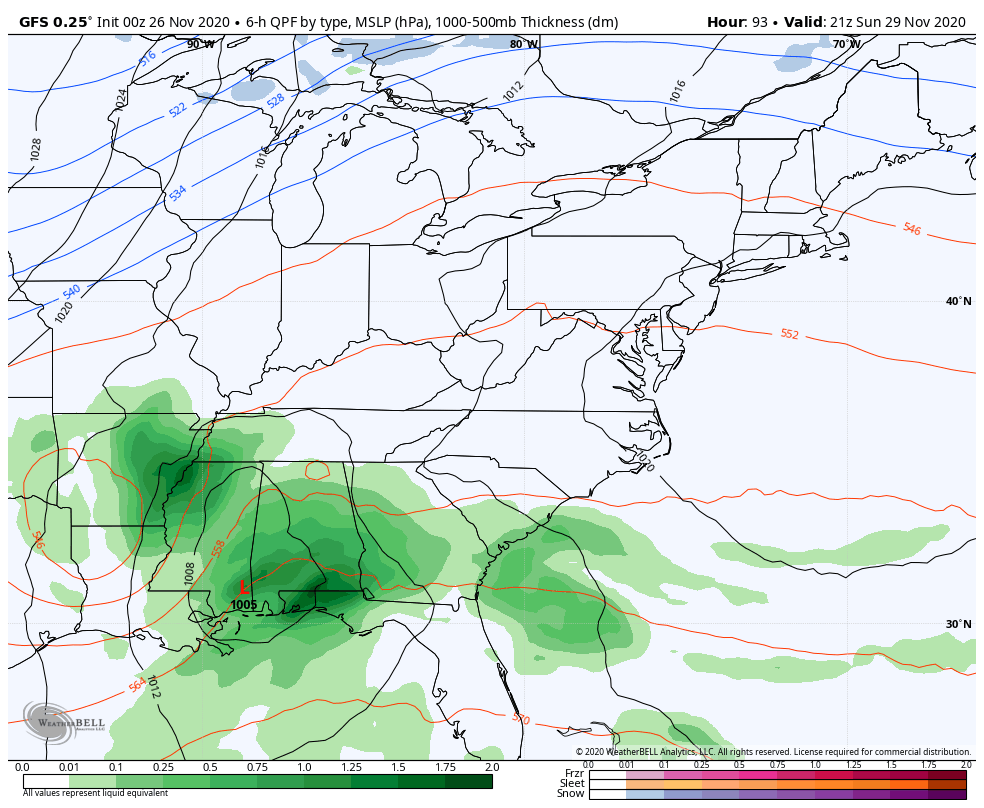
That run of the GFS is the most extreme of the overnight runs as it shows tremendous snow and wind into the above mentioned areas.
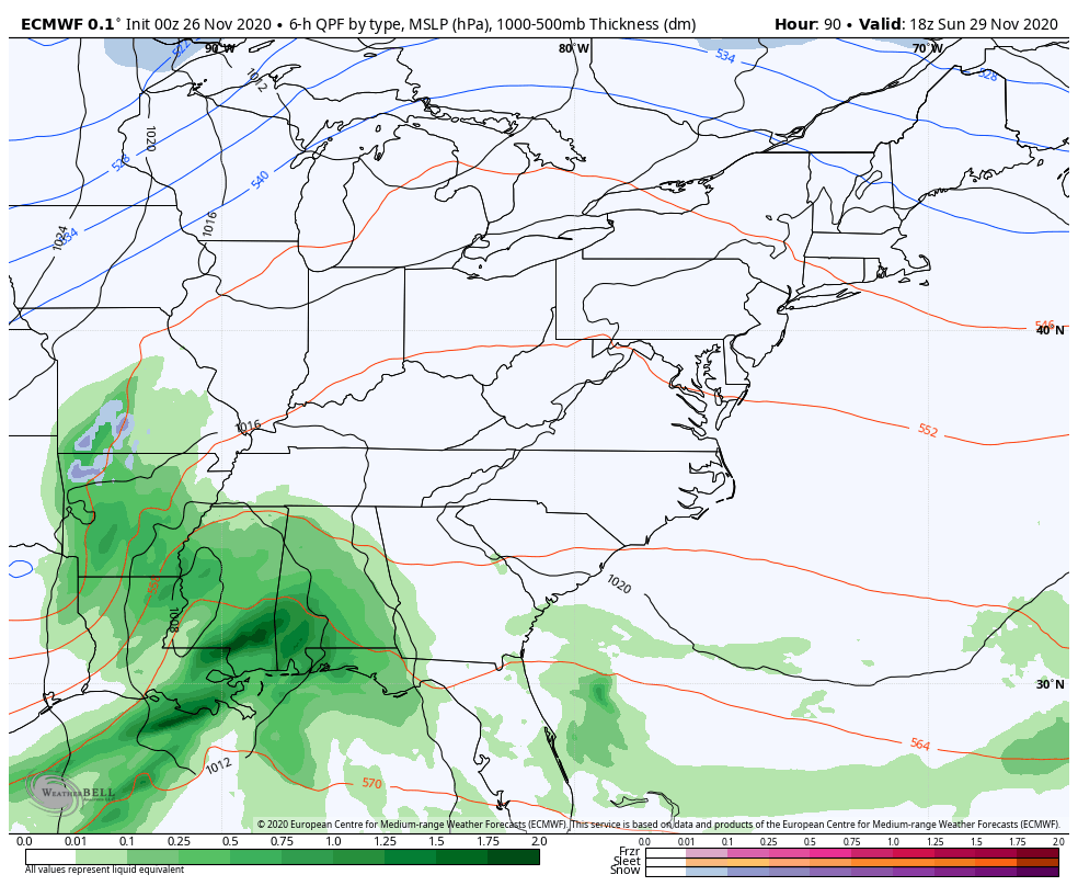
The EURO continues to be very steady with our storm with only some minor variations from run to run…
The Canadian has also been steady…
Here’s are some thoughts on all this:
- We pretty much know a major storm is going to form, both in the upper levels and at the surface.
- What we don’t know is the location of the upper low and surface low and where each track and at what pace.
- Once we get a little closer, the question marks will start to fade pretty quickly.
- As it stands on the models, they are all suggesting our first snow is a sizable one and complete with a lot of wind.
- Again, the first flakes of the season are very likely during this time. Accumulating snow odds are also pretty high from 3-4 days out, but I can’t tell you for sure if its just a little bit or a lot. I hope to be able to put out a risk map later today.
- Last winter was the first winter for KWC without a even single Winter Storm Threat. We may not have to wait very long for one this winter.
By the way, there’s another storm system that may follow this one up late next week and it could also bring winter weather…
Multiple updates are coming your way today and I’ll be on WKYT for my normal shows. Keep checking back and following my Twitter feed for updates. Happy Thanksgiving and take care.

The forecast has put me in a holiday mood.
HAPPY THANKSGIVING TO ONE AND ALL !
Hope all the Winter Lovers on KWC receive a ton of snow !
Happy Thanksgiving everyone!
Happy thanksgiving to All!!
My confidence in this storm is way up there..common it’s 2020 (why wouldn’t it)
LOL! That’s what I said last night, and have been saying pretty all summer/fall. i figured that if we were going to get some decent storms in here, it would be the Winter 2020/21!
Happy Thanksgiving to all get ready for a fun weather week
Looking good! Keep it coming!
My kid just KNEW we would have lots of snow this winter since we pretty much don’t go to school anymore lol Maybe he was right?!? Let the tracking fun begin!!!
Happy Thanksgiving to all. Keep our fingers cross that the snow will materlize.
I know a lot of people has already put up Christmas decorations. I’m one of the few that decorates on Thanksgiving weekend. I told the family last night. Decorating happens this evening. Got to get ready for the snow.
Happy Thanksgiving every one.!!!
Excited!!!
Happy thanksgiving everyone