Good evening, folks. As our Thanksgiving Day wraps up, we continue to look ahead to our next storm system rolling in here Sunday night and Monday. This storm will bring an increased potential for winter weather and our first snowfall of the season. No, I still can’t answer if it’s just a little bit or a lot. Sorry, Charlie. 🙁
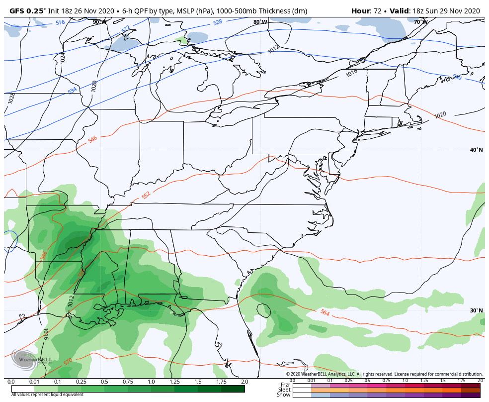
The only new model that goes through the entire event is the GFS. This continues to take a potent low up the Appalachian Mountains with a major upper level low spinning behind it on top of us. This setup is the same as we’ve been advertising, bringing rain in here late Sunday with a switch to snow from west to east Monday morning. From there, a northwest flow keeps snow and snow showers going through Tuesday as temps stay below freezing during this time.
Here’s the GFS…
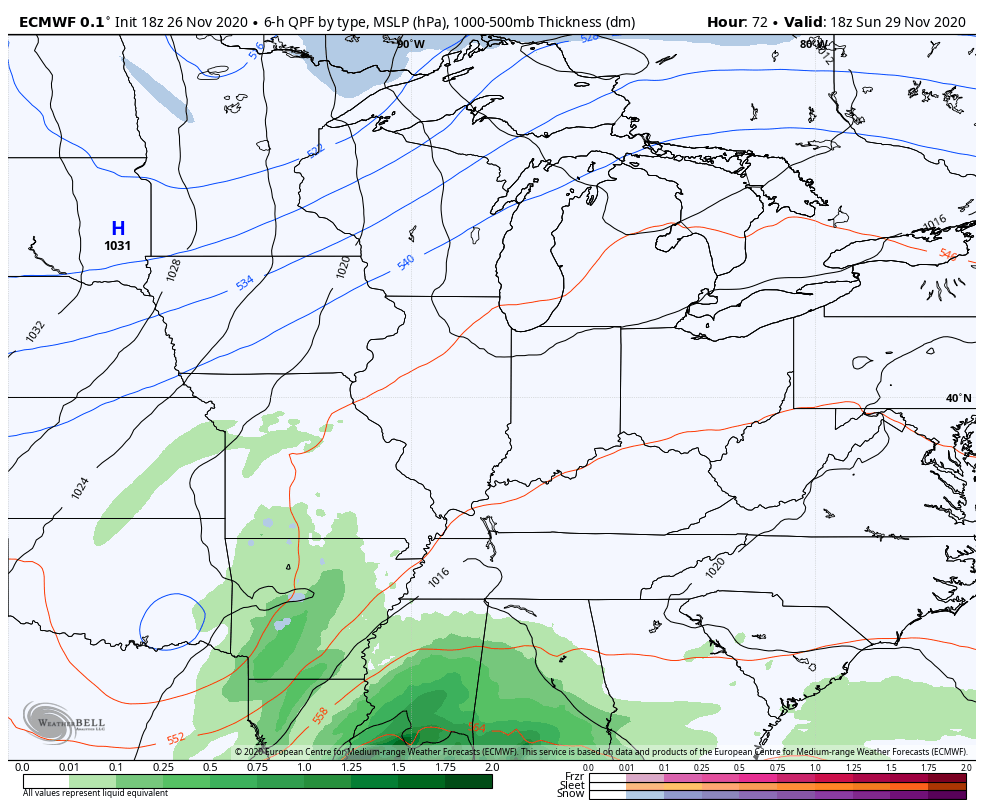
The late day EURO only goes through 7am Monday, but you can see this storm taking shape with a quick switch to snow underway…
One thing to watch for is the energy coming from the Pacific Ocean will be getting properly sampled soon as it moves into the northwestern part of the country. That means the models into Friday will have better data to work with.
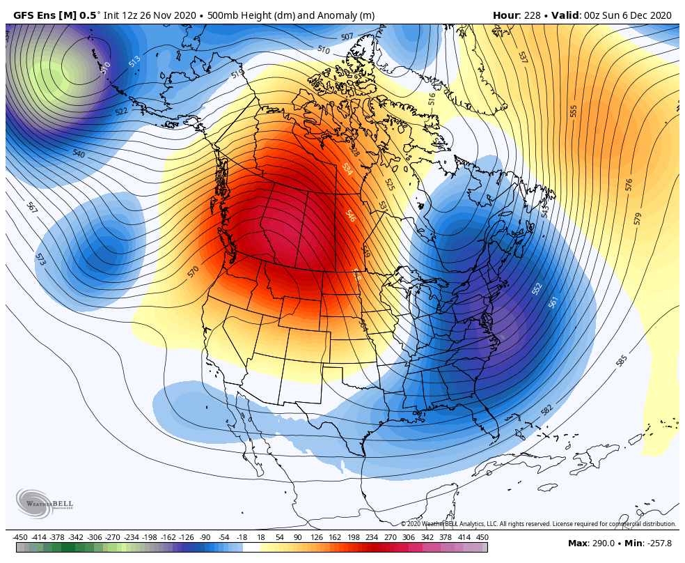
Another system will try to follow this up from the southwest later next week and that may bring another threat for winter weather.
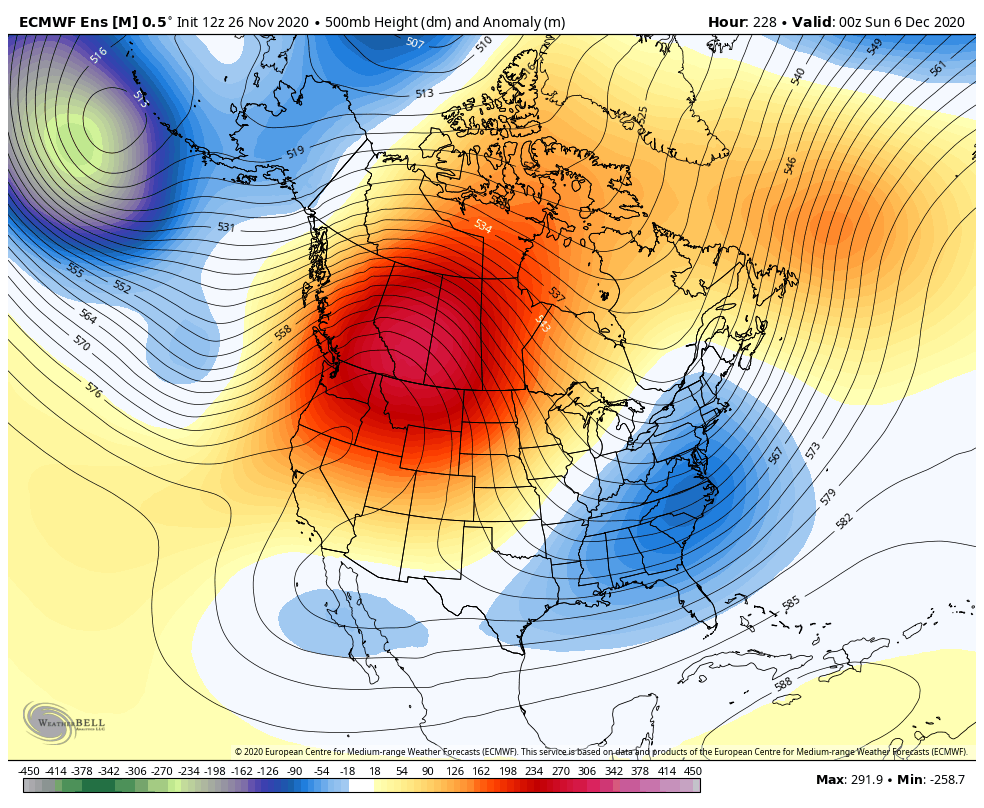
As I look at the pattern down the road through the middle of December, I can see a few more of these type systems trying to impact our weather. The various Ensembles are locked in on a similar look…
GFS
EURO
I will have the latest on WKYT starting at 11 and with a full update on KWC later tonight. Enjoy the rest of your holiday and take care.

Waiting pattern, I hope the waiting for the actual weather Sunday-Tuesday is worth the wait(and anticipation). Thankful for today!
Exciting! The first real snow chance in over a year! We’ll see what happens. I know Chris is sharing models rather than a forecast but I am excited, none the less. I am sure many others are as well.
Let it SNOW! Let it SNOW! Let it SNOOOWW!!
The more, the merrier! Happy Thanksgiving!
So far, each model run has narrowed the chances for South Central Kentucky to receive barely more than a glancing blow. Pretty much as it’s been for the past several years.