Good Friday, everyone. Thanksgiving is now behind us and we are rolling into the traditional weekend with another weak cold front dropping in. The main show continues to be a developing winter storm set to impact our weather from Sunday night through Tuesday. Now that we are under 3 days away from this system developing, confidence continues to increase that we will in fact see our first snows. I’m still not confident enough to get specifics on totals. Just a little or a lot? That depends on how the upper low comes together and how the surface low tracks.
Let’s start with today and move forward. Mostly cloudy skies are noted again with some sun in the south, especially. Temps are in the 50s ahead of another front that moves in with very little moisture. I still can’t rule out a sprinkle or some drizzle again.
Ok, lets’ get into the meat and potatoes part of the program. Our winter storm system continues to look on track to impact us from Sunday night through Tuesday. As I mentioned off the top, there are some question marks still to be answered. This is likely to be a major storm that blasts areas of the Ohio Valley, Great Lakes, Appalachian Mountains and Tennessee Valley with wind and snow. How much snow for any one location is still to be determined. Tired of hearing that yet? Yea… Me too.
This whole setup really boils down to where we get our two upper levels systems to combine forces into a massive cutoff low and how fast does it move through. The faster it moves, obviously, the less snow the region sees. The slower, the snowier.
I suspect we see some model wiggles today as the energy starts to get properly sample and ingested into the data. Once they get all this sampled, the final trend will show itself tonight and Saturday.
Here are my current thoughts on how this might play out around here:
- Rain arrives quickly from southwest to northeast Sunday afternoon and evening. That’s as our surface low takes shape to the southwest.
- The track of the actual surface low looks to go from near Birmingham to Pittsburgh to Buffalo.
- As the low takes that track, it’s intensifying along the way. That brings much colder air quickly into the western side of the low and changes rain to snow quickly late Sunday night into early Monday.
- As the upper low digs in on a strong northwest wind, an increase in the snow should take place Monday afternoon into Tuesday morning. The best chance of this happening is across central and eastern Kentucky. I suspect this is where our best chance for some accumulating snow originates from.
- Models tend to underplay precipitation associated with these upper level systems producing such strong lift.
- The snow tapers to snow showers as the system pulls away to our northeast Tuesday.
- Wind gusts of 30mph or higher will be possible during this system.
- In terms of snowfall totals… I’m nowhere near ready to put out a forecast on that. Some may only see minimal amounts, others may see some decent totals. I still have too many question marks I need to find answers for.
- Regardless, I feel good in saying this will be the first snow event of the season in our region.
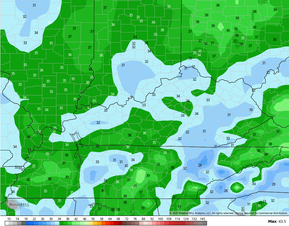
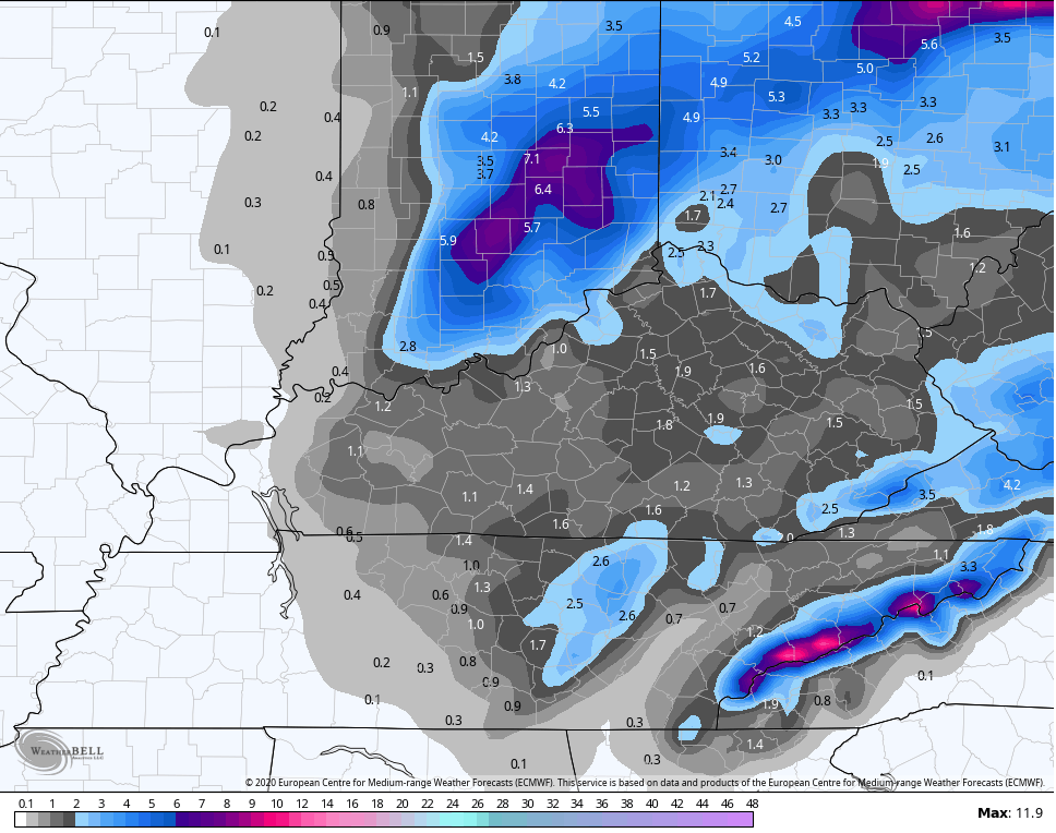
I made this map earlier Thursday and it still looks good in the general sense…
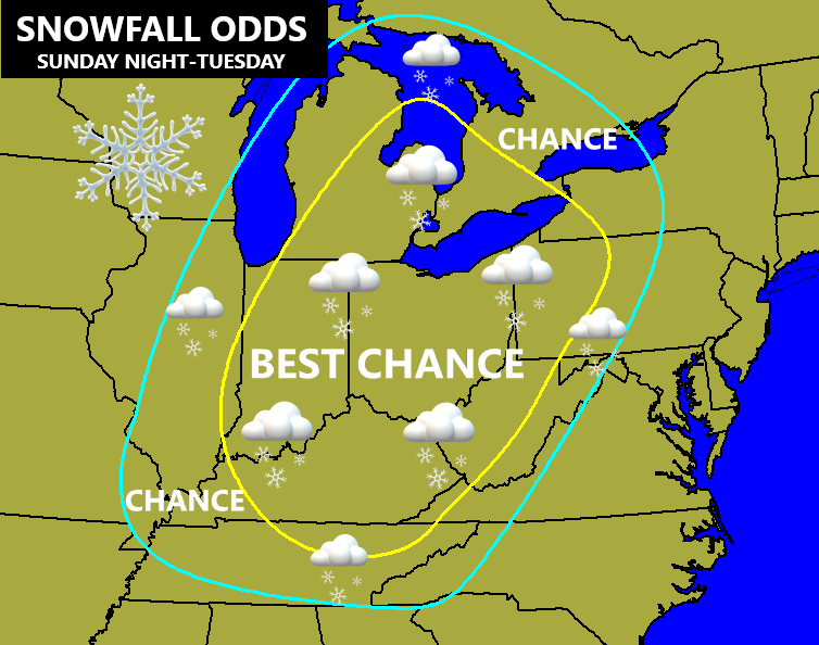
Notice that doesn’t specify between very light accumulations or significant accumulations. 😉
Let’s do a check of where the latest models stand as of this update…
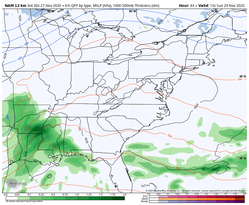
The NAM only goes through 7am Monday, but has a quick change to snow already happening by that time…
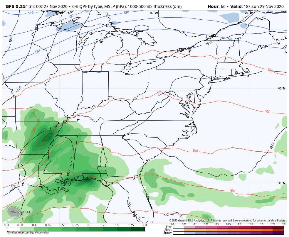
I actually like the GFS at the moment because I think it is handling the upper level system pretty well. Notice how the Monday morning change to snow is a little slower, but watch how the snows kick in during the afternoon and evening with the upper system…
Since we are within a few days now, here’s what that particular run shows in terms of snow…
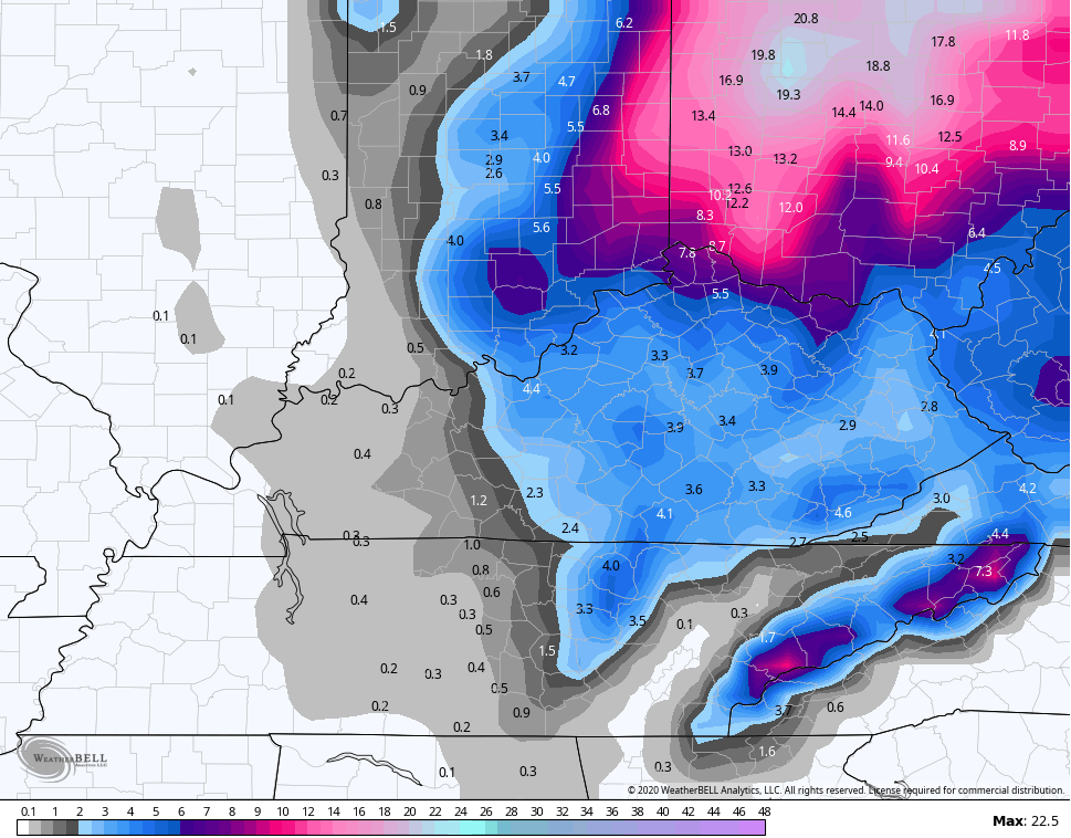
Again, folks… that’s a model and not my forecast. Those models will change with each run and could change dramatically up until the virtual weather becomes the real weather.
Check out the wind gusts from the GFS…
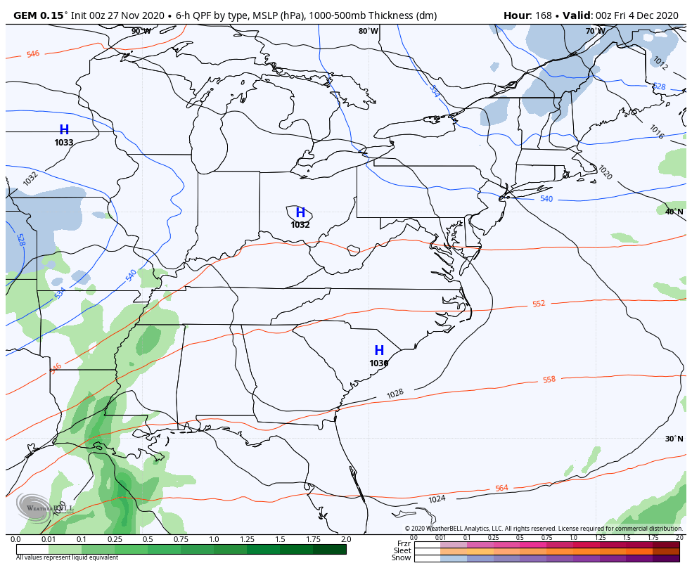
The Canadian Model is similar to the GFS, but is just a little slower with the departing system…
Here’s the snow forecast from that model…
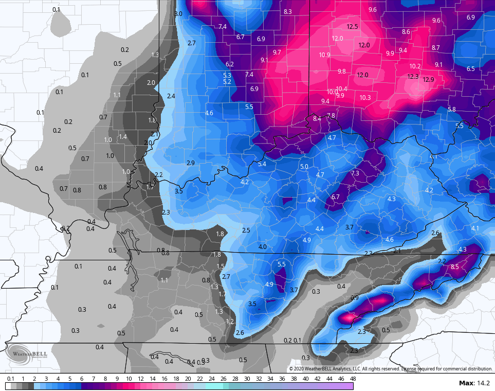
Notice how that has higher totals. Why? Because it’s slower and keeps the snow going longer around here.
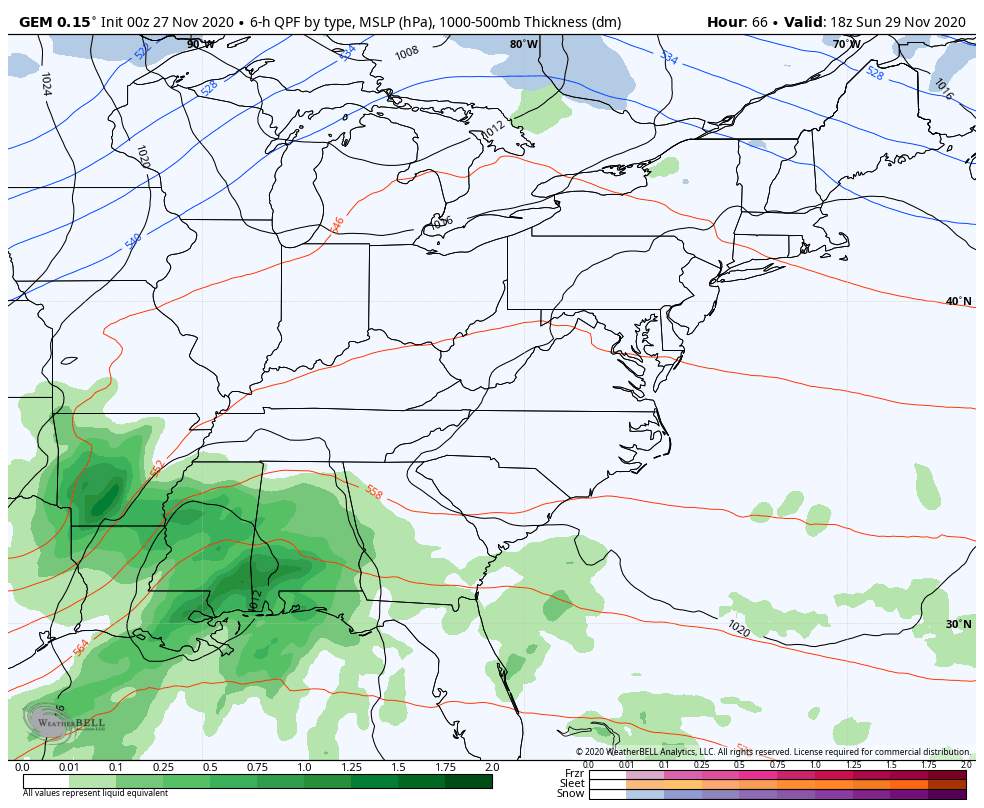
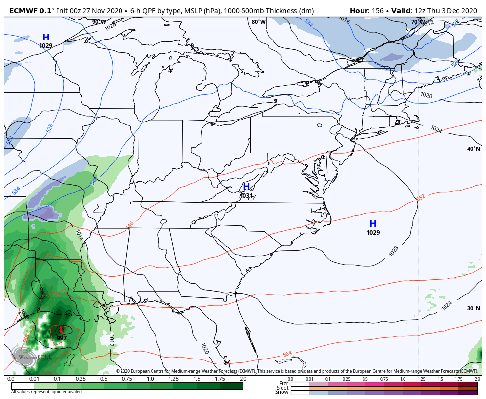
The latest EURO decided it would become the most progressive of the 0z model runs and give us the shortest window of snow…
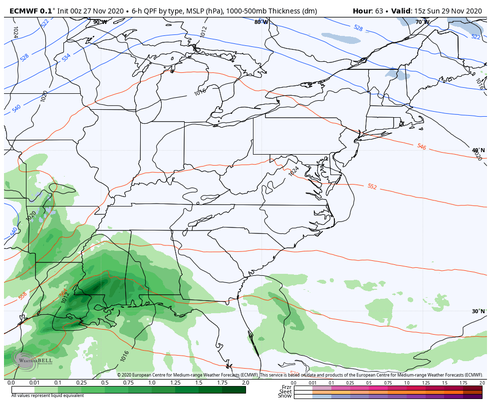
Look at what a faster moving system means for totals…
I can’t say that any of the above models are right or wrong, but the EURO was actually forecasting 22″ of snow in Kentucky just a few runs ago. 🙂 That run didn’t look right and I’m not sure the above run looks totally on the mark, either.
I suspect the models are also having speed issues because they’re trying to figure out the next system coming in behind this one by Thursday and Friday.
The GFS is too flat with it because that’s what the GFS does with systems in this time frame. The Canadian has been more consistent, but still has some hefty swings…
The EURO was taking this storm to our south and east. The new run now goes crazy with it in the Mississippi Valley and rolls it over us…
So, as we flip the calendar from November to December, we have a couple of nice looking winter systems to track. I think that’s two more than we had all last winter. 🙂
I just realized I’ve written a thousand words in this update. The things I do for you guys!
More updates will be rolling your way later today, so keep checking back. The blog will be slow at times because of the increased traffic and I’m still working some kinks out with the new site. Appreciate the patience.
Have a great day and take care.

I am not going to lie I am really not that thrilled about the latest model runs.
With each model run the accumulation of snow has shifted more to the north and east. I’m not really or expecting any snowfall for my county of Taylor. Looks like the old familiar weather pattern. Darn southeast ridge.
I can’t believe it, but there may be another tropical storm to tract in the Atlantic. Crazy year folks.
I can see why CB is not forecasting specific snowfall amounts yet, because of the widely varying amounts the computer models are showing.
One thing for sure is that the snow from this storm will miss the Chicago Metro Area, with only areas close to Lake Michigan possibly seeing a little bit. It will get windy and cold though.
It was a cloudy and mild Thanksgiving for the Chicago area, with highs in the mid 40s, as our incredibly mild November continues. Only four days this month have averaged below normal so far.
We appreciate all that you do to keep us up to date, I’m glad you enjoy what you do,we know if you didn’t enjoy your job this blog would have been history along time ago.
I’ve been here about as long as the blog, and it’s always interesting.
Thank you for your time and effort!!!
The weather channel wasn’t given much either for our state ky. But with two or three days out a lot can change from now tell then. I’ remember that famous blizzard we had back in 1978 before it hit all that there saying flurries in the forecast.