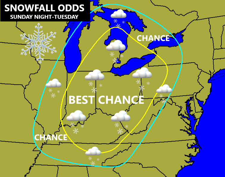
Good afternoon, everybody. I continue to target the Sunday night through Tuesday timeframe for a winter storm system to impact our region. This is now likely to bring the first snowfall of the season to much of the region. While I’m still not ready to commit to a light event or something a little bit bigger, the setup from a few days out continues to look good for a snow maker around here.
I’ve been running down the scenarios with each update, so I’m going to skip all of that with this post. You guys are probably tired of hearing about phasing, anyway. 🙂
I will throw out a few reminders of how things may play out:
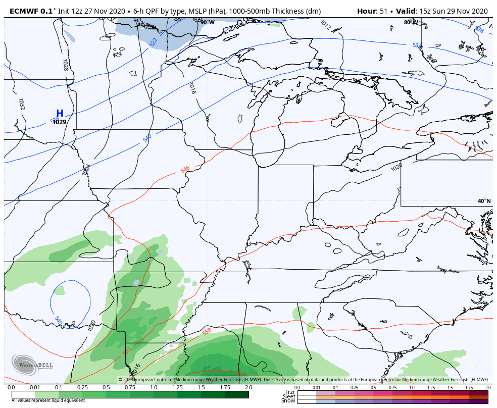
- Rain arrives from the southwest Sunday afternoon and evening.
- As our low pressure strengthens to our south and east, cold air quickly wraps in on the backside. Western Kentucky may switch to some snow fairly early Sunday night. The switch to snow then shows up in central Kentucky Monday morning, then later in the day in the east.
- A comma head of snow is likely to set up from Indiana and Ohio into Kentucky Monday afternoon through Tuesday morning. Throw in a fetch of moisture from Lake Michigan and you can get in on a possible overachieving setup for a few hours. Remember, the Lake Michigan waters are still pretty warm and that enhances the moisture!
- The best chance for accumulating snow in western Kentucky is with the actual low pressure itself Sunday night and Monday morning. For central Kentucky, it comes from a few hours behind the surface low then with the upper low through Tuesday morning. Eastern Kentucky waits until the upper low and northwest winds kick in Monday evening through Tuesday.
- As the upper low pulls away on Tuesday, snow showers quickly diminish from southwest to northeast.
- I still cannot say if you location gets a lot of snow. I’m confident it’s going to snow, but I’m not ready to commit on a coating or several inches. Don’t put so much pressure on yourselves one way or the other. It’s 2020 and we are already talking about a system like this to end November. 🙂
- Wind gusts of 30mph or so may also show up.
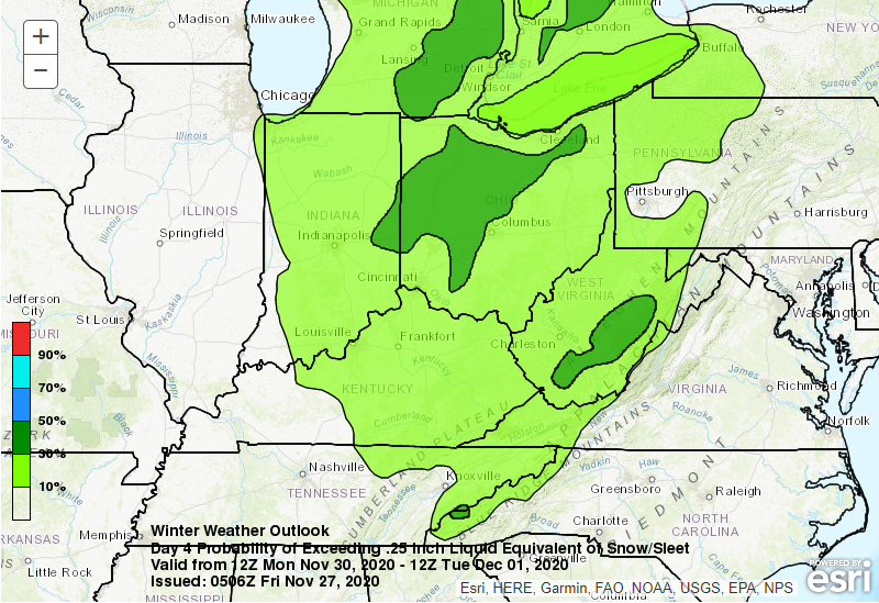
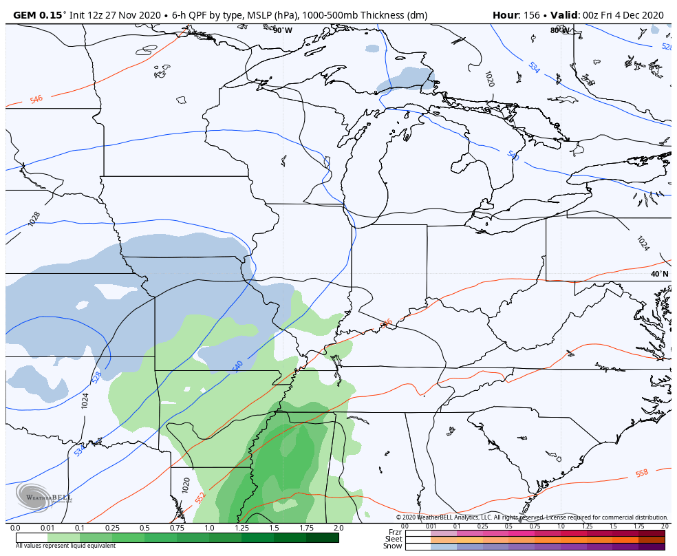
I notice the Weather Prediction Center is highlighting much of the same region as the map I put out a few days back…
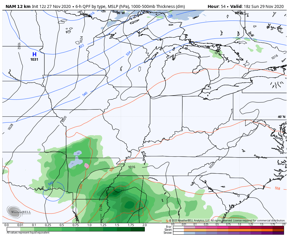
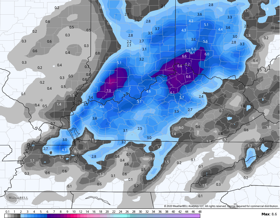
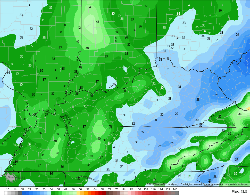
The NAM now goes through 7pm Monday evening and looks like this…
I mentioned the flow off Lake Michigan and you can see that VERY well on the NAM future radar at 7pm Monday…
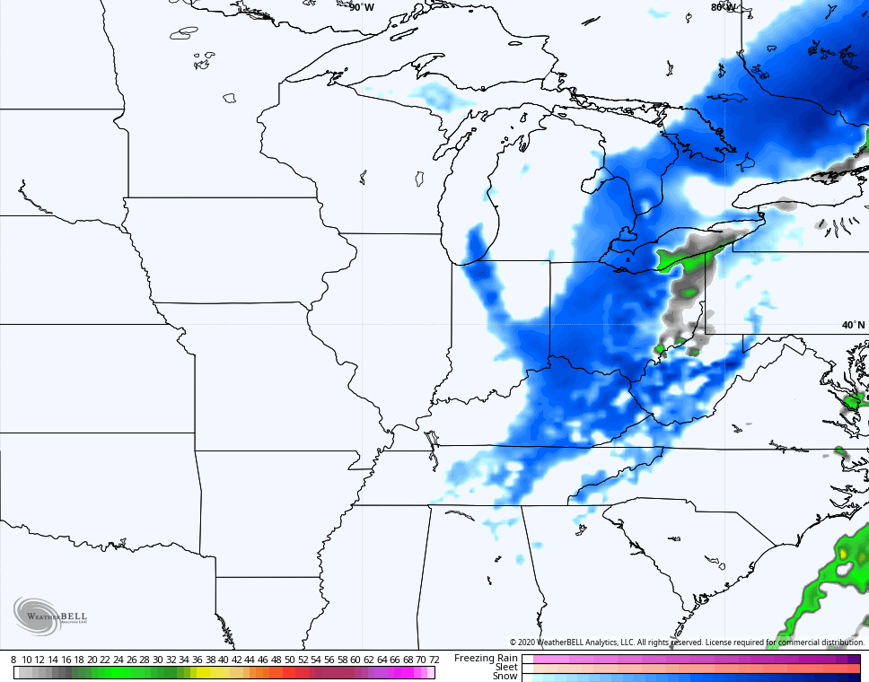
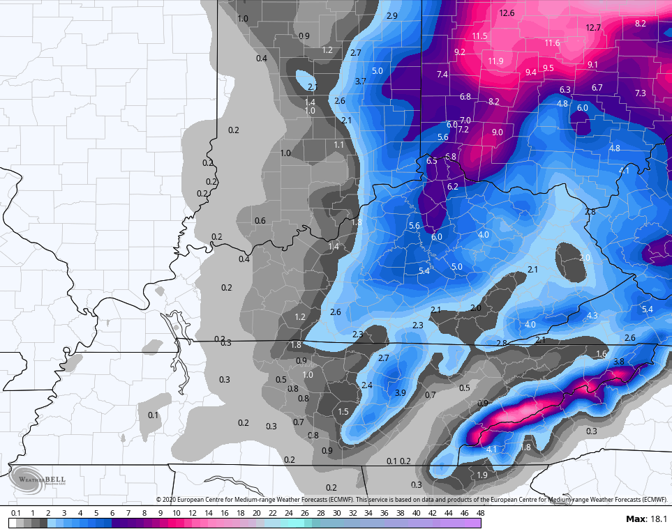
Here’s the snow map from the NAM through 7pm Monday…
And the wind gusts through the same time…
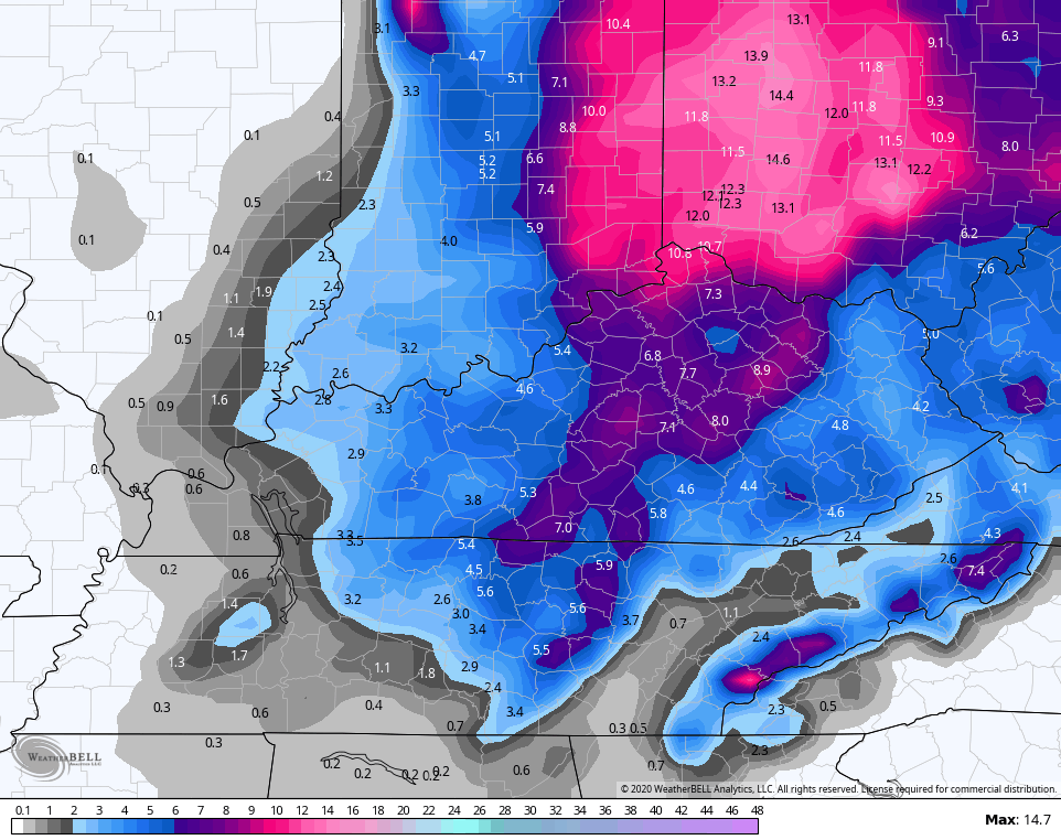
The Canadian is going with a similar look to the NAM…
Here’s the snow map from that particular run…
The latest EURO is also back in the fold, but just a bit east of the above models…
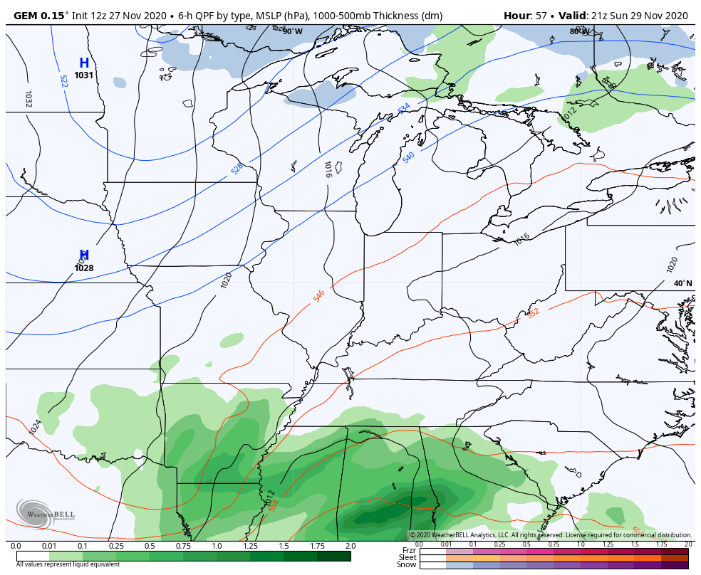
The new GFS appears to be having issues with developing two surface lows instead of consolidating the energy into one low…
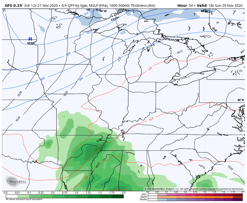
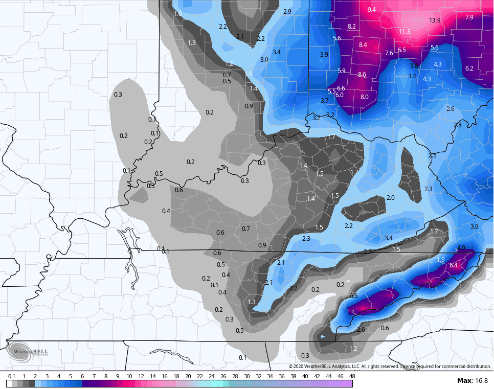
Looks like some convective feedback is showing up along the Gulf, so the model sees that as a low pressure then rides it up the east coast. Still, here’s the GFS snow map…
After a break by the middle of the week, the next storm system rolls our way by the end of the week into next weekend. The models continue to vary on how to play this, but this is likely to bring another winter weather threat…
I will have updates on WKYT starting at 4 and going through the rest of the evening. Another KWC update comes your way later in the evening, so check back.
Enjoy the day and take care.

I’m starting to think I’m not going to get much of anything where I live near Bloomington, Indiana. The euro only shows an inch now and who knows how much of that will actually accumulate. I’m hoping the Canadian is right and I can at least get a couple inches.
Thanks Chris, I think you have done a great job keeping us updated with this impending snowstorm.
I never get tired of learning about phasing. That’s what makes meteorology interesting. The making of a snowstorm.
wonder how much rain we will get Sunday