Good evening, everyone. My thoughts remain unchanged on the big blast of winter weather coming in here from Sunday night-Tuesday. This will bring our first accumulating snow to the region and I should be able to throw a first call out sometime on Saturday.
With my last post, I said I wouldn’t recap everything I had already talked about then I went and did it again. I’m not going back down that rabbitt hole with this update, so check the last post for my breakdown thoughts.
Since we are now with a few days of this system, we get more model data from the afternoon hours, but most won’t go through the entire event.
The NAM has a bias of being too limited with moisture from the northwest and the 18z run essentialy does just that. It’s not fully seeing things…
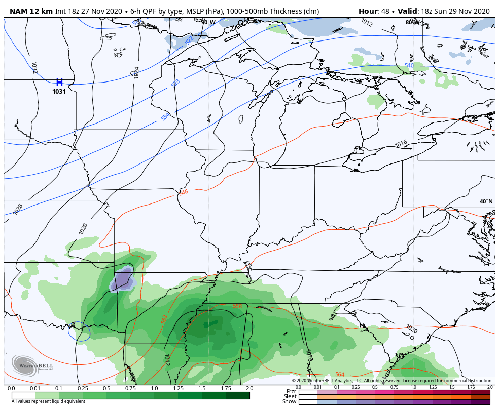
Here’s the snow map from that run through 1am Tuesday…
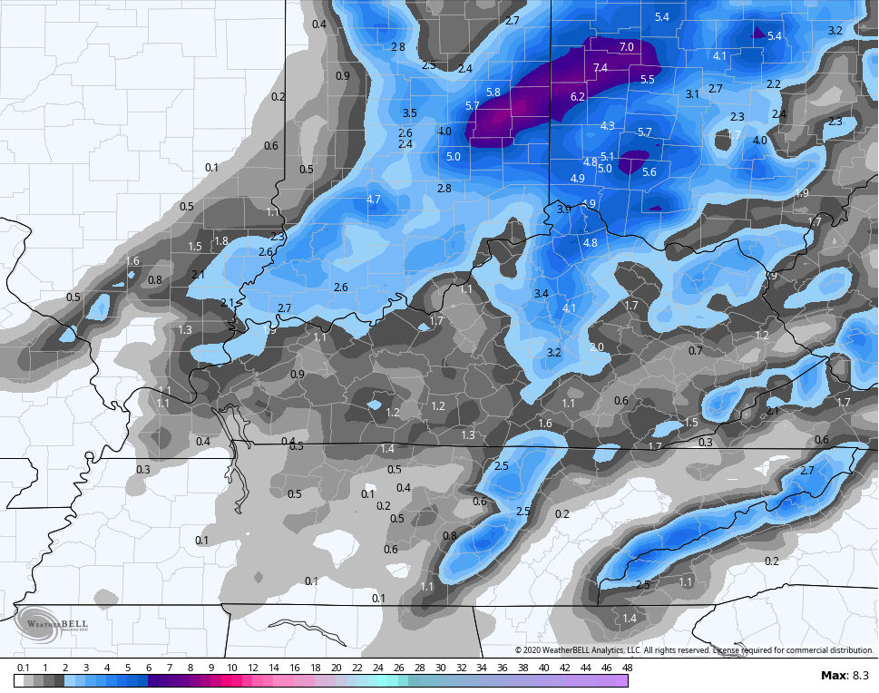
The Canadian Model has a cousin of the NAM that also only goes out to 84 hours. Notice how much better it sees the moisture coming from Lake Michigan that’s aimed right at us…
Here’s the snow map from that run through 1am Tuesday…
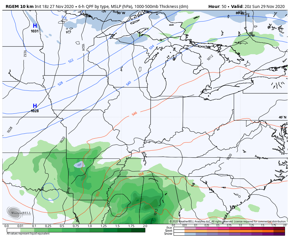
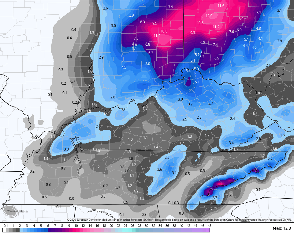
The afternoon EURO only goes through 7am Tuesday, but it continues to stay the course and matches up well with the above models…
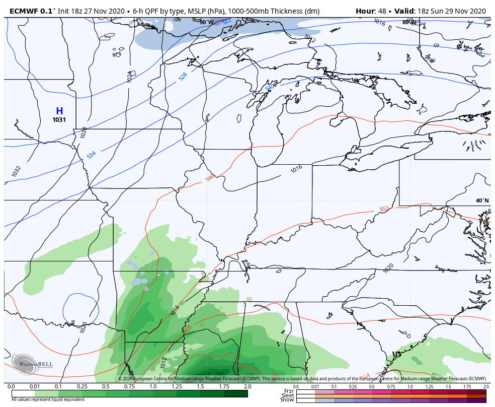
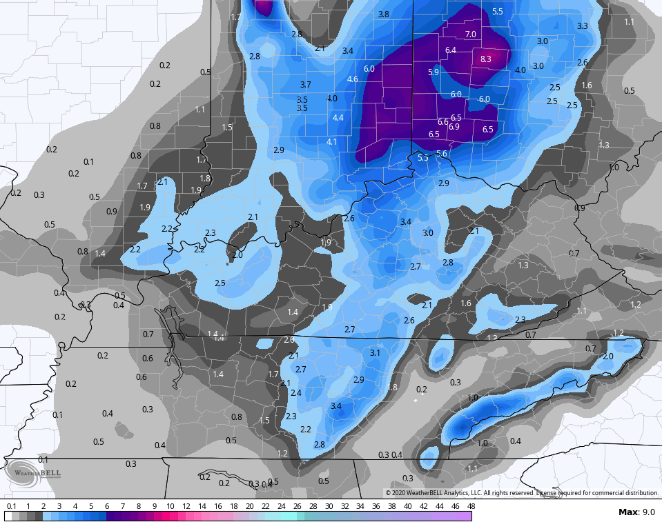
If anything the EURO is slower to move the snow away early Tuesday. Here’s the snow forecast from this run through 7am Tuesday…
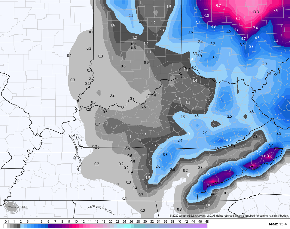
The GFS continues to have some feedback issues and that’s hurting the model run overall because it’s not keying on the main surface low enough. That leads the model to be slower with cold air and not as strong with the northwest flow…
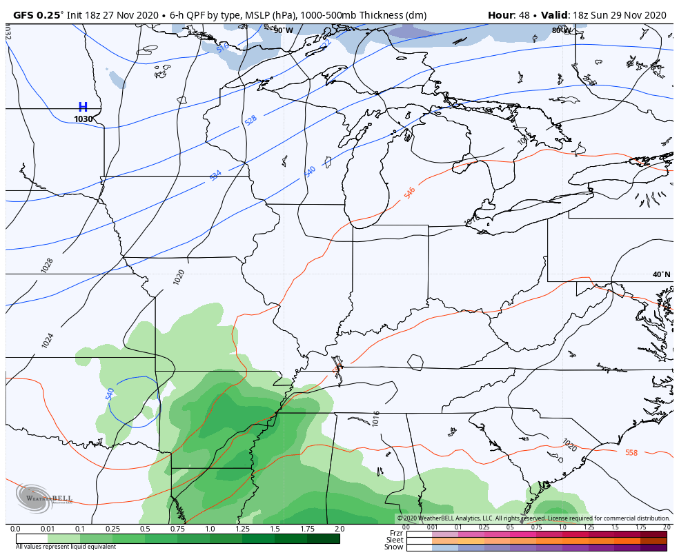
Even with the problems, the model is still finding snow…
As I said in the earlier post that I promised not to rehash, our best opportunity for accumulating snow behind the surface low as the northwest wind from Lake Michigan hooks up with our upper level low.
The national weather folks continue to pick up on our storm…
November will wrap up with a major Eastern storm with wind-whipped rain along the East Coast and #snow in the Ohio Valley, Great Lakes and Appalachians.
Complete forecast briefing: https://t.co/tgTpVEYNcn pic.twitter.com/DWvlssfyHc
— The Weather Channel (@weatherchannel) November 27, 2020
NEW: A powerful storm system appears more likely to come to fruition and deliver feet of snow and near-blizzard conditions in parts of the Midwest next week. https://t.co/HpLA9jkeym
— AccuWeather (@accuweather) November 27, 2020
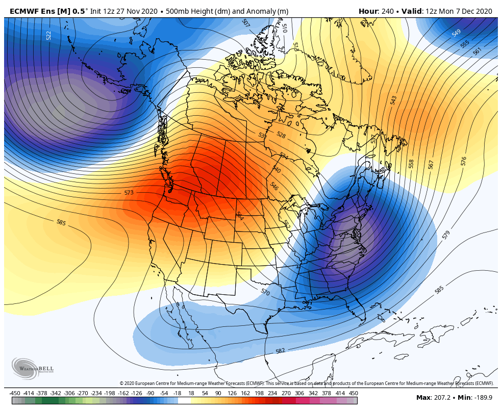
As we look even deeper down the road, we find a pattern that’s likely going to throw several winter weather makers our way through the middle of the month, at least. The EURO Ensembles have a cold and stormy look…
I will have the latest on WKYT tonight at 11 and will have your regular full update after midnight. Have a good one and take care.
