Good Saturday, folks. It’s full steam ahead toward our first snowfall of the season on Monday as a winter storm system rolls through the region. This will move in as we close out November and say hello to December. How much of the white stuff will vary depending on where you live across the state, but December looks to begin with, at least, some snow in the air and on the ground. No, this doesn’t mean you need to raid the grocery stores by any means. There’s no TP left anyway. 🙂
I should be able to get you the First Call For Snowfall later today, but I would like to see another model run or two before doing that. I’m still not convinced the models are handling all this energy properly and there’s still just enough disagreement among them.
A few thoughts:
- Sunday afternoon will find clouds increasing as temps spike into the 55-60 degree range.
- Rains arrive from southwest to northeast Sunday evening into Sunday night as low pressure works into east Tennessee then far eastern Kentucky by Monday morning.
- As the low wraps up to our east, western Kentucky will see the transition to snow first, then into central Kentucky sometime Monday morning. Eastern Kentucky won’t get in on the flake action until later in the day.
- For me, the switch to snow behind the surface low is the most uncertain part of the whole setup. These things are always tricky and that’s why I’ve been putting much more emphasis on the snow chances showing up with the upper low and the northwest flow. This is why I want to see a few more runs.
- As the upper low digs in and closes off Monday afternoon and night, this is where I’m most confident of sticking snows across the region. Throw in a nice flow straight from Lake Michigan and you will get a healthy look on the radar for several hours.
- This is likely Advisory type snows with a chance for something more in parts of central and eastern Kentucky.
- Winds will be gusty and may reach 30mph at times as temps drop through 20s from late Monday afternoon through much of Tuesday. That will make it feel a lot colder.
As far as the models are concerned, we seem to have the world stacking up against the GFS and, to some extent, the NAM.
Let me start you out with the Hi Res NAM. It only goes through 7am Monday, but it has one of the better looks at the snow developing on the backside of the surface low…
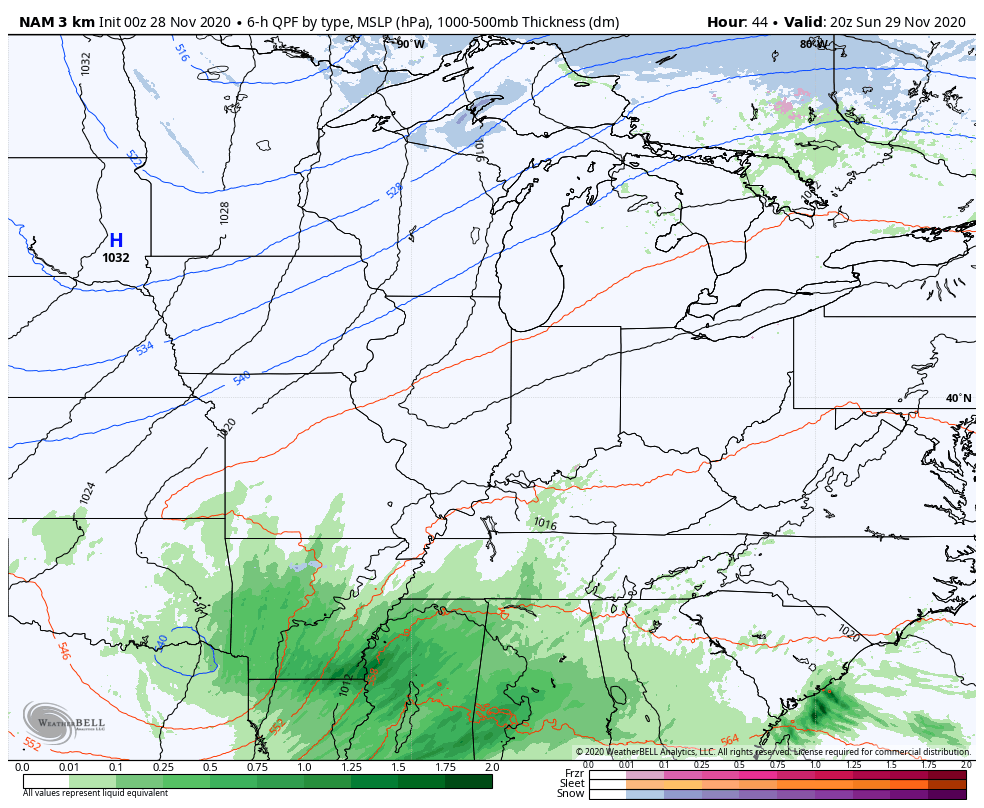
Notice how it has the low stronger and farther west than it’s big brother, the NAM…
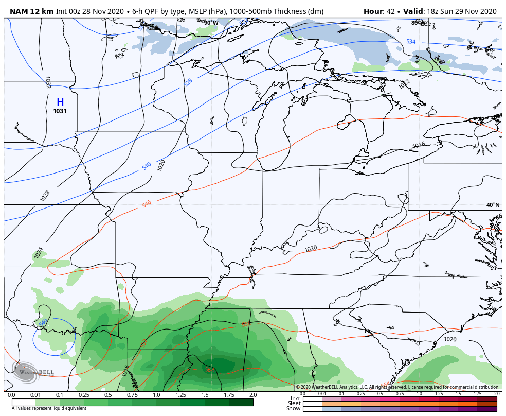
That run only goes through 7am Tuesday and has less snow from the surface low, but has a nice northwest flow event with the upper low…
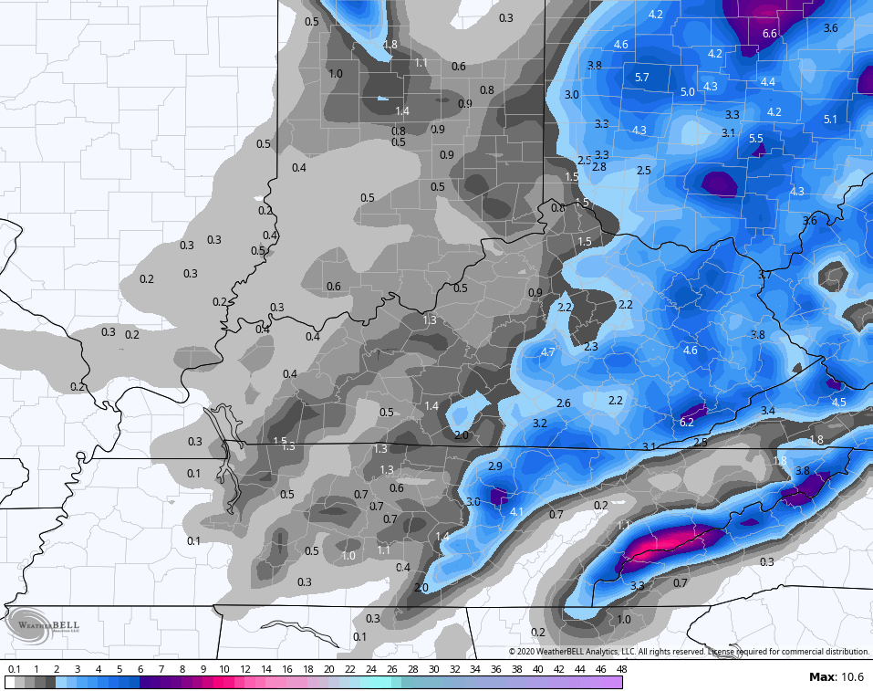
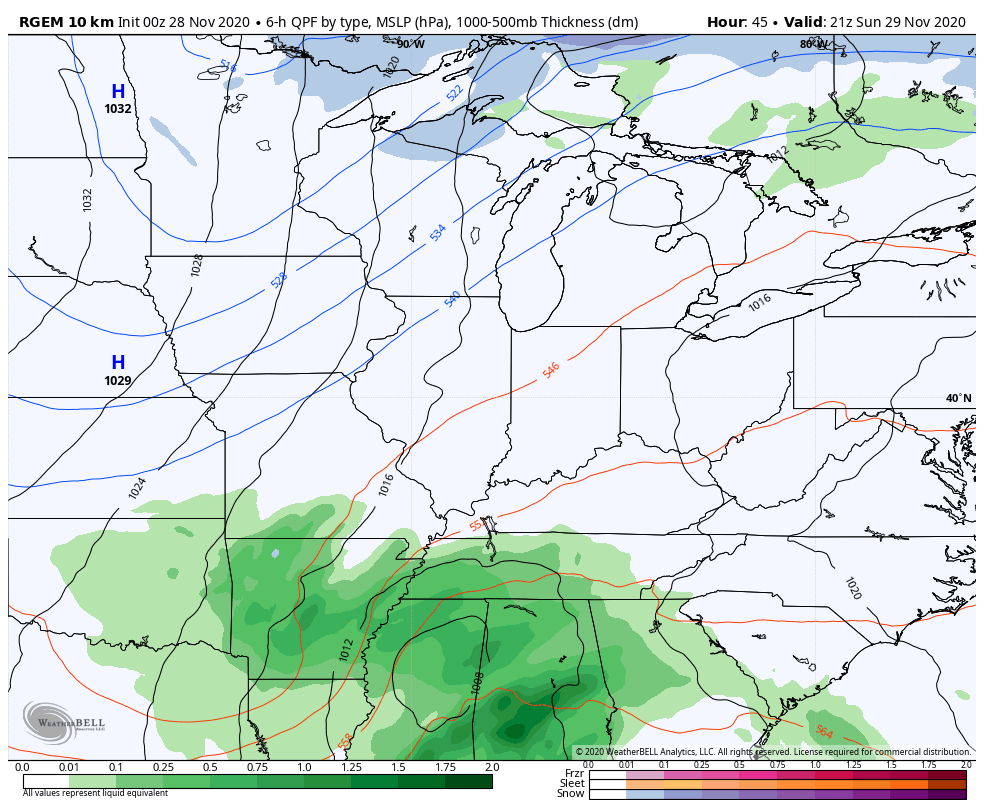
The Canadian counterpart to the NAM is the RGEM and it looks more like the Hi Res NAM with the surface low and picks up very well on the northwest flow snows through 7am Tuesday…
Here’s the snow map from that run…
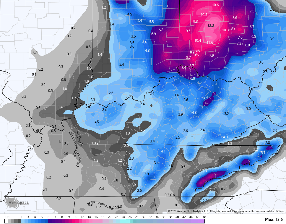
The “regular” Canadian Model is similar to this…
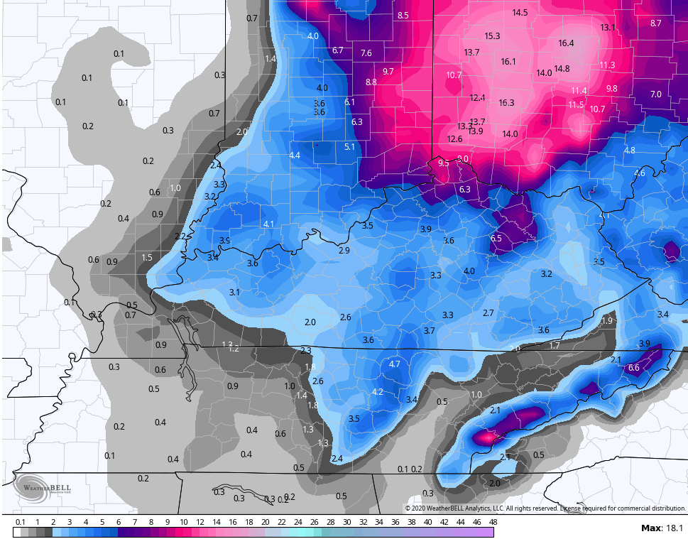
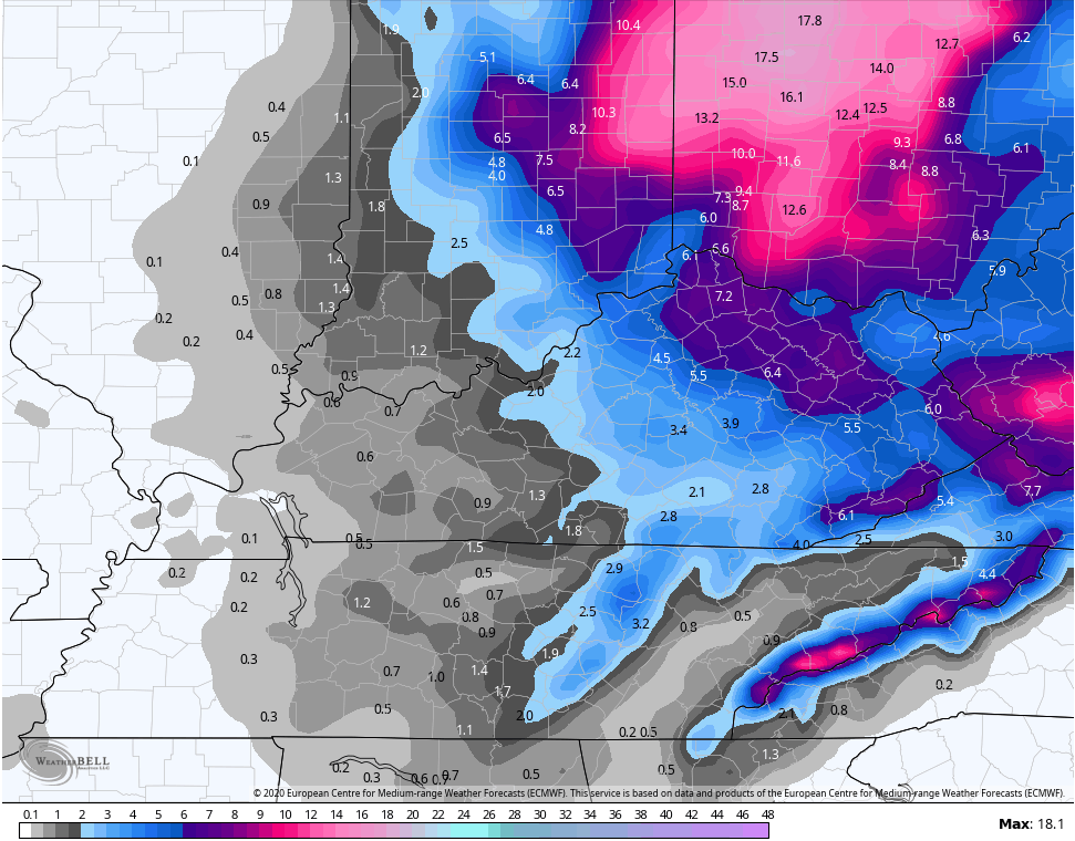
The EURO is a bit east, but keeps the northwest flow snows going well through Tuesday…
The snow map from that run of the EURO…
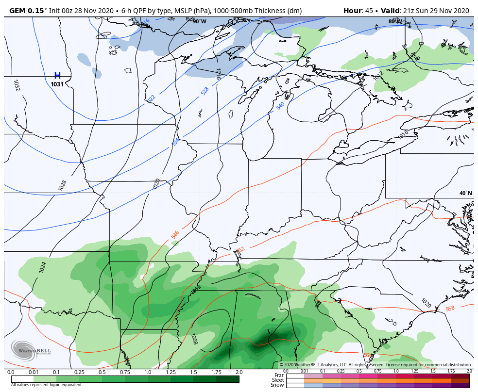
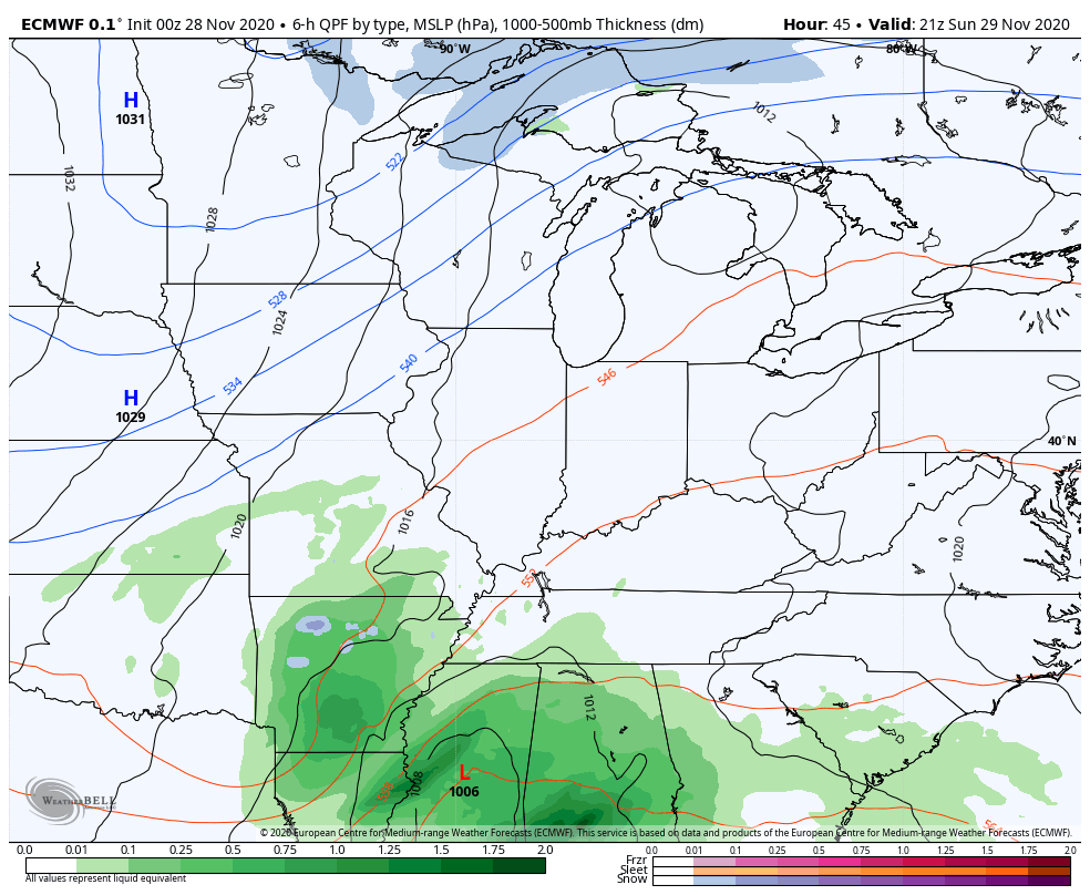
That brings us to the GFS. The model has been all over the place in recent days and is the weakest of all the models with the surface low because it still seems to be suffering some feedback issues…
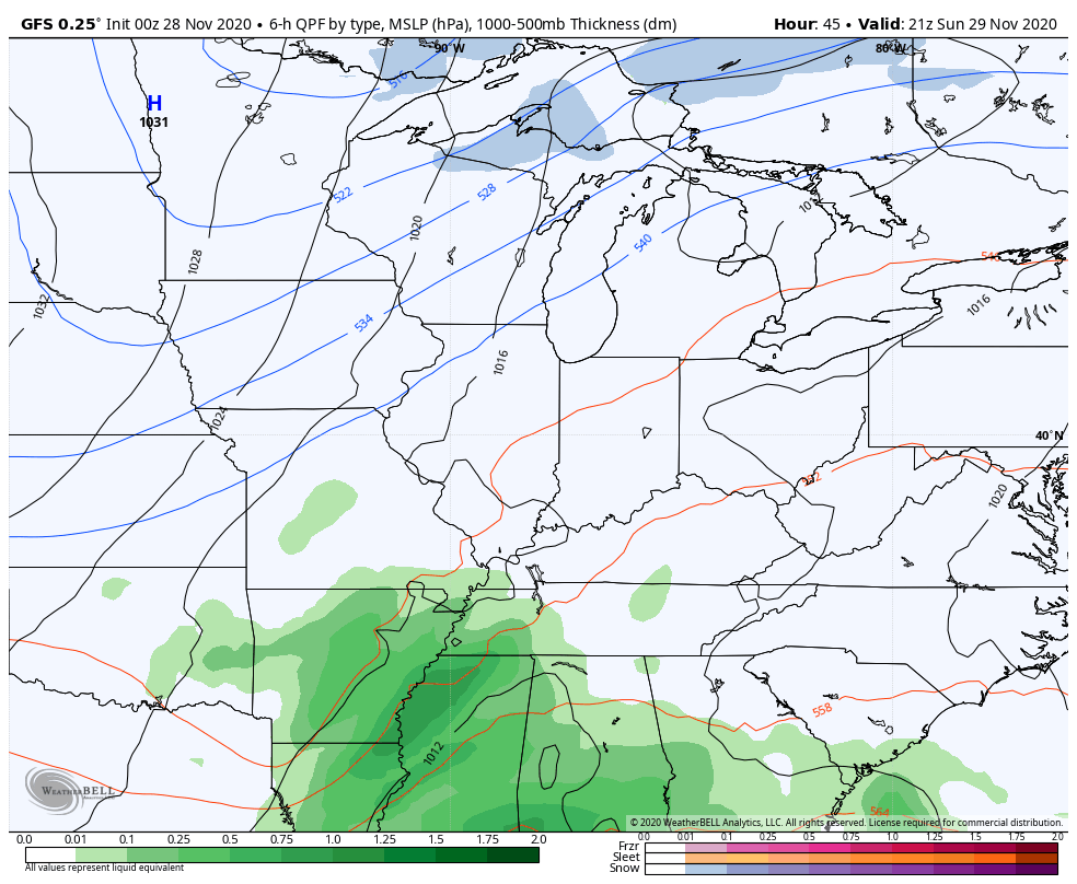
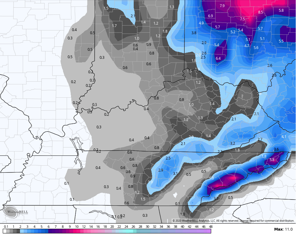
Given the fact it has a weaker low, it doesn’t have as strong of a northwest flow behind it. Here’s the snow map from that run…
I will have updates throughout the day, so check back.
Have a good one and take care.

Sure hope WKY doesn’t miss out.
Looks like much of Ohio is in the sweet spot for the most snow from this event.
It seems like the Polar jet and the Subtropical jet just can’t get together to form that perfect Winter storm.
I don’t know if the models forgot to factor in that we are in a La Nina phase of ENSO or not ?
Anyway it is disappointing to all the snow lovers out there I’m sure, but maybe later that perfect snowstorm will form and give us a state wide major snowstorm.
The forecast for my county is for 1-2 inches of rain and then some snow showers on Monday before ending.
It looks like N. East Ky will be the best place to pick up any decent amount of accumulating snowfall.
can we conger up a snow storm at the Swamp at 12 pm today
While not out of the realm of possibility to get good snows this early..remember it’s still the end of Nov/Early Dec…so don’t get hopes up. But also, it is 2020! Anything can happen.