Good Friday, folks. We’ve made it to the end of the week with the weekend finally within sight. The mild weather is about to be pushed out of here as a strong cold front ushers in the return of more typical December weather later in the weekend. We have two potential winter weather makers rolling at us from late Sunday through Wednesday.
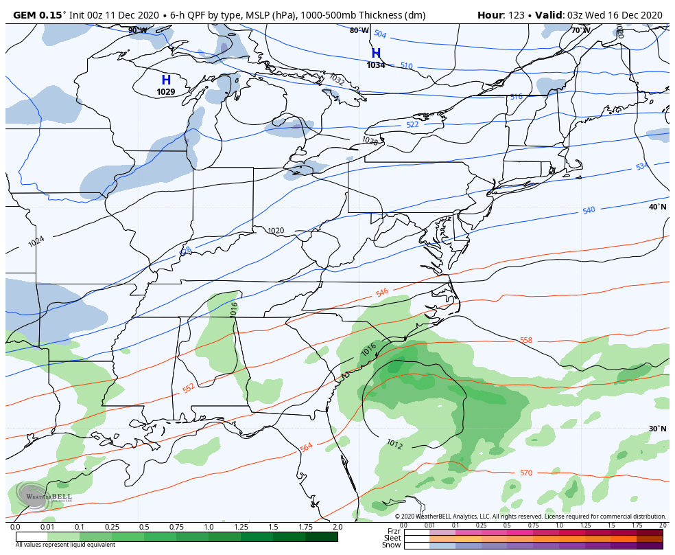
Temps out there today are back toward 60 or better in many areas as clouds increase from the west. These clouds are ahead of our storm system that impacts us tonight and into Saturday. A few showers and storms will push close to western Kentucky before the afternoon is over. Here are your radars to track whatever is out there to our west…

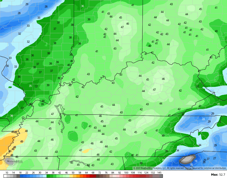
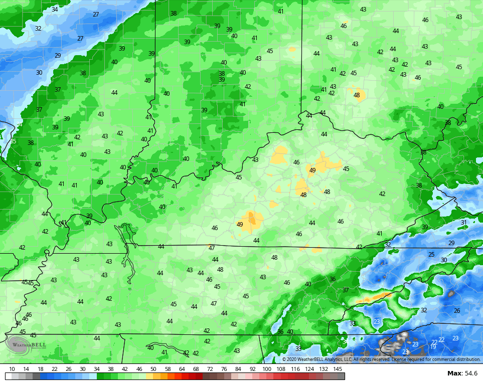
A cold front rolls into the state on Saturday and brings showers and thunderstorms from west to east. This isn’t all day type of rain and this will actually decrease the farther east it gets. Look at the rainfall forecast through Sunday morning…

Winds are likely to be a big player later tonight and Saturday and we may see gusts topping 40mph at times. The NAM fam is showing some healthy gusts…
NAM
Hi Res NAM
Might be a good idea to make sure the Christmas decorations are all secure or else you might be fishing Frosty out of a tree somewhere. 🙂
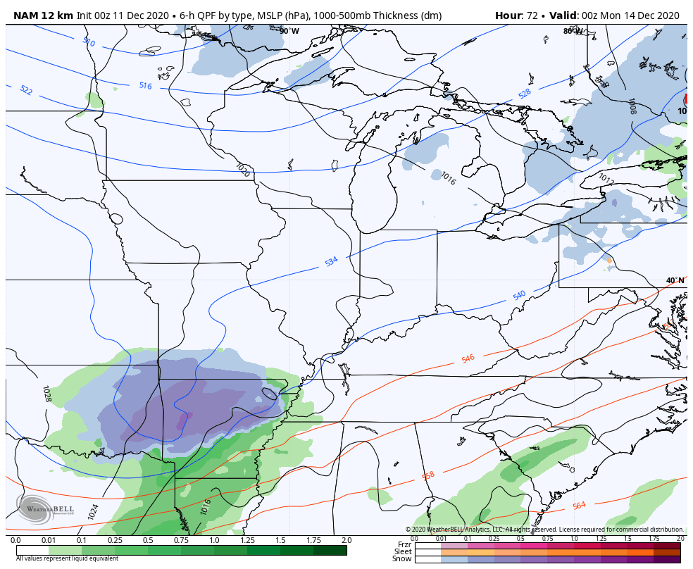
This brings us to the winter weather potential portion of the program. Colder air crashes in behind the cold front as another low pressure moves our way from the southwest. This low takes a track to our south and is likely to bring a swath of snow with it. Just how far north this swath can get depends on the track and strength of the low. As I stated yesterday, it will probably come into better focus late today or Saturday.
The NAM only goes through 7am Monday, but has a nice swath of snow along and south of roughly Interstate 64…
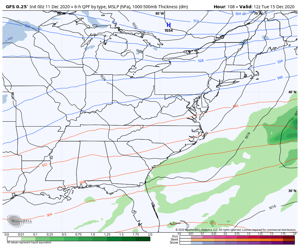
The GFS, obviously, goes out much farther in time, and it continues to show more rain than snow with a less amplified system…

The EURO is more in line with the NAM, but is a little farther southeast with the snow shield. I can’t get the images to load properly to show you guys.
The next system coming in behind this is going to work through here late Tuesday through Wednesday and Thursday. One weak low works toward us as a stronger low pops to our east. Typically, these setups bring the initial fence in here with rain and snow. As the main low takes over to our east, these usually go over to snow.
Here’s how the GFS sees it…
That’s probably too wound up with the low into our region and too progressive along the east coast.
The Canadian lost this whole setup for a few days, but is finding it again…
The Canadian then goes on to bring another possible winter weather maker in from the northwest next weekend…

Looking down the road toward Christmas, we continue to find the GFS Ensembles showing a trough into our region…

The new run of the EURO Ensembles is also seeing the trough developing across our region and keeps it through the New Year…
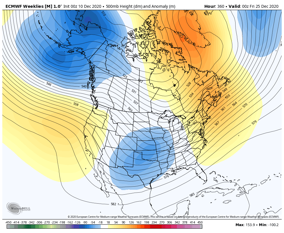
It’s almost funny to watch that model finally start to see troughs within 2 weeks after constantly showing torches in weeks 3 and 4.
I will throw you the normal updates today, so check back. Have a fantastic Friday and take care.

‘East Is the Best’ if you want your snowfall to accumulate.
Also the northern Rockies is best. Here’s what’s happening in the upper levels Worldwide : https://www.ventusky.com/?p=52;-147;1&l=temperature-10hpa
Notice the huge High Pressure System located near the Gulf of Alaska permanently preventing the Polar air from entering the United States except the extreme Northeast.
The Southeast Ridge is also acting as a block.