Good afternoon, everyone. It’s a gorgeous day in the bluegrass state, but big changes are blowing in for the weekend. These changes start out with a cold front bringing gusty showers for Saturday, then we focus on two possible winter weather makers coming in behind this from Sunday night through Wednesday.
Our cold front is well out to the west of us today and is spawning a few showers and storms ahead of it. Some of these will roll into far western Kentucky this evening. Here are your radars to track the action…

Saturday is windy and still mild with gusty showers working through. This isn’t all day rain or even close and the action slows down the farther east we get.
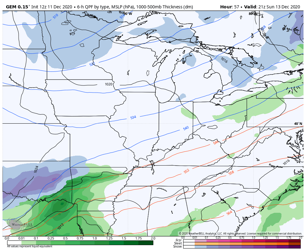
If you’re a regular reader, you know I’ve been making the case for a second low to develop and work in along or behind this front late in the weekend. The models went back and forth, but this low is going to happen as it rolls from the southwest to the northeast through the Tennessee Valley. We are missing a cold high pressure to the north, so temps are borderline for snow on the northern edge of this. Still, it appears a bit of dynamic cooling will take place and lead to a swath of snow that may accumulate. Here’s the area I’m highlighting for the best chance of this happening…
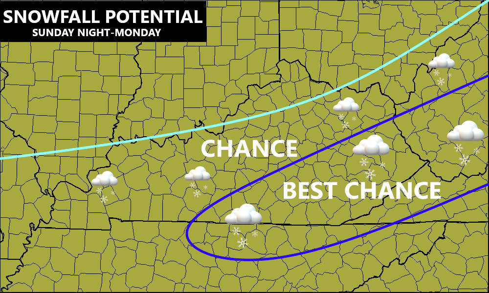
Again, that’s the preliminary map that I will keep updating that and put out a First Call For Snowfall if needed.
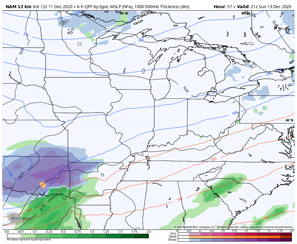
The latest forecast models are honing in on the potential for a wet snowfall for some, especially across the southeast. Here’s the NAM…
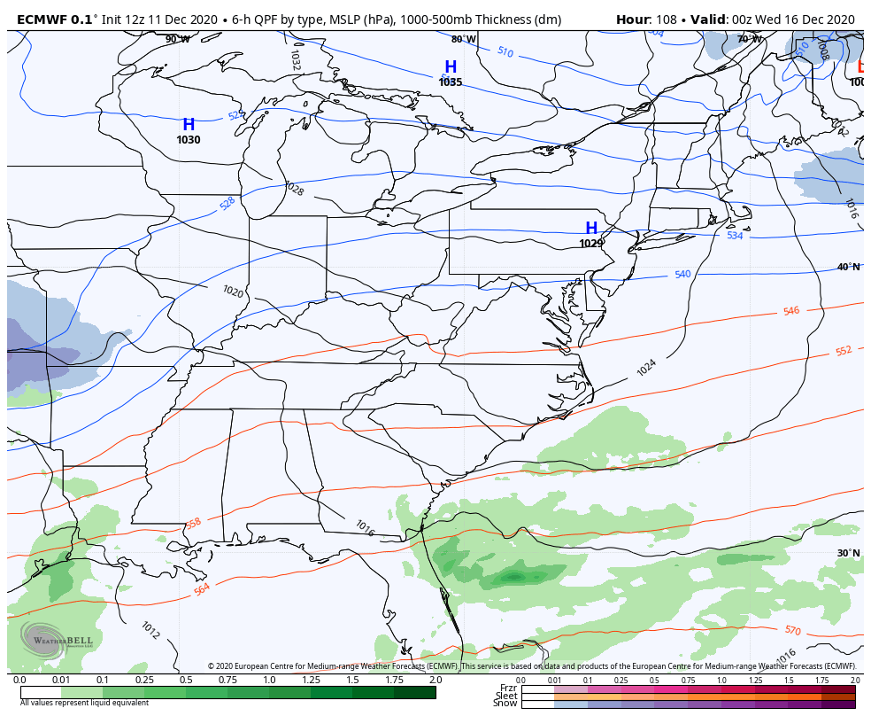
The EURO is pretty much in lock step with the NAM…
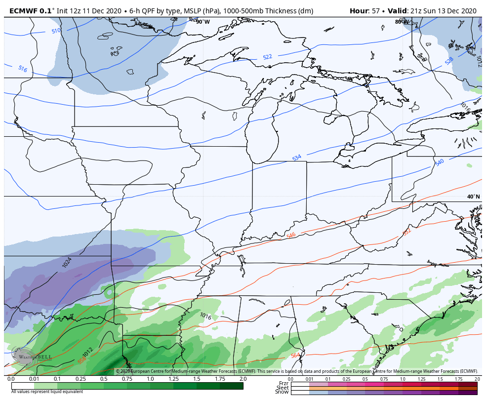
Those two hooked up well with our snowfall a few weeks ago, so let’s see if they continue to be on the same page. If they do, then it obviously lends more confidence to the whole scenario.
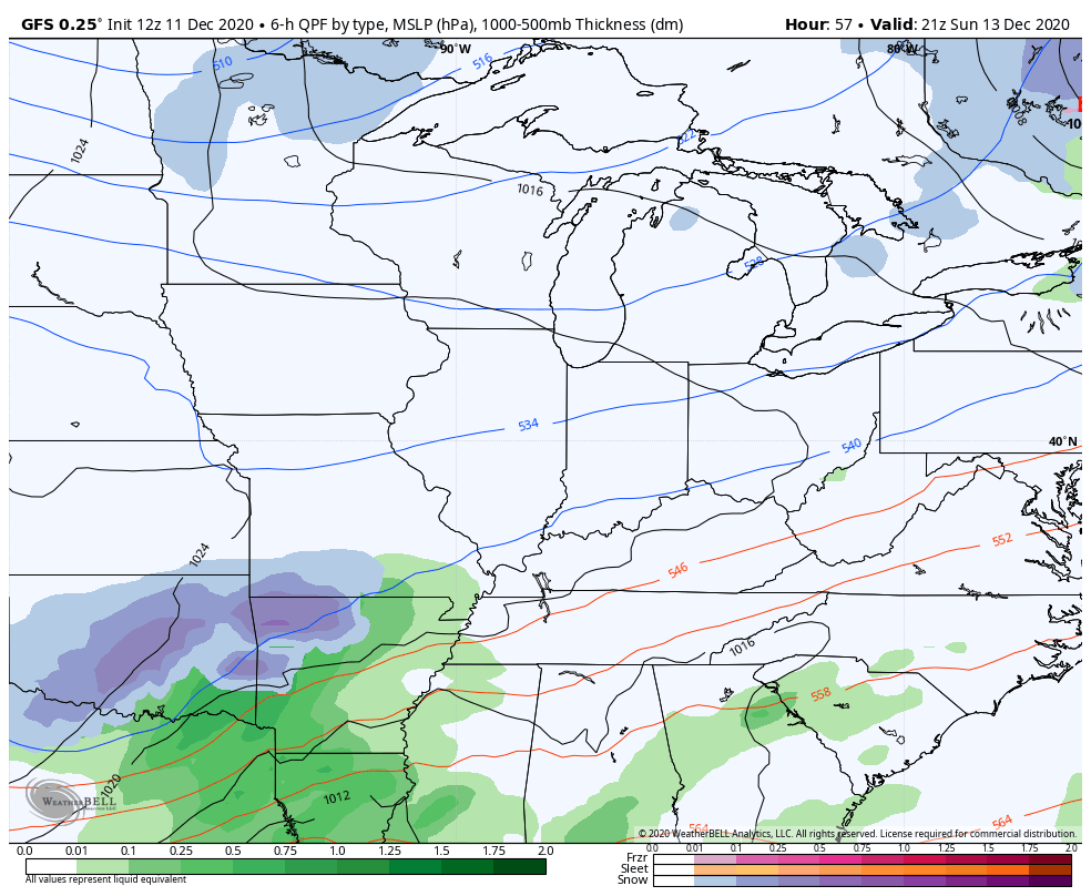
The GFS, just like it did with the last system, cannot find the dynamic cooling and is mainly rain…
The Canadian is actually agreeing with the GFS…
So, you can see this isn’t a clear cut case for a snowfall quite yet. I said the models wouldn’t get together until later today into Saturday and that still looks to be the case, no matter which trend wins out.
Once this moves through, we have no time to waste until we see the next system rolling in here for late Tuesday-Thursday morning. This system continues to look bigger and stronger and is going to garner national headlines for the potential of a major winter storm in the eastern part of the country. Many of the same weather folks in some of these larger cities who’ve been screaming torch because of bogus ensembles are now going to be scratching their heads when seeing what’s in front of them.
One weak low moves into the lower Ohio Valley or Tennessee Valley and weakens quickly Tuesday night and Wednesday. The weaker this is, the better the threat for snow around here. At the same time, a major storm takes shape on the other side of the Appalachian Mountains and takes over. The models are trending faster and farther southwest with this main storm and that’s a trend we will need to watch closely.
As it stands now, we would likely see the fence setting up on top of Kentucky initially with rain, snow and some mixed stuff. before we change it to snow as the main storm takes over in the east.
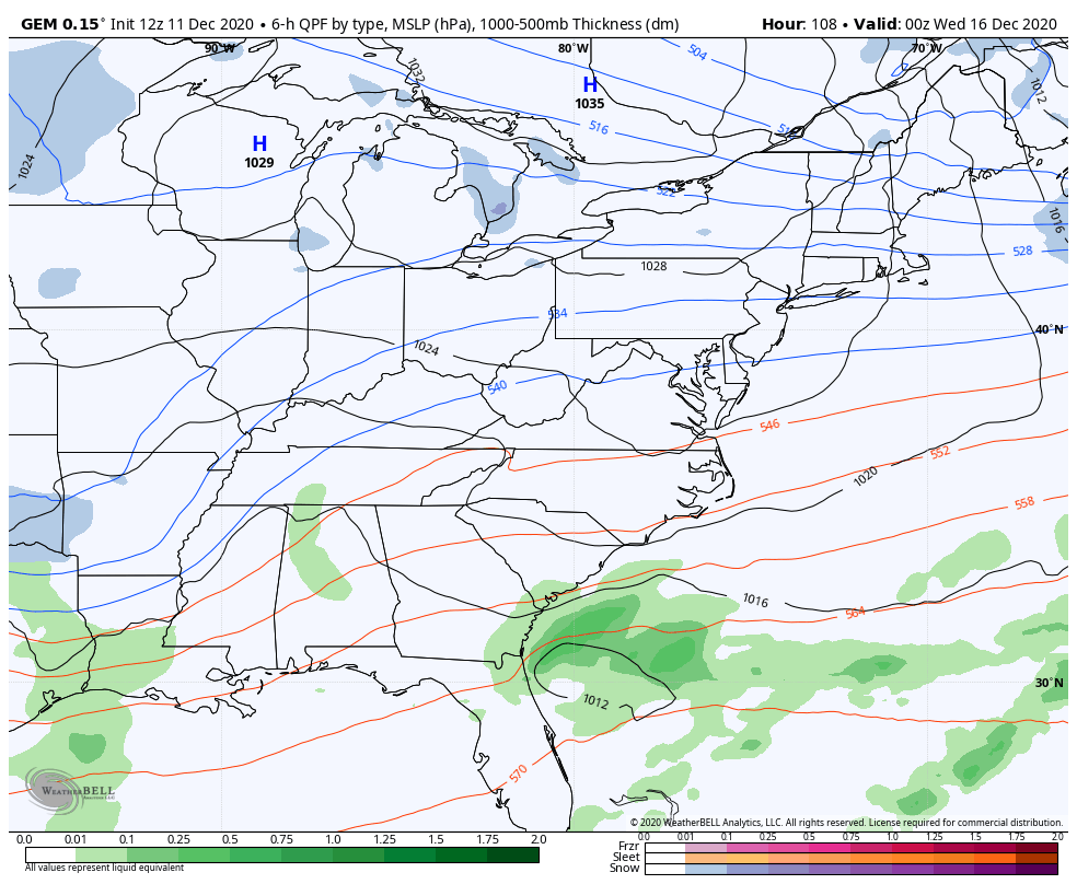
Here’s how the current EURO sees it…
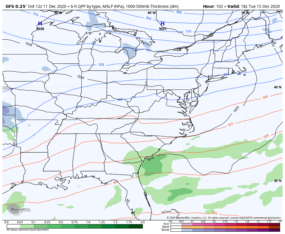
The GFS is actually pretty similar…
The Canadian Model is a mostly snow event across Kentucky…
Taken verbatim, all three models do put down accumulating snows across the state from this. They also all agree on a major snowstorm in the major cities along the east coast. Again, this is why I’ve been really trying to dispel all the nonsense noise I’ve been seeing from the weather world over the past several weeks. Folks simply relying on 2-3 week forecasts from Ensembles haven’t been paying attention to their track record this year. But, the weather echo chamber grows and grows with each passing year. 🙁
I will have another update this evening, so check back. Have a great day and take care.

I want the midweek system to be a little stronger so I can hopefully get my first accumulating snow of the season here near Bloomington, IN.
You’re north of the Ohio River which probably means that you are in good shape for a snowfall.
You would think so, but my last above average snowfall season was 2014-2015 and I haven’t had a storm drop over 5” since March 1st, 2015. I guess I’m lucky though because at least I have gotten over 6” in each season which I know some of you guys south of me can’t say that.
Yep! Know the feeling, even though I’m down here in Bardstown/Nelson Co. KY. I have pics of the last big one(a foot+)back in 2015, but since then….PFFFT! 🙂 Sure, a couple yrs ago we had a band set up right across us one March morning that dumped about 7″, but what good is that when the sun comes out and it’s gone before 1pm???! LOL! People in Louisville yak about the big Christmas snow of 2004. Yeah, they got snow. Almost a foot. 33 miles to the south, we had an ice storm on Dec 21st….luckily, the power came back on late Christmas Eve, so the turkey didn’t go to waste! 🙂 I’m still thinking(more likely, wishful thinking…) that we may get some good snows this winter. Nothing would shock me, though, if we did or didn’t.
I just checked the ten day accumulation snow map and at this moment South Central Indiana could get 4 to six inches on Wednesday, but this map changes minute by minute.
Yeah that’s probably based off the GFS model which is showing a heavy band of snowfall just to my south, but like you said it changes all the time so I guess I’ll just wait and see.