Good evening, folks. What an absolutely fantastic Friday we are wrapping up with mild temps and plenty of sun. Now comes the changes for the weekend as we track a strong cold front toward us for Saturday, and the potential for winter weather for some Sunday night. That unleashes a wintry pattern with another winter weather maker likely showing up by the middle of next week.
Showers and a few rumbles of thunder will be showing up into western Kentucky this evening and you can follow along with our radars…

Those showers and rumbles of thunder work across the rest of the state tonight and Saturday, but it’s not raining all day. Rain will actually decrease the farther east we get.
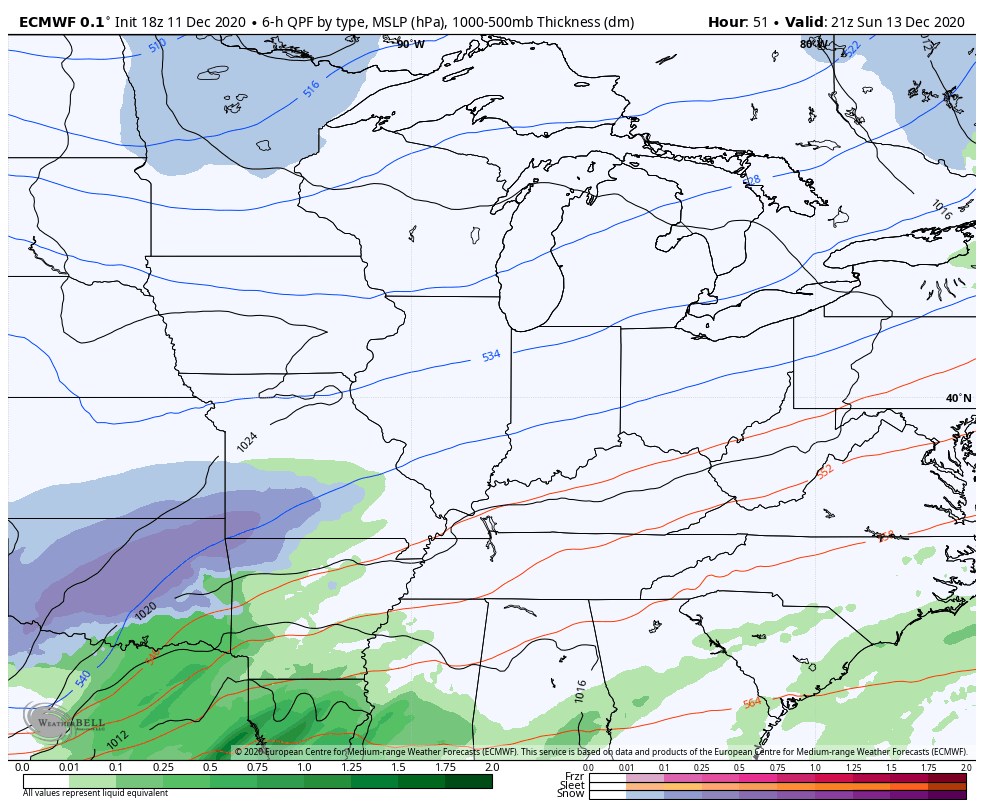
The cold front moving in will slow down just to our east as another low develops and works northeast along it. You know the drill from here, if not, read my last several posts. 🙂
The late afternoon NAM didn’t run for some reason, so we have one less model to rely on. The late day EURO did run and looks similar to the earlier EURO and NAM with a swath of accumulating snow…
The average of the 51 member EURO Ensembles suggests the snow potential a little farther north…
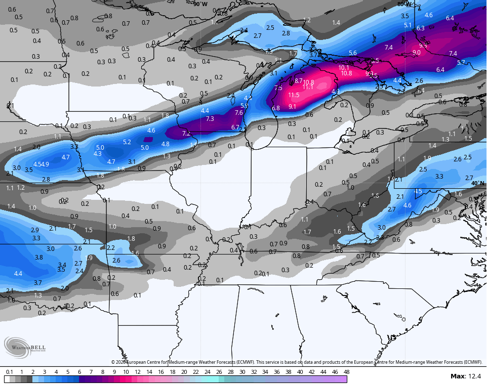
So does the EURO Ensembles Control…

The GFS is still mainly rain…

Of course, the GFS couldn’t find dynamic cooling with two hands and a flashlight. 🙂
I’ll keep this going for now…
The next system won’t roll in until late Tuesday and Tuesday night and I don’t have any new thoughts to share about that one. It’s another winter weather threat.
Enjoy the rest of the evening and take care.

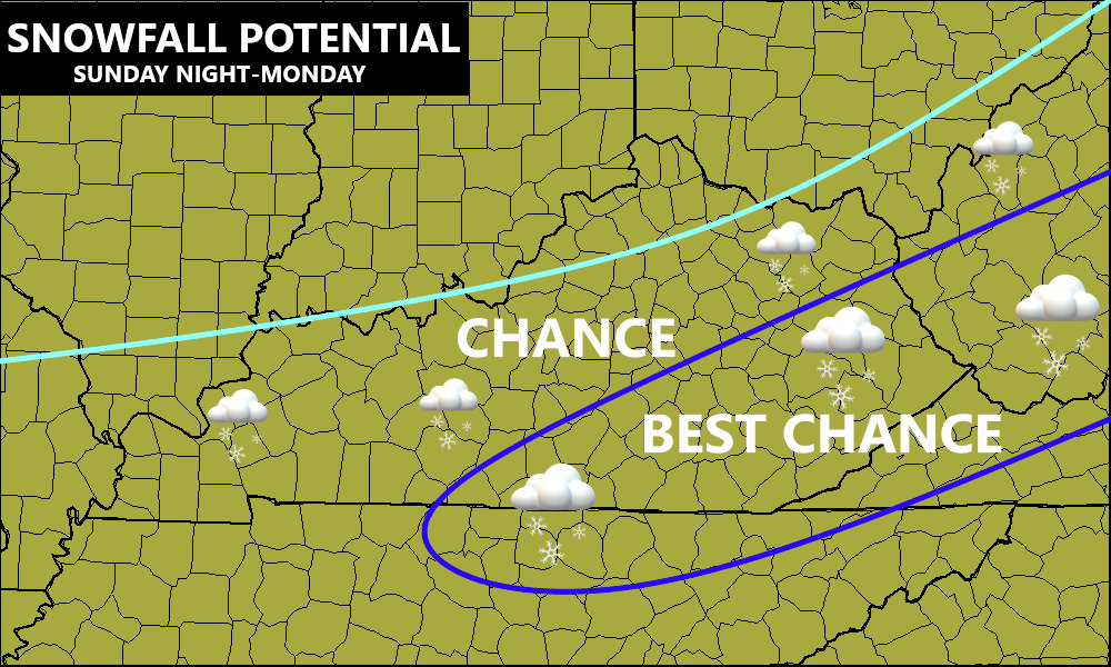
Wet snowfall for east Ky.