Good afternoon, folks. As winter weather and rain maker slowly pulls away, we are left with areas of light snow and snow showers developing. This action can put down some light accumulations through Thursday as cold winds continue to blow. Looking ahead toward Christmas, the setup continues to look frigid with the potential for some of the white stuff just before the big day.
Let’s begin with the current system. Light freezing rain was the main player of the morning across the northern half of the state. This created a light glaze for many areas…
@Kentuckyweather @JimWKYT @AdamBurnistonWX @allyblakewx Freezing rain in Frankfort. Vehicle is frozen over solid. pic.twitter.com/p4Oq7OvyuA
— james starr (@tripletdad2000) December 16, 2020
This was never going to be a big event around here, but for the past few days I argued to no avail for a Winter Weather Advisory to be issued for parts of the bluegrass region into northern Kentucky. That was finally issued around 5 this morning as the freezing rain was already falling…
This should have been out yesterday. Anyway, here is the active Winter Weather Advisory for our region. pic.twitter.com/MQ0evhUkPg
— Jim Caldwell (@JimWKYT) December 16, 2020
Freezing rain or a wintry mix moving in right before the morning commute warranted more of a heads up. I will continue to shout from the top of the mountain that Special Weather Statements for winter weather events are pointless. The general public only responds to headlines.
In terms of the current setup, our wintry mix and light rain continue across central and eastern Kentucky as a weak low pressure works through. Behind this low, temps are dropping toward the freezing mark with periods of light snow and flurries kicking in.
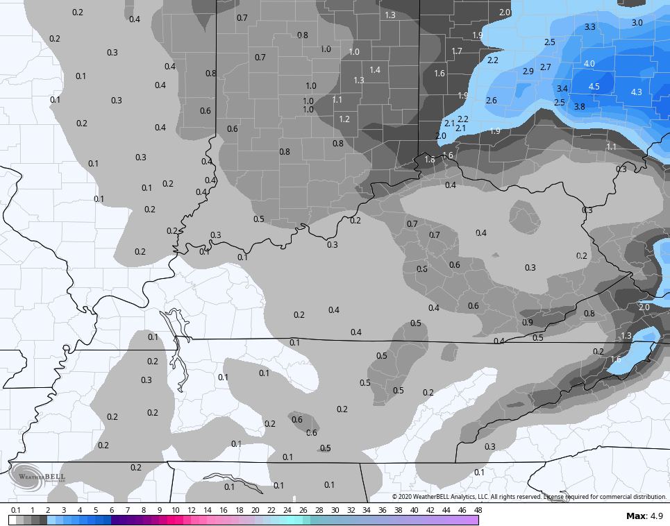
Rounds of light snow and snow showers will continue through Thursday evening and we will see light accumulations. Most areas are in the coating to 1″ range, but a few higher totals may show up in the mountains of the southeast…

Many of the models agree with this call for light accumulations…
CANADIAN
Hi Res NAM

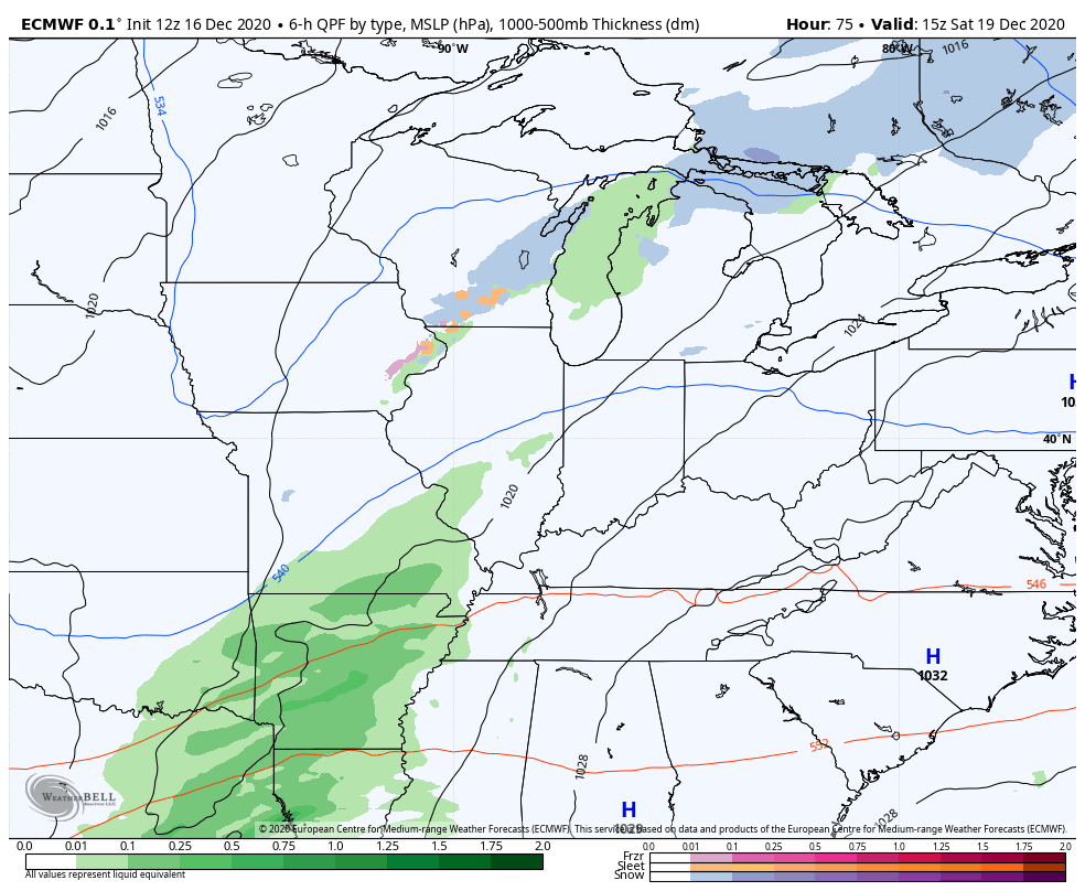
Here are your radars to follow the messy mix back to light snow…

Another system makes a run at us this weekend and looks to bring a bit of a light rain and light snow mix…
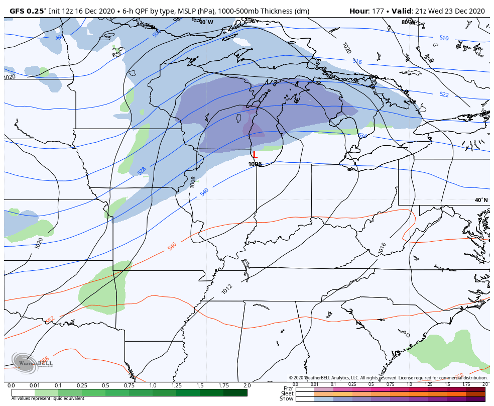
Once that system moves through, temps will rebound early next week as we get set for what looks like an arctic front dropping in here late Wednesday into Christmas Eve. It’s too early to talk about the specifics of this system, but there is the potential for this to slow down and allow for a stronger low to develop along the front. As of right now, the models see the front and some snow right behind it…
GFS
EURO
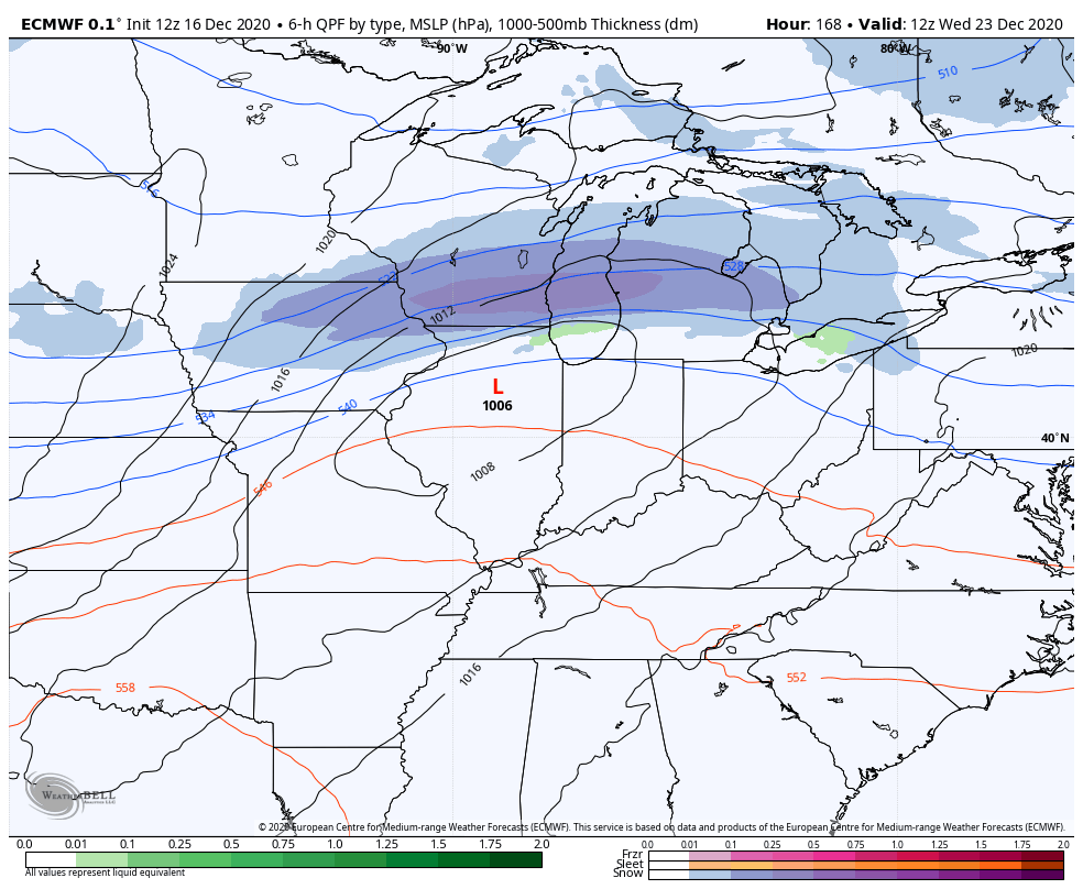
That’s not a bad look at all for a Frigid Christmas with the potential for some snow on the ground. Again, let’s see if this thing slows down and allows for low pressure to develop along it to make things even more interesting. 😉
I will have another update this evening, so check back. Until then, have a good one and take care.

I managed to pick up a whopping 1.3” of snow last night, it was an underachiever, the forecast was for 2-3 inches. The heavier snow which was supposed to set up over my area in south-central Indiana ended up in north-central Indiana where they got 3-4”. The snow I got is mostly melted by this point but at least I got something. My last snowfall of 1” of more was December 15th of last year and I sure hope I don’t have to wait that long again. Also I’m up to 1.5” of snow for the season.
You may have a better chance late next week as Arctic air is forecast to move south into the Ohio Valley and may phase with a slow moving surface low giving your area of Indiana a White Christmas.
If that happens I may get home sick as I was raised in south central Indiana. LOL
What I’m afraid of is Ice Storms and there was some areas of the state of Kentucky that had that problem this morning.
La Nina phase of ENSO is what we had back in the year 2009. The year we had the worse Ice Storm in the state of Kentucky. I sure hope that doesn’t happen this year or next year.
Wow! I just got through looking at the snow totals in areas of central Pennsylvania. Best widespread snowstorm in that region in years.
Usually when one Nor’Easter starts others will follow through the Winter.
Looking at what the current storm is dumping on Lehigh Valley region of Pennsylvania, takes me back to the strong La Niǹa Winter of 1976-77, which was a record breaker in the Allentown area. 5 major storms, the largest dumped 32 inches of snow, with 9 foot drifts. I didn’t see the backyard until mid-May!