Good Wednesday, everyone. It’s a super-active pattern rolling in just in time for Christmastime in the bluegrass state. We have the potential for high winds later today as a true arctic front drops in later tonight. This will give us the first of three chances at snow from early Christmas Eve Day into Christmas Day.
Here are some fresh thoughts:
- Today’s winds push between 40 and 50mph at times, especially ahead of the front this evening. Temps are deep into the 50s.
- Rain moves in ahead of the front during the same time.
- Temps behind this front will crash into the 20s from west to east late tonight through the first half of Thursday. Given the rain ahead of this, watch for a possible ice up.
- A band of snow will begin to develop behind the front just west of Interstate 65. This will expand in coverage and intensity as it moves east.
- Can we get a little sleet or freezing rain to show up in the transition? I can’t rule that out.
- As the arctic front moves into eastern Kentucky, low pressure develops along the boundary. Exactly where this happens and how much it slows the system down still has some wiggle room.
- Eastern Kentucky is likely to get in on several hours of some healthy snows by Thursday afternoon and Christmas Eve.
- As that’s happening, streaks of west-east snow squalls may show up across the rest of the region. Those could put down light accumulations and reduce visibilities.
- As the upper low spins in Christmas Day, a fairly widespread area of light snow is likely to develop. With such cold air in place, light accumulations will show up once again.
- Speaking of the cold, wind chills will be near zero from Christmas Eve through Christmas Day.
In terms of total snowfall for all of the above, I’m not ready to make any changes to my earlier First Call For Snowfall…
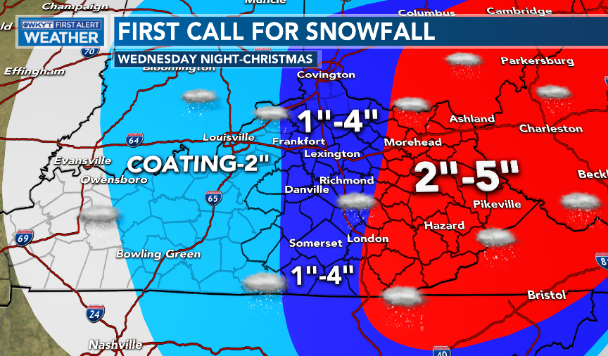
There’s a real chance I need to open that range up even more across the east.
So, why no changes to the map, yet? Because there is still some model spread I need to see get a little closer.
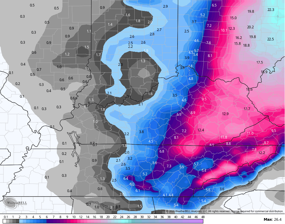
The NAM had a funny run that is the slowest and farthest west. It’s also the messiest…
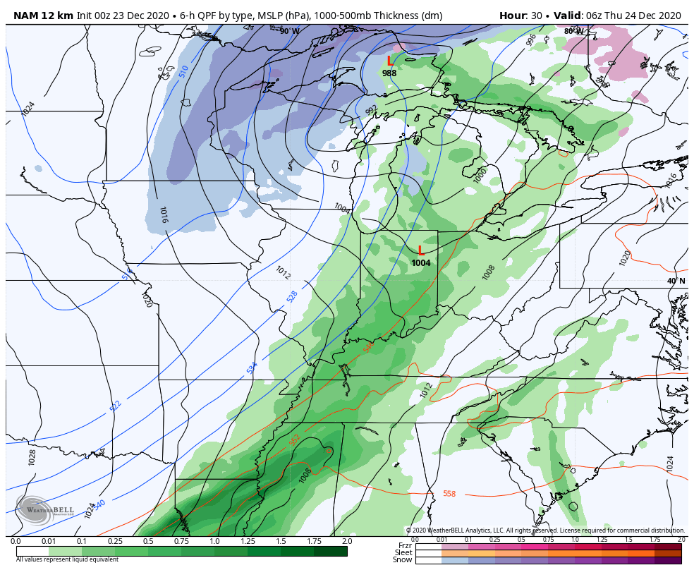
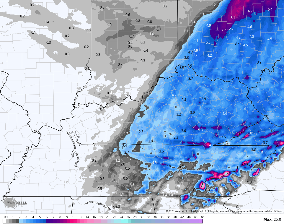
Here’s the snow map from that run…
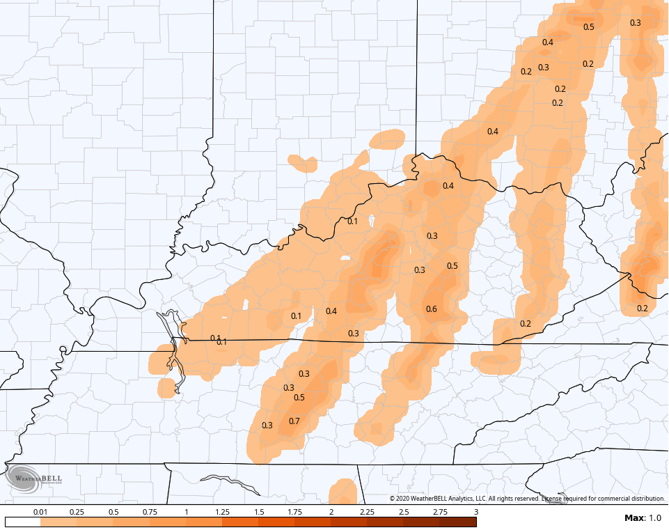
Freezing rain potential…
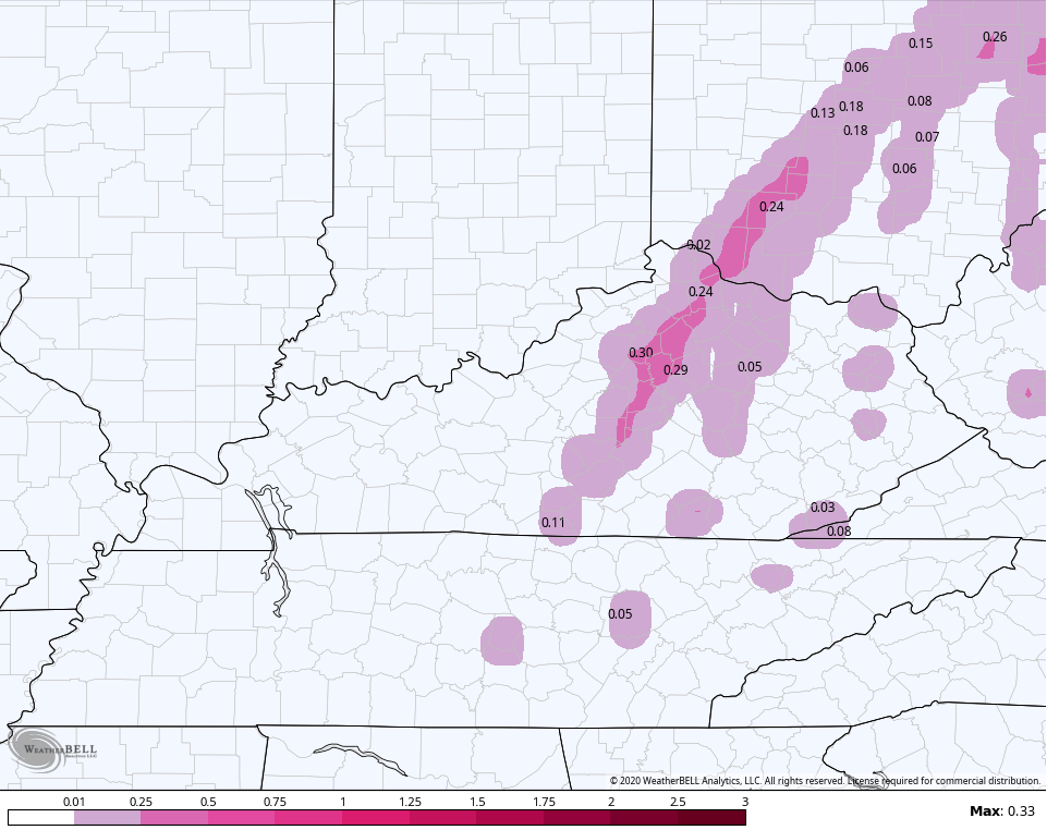
Sleet potential…
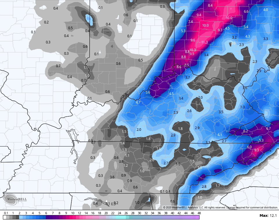
The model closest to my above thoughts is the Hi Res NAM. Here’s the future radar through 7am Christmas morning…
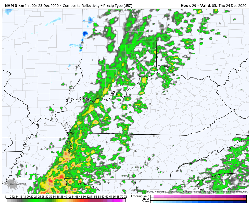
That has the snow band… The snow streaks… and you can see the light snow dropping in from the northwest at the end of the run.
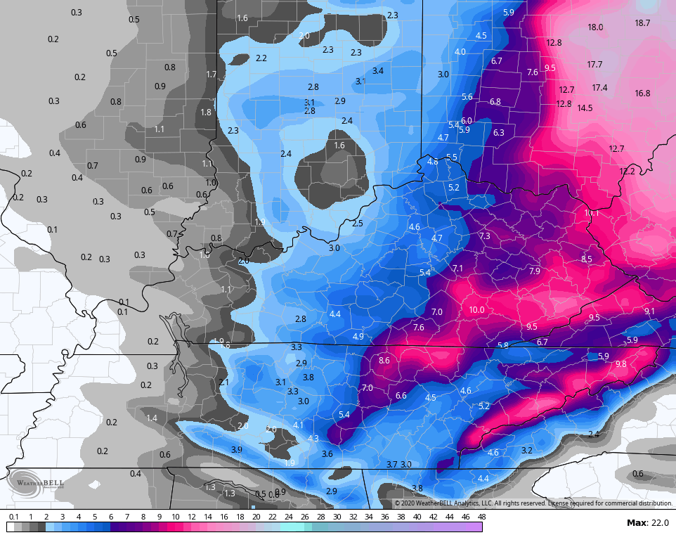
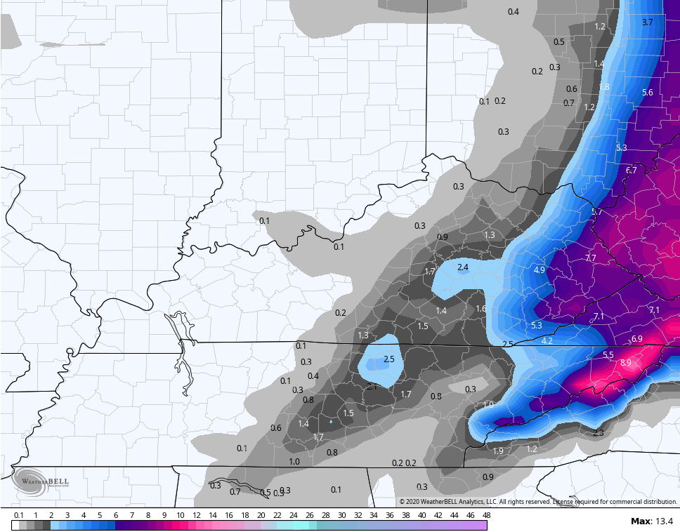
Here’s the snow map from that run through 7 Christmas MORNING…
Snow lovers across the entire area should be cheering on our neighbor to the north. The Canadian models continue to be the snowiest of the bunch
Short Range Canadian…
Regular Canadian…
The European Model in the upper levels looks like it should be a little slower and farther west, but it’s still dropping the hammer on the eastern part of the state…
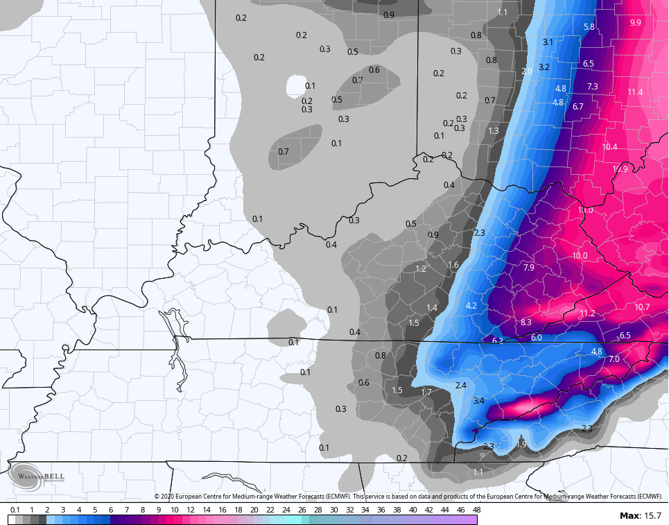
How about that tight gradient? Whoa.
Then there’s the GFS. The model had been the absolute most consistent with this whole setup for days, then it started going back and forth over the past day or so. It’s right now the most progressive and doesn’t see the snow streaks of light snow on Christmas Day. Still, it manages to do this…
So you can see there is just enough of a difference to keep me from changing my earlier call. That will likely happen with my next update around noontime.
I’ll see you guys back for that. Until then, have a good one and take care.

Thank you Chris for all your hard work keeping us updated on all weather events and sharing your knowledge of meteorology.
I like the new blog’s format that you launch earlier this year.
I will post my snow totals in my backyard when this weather event clears our area.
Can’t wait to see what the next weather event brings.
Early morning GFS keeps up with its progressive runs.
https://www.pivotalweather.com/model.php?m=gfs&p=snku_acc&rh=2020122306&fh=60&r=us_ov&dpdt=&mc=
It pains me to say this but I think the GFS is probably correct.
The bright side is there should at least be a little bit of snow for a good chunk of KY, but seems far east KY would be the more significant area. LOL, if it is going to get as cold as expected and the wind- it might blow it away for most 😉
O Canada
I gotta say I was a bit surprised to wake up to a Winter Storm Watch and a forecast of 6-10 inches of snow from NWS Jackson.
With Chris’ latest tweet, looks like I told my hubby right last evening when I said to expect some icing before any snow. Par for the course in Bardstown! 😉
In the latest 1-2 inches of snow in our area Debbie. Hush with that freezing rain stuff, but you may be right. May have to crank up the generator for Saint Nick. LOL