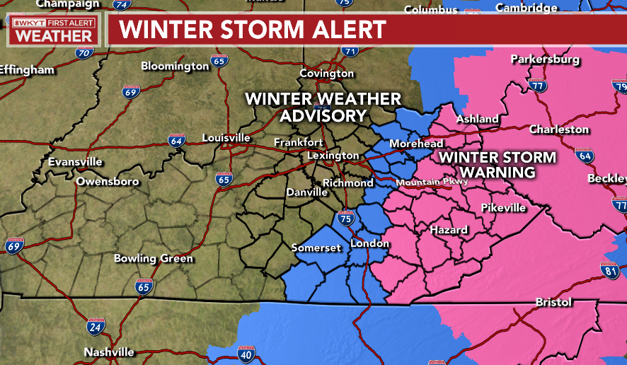
Good evening, everyone. A rare Winter Storm Warning is out for much of eastern Kentucky Thursday afternoon through Christmas Eve as 2020 tries to do something right for a change. This is with the snow developing behind the arctic front, but there are two more chances at snow after that pushes east.
Here’s a look at the current Warning and Advisory…
Your three chances at snow:
- A band of a wintry mix and snow develops behind the arctic front in central Kentucky Thursday morning. That band pushes eastward and expands in coverage and intensity as it hits eastern Kentucky in the afternoon and evening. This will put down some nice totals in the far east.
- Snow showers and snow squalls look to develop during the afternoon into Christmas Eve across central Kentucky. That will then roll into eastern Kentucky.
- The upper level low then brings a period of light snow on Christmas Day. This is a high ratio looking system.
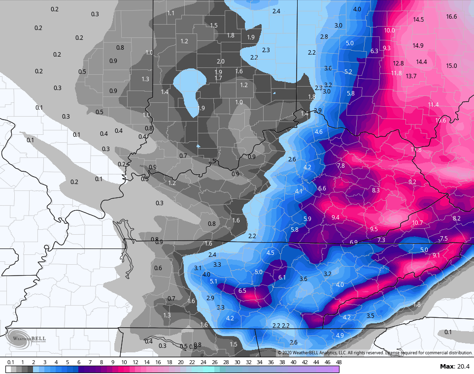
My New Call For Snowfall tries to hone in on things much better than earlier. Still, this isn’t the final call and I will make more adjustments later tonight and may have to pull the higher totals a bit west…
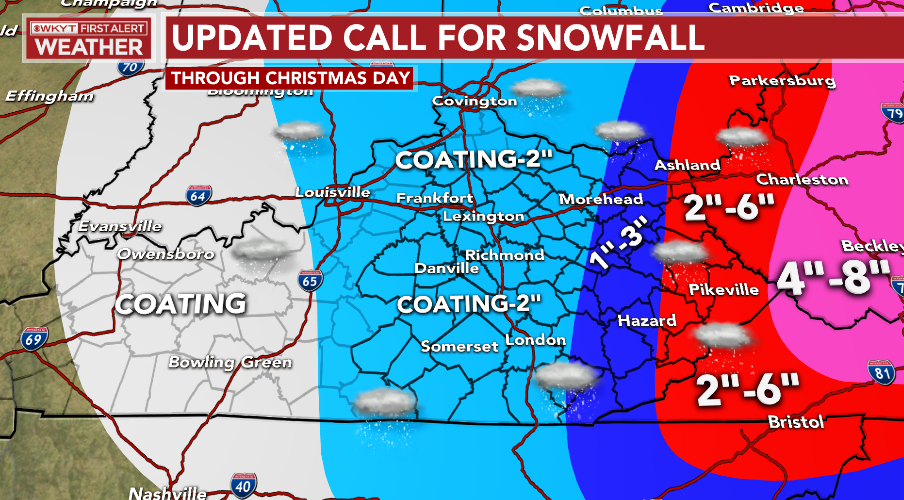
Now, within all these areas, pockets of higher totals may show up if snow squalls do fire up. Also, if I see tomorrow mornings switch to snow happens sooner, then the numbers go up farther west.
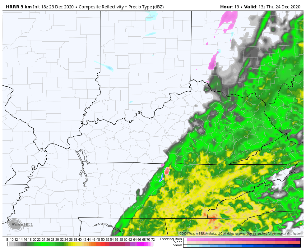
The HRRR shows these snow squalls well Thursday afternoon and Christmas Eve…
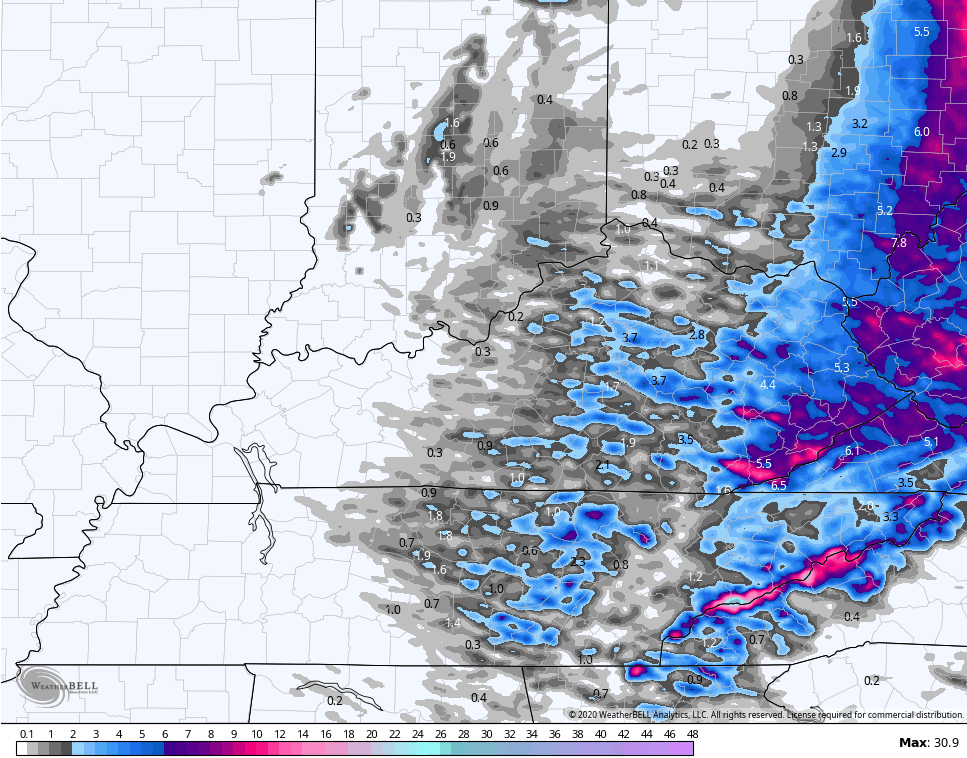
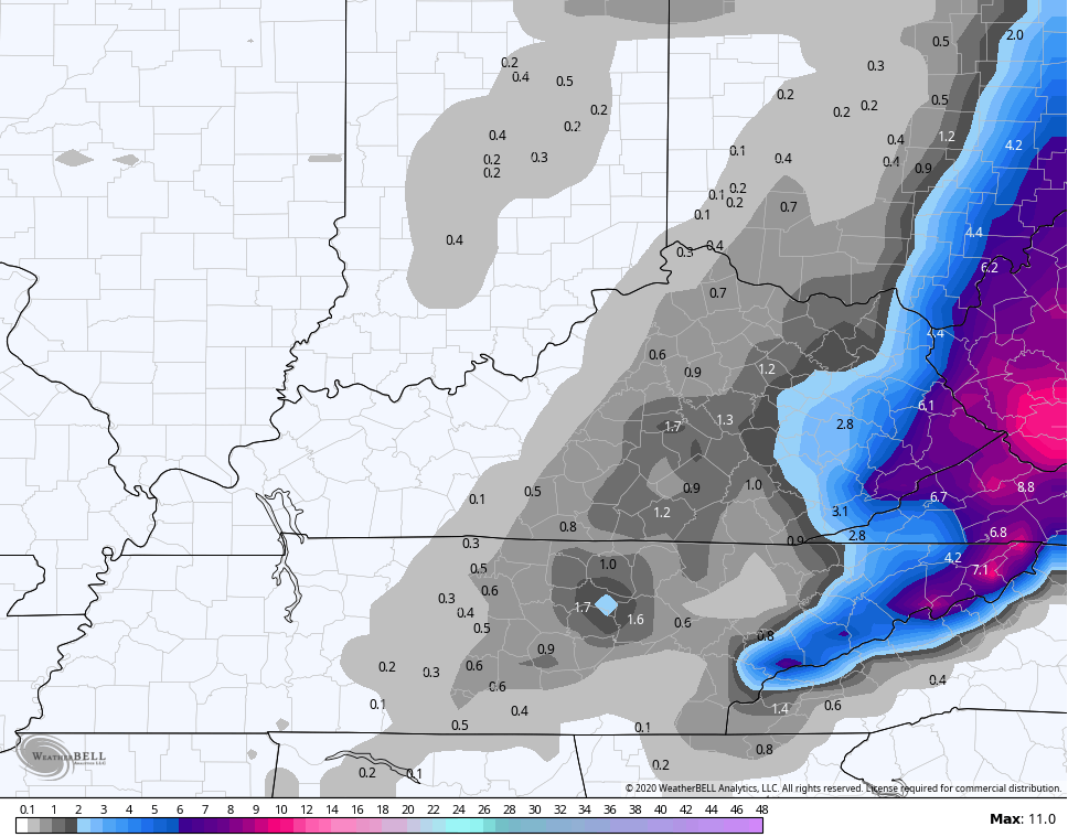
Look at the snow totals from that…
In terms of the other models, we have a major spread that still shows up.
The new Short Range Canadian Model continues to shows the snowiest solution…
Even in that, you can see the snow streaks.
The RAP is still in the same camp and you can also see those snow streaks into central Kentucky…
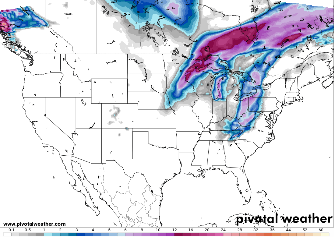
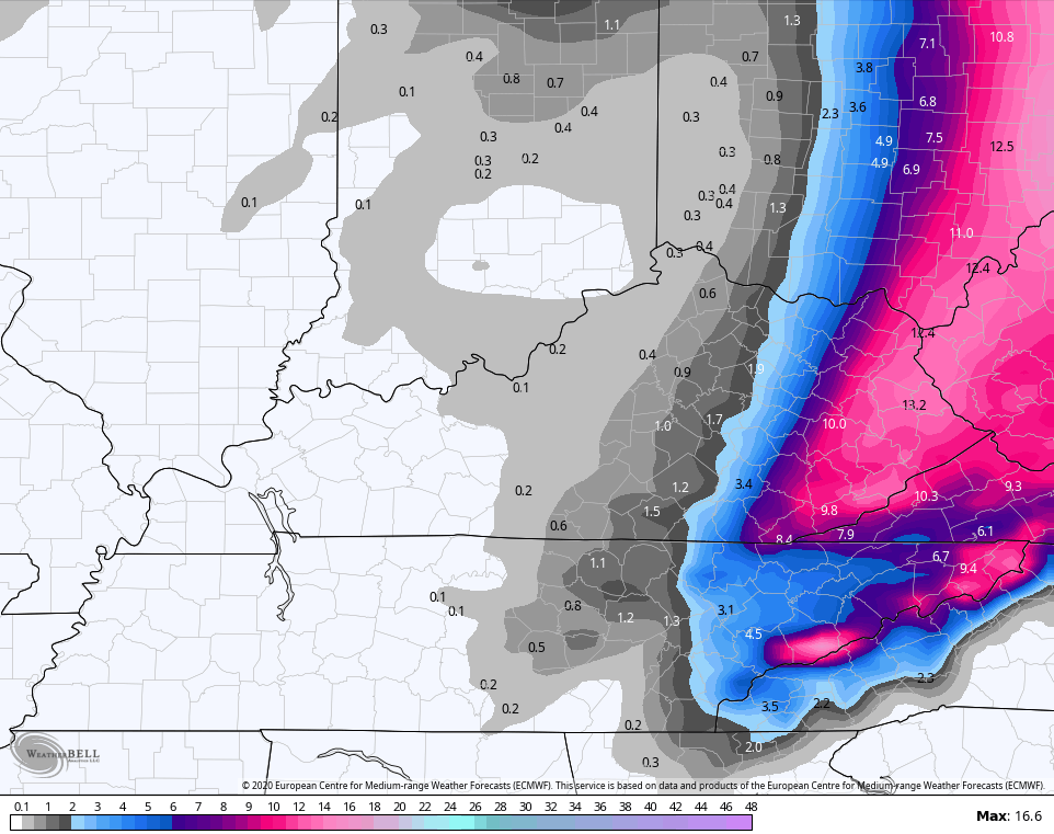
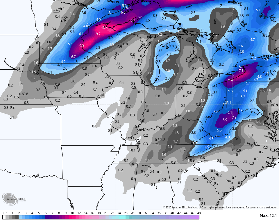
The EURO continues to drop the hammer on the east…
The SREF matches the Canadian in terms of coverage. These totals are based on the 10-1 ratio..
The American models like the GFS and NAM really decided to speed things up and neither see the snow squalls or the Christmas light snow system.
GFS
GFS Ensembles numbers are based on 10-1 ratio…
The NAM Fam really went east compared to earlier runs…
HI RES
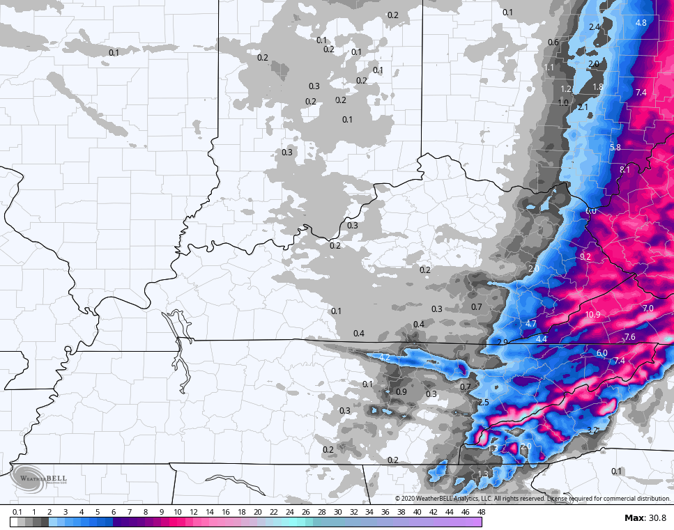
NAM
The American models appear to be the outliers at the moment.
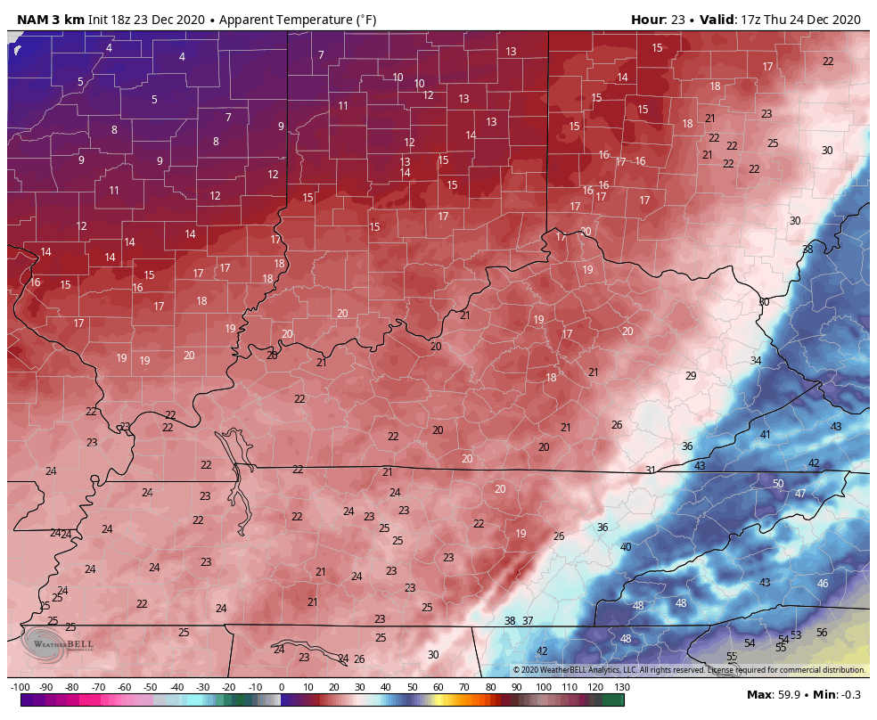
In addition to the snow, Santa brings some North Pole temps with him into Kentucky. Look at the wind chills from noon Christmas Eve through 7pm Christmas Day…
I will have a New Call For Snowfall tonight at 11 on WKYT and then again on KWC later tonight. Merry Christmas Eve Eve, folks and take care.

Excited for our first major snowfall in two years!
you’re in a great spot, enjoy
Hope you get a lot! 🙂 Meanwhile in Bardstown…….0000000…lol!
Merry Christmas, Jared!
I know right !!
I just heard thunder!
Wow.Close to a shutdown.
https://giphy.com/gifs/jasonderulo-wiggle-tattoos-l1KXr5xlvrYGg8eME
Wander what that tweet means.(Close to a shutdown).
Yikes.
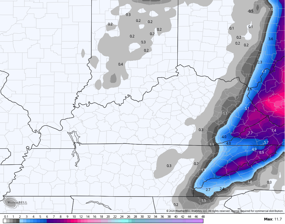
https://www.pivotalweather.com/model.php?m=rdps&p=snku_acc&rh=2020122318&fh=51&r=us_ov&dpdt=&mc=
And
https://www.pivotalweather.com/model.php?m=rdps&p=snku_acc&rh=2020122400&fh=57&r=us_ov&dpdt=&mc=
If this panned out, anybody in pink with the cold air and wind- that’s borderline blizzard stuff.
This map is more in line with the trend east. Seems you have to be way east to expect the mid and higher map totals. Folks west of that likely the low end of the map totals. Still, it’s better than nothing 🙂 Unless it turns out to be nothing 😉