Merry Christmas, everyone. Here’s hoping this update finds each of you enjoying this big day to the absolute fullest. For much of the region, it’s a dream come try of a day as it’s the first White Christmas in a decade for central and eastern Kentucky. Guess what we have out there today? Another round of snow squalls and arctic air.
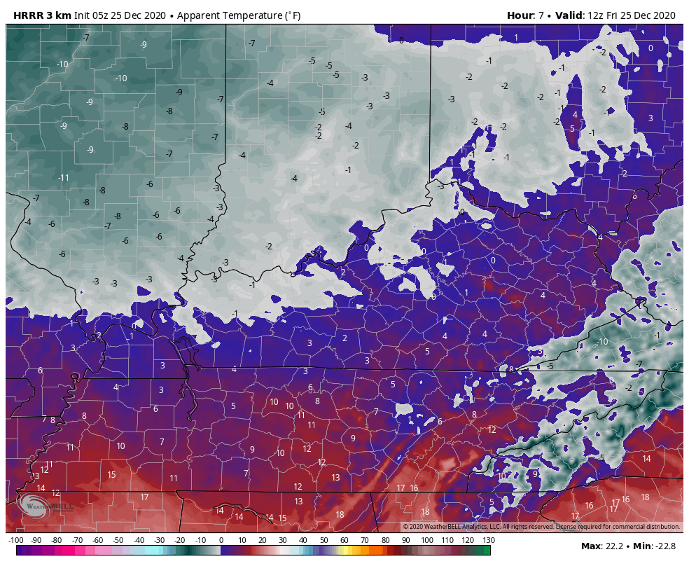
Roads are a mess out there today, so please be careful if you absolutely have to be out driving. Unfortunately, snow squalls will likely cause additional issues for some as they continue through the afternoon. These snow squalls are coming from an upper level disturbance rotating in behind the departing upper level low. This gives the atmosphere a little kick in the pants and touches off snow showers and squalls. With arctic air firmly in place, the atmosphere doesn’t need much moisture to produce flakes.
Streaks of 1″-3″ of snow may show up today across central and eastern Kentucky. Where those streaks set up won’t be known until they show up on radar, but even then, the flakes don’t have much moisture for the radars to see. Regardless, let’s see how many we can spot…

Visibilities will also be greatly reduced in these squalls. Here’s hoping Winter Weather Advisories are extended through the day.
It’s also a bitterly cold Christmas Day with temps that may not get out of the teens for many. Gusty winds may cause wind chills to drop to zero or below at times from this morning through the evening…
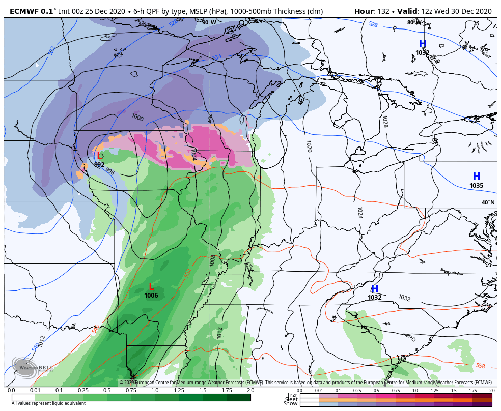
Temps rebound over the weekend as another system moves our way by late Sunday and Monday. That one looks weaker and weaker as we get closer. The one behind it is worth watching as we get set to end 2020 and begin 2021.
The new EURO actually shows a setup very similar to the one we just had…
First Christmas and now New Year’s? Why not!
This system likely kicks off a full blown winter pattern for much of the country. It’s one that has the look of producing a lot of winter storms as big time blocking shows up over top of us. Look at this massive ridge in eastern Canada and Greenland through the first few days of the new year…
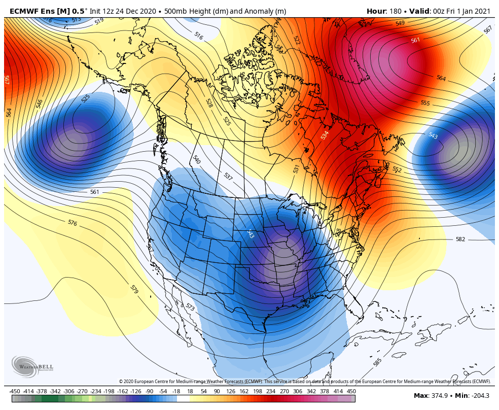
Notice how that trough just keeps coming under it from west to east.
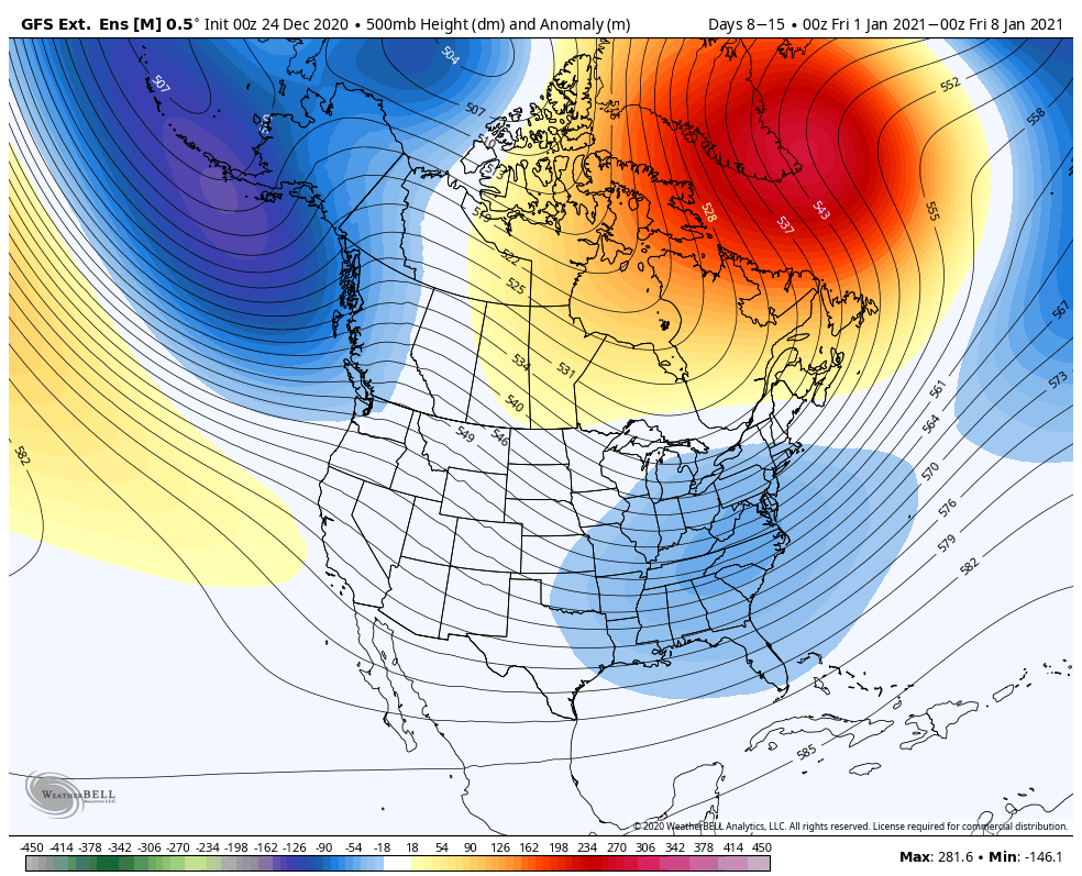
If we are to believe the GFS Extended Ensembles, this same setup tries to lock in for all of January.
Here’s the setup for the first week of the month…
Week 2

Week 3
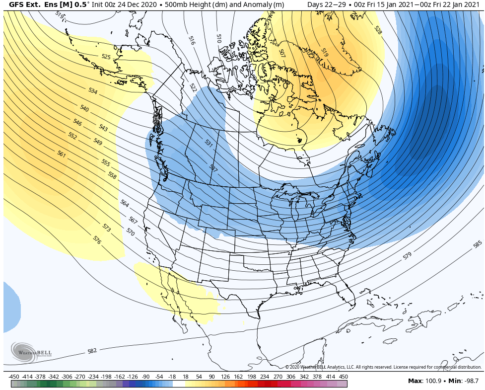
Week 4

2010 was one of my primary analogs for the winter and this year has featured a lot of firsts that happened since that year. The White Christmas is the latest example. If we continue down the same road as the 2010-/11 winter, then the above maps make perfect sense.
I will have another update or two later today.
Once again, Merry Christmas!!! Take care.

Merry Christmas Chris and everyone. Thanks Santa for the snow!
WKYs snow drought continues….
MERRY CHRISTMAS TO ALL !
One inch of Snow on the ground in Northern Taylor county.
Officially a White Christmas here.
you hit this one Thanks Chris MERRY CHRISTMAS TO ALL
I’m happy that all the snow lovers got their white Christmas. Stay safe and enjoy a beautiful Christmas everyone.
I forgot was the 2010/11 winter was like. Anyway, definitely white in Lexington and COLD. BRRRR
I don’t remember, either? I really do not remember having a White Christmas in 2010? Maybe the ageing process is beginning to kick in?! 🙂
Nice little 1/2″ or so here in Bardstown and still coming down every few minutes. I’ll take it!
Once again, Merry Christmas to ALL! 🙂
It’a a bright, sunny, snowless but very cold Christmas morning here in the SW suburbs of Chicago, with a temperature of 11 degrees and a wind chill of 5 below zero.
I just checked a map of the current temps in the US at 10 AM Eastern time, and believe it or not, the warmest location in the lower 48 states is Boston MA with a temp of 63 degrees, eight degrees warmer than Miami’s 55. Wow!
Everyone have a good Christmas Day!
Along the gulf and up the East coast there was a bout of severe weather.
If this surface low that brought the Snow would have phased over the southern plains states we would be talking about a lot more Snow over the entire state of Kentucky.
The New Years system better hit western Kentucky and Indiana, we deserve a nice snow
Looks like Eddie Munster was wrong. We did get a white Christmas in Bardstown!
Might hit the 9 inch mark here if the snow squalls keep coming.
Merry Christmas everyone!
Merry Christmas Everyone
Chris you sure nailed this one!
I agree. This played just as Chris predicted! He’s not your everyday blind squirrel finding a nut!