Good evening and Merry Christmas. The snows are finally beginning to shut off across the region as our Christmas snowstorm of 2020 pulls away. The bitterly cold air remains tonight and early Saturday, but things improve over the weekend. Once into next week, we have another system that has a similar look by New Year’s Eve. Of course, that doesn’t mean it will deliver the same result.
For perspective sake: Lexington picked up 2.1″ since Christmas Eve and that’s the most for Christmas Eve/Day combined since 1993. The 18 degree high is the coldest Christmas Day high since 1983 and the coldest December high temp since 2000.
If you want to see a recap of some amazing snow pics and videos, check out my twitter feed: Tweets by @Kentuckyweather
Snow showers and a few squalls are still out there across eastern Kentucky, but this action is wrapping up…

Temps rebound for the weekend, but a weak system knocks them back down by Sunday night and Monday.
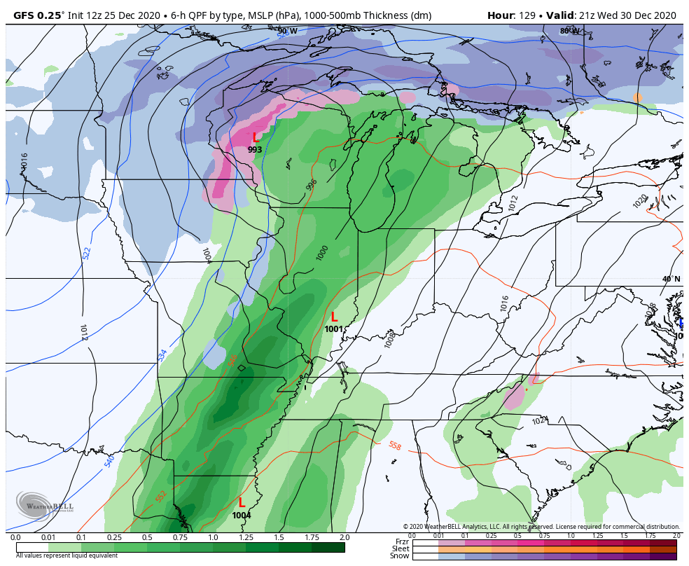
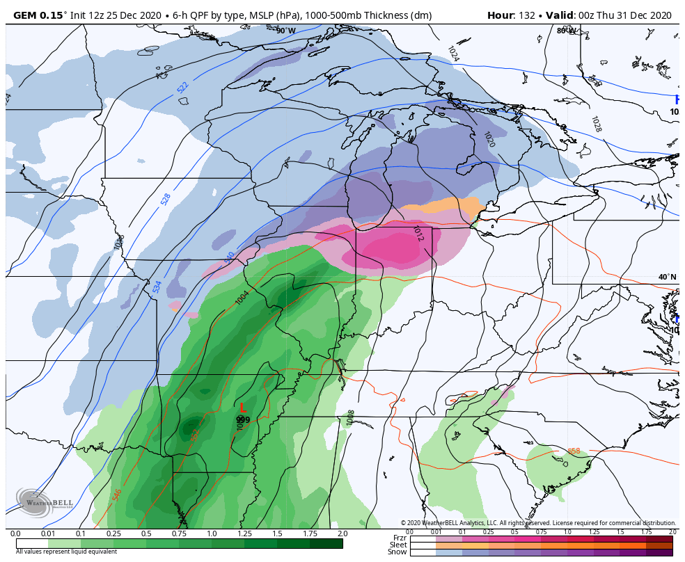
The next system has my attention because it has a similar look to what we just had. We see a big storm head toward the Great Lakes, dragging a cold front across Kentucky. High winds may show up ahead of this front as low pressure develops along the front. From there, we see rain changing to snow for New Year’s Eve and there could be another system right behind that…
GFS
CANADIAN
EURO
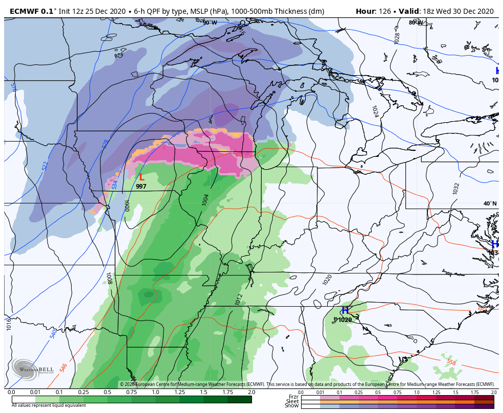
I doubt we can repeat what we just had, but it’s pretty neat to see a very similar setup.
Coming up tonight, I’ll go more in depth on that and the month of January as a whole.
Enjoy the rest of your White Christmas and take care.

Thanks for the update Chris. We had an additional snow accumulation throughout the day so we came to a total of 1.5 inches. Snow squalls were quite impressive late this morning.
Maybe we are going into a setup with snow events every week and it looks like that stronger system is going to cover the whole state next time.
The AO and NAO and lastly EPO are going negative, while the PNA is going positive for early January. Better chances for snowstorms in the Eastern part of the country for all the snow lovers out there.
Enjoy the rest of your Christmas everyone.
Love your approach now CB for outlooks- very cautious! The models did a good overall estimate, so if similar set up- could mean a chance they pan out again. Ho Ho Hoooooo!
Warren County ended up with a big, fat snow goose egg.
Regarding next week’s action, it’s a week out, so naturally the GFS and EURO are showing South Central Kentucky in the snow bullseye. That’ll change quicker than you can say “Bowling Green Bubble”!