Good Saturday, everyone. Our white Christmas is now a thing of the past as we start looking toward the closing days of 2020 and the start of 2021. The overall pattern continues to look very active and there’s a system catching my eye for New Year’s Eve. I’ll take a look at that and take a peek into the month of January.
The big Christmas snowstorm delivered nearly 10″ of snow across parts of eastern Kentucky. That’s right several areas were pushing double digits. Wow. A big shoutout to the Canadian Models because they kicked the snot out of the American Models like the GFS and NAM. The EURO had a couple of good runs, but it was also too far east. Oh, Canada!
With all that snow on the ground in the east, this dude found a creative way to clear his driveway…
A snowstorm is no match for a flamethrower. This is must see video is from Ashland, Kentucky. #kywx
Courtesy of @ChadBlue83
— Chris Bailey (@Kentuckyweather) December 26, 2020
Thankfully, the weather is much calmer this weekend as temps moderate. After starting today in the single digits, much of central and eastern Kentucky will try to crack freezing. The numbers climb even more on Sunday ahead of a weak front dropping in Sunday night.
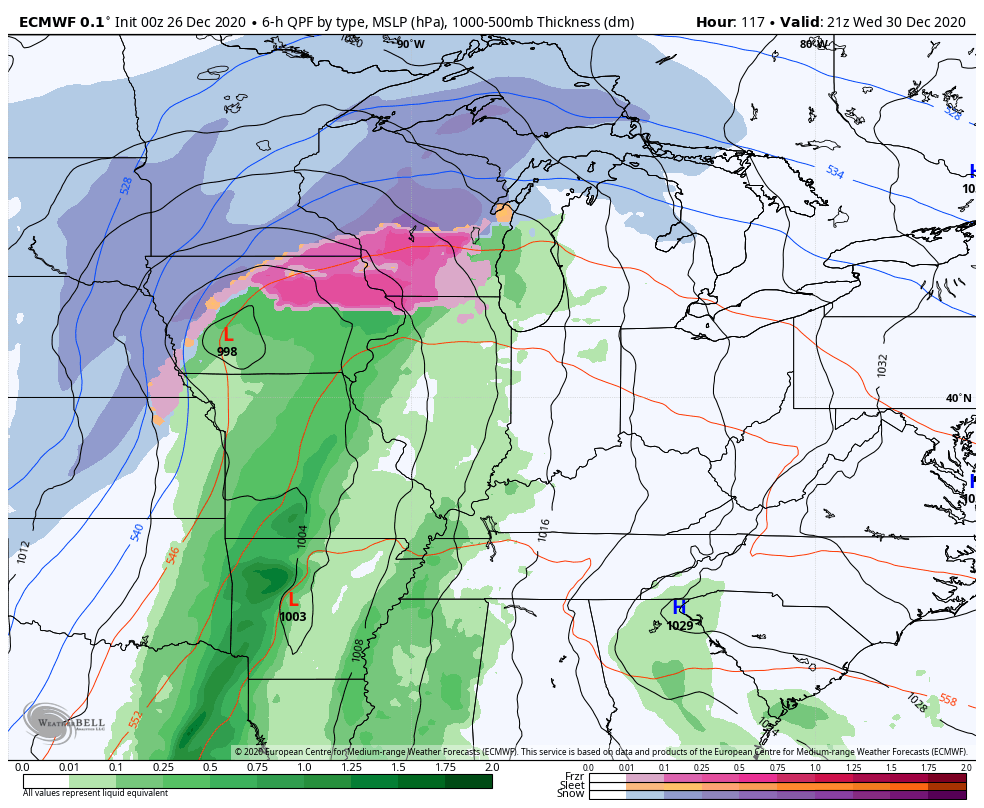
The setup from here will feature another strong cold front rolling our way by late Wednesday into New Year’s Eve Day. This will likely have another storm developing along it that can bring a switch from rain to snow. The evolution on this is still in the formative stages, so the models will flip around for a few days…
GFS

CANADIAN
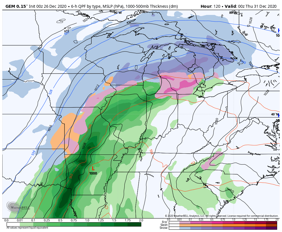
EURO
Another system will try to follow that up a few days later as the colder setup starts to flex again.
One of the things I’ve been keying on for a while now is the amount of blocking showing up over the Arctic and in Greenland.
A negative NAO shows a lot of blocking in Greenland. Look at the forecast through early January…

The same goes for blocking over the Arctic…
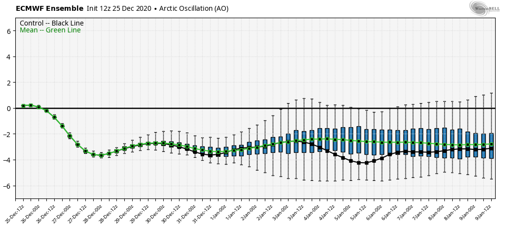
Those two in tandem help direct cold into the United States and, likely, into Kentucky.
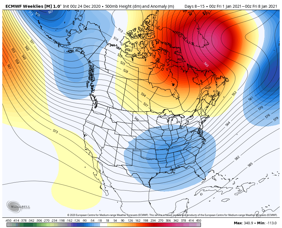
Yesterday, I showed you guys how the GFS Extended Ensembles were showing this pattern setting up through January.
The EURO Weeklies have a similar look…
Week 1 of January…
Week 2

Week 3
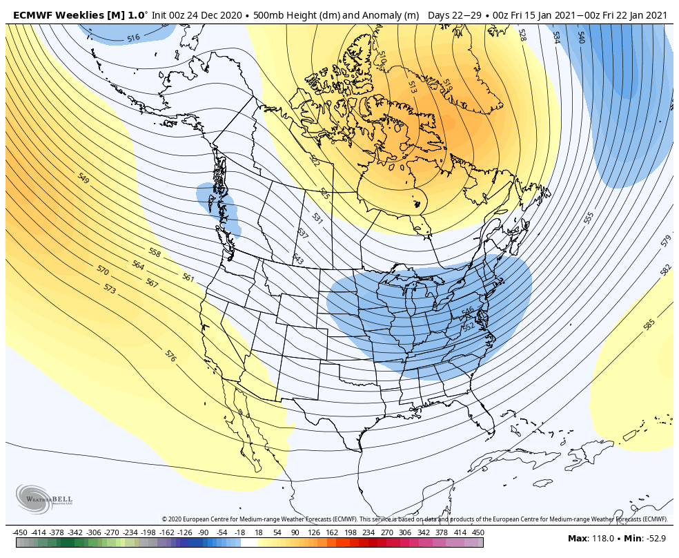
January has the potential to produce significant winter storms across the country and, with the setup I’m seeing, don’t be surprised if a few take aim at our region.
I will have updates later today. Have a good one and take care.

Thanks Chris, With better than an inch of snow on the ground this morning we dropped to 11 degrees F. under clear skies. Hopefully we will have Sunshine today and the thaw will begin.
Now I can’t remember what I did an hour ago, but I can remember back in the year 1964-65 we had warming trends between storm systems which produce heavy rains and would always turn into Snowstorms with frigid Arctic at the finish.
This weather pattern we have now sure looks like one out of the past.
Maybe the Wednesday system will bring a better opportunity for the whole state of Ky. to receive some accumulating snow.
I’m not sure I like the new NWS radar. It fails to load fully most of the time and when it does, the motion is super slow. Unless I’m doing something wrong.
I tried NWS radar with the same negative results you had Mark.
The old way was the best for me.
I was always told when something works don’t change it or fix it.
Hopefully western ky will get some snow with this storm.
May be something showing up in the way of accumulating Snow for the whole state of Kentucky around the forth of January ?
We need a good widespread snowstorm for the whole Ohio Valley, us snow lovers deserve it