Good afternoon, folks. The sun is back in the bluegrass state as temps slowly increase. This is ahead of a bigger push of milder air for Sunday. The focus continues to be on a system rolling our way for New Year’s Eve. This tries to bring another rain to snow maker to our region to end 2020 and kick off 2021. That may be followed up by another storm system a few days later.
Before looking ahead, let’s look back at a frigid late December morning in the bluegrass state. Temps were flirting with zer0 in some areas on the Kentucky Mesonet…
Wind chills last night and this morning were below zero for many.
Winds are going to be a big player with a cold front dropping in late Sunday and early Monday. Gusts may approach 50mph once again…
Colder air comes in behind this with a rain or snow shower possible with the front.
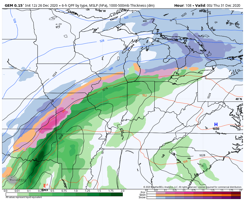
Our next storm system will also pump up the winds on Wednesday into New Year’s Eve. This happens as low pressure works toward the Lakes and drags a cold front across the state. Another low is likely to develop along this boundary. This isn’t too dissimilar to what we just went through on Christmas Eve. The GFS was the most consistent model with our last storm until we got to within 24 hours, then it was just too progressive.
Here’s how the GFS sees this next system…

That would leave a mark!
The Canadian Model wound up as the best model with this last storm, but not until 36 hours out. Before then, it struggled mightily. The Canadian is much slower and farther west…
The EURO is also likely way to wound up and too slow…
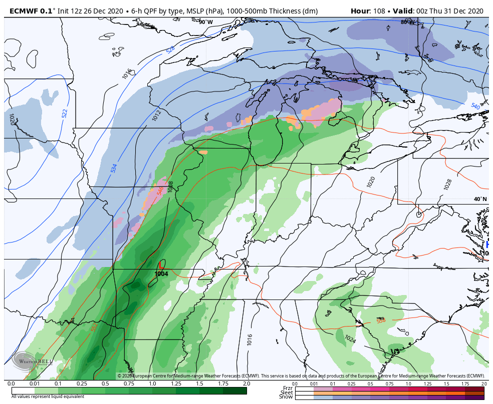
Notice how both models are developing multiple lows along this front? Go back to my discussions about these same models days before the Christmas Eve system. They were doing the same thing.
The weather doesn’t really work that way and it’s the models way of saying it can’t figure out exactly where to develop the single low that should be along the front.
I will drop by for another update this evening. Have a good one and take care.
