Good evening, folks. I promised you guys another update and I’m here to deliver the goods, albeit with a short update. The overall setup continues to look active for the closing days of 2020 and I think this takes us into the start of 2021.
The main item of interest in the week ahead is the New Year’s Eve/Day storm system. One low works into the Great Lakes and pulls a cold front in here. Low pressure develops somewhere along this boundary and that could bring some wild weather with it.
Here’s what’s on the table of possibilities:
- High winds
- Heavy rain that can cause issues
- Wintry mix and freezing rain
- Accumulating snow
Again, how all that plays out remains to be seen, but this looks to be a disruptive storm system.
Here’s the late day GFS…
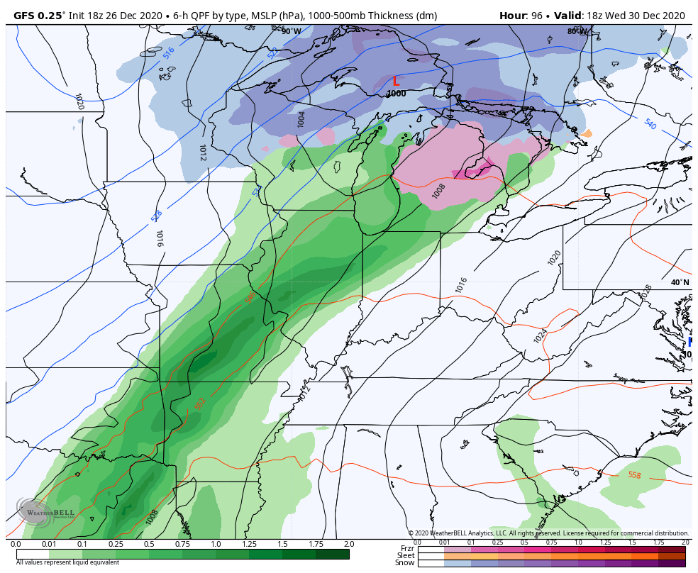
That’s a powerful looking storm system and the track of that will mean the difference between too much rain and a lot of winter weather… Or both.
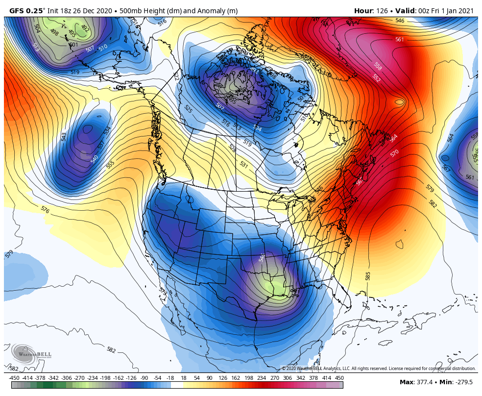
This is a setup that’s likely to feature a lot of disruptive storms rolling across the country. Check out this active 500mb anomalies animation…
Enjoy the rest of the evening and I’ll see you back late tonight with a full update. Have a good one and take care.

We had 6.5 inches of wet snow here in Flat Gap, KY from our Christmas Eve 2020 storm!
Thanks Chris! Man you always working! Lol but if is appreciated!