Good afternoon, everyone. It’s a windy and milder day across the Commonwealth as a cold front drops in from the northwest. This may bring a shower or two tonight, but the focus of the forecast is on a big ticket storm system arriving New Year’s Eve. The current trend on this is more wet and white.
Winds this evening through tonight may top 40mph at times. Here are your radars to follow any shower action that shows up…

The setup for New Year’s Eve and Day continues to feature a disruptive storm system as we get another big dip in the jet stream. The southern energy looks slower than the northern stream, so that would mean a slower, farther west and stronger storm system. Still, the track on this isn’t set in stone as we are in the window where models often show big changes to only revert back to what they were showing from the beginning.
The Canadian has the most winter weather as it brings a lot of freezing rain into the west with wrap around snows…
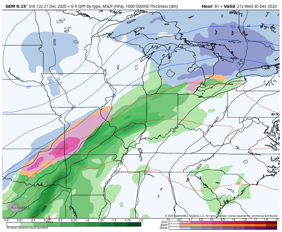
The GFS now looks more like the EURO with a strong, wrapped up system to our west…

EURO
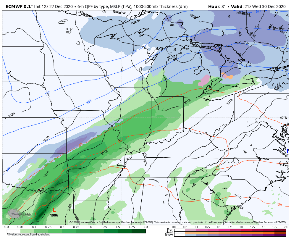
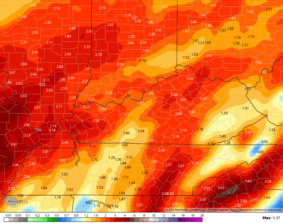
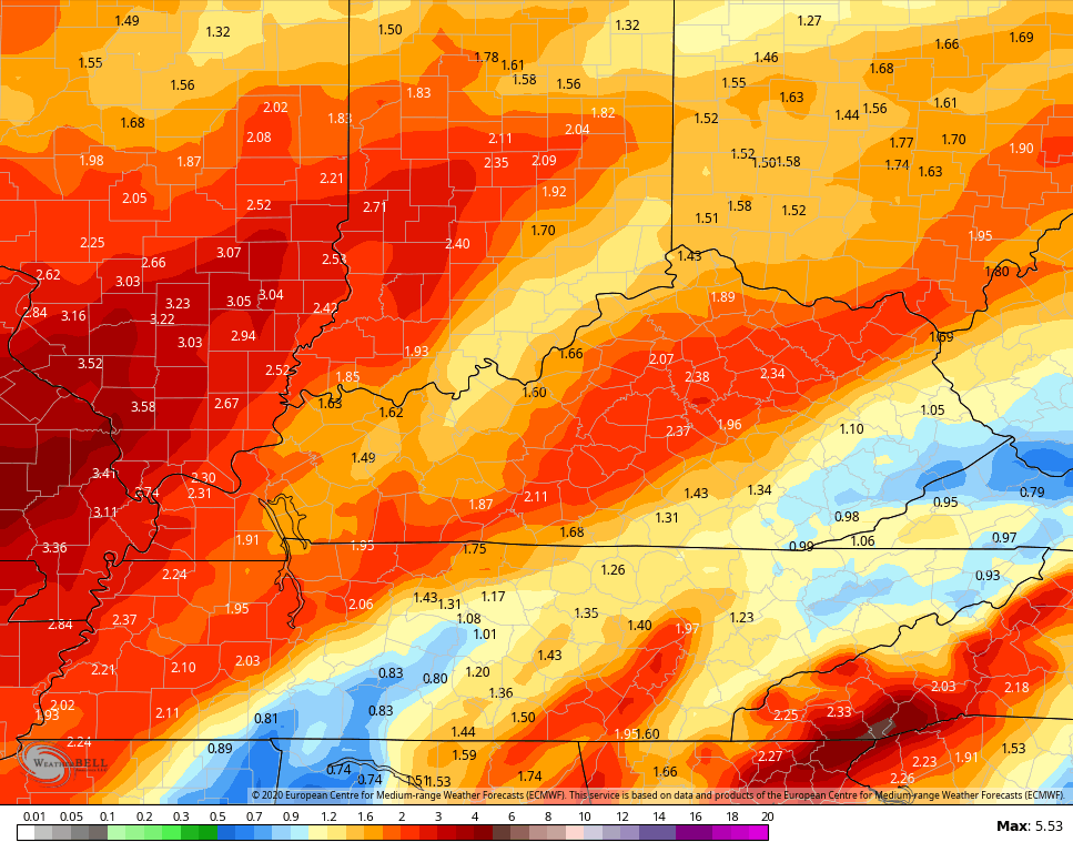
If the GFS and EURO verify, high winds, heavy rain and even some thunderstorm action would be possible. Check out the rainfall forecasts from those two models…
GFS
EURO
We will see how this plays out over the next few days, but this slower moving system likely misses the cold air connection to the north and that could spell a lot of wind and rain around here.
I will drop by for another update this evening. Have a good one and take care.

Well that is not the news Kentucky wants to here. Rain to flurries. Reminds me near misses from years ago. Thanks for the update and let’s all hope for another Canadian win if the models. Could be very interesting for some!
If this storm is mainly rain that will makes us 0 for 3 here in Louisville. (Chance for a accumulating snow)
Hope its not going to be a forerunner of most winter systems tracking this winter season but at least we are talking about snow and not warm and rain as the last several years.
Most likely there will be a surface low form in the Gulf on the cold front as it did with the Christmas Snow and if the storm moving slower the secondary surface low would connect with the Arctic air and hopefully bring in a more widespread Snowstorm state wide. Could be more Snow with this system than the last. Like I said in the comment above we shall see.
I think I just woken up.by a loud rumble of thunder!? Crazy ..
I’ll take the RAIN over ICE anytime. It’s been a long time since I’ve heard any thunder with any system.
Maybe as all this energy moves East, Western Kentucky and South Central Indiana will finally accumulate a lot of Snow ?
Days away though. We shall see.
I agree rain over ice all day and right now it looks to be mostly rain for me. Hopefully, sometime in January we can finally get a big one. It’s got to happen eventually right? At least that’s what I keep telling myself.
These models before today showed more snow and a few with direct path over KY. Looks not the case for now anyway. Looks like they mainly go north of KY instead with frozen stuff. They seem to be al to more pink than blue. Don’t recall the models doing these things with Christmas Eve system.
Looks like a lot of rain to me and there’s absolutely nothing worse than cold winter rain in my book
Suggest ice is way worse. If frozen is mainly ice- rain FTW!
Agreed, Bubba.
RIP snow