Good Monday, everyone. We are into the closing days of 2020 and we have a big time storm system getting set to blow into the Commonwealth. As we get closer to this storm, it’s a rather complicated setup with 3 different systems looking to impact us. Heavy rain, strong thunderstorms, gusty winds and winter weather will all be possible at some point between New Year’s Eve and the Saturday that follows.
Our week is starting very windy with gusts around 40mph this morning. This is associated with a cold front dropping in from the northwest. A couple of showers may also be noted along the boundary and there’s a small chance for a flake to fly. Here are your radars…
…

Temps today are colder than what we had on Sunday and range from the upper 30s to middle 40s across the state.
As mentioned, this is a very complicated setup that follows all this. We have one storm rolling into the Great Lakes, dragging a cold front in here on New Year’s Eve. Rain and wind will be noted ahead of this front with freezing rain behind it. How far south can this front get before tapping out? I’ve seen setups like this in the past underdo the southward progress of the colder air.
As this happens, a stronger storm develops across the southern Mississippi Valley and lifts to the north and northeast on New Year’s Day. What happens with this system will be dictated by just how far south the New Year’s Eve front can get. The farther south that front gets, the better opportunity for freezing rain to show up somewhere across the region. If that initial front doesn’t drop south of the Ohio River, then it’s nothing but heavy rain and thunderstorms.
The third part of this setup comes from an upper low that may spawn another low by Saturday. That one would have cold air to work with and could produce, at least, some snow.
I told ya this is complicated.
The model that’s on the Freezing rain train is the Canadian…
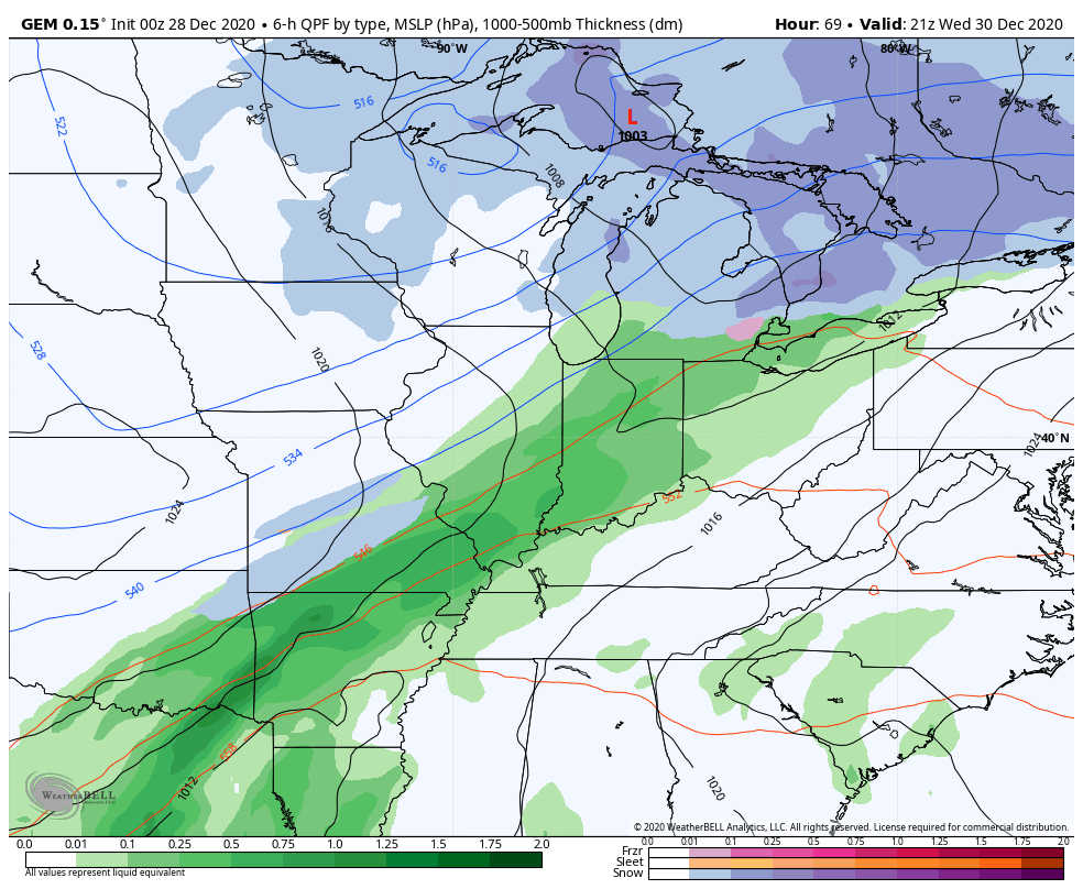
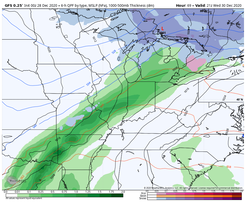
The GFS wants no part of that and keeps the ice north…
Instead, it brings a lot of rain and even some thunderstorms in here…
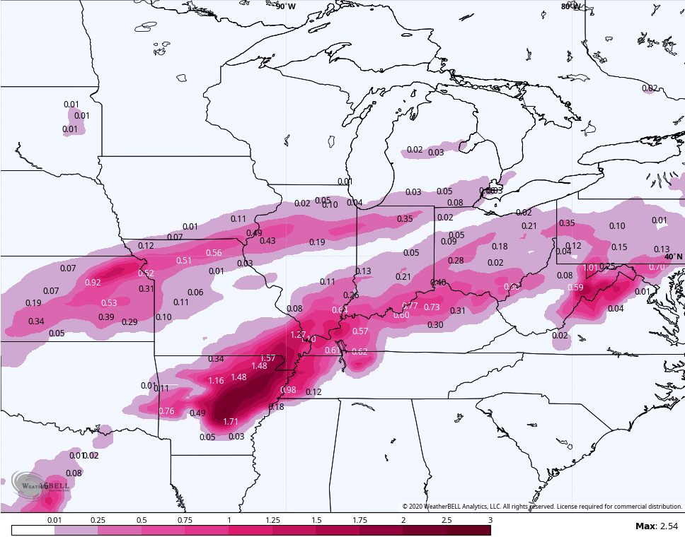
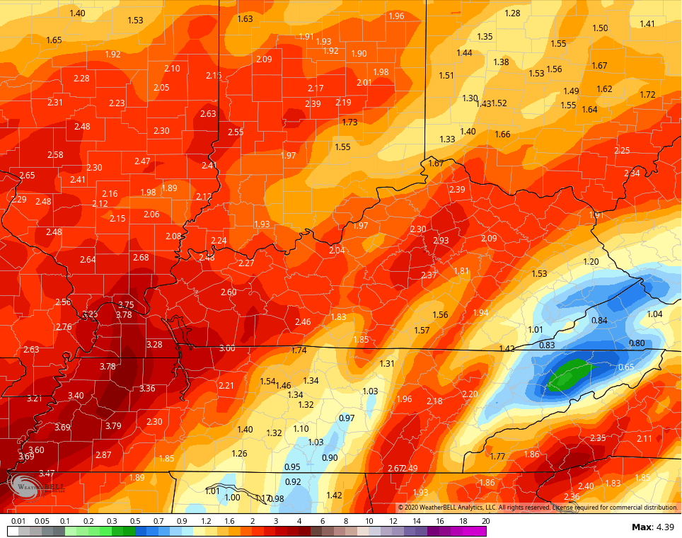
Here are the rain numbers from the GFS…
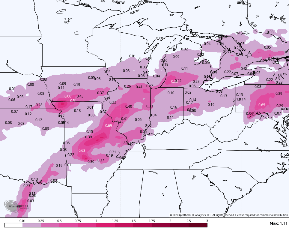
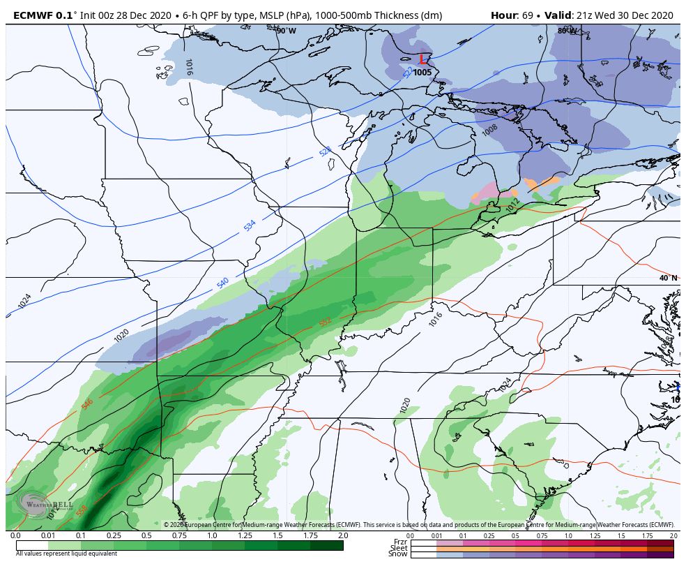
The European is on the side of the GFS, but it’s even farther to the west…
That’s like too wrapped up, but it likely has the general idea. If that verifies, severe storms could even show up. 😲
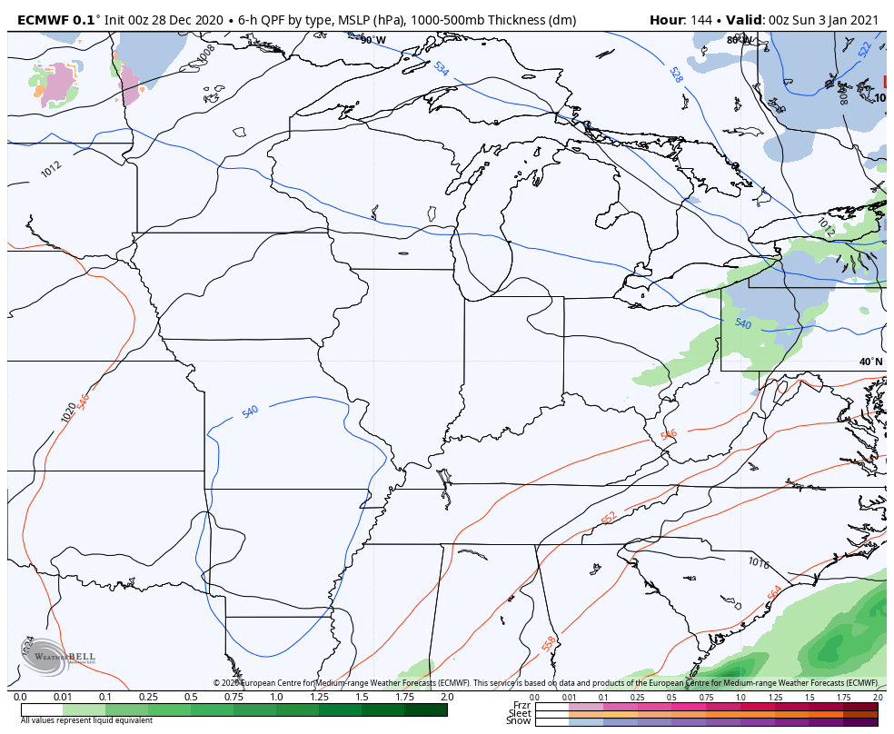
Oh and it follows it with some snow by Sunday…
This is part of a highly energetic pattern that shows no signs of letting up as we head into January. Initially, we may see some pretty wild temp variations with storms passing through the region, but the overall setup favors cold to take control. Don’t be surprised if we see some significant arctic outbreaks around the middle of the month.
I have your normal updates later today. Have a great Monday and take care.

Looks as though La Niǹa is being overwhelmed by the blocking pattern. January could get very interesting.
Thanks Chris, Complicated and interesting. Now I will have to figure out how much Ice accumulation it will take to knock out the power. LOL
La Nina is beginning to wane. Good news for Snow Lovers.
I hope the New Year system stays all rain.
ive seen several posts on facebook from wx stations in TN, showing that models are spitting out upwards of 20 inches for eastern kentucky and parts of the entire appalachian mtn area for around jan 4th. i really dont think its gonna happen, its way too early for that kinda call. but its still interesting to see the possibilities.
Hoping the Euro wins this one…looks like its solution has the least rain involved.
Wasn’t the Canadian the model that was spot on with the last system?
GFS Para, has the Jan 3rd storm