Good afternoon, everyone. A potent storm system is on the way to the region as we end 2020 and begin 2021. As the track on this becomes more clear, we now have to focus on the potential for heavy rain, high winds and strong thunderstorms. For some reason, that seems like a fitting end to this tumultuous year.
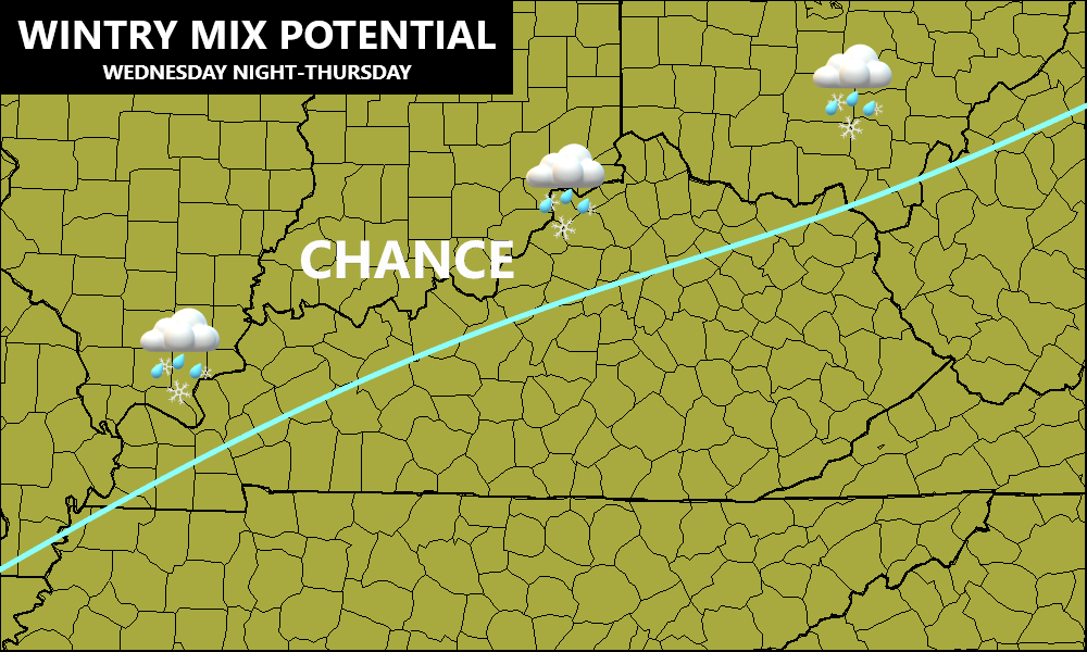
This comes at us in three waves with the first arriving as a cold front by New Year’s Day. Heavy rain and gusty winds will be ahead of this, but how far south this front gets remains to be seen. It may get into far northern and western parts of the state and that could bring some freezing rain or mix into these areas…
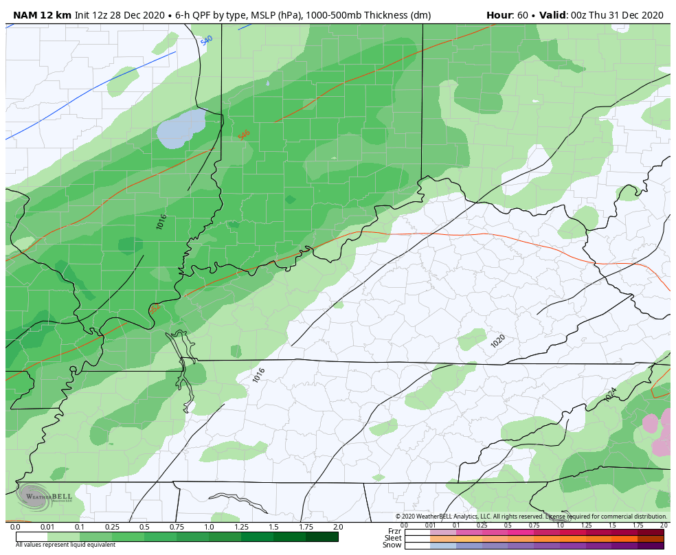
Here’s the area I’m highlighting for, at least, some frozen precipitation for a while…
That front slams on the brakes as a strong low pressure develops and rolls northward along the Mississippi River into New Year’s Day. Our weather map may look something like this to begin t2021…
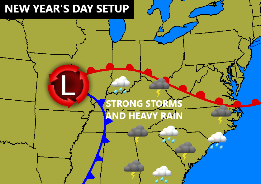
This would bring some moist and unstable air into the state, setting off the potential for strong storms.
The GFS has a potent look…
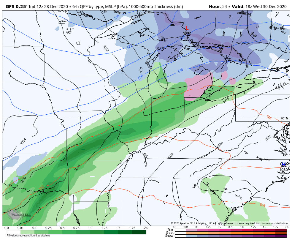
Look at the wind energy available with this system…
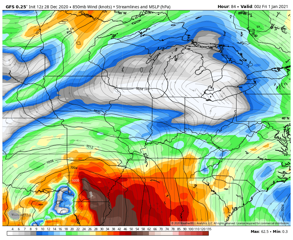
High winds could very well become an issue, especially if thunderstorms do ramp up.
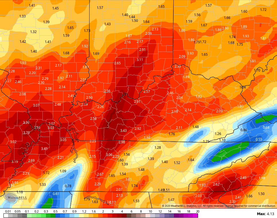
The amount of moisture in the atmosphere is very high in this type of a flow, so heavy rainfall may cause issues. Look at the total rain numbers from this run of the GFS…
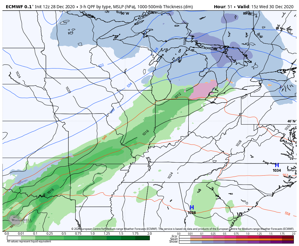
The EURO is similar to the GFS…
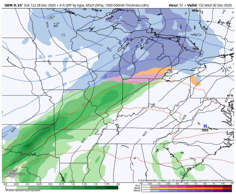
The Canadian isn’t quite as potent with this storm, but still has a similar setup…
Another system will follow this up on Sunday and could bring winter weather to parts of the region.
The amount of blocking strongly showing up across the Arctic and in Greenland argues for this pattern to tank hard toward winter as we get deeper into January. This continues to show up very well as we head toward week two of the new year…
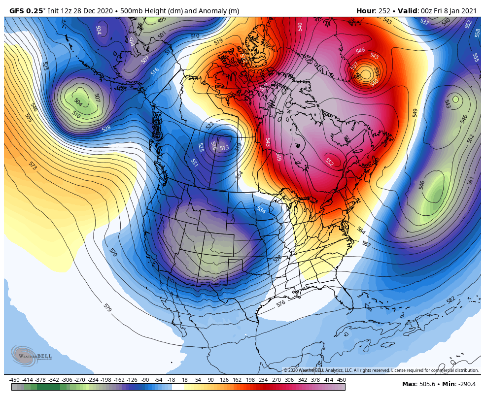
This setup should be able to unleash additional arctic air outbreaks into the country and will also likely fire up some big winter storms that will target our part of the world.
I will try to drop by for an update this evening, but no guarantees. After no sleep in tracking the Christmas Eve Snowstorm and everything else 2020 throws at us, a little decompression might be needed. 🙂
Enjoy the day and take care.

Maybe thunderstorms followed by a surprise Snowstorm or blizzard for the three state area.
2020 can go to !@#$%^&*()
Yes!!!
It looks like the fz. rain chance has demission.
Middle of January looks good on modeling if they don’t change.Should be plenty of cold air diving into our neck of the woods.Long range so who knows.
LOL, apparently a met somewhere mentioned blizzard chance for January and that grew legs with some. Put ten people in a line and telling each in line to say “red bike” by the tenth person become a “blue F150”.
LOL, I just spewed my soda reading that Bubba…..it’s so true!!!
In Bardstown, it’d be a Peterbuilt before it even got to the 6th person….