Good Tuesday, everybody. We have a wild storm system set to close out 2020 and usher in 2021 and it looks to be highlighted by a lot of rain, wind and some strong storms. To top it all off, there’s even the chance for some freezing rain in the north and west before the storm really cranks. We will take a look at this system and go deeper into what could become a wild January across the country.
Let’s begin with the initial cold front dropping in here Wednesday night and early Thursday. This will have gusty winds and rain ahead of it and a big temp drop behind it. The front is likely to get south of the Ohio River, creating quite the temp gradient on New Year’s Eve. Temps may drop to freezing or a bit below in the west and north early Thursday, leading to the potential for some freezing rain. Here’s the area I’ve already highlighted for this potential…
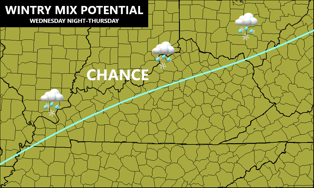
Again, the greatest threat is along the Ohio River Counties, but we will need to keep watch on just how far south this can get.
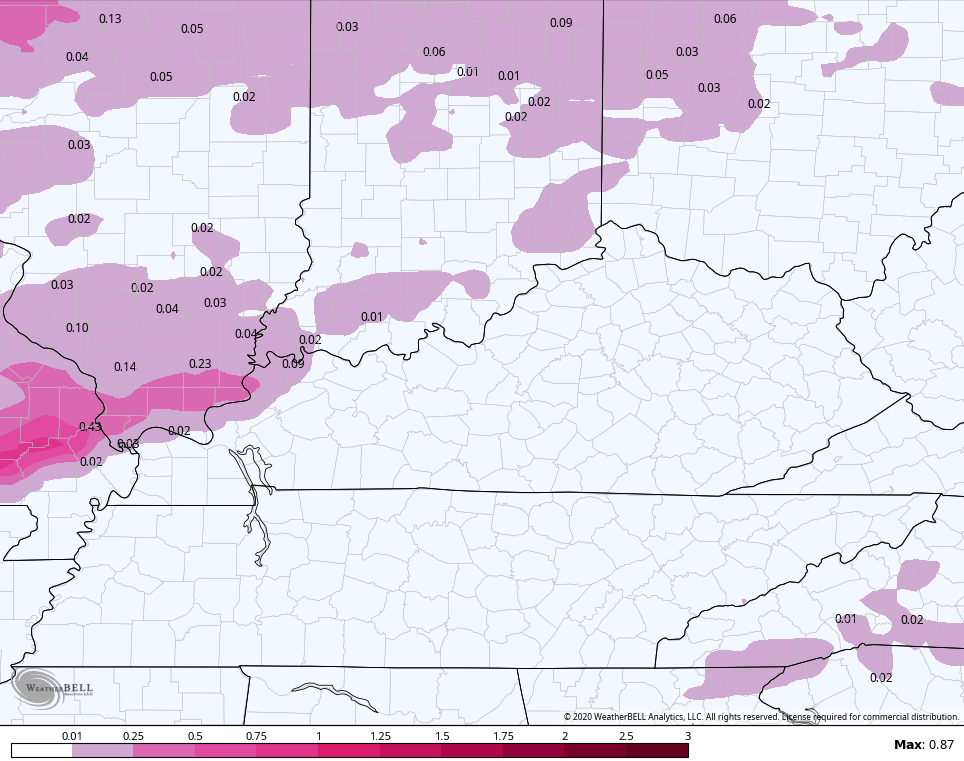
The GFS has literally nothing north or south of the river. The NAM has some light stuff…
The Canadian models continue to go crazy with the freezing rain…
Short Range Canadian
Canadian
The EURO has some freezing rain and some snow…
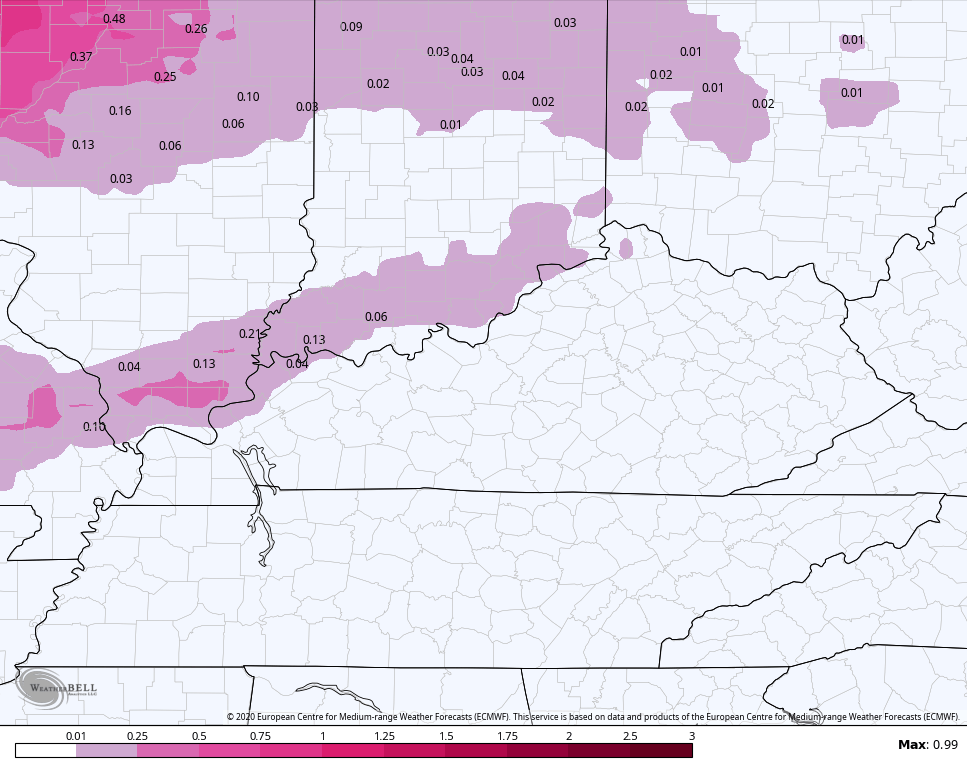
Obviously, this is something for us to watch closely. It’s all about just how far that front can get.
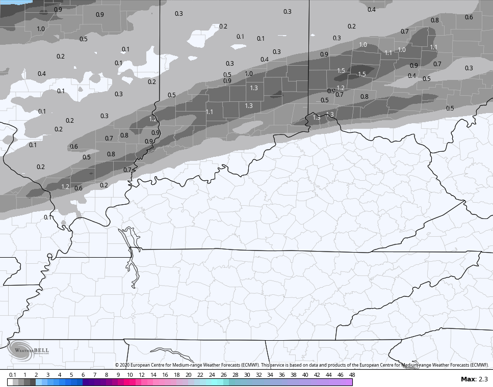
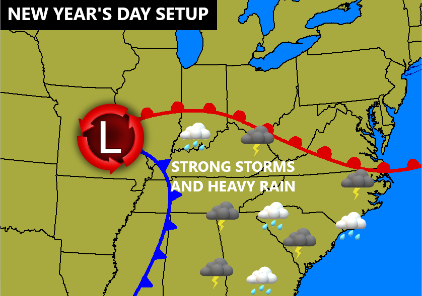
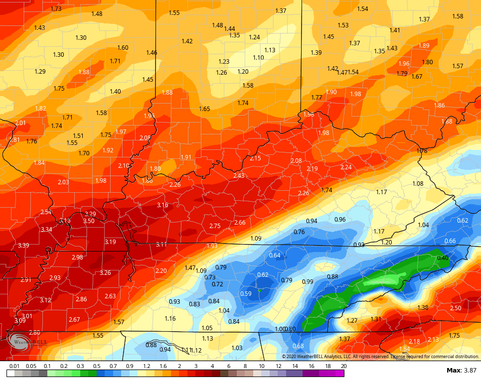
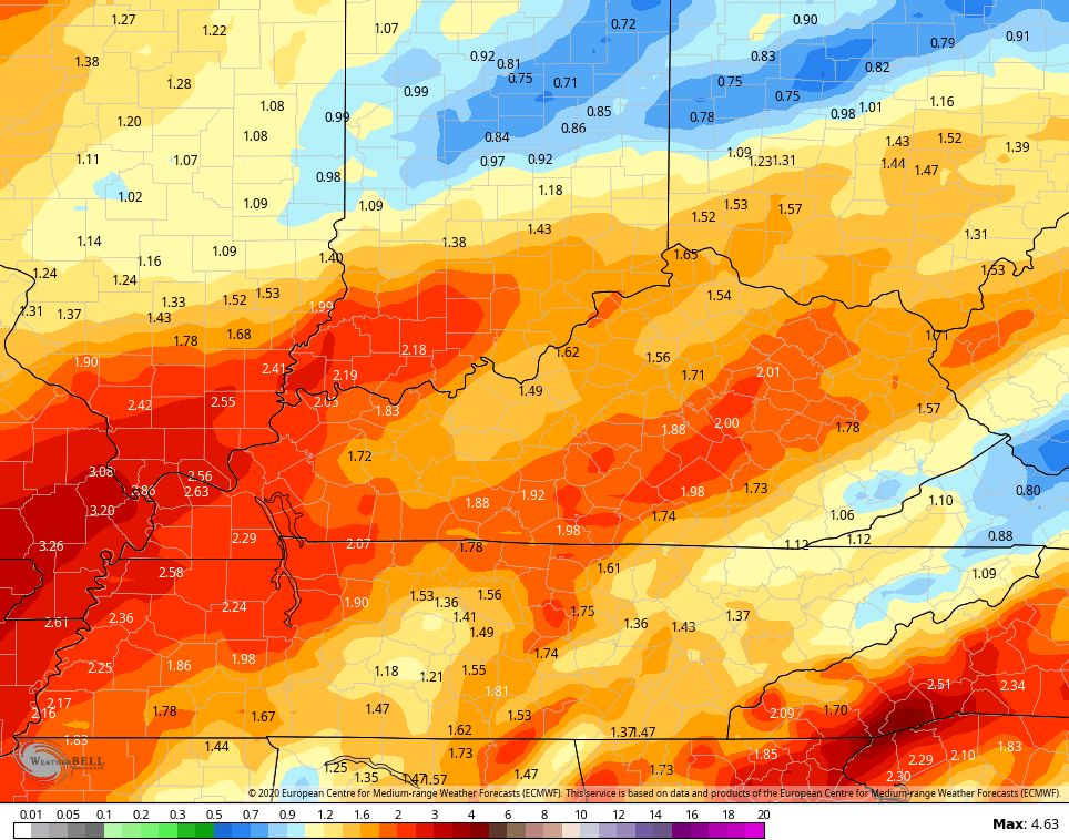
That front then lifts back to the north as a warm front New Year’s Eve into New Year’s Day. At the same time, strong low pressure develops across the lower Mississippi Valley and lifts to the north. The negative tilt on this system suggests we get into an environment where high winds and strong storms try to flare up. Here’s the map I made for the first day of 2021…
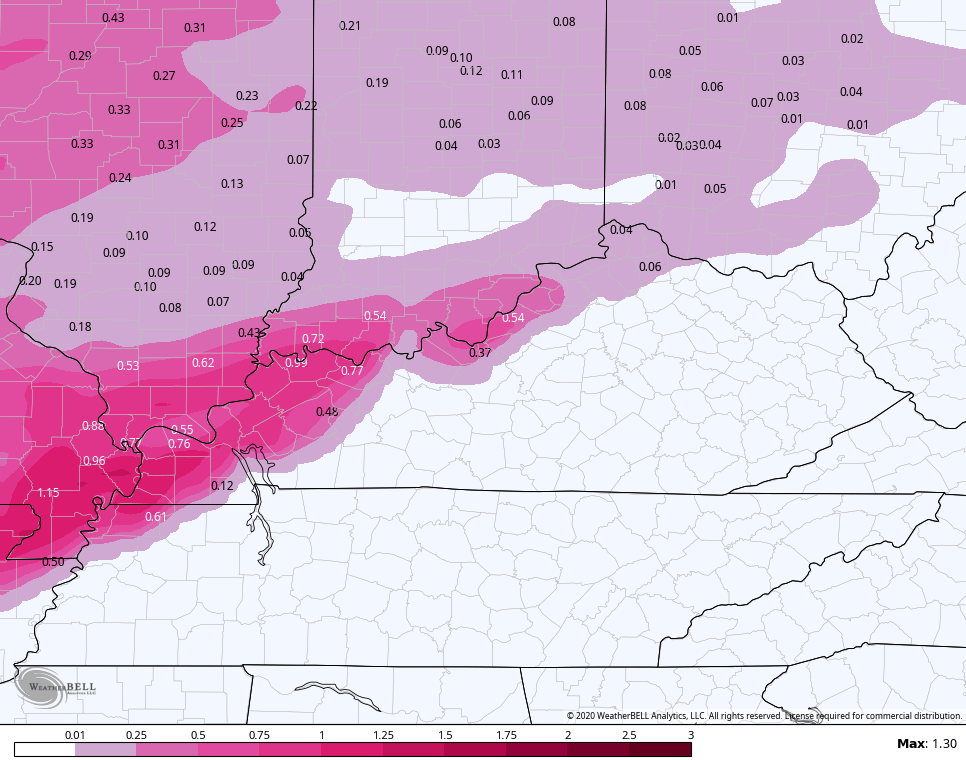
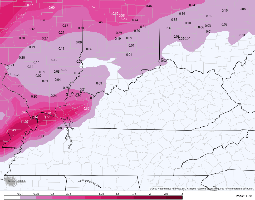
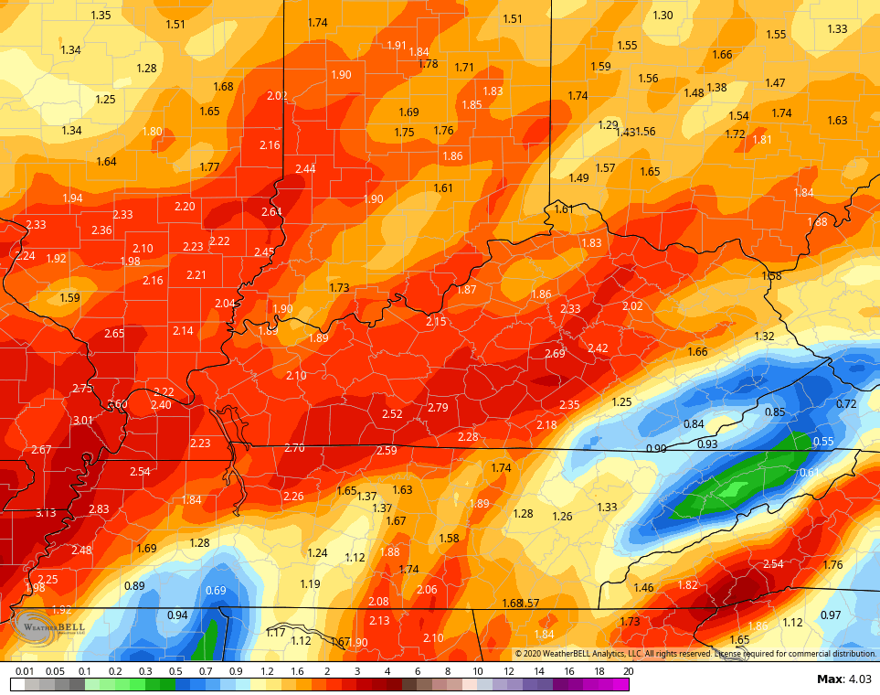
Between the heavy rain with the front dropping in Wednesday night and the heavy rain/storms ahead of the New Year’s Day storm, high water issues may develop. Here’s the area I’m targeting at the moment…

The models are spitting out a 1″-3″ rain within this area…
GFS
Canadian
EURO
Another system follows this up by Saturday night into Sunday and could bring a round of wintry weather.
The overall pattern across the Northern Hemisphere is taking a hard dive into the extreme category. We have what is likely the highest barometric pressure ever recorded on planet earth in Mongolia…
Looking at 2100 UTC obs in Mongolia, Tosontsengel is reporting 1089.5 hPa. This station is the record-holder from 2001 (1084.8 hPa). Further, Tsetsen Uul (labelled w/ H) is reporting 1093.5 hPa (32.29"). These, along with other reports, if verified, would break the world record. pic.twitter.com/jXx24W4JP5
— Mike Adcock (@MikeAdcockWx) December 28, 2020
At the same time, the EURO is forecasting one of the lowest non tropical barometric pressures ever recorded near the Aleutian Islands…
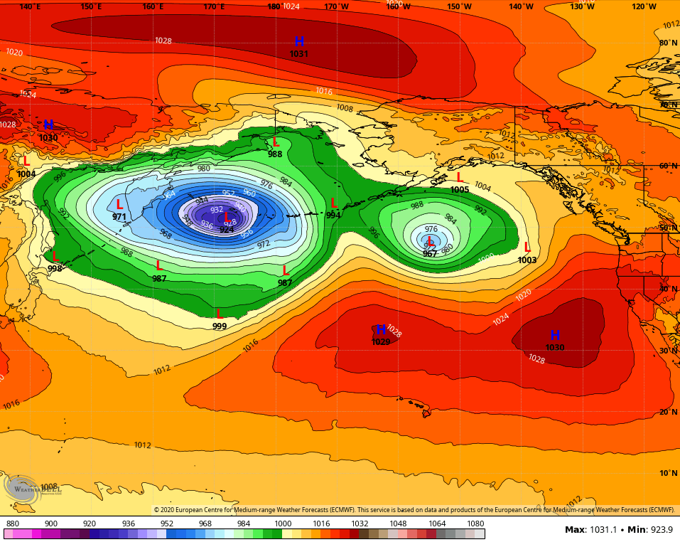
Both of those are just kinda WOW moments to look at.
The potential for extreme winter weather to show up in the United States is on the table as we get deeper into January.
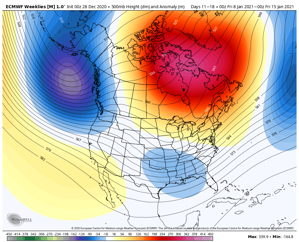
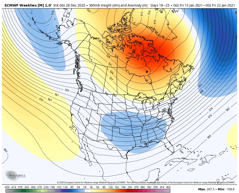
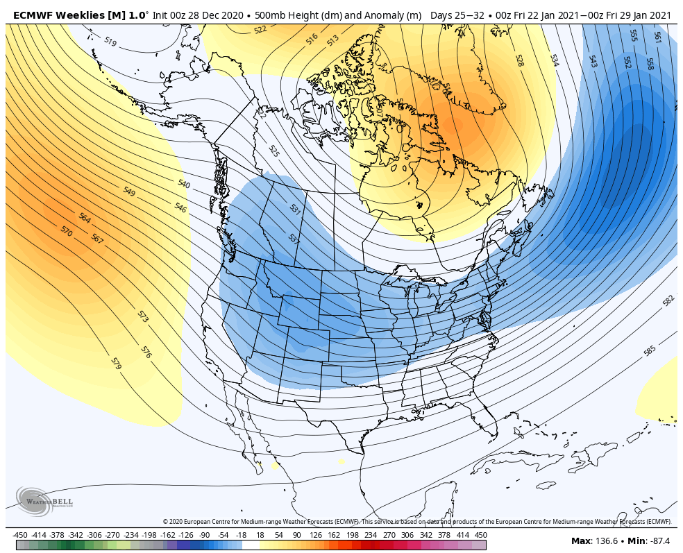
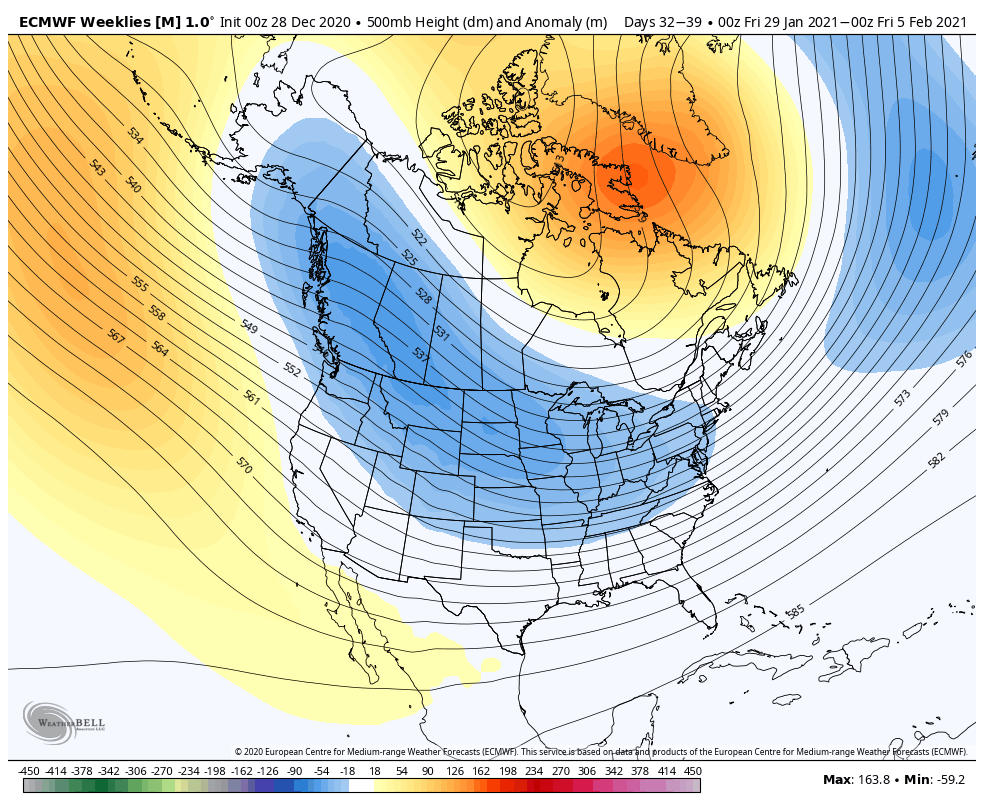
You guys have heard me rail on the EURO weeklies because the model had done horribly all year long in seeing any kind of trough in the United States. So, what do we make of the model actually seeing troughs developing? With the amount of blocking showing up over the Arctic and into Greenland, it doesn’t have a choice but to show these deepening troughs.
After a tranquil week one, here are the January weekly breakdowns of the 500mb anomalies…
Week 2
Week 3
week 4
Week 5 that goes into early February
That could get interesting.
I will have other updates later today, so check back. Have a good one and take care.

Thanks Chris, That is some kind of WOW with the barometric pressures. Who knows how that will ultimately affect our weather here in the Ohio Valley ?
While looking at the Ventusky web site the jet stream across the country is very erratic.
Looks like March weather for New Years Eve and New Years Day. Ugh !
Damn, I double click to post. Still asleep this morning. LOL
Darn, double click to post again. Going to be one of those days I guess. I’ll blame it on 2020. LOL
I am not going to complain about a warm rain,
It is better than cold freezing rain.
Perfect blustery ending for this year!
Here IN NW PENNSYLVANIA I recorded 68″ of snow in December that’s more snow than I recorded all last winter which totaled on 49″ of snow for the winter of 2019-20.
I can’t imagine 68” of snow in one month, I haven’t even gotten that much in the last 5 winters combined and right now I only have an 1.5” on the year.
Now that’s a REAL WINTER big time. Keep us posted on any additional Snow that may fall in your area of NW Pennsylvania. You may have a record breaking Winter for Snow.
Seems decent chances for January- compared to the previous four years.
At the latest doesn’t look like any Snow will be accumulating here in Central Kentucky.
Darn La Nina and the Southeast Ridge.