Good evening, folks. The three-pronged storm system continues to be the focus of the forecast as we get ready to close out the year and usher in a brand spanking new one. The first part of this still appears have the potential to produce winter weather in parts of the north and west.
The Weather Prediction Center is now showing the potential for freezing rain getting into parts of Kentucky Wednesday night and early Thursday. Here’s a look at the percentages they give of seeing .01″ of freezing rain accumulations…
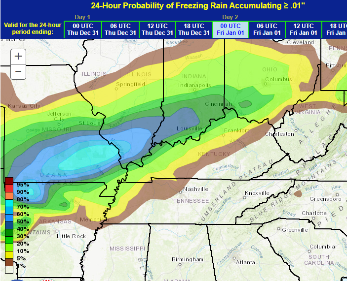
This seems to match up well with the map I first put out early Monday…
At the time, there was no support for this outside of the Canadian. Now we find the American models seeing the opportunity for some winter weather.
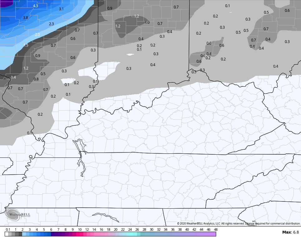
The NAM sees a little snow and freezing rain.
Snow
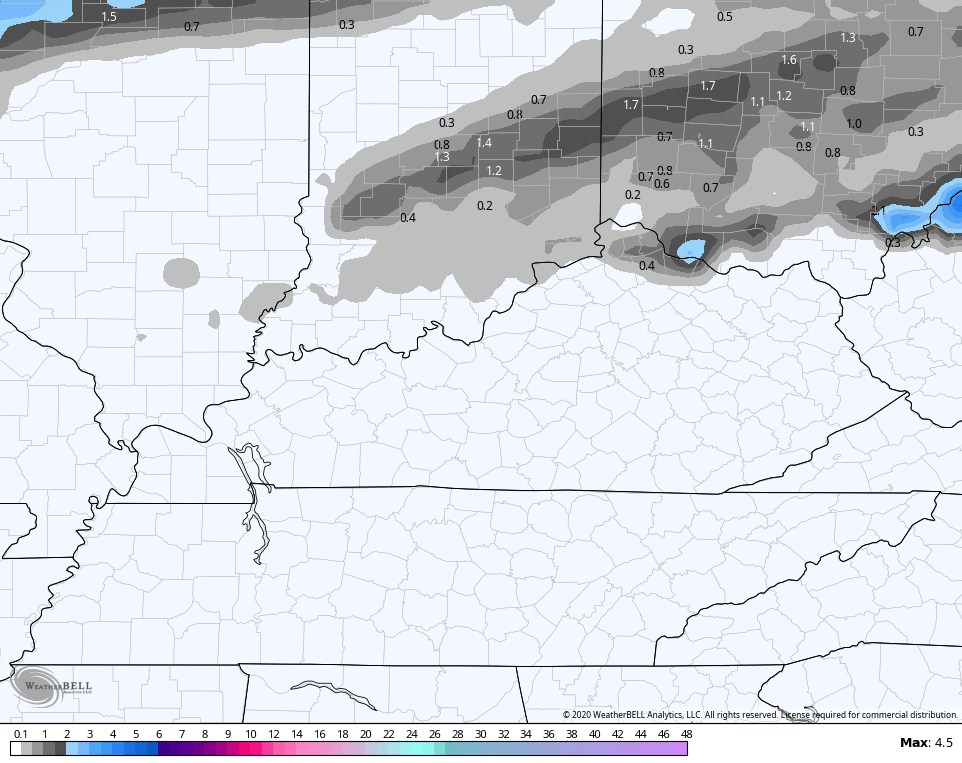
Freezing Rain
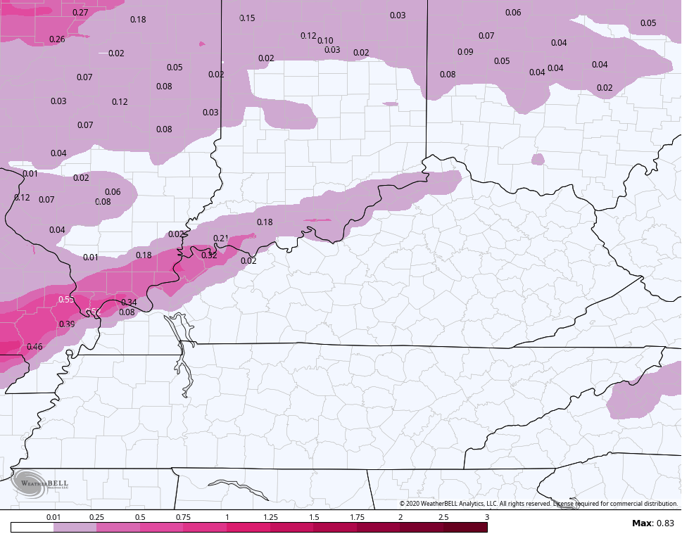
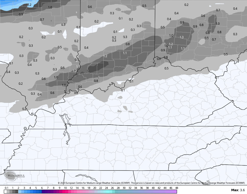
The GFS has a similar line of thinking…
Snow
Freezing Rain

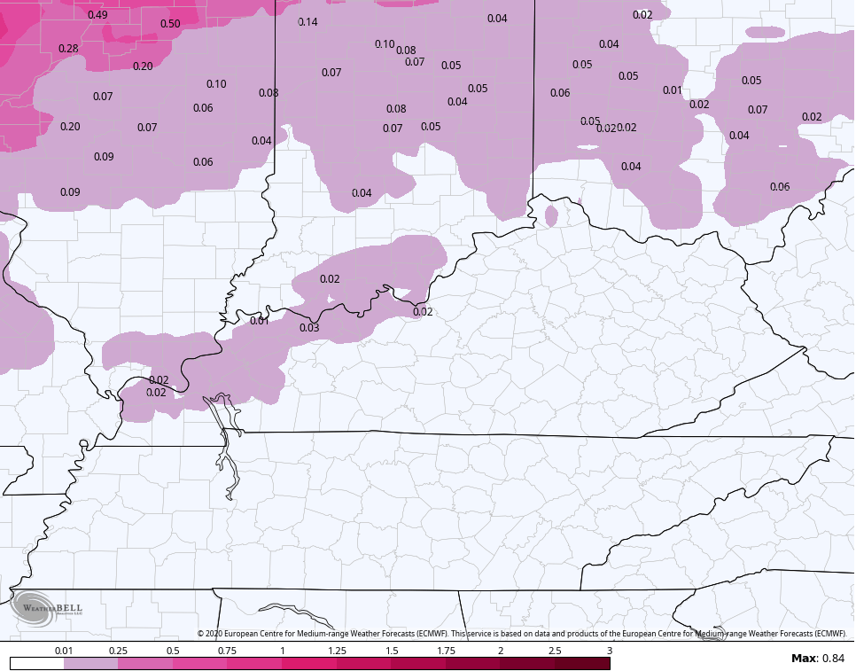
The EURO sees a little more snow than ice…
Snow
Freezing Rain
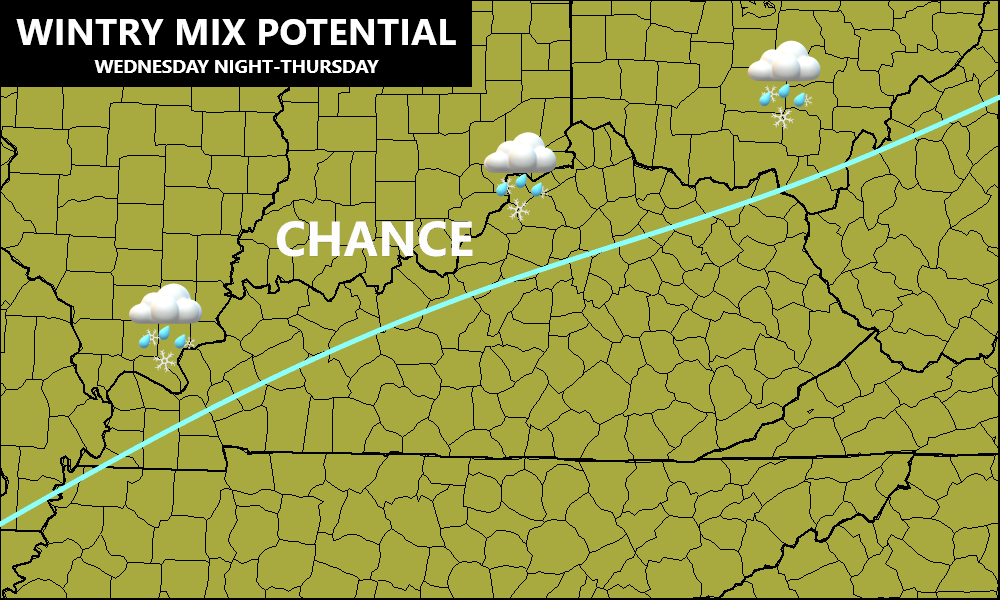
Again, this may very well reach Advisory type impacts in the west and north, so stay up to date.
Heavy rain and gusty winds will be along and ahead of the front causing the possible mix above. From there, we find a strong low pressure riding up the Mississippi Valley, bringing more heavy rain and high winds our way. We even have the chance for a few strong storms.
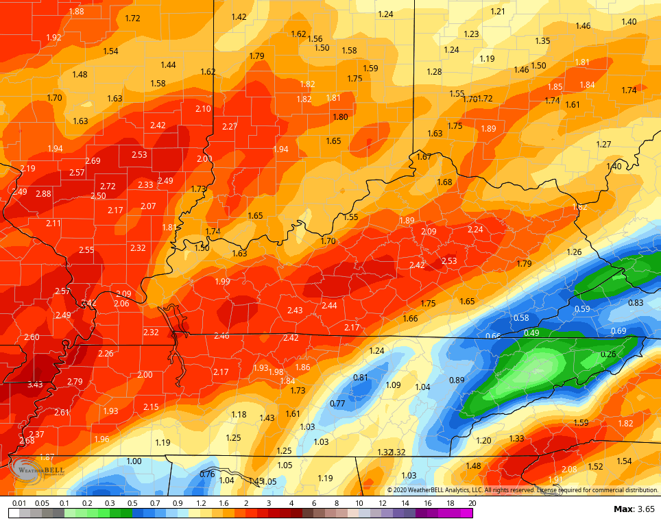
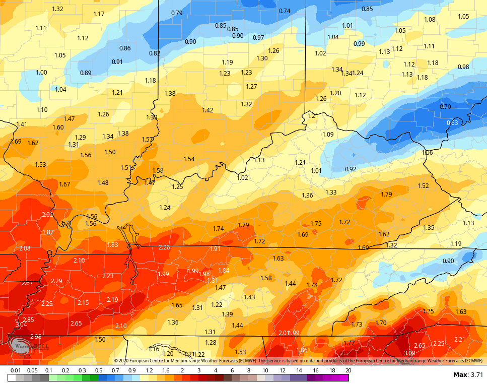
Here are the total rain numbers through Friday night…
NAM
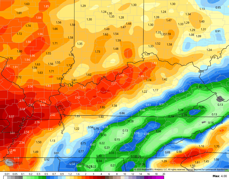
GFS
EURO
This will be followed up by another system Saturday night into Sunday and it may very well turn into a bigger system than the models currently have. Temps will still be borderline for any winter weather with that.
Get through the first week of January then watch the block try to lock. I will get a little more in depth on this later tonight.
Enjoy the rest of your evening and take care.

Rain and then some rain! Let’s hope the rest of January is better for snow..not rain
Most of the models through mid January show the now all too familiar rain sceneros for “fencetucky”.
I’m hoping the second half of January produces some snow, but the pacific pattern is going to have to change for that to happen.